We finally departed Alameda on October 20th, a week behind schedule. We were waiting for the new canvas installation, which was finally done on October 19th at 5:00PM. We left the next morning.
October 20th, 2013
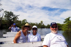
After waiting for a week to get our canvas work done, we were finally able to leave to start our journey. The weather while we were waiting was beautiful – sunny and warm every day, like October in Northern California typically delivers. However, Sunday morning it was overcast and gloomy early, but it started to get sunny by the time we left. Friends at the dock came to give us a send-off, and took some great pictures of us on the boat. We really appreciated and enjoyed all the great friends we met at the Grand Marina. We hope to see some of them during our journey.
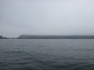
By the time we left the Oakland Estuary, the weather deteriorated rapidly: heavy fog, close to zero visibility, and cold. Fortunately, few boaters were out on this Sunday morning. We quickly learned to use our navigation instruments, just like when passage making on a moonless night.
Before we left the Bay, we were visited by the Sumudra Joy on its return from a short sea trial. At 428 feet, we didn’t see it until it was less than a quarter of a mile away. The AIS and radar were our friends that day! Going under the Golden Gate Bridge, we could hear the foghorn, loud and clear, but we couldn’t see the pylon of the bridge until we were almost on it. As we passed under the bridge, we couldn’t see the bottom of the roadway above us. The current was very heavy coming in on a flood tide, slowing us to less than four knots. As we passed out of the gate and headed south, seas were pretty calm, but we didn’t make much more than six knots.
It was easy going to Half Moon Bay, but gray and foggy – no sun. Winds were around 11 knots, and the leg covered 35.6nm. And as for Captain Quincy, he did pretty well for his first cruise. He didn’t mind the engine noise, but he decided to sleep in “the cat cave” in the forward berth for most of the day. Fortunately for him, we had following seas – no pitching. We anchored in Pillar Point Harbor, without problems – good holding in very thick mud. For dinner, we had a crock pot dinner of roast beef, potatoes, and carrots, cooked by the Admiral. Quincy emerged from the cave, anxious for dinner. We observed that few boats anchored in the harbor used anchor lights.
Position at destination: 37°30’ N, 122°29’ W
Air temp: 55, Water temp: 54
Nautical miles for this leg: 35.6 Total: 35.6
October 21st, 2013
We left in the dark, and it was really dark in this harbor. It was another gray, gloomy day – for the first time ever, we used the heat in the boat. Fortunately, it worked. Captain Quincy (so named by our realtor, Barbara) stuck to his cave. It was an uneventful passage – we did see some whales in the distance in Monterey Bay. We decided to stay at a slip in Monterey, since the cruising guides said the anchorage was rolly. Based on our observation, this wasn’t the case.
The first slip we were assigned to was on the fringes of the marina, and we were surrounded by LOUD and smelly sea lions. They were all over the docks, and we knew that our new swim platform would be irresistible to them. However, we were able to move to a better slip. While Rosé showered, I made a valiant effort to clean off the caked mud from the anchor and the chain. That was the thickest, toughest mud I have ever seen. Many people admired the Tropical Blend while we were there. We had a nice dinner at a small restaurant in the harbor, just steps away from the boat – sand dabs and mahi-mahi. We split it with Quincy. He liked the mahi-mahi, but was ambivalent about sand dabs.
Position at destination: 36°36’ N, 121°53’ W
Air temp: 58, Water temp: 57
Nautical miles for this leg: 63.8 Total: 99
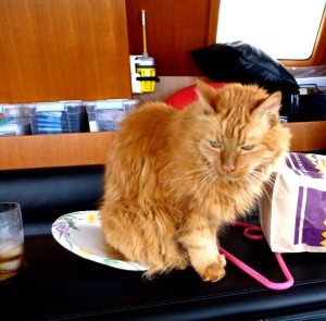
Captain Quincy patiently awaiting his dinner
October 22nd, 2013: Monterey Harbor to San Simeon Bay
This was the Queen Stage (as they say in cycling races), or the longest leg on our California portion of the voyage. We got up at 3:30 for a 4:10 departure, knowing this leg would take at least 12 hours, and we wanted to anchor in daylight. Another gray day, with a little bit of late afternoon sun. In bright light, this is supposed to be a beautiful passage – along the Big Sur coastline. We have driven this a few times, so we know it to be true. But this day, all we could see was a big cloudbank obscuring the coastline all day. Seas were calm, but no favorable currents, holding our average speed to around 6.5 knots. Lots of sea lions, many birds, and some kelp were all we had to entertain us.
Somewhere out there is Point Sur
We anchored in San Simeon Bay, which the guides said was a calm stopover. We did get some sun on arrival, but it was windy and cold. There was one other boat in the anchorage, an NOAA catamaran named the Fulmar. It seemed to be stable in the bay, although we could see a big swell coming through. We got as close as we could to the rocks, but the swell still rolled us badly. We decided to deploy the paravane poles, to see if that would help – not really. But this was our first time putting out the poles, and it went relatively well, and our marriage was preserved.
We had bought a Magma Flopper-Stopper, which is a hinged plate designed to reduce rolling. Milt Baker, owner of the Nordhavn 47 Bluewater, said he only needed to deploy a single unit, on the swell side. We tried that, but we still rolled badly all night – not much sleep. In the morning, we retrieved the plate to find that two of the lines had broken loose – not much build quality in it. But, Quincy didn’t seem fazed by the roll – he has four sea legs, as opposed to our 2. Our OJT continues.
Position at destination: 35°38’ N, 121°115’ W
Air temp: 58, Water temp: 56
Nautical miles for this leg: 84 Total: 183
October 23rd, 2013: San Simeon Bay to Avila Beach
Another gray day, but it was sunny once we arrived in Port San Luis. We decided not to stop in Morro Bay, as it takes a lot of time to get into it, and there are a lot of concerns about the swell and surge when anchoring there. Avila Beach is a large, open bay, but protected by a big seawall. The weather brightened throughout the day, and we anchored for the night. We had a good anchorage, but the wind was howling. Our instrument said 20 knots, but it felt stronger, so we laid out 150 feet of chain in 25 feet of water. I learned how to properly use the anchor alarm on the GPS, providing some peace of mind.
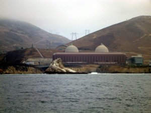
Diablo Canyon nuclear power plant was easy to see
Nothing was remarkable about the passage itself. Captain Quincy started to spend more time on duty in the pilothouse.
Position at destination: 35°10’ N, 120°45’ W
Air temp: 64, Water temp: 61
Nautical miles for this leg: 40 Total: 223
October 24th, 2013: Avila Beach to Cojo Anchorage
This day we were planning to round the famous Point Conception to officially enter Southern California waters. The forecast was good, and the weather was definitely sunnier. We had a pretty good view of the missile silos at Vandenberg, and saw lots of sea lions and birds again. There was a lot of radio chatter about boats in the target zone, which provided some entertainment.
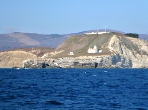
Point Conception was sunny and calm!
We rounded Point Arguello, and the clouds opened up to reveal that the sun did still shine, after all. The waters were easy going around Conception, and we finally hit seven knots, at 1750rpm’s. We found Cojo around the bend, and pulled in to anchor. There was one small express cruiser, a skiff with three people fishing, a couple of other commercial boats, and a cable laying boat. The guide was right in that the waters were smooth despite the STRONG winds. We were reading gusts to 25 knots, and were a little concerned about the snubber’s holding ability. However, it managed to hang on. The wind died somewhat after dark, and we didn’t roll too much.
In the absence of wind, we guessed that this would be a really nice anchorage. There’s not too much kelp, no fish traps plaguing the entrance, and just a few trains rolling by.
Position at destination: 34°28’ N, 120°26’ W
Air temp: 64, Water temp: 59
Nautical miles for this leg: 51.3 Total: 274
October 25th, 2013: Cojo Anchorage to Santa Barbara Harbor
We left early with bright sun shining. We ran the generator to get some laundry done. The normal cycle takes forever, about one and a half hours – but it works. The dryer seems to be much more efficient. Later, the Admiral would figure out that the express cycle worked as well as the normal one, in half the time. Well, we’re learning as we go…
Easy passage, but it also got very cloudy, not clearing until we got to Santa Barbara. We passed through an area off of the aptly named Coal Oil Point. The guide said that oil naturally seeps to the surface here, unrelated to the offshore drilling platform. The surface was covered by an oil slick, and you could really smell the raw petroleum odor. We quickly shut down the water maker – I can only imagine what raw petroleum would do to the filters and membrane.
We saw a large cruise ship anchored off of Santa Barbara harbor – the Golden Princess. Apparently in the fall shoulder season, this ship journeys between Ensenada and Santa Barbara. A drinking and shopping extravaganza, we suppose. Approaching the harbor, we ran across a large collection of fish traps. For some reason, most harbors in Southern California are fish trap magnets, they collect around the harbor entrances like flies on dog poop – I had to take care to dodge them. I’d rather not test our shaft cutters unless by accident.
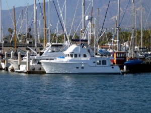
View of Santa Barbara Harbor with Tropical Blend
We spent two nights in a slip in the harbor. Friday night we walked over to the pier for dinner. There was a sailing school for kids going on in the harbor for entertainment. We were amazed that none of them flipped over, although our waitress said that happens regularly. On the way back we found a little sushi place right on the dock. We bought some Maguro sushi to go, fed it to Captain Quincy, who gave it his nod of approval.
We had an end tie that was a LONG way from the entrance – longer than the walk we had at the Grand Marina. So, it was time to BRING OUT THE BIKES! That really shortened up the distance. On Saturday morning, we biked to a grocery store in town to re-provision a little bit. We have to be able to fit everything into two small bags on the bikes. No room for extras. Like the tomatoes we bought that somehow didn’t make it into the bags we carried out of the store…
Anyway, it was a beautiful day, hitting 75 degrees. It was like a vacation within the vacation, although we did do some work. Debbie washed down the boat, and I made a couple of trips to the West marine at the dock to try and re-rig the flopper stopper. Captain Quincy ventured up to the boat deck for the first time – he’s starting to get into the cruising life.
We were interrupted out of our roll-free sleep by an electronic foghorn located just across from our slip – at 5 in the morning. It gave off two long blasts, waited about 10 seconds, then blasted again. It reminded me of a cross between a vuvuzela and a flugelhorn. Really, really annoying.
Great day to sail outside of the harbor
For lunch, we got a 25-piece sashimi sampler, which included tuna, salmon, yellowtail, albacore, and snapper. It was fabulous, although Captain Quincy still got his share, about four pieces worth.
We lowered the Little Blend and got it up on plane for the first time, since we’re still breaking it in. Of course, it promptly ran across some wayward kelp, so we had to clear the prop. We saw two other Nordy’s in the harbor: a 40 called Zeeno, and a 47 called Seabird. The 47 had two dinghies on the boat deck. Looking at the larger deck, flying bridge, and pilothouse made me think again that we should have considered a 47. Well, it uses more fuel… and costs a lot more. But our broker always told us that we could afford a lot more boat, so I won’t let him know about my bigger boat envy.
Position at destination: 34°24’ N, 119°41’ W
Air temp: 75, Water temp: 67
Nautical miles for this leg: 38.7 Total: 313
October 27th, 2013: Santa Barbara Harbor – Channel Islands Harbor
We started off at 8:00AM after purchasing 300 gallons of diesel fuel at $3.96, tax included. We had planned to go to Santa Cruz Island in the Channel Islands National Park. We had checked the weather forecast the night before, and it was supposed to be pretty calm out there. But, after about 10 minutes of rocking and rolling in some decent swells, we checked the weather again on the VHF – and the forecast now included a small craft advisory, with winds to 30 knots in the islands. We decided that there were many, many islands in our future, so we gave it a pass, and aimed for Channel Islands Harbor at Oxnard. With a following sea, the ride smoothed out, but there were a lot of whitecaps breaking. On the plus side, it was sunny.
As we approached the entrance to the harbor, we were again greeted by the ubiquitous fish traps very close to the entrance. After dodging a few, we entered the channel. Shortly before entering, we saw a large express cruiser zooming out, and zooming back in after seeing the waves. We stopped at the harbormaster office to check in. They have a side tie dock in front, with their boats tied up aft of the dock. Across from their boats were a Coast Guard cutter and some other smaller boats. The basin ended in a rock wall. After completing check in, I decided to back off of the dock to avoid hitting the stern, using the bow thruster to push the bow into the channel. There was a 15 or so knot wind directly on our port beam, pushing us into the dock. After backing out, I started to apply the thruster. Some people say that boating is 99% boredom, interrupted by a brief moment of sheer terror. I was about to experience that terror – the thruster failed. There was enough space for us to fit between the sets of boats, but not enough room to power out using the single engine. I worked to maintain our position between the boats, as we pushed towards the wall. There was great excitement on the cutter, as they tried to start it and move it, after I told them the thruster was out. But, it wouldn’t start. The harbormaster rushed down and powered up his boat, and was prepared to push our bow. Rose was going fore and aft with a fender in case we hit something. I could tell that the wind would push the bow just enough so that I could back out of there – and for once, an emergency plan worked. I powered back out to the channel, and we proceeded to the dock – a side tie far up the channel with lots of room. We had recently had the thruster repaired, replaced the drive gear in it. But, we had never experienced motor failure in it before – I thought it might have overheated and popped the breaker.
Once we tied up (easy, with the wind pushing us onto the dock), I checked the breaker, and it was not popped. I waited a while, but no thruster. I checked the fuses – they were good, as far as I could measure. I could hear the solenoid, but there was little voltage across the motor. At this time, I threw up my hands in despair. I figured that we could head south to Newport the next day, and ask Outbound Yachts, the resident Nordhavn specialist to troubleshoot and fix it. Rose pointed out that we could ask the local boatyard, which was worth a try. As it turns out, the weather was still going to be bad on Monday, so we were stuck there anyway, with a storm approaching that morning.
Resigned to our fate, we had a late lunch and decided to walk around in search of a store to get some cat food and jellybeans – depression medicine to cheer me up, and Captain Quincy could always use a snack. The area around our dock was pretty deserted – a number of failed restaurants. The location seemed good, and the buildings had potential, but still empty. Across the main street, we found a small strip mall, but no grocery store. There was a store called “Big Lots” that seemed to have some groceries. Trouble is, it had a lot of little lots of what appeared to be cast-offs from other stores. Rose called it a clusterfuck store. We decided we could find better groceries at the Rite Aid drug store. They did have some cat food, and some off-brand jellybeans that managed, but paled next to Jelly Belly’s. Such is life. We grilled some chicken for dinner and made an early night of it. With the extended time at the dock, Captain Quincy started venturing outside the cabin of the Tropical Blend.
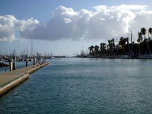
Looking south into Channel Islands Harbor
Late that night, a sailboat came in and docked just ahead of us. In the morning, I talked with the captain, and he said that they were passaging from Catalina to Santa Cruz when the weather hit them out of nowhere. They also decided to run for the Channel Islands Harbor. He told me they were taking 6-foot waves over the bow, and came close to broaching.
A little after 8, I called the local boatyard, and they said if I would bring it down, they could look at it. They only had one slip open, which could accommodate the Tropical Blend, but not the fenders. I explained what I had done to the yard manger, and he said that in his opinion, the small fuse for the solenoid power was probably bad, even though it measured continuity. When he showed me some burn marks on the end, I started to think that he might be right. Of course, I didn’t have a replacement fuse in the spares kit, and they didn’t have one in their office. He said that he would send someone out to get one soon.
In the meantime, we started to work on rebalancing the load in the Tropical Blend. Rose had noticed, and I concurred, that there was a list to port that we had never seen before. There was some idea that maybe the starboard auxiliary water tank (60 gallons) wasn’t filled, since the sight glass showed nothing. But, I determined that there was water in that tank. Rose believed that the balance issue could be caused by the load in the salon storage areas – I didn’t think that was likely, but I have a habit of being wrong. Under the settees in the salon, Nordhavn was good enough to provide a ton of storage space. As it turns out, we used that storage for the deep liquor cabinet – big bottles of vodka and rum, as well as a case of wine and a case of champagne. In addition, my DVD collection was there – ten binders full of movies and TV shows to provide entertainment on the water (before we decided to add the Direct TV service). On the starboard side, the stored items were pretty light. We spent about an hour redistributing the load, and lo and behold, the list was gone! Chalk one up for Rose. Concern about the list had kept her up the night before, so now she could sleep peacefully.
In the meantime, we were still waiting for the fuse, which finally showed up at 12:30. I installed it, and … nothing. So the yard said they would send someone to troubleshoot it after lunch. A little after 1:00, Dale arrived with a multimeter. After poking around a bit, he wanted to blame the batteries – but I pointed out that three 8D’s were connected, putting out close to 13 volts. So, he looked again, and noticed some corrosion (melted plastic) around one of the terminals on the 500A fuse. He decided to clean this area up, but I didn’t have much hope. In addition, he replaced one of the solenoid wires, which had a burned terminal. This took about an hour and a half, and miracle of miracles, it worked! I was now wrong twice today. Feeling a little humbled, I strolled to the office to pay what I figured was at least $200. A third miracle then happened – the yard manager said no charge! After all of the grief we have experienced with boat repair people, this was a real delight.
We headed back to our dock, where the sailboat was also waiting out the weather. Rosé took a shower, and I looked at a map of the area. It turns out that there was another shopping center just past the one that had the Big Clusterfuck Lots store in it, and that center had a Ralph’s grocery store there. In addition, I found a pizza parlor close by that got great reviews. So we decided to hit the grocery store, then the pizza parlor. This turned out very well – we got the tomatoes that we lost in Santa Barbara, and the pizza was great. We also committed a high crime by lifting one of the parmesan shakers. We decided to leave very early the next morning, skipping over the previously planned anchorage in Long Beach, heading direct to Newport Harbor.
Position at destination: 34°10’ N, 119°13’ W
Air temp: 68, Water temp: 66
Nautical miles for this leg: 32.6 Total: 346
October 29th, 2013: Channel Islands Harbor – Newport Harbor
We got up at 4:30 for a 5:00 departure. It was pitch black, but no wind. While I was getting the key deposit refund, we heard a small craft warning over the VHF, from Point Conception to Dana Point. We decided to go anyway – worst case, we had some harbors we could escape to along the way. I was nervous about the fish traps, so I steered from the FB for some time, checking for fish traps with the spotlight – I never saw any. Although it was really dark the shores in this area are brightly lit. Shortly after departure, Rose decided to continue her beauty sleep in the salon. I was wide awake, waiting to see if the weather would turn. Just before dawn, around Pt. Mugu, we ran through a pod of dolphins – at least 100 by my estimate. But they seemed to be on a mission for breakfast, so they didn’t play in our bow wave.
This turned out to be the calmest day we have had on the trip to date. We turned off the stabilizers, as the water reminded us of a day on the Delta. We heated up the leftover pizza for lunch – I learned that a small oven cooks faster than a big oven! It was a beautiful, bright, sunny day. There were three really big container ships off to starboard. They were 1000 feet long, but making 11 knots. As we approached Los Angeles Harbor, they turned toward us, using the vessel traffic separation lanes. We saw the harbor pilot boat drop off pilots at all three ships. The first one was well ahead of us, but the second one was on a direct collision course. The AIS showed a CPA of 0.00nm. Given our size differential, I decided to change course to go astern of the Evergreen Salute. It’s amazing how many containers they stack onto one of those ships. More cheap stuff from China!
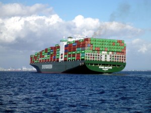
The Evergreen Salute, carrying cheap Chinese crap to satisfy the American consumer
The rest of the trip to Newport Harbor was easy and warm. We entered the channel and headed to the Harbor Patrol Office. There is only one small anchorage area in the harbor, and if you swing out of the area, the sheriff presents you with a ticket. They also require one person to be onboard an anchored vessel at all times. We decided to take a mooring ball, at a cost of $25 per night. We got an assignment, and I tried to decipher where our field was located. The map showed it adjacent to 13th Street, but how in the Hell would I know where that was? Anyway, we finally found the mooring field we were assigned to, about 30 minutes before sunset.
Now we have a lot of experience picking up moorings from our chartering days. All of the mooring balls we have used have a floating line connected to them, which you pick up with a boat hook. Then, you run a line through the loop connected to the ball, and tie it off on the bow cleats, forming a bridle. Rose is quite the expert at this. We have been a little concerned because of our bow height, but we bought the longest boat hook we could find, and we were pretty sure it would work. Of course, if the ball HAS NO LINE, nothing will work. And the balls in this harbor HAVE NO LINES! In addition, in order to maximize the mooring density, you have to tie off fore and aft. We could reach the aft ball from the swim platform, but there was no way to get to the bow one. We pulled back from the field, (which requires some very tight maneuvering) to call the Harbor office. They said they could send someone out in an hour or so (when it would be totally dark) to help. This wasn’t an acceptable solution, so we started to think about anchoring, when the guy on the boat next to our assigned ball was able to attach a line and a float to the ball. With this, Rose was able to get us tied up. We gave the guy and his dad a couple of beers for their help. On a side note, as we were navigating the field, we saw a great sight on a dilapidated sailboat just ahead of our mooring. A very large sea lion had gotten aboard, and was sitting on top of the cabin area, as if he was King of the Hill. Too bad we were otherwise occupied – it would have made for a great picture!
Position at destination: 33°36’ N, 117°55’ W
Air temp: 74, Water temp: 68
Nautical miles for this leg: 81.7 Total: 427
October 30th, 2013: Newport Harbor
We spent the day moored in Newport Harbor, exploring the harbor in the Little Blend. We ventured up to the Newport Shipyard, where we had the Tropical Blend hauled last May. There was an enormous yacht docked there, called Cocktails – we decided this should be our next boat. However, considering that a few fill-ups would cost about the same as the entire Tropical Blend, perhaps we should be content.
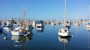
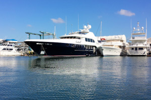
October in Newport Harbor Our next boat – Cocktails
Anyway, we had heard that there were plenty of public docks in the harbor to serve the many restaurants and bars that surround the water. This was definitely misleading. We only found one very small dinghy dock near Balboa’s Fun Zone, where we went ashore for lunch. The harbor itself is very large, and we could only imagine the money that it would take to have one of the harborside mansions with a yacht dock at the door.
Later in the afternoon, we toured the back bay, where there are more boats, more houses, and even a little bit of nature. We then went back to the north end of the harbor in search of a West Marine that we had seen from land on a previous trip. We actually found one more public dock, and using the phone, we got to the West Marine. This was one of the largest stores we have been to. We decided to see what they might have to aid on grabbing a mooring ball, after last night’s miserable experience. We ended up buying a contraption that fits onto the end of a boat hook, and allows a line to be strung through an eye. It looked simple enough in the promotional video, but someday in the future we can see how easy it is to use.
October 31st, 2013: Newport Harbor to Dana Point Harbor
Happy Halloween! This day marked the return of Tropical Blend to Dana Point harbor, where it was originally commissioned as Island Magic in 2004, and where we had kept it for 10 weeks after we purchased it. Dana Point is also the headquarters of PAE (Pacific Asian Enterprises), the company that makes Nordhavn yachts. We planned to show all of the upgrades to the broker (Larry Gieselman) who had sold us the boat. It was a beautiful day for cruising: bright, warm, and very little wind. We made the short hop in the morning, arriving around noon.
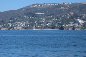
Passing by Laguna Beach, on our way to Dana Point
The views of the coastline were just stunning. Dana Point Harbor has a large kelp bed just to the northwest, and it was as big as we had remembered it. There is also a large colony of sea lions, which use the breakwater as their personal toilets. Fortunately, the smell wasn’t nearly as powerful as we had remembered it last May. As the Nordhavn HQ, there are always a large number of Nordy’s in the harbor. This time, the N86 (formerly Aurora) was in the harbor. We were hoping for a tour, but it had already been sold. We were assigned to a side tie at the far end of the West harbor. Fortunately, there was no wind to speak of, and the bow thruster worked as promised, so we were able to squeeze the Tropical Blend into our assigned space with no drama.
Later that afternoon, Larry from Nordhavn dropped by, and he really loved what we had done to the boat. Of course, he had to remind us again that we could afford a bigger boat, so when we were ready… The harbor is surrounded by a number of shops and restaurants, so Rose could get some shopping done. Quincy also decided it was time to stretch his legs on the dock. Later that night as we were making dinner and getting some laundry done, he even ventured onto the dock without us knowing. Fortunately, he didn’t go too far.
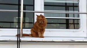
Captain Quincy’s big adventure
Position at destination: 33°28’ N, 117°42’ W
Air temp: 72, Water temp: 66
Nautical miles for this leg: 16.4
Total: 443
November 1, 2013: Dana Point Harbor
Today we met our crew member for FUBAR, Ron Okada. Because there would be several overnight passages, including two legs with consecutive overnights, we wanted to add a crew member. None of our boating friends were able or willing, so we checked on the FUBAR website, where a number of people had posted, hoping to go as crew. Ron had a 50-ton license, had owned sportfishing boats in Mexico, he had a ton of fishing experience, and a lot of local knowledge of the waters where we were going to be cruising. We talked with him on the phone, and we believed he would be a good match for us and the Tropical Blend. We were particularly excited about his knowledge of fishing. Our saltwater fishing experience was limited to sportfishing in Alaska, which bears little resemblance to the fishing that was planned for warm water pelagic species.
Ron picked us up late that morning, and we gave him a tour of the TB, and then set off to get outfitted at local tackle stores. He gave us a lot of great advice, picked out a good starter set of lures and tackle, and helped us to select good trolling gear. The outfits we had purchased previously really weren’t heavy enough to catch some of the larger fish we would encounter. After meeting Ron, we were very certain that we had made a good decision to ask him along. He would be joining us in San Diego shortly before we would depart for Ensenada.
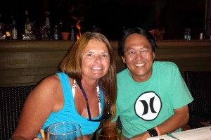
Rosé and Ron
A friend of Ron’s had designed and manufactured a product called Dry Tubes, which are plastic cylinders sealed with an O-ring, designed to keep supplies for the ditch bag dry – also good for transporting items through surf on a dinghy! They float, you can attach lines to them, and they aren’t too big. Ron had shown these to the FUBAR organizers, and they had decided to buy one for every boat in the fleet. However, they had to get to Ensenada, so the Tropical Blend was enlisted as the cargo vessel. We stuffed as many as we could in the forward stateroom, and the rest were tied onto the bow. That night, we had fish and chips on shore, and did as much laundry as we could prior to heading to San Diego.
November 2, 2013: Dana Point Harbor to Mission Bay (San Diego)
After spending a couple of peaceful nights in Dana Point harbor, we were ready to undertake our last California leg to San Diego. We planned to spend a couple of nights anchored in Mission Bay, then head to our final stop at Kona Kai Marina on Shelter Island. We left at 8:45 to brilliant blue skies, warm temperature, and little wind. By now, Quincy was content to spend passages curled up in his electric bed in the pilothouse. And to thank, some people say that we spoil our cat…
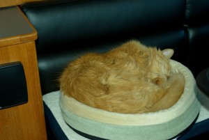
Captain Quincy, off-duty in his electric bed
We started out the day from the flying bridge. There was a large pod of dolphins that wanted to play on our bow wake for quite a while. Later in the afternoon, the winds picked up and we were rolling in and out of some pretty heavy fog banks. We decided to run the wing engine for a while. Most Nordhavns are single-screw boats, but are equipped with an auxiliary, or wing, engine. This is a small secondary engine with its own drive shaft that will get you home in the event of a main engine catastrophic failure. The previous owners of Island Magic barely exercised the 27hp Yanmar engine – it only had 20 hours on it. This isn’t good, as the engine has never been broken in. We decided to run it for at least an hour per month. Since it is so small, it only propels us at 3 to 3.5 knots, so we only want to use it on flat days – stabilizers don’t work at those speeds. We had previously run the engine in the dock, pulling against the dock lines. This was the first time for us in open waters. After a few minutes, I went into the engine room for a check, and I was surprised to see that there was no water at all dripping from the stuffing box, and that the shaft temperature was really high – 145°! This is hot enough to melt the packing material, so we shut it down, with a plan to adjust it once we were in port. It’s a V-drive, and the space to get at the packing nuts is much too tight to adjust it under way.
The rest of the journey was uneventful, save for the excessive fish traps and kelp as we approached San Diego. There was a lot of emergency radio chatter as it was Saturday – some missing snorkelers (later found unharmed), a kid yelling, “help!” on channel 16, a boat with propulsion failure that wasn’t sure if they were in Mexican waters, etc. We turned in to the inlet for Mission Bay to find a fish trap square in the middle of the channel – I have no idea what the moron who set this could have been thinking!
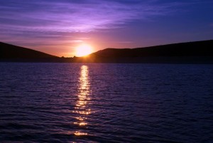
Just inside the breakwater, there is a small anchorage tucked in towards the beach, where transient boats can stay up to three nights. It’s a little tricky here, because there are a ton of sailboats permanently moored, and of course they swing much differently. While there was little wind here, the changing tide spun us completely around a couple of times each day. We stayed here two nights, exploring the bay by dinghy. I had hoped to see the Chargers game on local TV Sunday morning, but the signal kept coming and going as we swung around. Rose did enjoy a bay tour on her paddleboard, as the mid-day winds were very calm. That evening, we were treated to a beautiful sunset, coming over the houses on the narrow spit of land facing the beach.
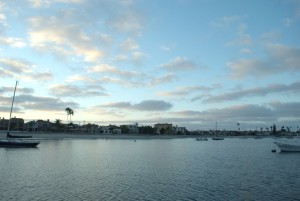
Mission Bay sunset
Position at destination: 32°46’ N, 117°15’ W
Air temp: 71, Water temp: 65
Nautical miles for this leg: 49.4 Total: 492
November 4, 2013: Mission Bay to Kona Kai Marina, Shelter Island
This small jump would be our last leg entirely in the United States. Daylight savings time had also ended the day earlier, so there were a couple of milestones reached. We left at 8:45 in the morning, to partly cloudy skies and mild winds. Once in the channel departing the bay, the winds and swells picked up significantly. While the swells weren’t breaking, they were probably 4 to 5 feet going over the bar. Once we cleared that, we had to dodge kelp beds constantly, which are quite dense in that area. There was also a lot of Navy traffic in the area, and recreational boats are expected to give these monsters a wide berth. I had expected that they would show up as AIS targets, but clearly they don’t broadcast. They simply are identified as “warship xxx”, where the number is the large painted number on the sides of the bow. Because of the very thick kelp, we had to travel well offshore to transit around Point Loma, while keeping an eye on the various warships. This was the roughest day of passage making we had faced yet during our trip down the California coast – very much unexpected. We finally cleared the kelp beds, and started our passage to the channel for San Diego Bay. A couple of warships passed us to port, going fast at a very close distance- no announcement. Another one was heading out, flanked by four patrol boats (with deck guns). We altered course to give the ship a wide berth, but two of the patrol boats still shadowed us ominously, refusing to acknowledge Rosé’s friendly waves.
We turned into the Shelter Island opening, which is the first island in San Diego Harbor. There are two sections to this marina, and the map we had didn’t show actual slip numbers, forcing us to guess. Which of course, was wrong. Once again we were lucky to have no wind, so moving out of the alley and back to the other side wasn’t too difficult. This marina mostly uses side-by-side slips, which we have rarely used. Our assignment was shared by the Nordhavn 40, Salacia, also on the FUBAR. Salacia is owned by Neil and Dianna Simpson from Spokane, WA, and we would become great friends. It turns out that it wasn’t too tough to ease into the port side of the slip, next to Salacia. Later that day, we would tour their boat, then host them for some Tropical Blends. We were planning to cruise together for most of the FUBAR.
One of the nice services arranged by FUBAR was an inspection of the engine room and systems by Bob Senter. Bob is considered to be the pre-eminent expert on Lugger engines, and he is widely known as Lugger Bob. He was pretty pleased with the condition of our engines and systems, but he did caution us to tighten the throttle linkage (which was loose), and he did recommend a set of spare parts that we hadn’t considered. He went through a lot of the maintenance procedures for both the engine and generator, and I was glad to he came on board.
The Kona Kai Marina is at the Best Western Kona Kai Resort at the western end of Shelter Island. At least during our stay, the resort seemed to be pretty deserted. We had dinner at a resort restaurant, and there weren’t more than a handful of people there. We were planning to rent a car for the next couple of days to get some final supplies and provisions.
Position at destination: 32°43’ N, 117°14’ W
Air temp: 70, Water temp: 66
Nautical miles for this leg: 15.6 Total: 508
November 5 – 6, 2013: Kona Kai Marina, Shelter Island, San Diego
Tuesday morning, we got a rental car in order to complete our last errands:
- West Marine – replace the line on our anchor snubber to something more robust, and get a few other last-minute supplies
- Petco – more cat food and litter for Quincy
- Home Depot – see if they had short wrenches that could be used to loosen the shaft packing nuts for the wing engine – short answer was no. But, we did get a small bucket that would be used to dry out cat litter. We had heard from the Nordhavn N52 Dirona that they were recycling pearls cat litter by soaking it in salt water. We had done this, but we had a difficult time drying it out in the cool, moist air of the California coast. We took a bucket, drilled a bunch of tiny drain holes, and voila! We now had the cat litter washing system finished.
- Costco – more supplies, that I can only say seemed like a mistake at the time. We really struggled to get everything put away, but somehow, we managed. There wasn’t an ounce of storage left after this run.
Auto parts store – we were looking for Standydne diesel fuel stabilizer, with no luck. I did manage to find some electrical terminals to replace the bonding wire terminal of the stuffing box that had broken off during repeated adjustments. - Veterinarian – we had to get a health certificate for Quincy, basically confirming that he has an up-to-date rabies shot (he got that right before we left San Jose), and that he doesn’t have communicable diseases. The very also recommended fluids and a Vitamin B-12 shot, which she said would perk him up. It certainly did – he was feeling great after we got him back on board.
Quincy is an older cat, and his kidney function is going away. We’re just planning to let him eat whatever he wants, to enjoy his last days. I was afraid that the stress of the journey would accelerate the disease, but there have been no signs of that at all. If anything, he is thriving.
Kona Kai has a megayacht section – and the yachts were definitely in the mega category. The biggest was the Invictus, and brand-new 262’ beauty. It’s owned by a Southern California real estate developer billionaire, and it really was amazing to see.
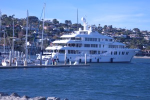
The Invictus – our next boat, for real this time!
On the evening of Nov. 6th, Ron came on board. He decided to bring some specialty provisions – some sushi rice, wasabi, sesame oil, coffee (since we don’t drink it), trail mix, pistachios, energy drinks, and some more fishing gear. Somehow, we found room for everything!
November 6, 2013: Kona Kai Marina to Ensendada Marina Coral
FUBAR 2013 had 34 boats signed up The organizers set a baseline speed of 8.5 knots for the fleet. We’d have to run at WOT to make 8.5 knots, so several of the smaller Nordy’s decided to group together in a “slow boat flotilla”, leaving earlier on each leg.
The Slug Boats:
- Salacia, an N40 owned by Neil and Dianna Simpson
- Koumba Bang, an N40 owned by Abdullaye Diop
- Endurance, an N43 owned for Kurt Antonius and Steve Stroud
- Tropical Blend, our N43
Since we were the only boat in this group with a flying bridge, we actually had the heaviest and slowest boat. Originally, the FUBAR kickoff was to be in San Diego, the morning of November 7th. The organizers eliminated the San Diego leg, since many boats were planning to cruise direct from the harbors in Los Angeles and Orange County to Ensenada. The Slug Boats decided to leave the night of the 6th, arriving in Ensenada the next morning, so we could get fuel and relax. We would meet Endurance and Koumba Bang at the offshore buoy marking San Diego Bay. Salacia decided to leave the morning of the 6th, to make the first leg a day trip.
We kept in phone contact with Endurance that day, and we were guessing that we should leave the marina at 10:00PM in order to rendezvous with them outside of San Diego Harbor. It was a moonless night, although the harbor was well-lit. I always dock and depart from the flying bridge, which gives me a lot more visibility. We eased our way out of the slip and the marina, and headed into the channel. Before I returned to the pilothouse, I replaced the instrument covers and turned off the lights on the flying bridge instrument panel. Given the darkness, I fumbled a bit with this, and then went to the pilothouse.
Just ahead of us in the channel was a sailing catamaran, Razzle Dazzle, which I followed out of the channel. I noticed that the engine gauge panel lights weren’t on, so I flipped the switch – nothing. I checked the electrical panel, and every switch was correct. I did notice that the voltage reading for the engine battery was zero at the panel. I put a light on the engine gauges, and they were all off – very strange. Rosé took the helm while Ron and I tried to reason out what was wrong. I re-checked the panel on the flying bridge, and it was dead as well. We attempted to re-start the engine, but there was no response to the stop button. I did an engine check, where I could verify the temperature, alternator output, and oil level – all was well. We decided to go ahead to Ensenada where there would be a lot of assistance available – not the least from Lugger Bob. We did step up the engine checks that night, just to be certain. Rose was not comfortable, and wanted to return to San Diego, but we really believed there was nothing fundamentally wrong, just an open circuit on the gauge panel. Rose went down below with Quincy, and Ron and I shared the watch for the rest of the passage.
We picked up Endurance at the buoy, but they said they couldn’t see us on their AIS – I guessed it might have something to do with the electrical problem we were having. Koumba Bang was well behind, and well outside. Apparently he had decided to take a passage outside of the Coronado Islands, to avoid any fish traps. Ron was confident that we wouldn’t see any traps inside of Coronado, and that there are many tuna pens on the outside, so we agreed to the inside passage. We continued to monitor Razzle Dazzle to port, as was Endurance.
That night there was a warship doing an exercise that had them making continuous circles – and they were good enough to broadcast there intentions every five minutes. I have to say that gets old, fast. And when they are making circles, they get pissed if another boat, staying on its straight course, got too close for their comfort. The funniest exchange came when a radio operator with a string Russian accent on a commercial boat gave the Navy a lecture about ocean etiquette…
After I was convinced there were no serious issues with the electrical problem, I took a brief snooze, and then relieved Ron. Right about sunrise, we passed through several really large pods of dolphins that were very appreciative of our bow wake. I never get tired of that.
Shortly after sunrise, Ron got up, and we discussed options for stopping the engine one we got to Ensenada. The brute force way was to stop the fuel supply, but that could take a while, and then we would have to re-prime the engine. I remembered that Endurance had told me about a box on the engine that had an emergency stop button, so I located that one. Still, we wanted to know the ramifications of using that button. While Ron was on the phone with a friend that was an engine expert, I raised Lugger Bob on the radio. After I briefly described our problem, he had two words for me: circuit breaker. D’oh! That red button isn’t an emergency stop, it’s the circuit breaker for the engine diagnostics. One quick push, and voila! We had gauges again. One think about owning and operating a complex boat – something happens just about every day that makes you feel stupid.
Position at destination: 31°52’ N, 116°40’ W
Air temp: 75, Water temp: 66
Nautical miles for this leg: 65.4 Total: 573
November 7th – 8th, 2013: Hotel Coral Marina, Ensenada, B.C.S.
Ensendada was the official starting point for FUBAR 2013, and we were staying at Marina Coral, together with Endurance and Kumba Bang, and a host of other FUBAR boats. The rest of the fleet was at Cruiseport Village, located in town. We stayed at Coral because that’s where the fuel dock is located, and where the kick-off dinner would be held. We decided to get our fuel as soon as we arrived, so we could have the rest of the day to do whatever. When we arrived, there were already two boats docked at the fuel dock, and two others waiting in the marina basin. We joined the queue, and were enjoying the morning sunshine. With no wind, we didn’t have to do much motoring in the basin. Coral is legendary for big surge in the marina, but there was nothing when we were there.
While we waited, Quincy actually ventured out onto the bow with Debbie.
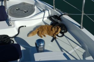
Captain Quincy soaking up the morning Mexican sunshine
After circling for about a half an hour, and seeing no fueling happening at the fuel dock, we began to realize that there was probably no fuel. Yes, there was no fuel at the fuel dock. We called one of the boats at the dock, and learned they were waiting for the fuel truck to arrive. This being Mexico (mañana land), we decided to get into our slip and check in.
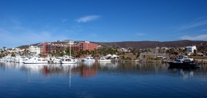
Waiting for the fuel truck to arrive
One downside of Coral is the width of the fairways – they are some of the narrowest I have ever seen. Fortunately, with no wind and no surge, docking was easy, as long as we moved very slowly. After tying up Tropical Blend, we went to the office to check in. At that time, they told us that we didn’t need to visit immigration, and that they would take care of this for us. It’s easier to check in to Mexico than it used to be, especially if you are prepared. We already had our TIP (temporary import permit), so we wouldn’t need to go to the bank to pay for it. For the fueling situation, we told them we were in line behind After Midnight, so we were given number 6, and they told us they would call us on the radio when it was our turn. The day before we left California, I placed a travel advisory with the credit card company I was planning to use in Mexico. Otherwise, they would deny the charges. Yep, you guessed it – they denied the charge at the Marina! I used a different card, and then called up the card provider. Their lame excuse was that we tried to make a major purchase ($200!), which was different than our typical pattern. I asked them how a $200 purchase could be “major” when the card limit was $25,000. I told them there was no way I was going to call them every time I was going to purchase $200 on the card. They seemed to get this…
Rosé decided to go check out the pool, and Ron and I returned to the boat to wait for our fuel call-up. We noticed that After Midnight was still circling in the basin – perhaps they didn’t know that there were assigned slots. At about 1:30, we saw that the fuel truck had arrived and actual fueling was taking place – que milagro! In the meantime, we heard some chatter on the radio that immigration had declared that we would indeed have to go check in personally with them – all crew members! The marina said they would take us in after we finished fueling. Once we saw that boats one and two were finished fueling, we decided to get in line. We pulled into the basin, and then boat three finished, allowing After Midnight to tie up at the dock. However, boat three was still at the dock, although there were no signs of fueling. Rosé was standing above the dock, and she told us that the boat was fueled, but they couldn’t find the captain. Then when the captain finally returned, they couldn’t get their credit card to work for the payment! That made me think about my card, so I called the card provider again to warn them that we were about to make a $1500 purchase for fuel – a major major major purchase!
In the middle of fueling After Midnight, once again the dock was out of fuel, and was waiting for another truck. After the truck transferred the fuel, we would have to wait 45 minutes for the debris in the tank to settle. This was getting to be unbelievable. But it didn’t matter, as the boat sitting on the dock was still sitting on the dock, trying to figure out how to pay. At long last, the fuel was flowing again, and the incredibly annoying boat at the dock left. We pulled in and quickly took on 1,600 liters (422 gallons) of diesel fuel. By now, it was four o’clock, so after returning the boat to the slip, we hustled up to the office. We saw our friends from Endurance at the dock, and we let them know that they had to go to immigration in person. We weren’t sure when the office would close, so we were anxious to get there – but so were a lot of other Fubaristas. We finally left for the immigration office, and the process of checking in and getting our tourist cards was quite lengthy. We returned to Coral at around 5:30, and the dinner was scheduled to start at 6:00. What was supposed to have been a relaxing day turned into something ugly – but at least we weren’t working, or stuck in traffic.
One of the nice things about FUBAR, compared to the Baja Ha Ha, is the onshore dinners. We had heard very good things about the food served on previous FUBAR’s. However, the dinner was indescribably bad. It was apparently some kind of paella, but I wouldn’t have known it. The meal consisted of overcooked rice in a weak sauce, with a variety of tasteless protein items in it – a gray and grisly lamb, mussels that seemed to have been left in the sun for a few days, and other mystery items. It was really bad… We met with the other slug boats, and we agreed to leave at 4:00 the next afternoon for Turtle Bay, although the rest of the fleet was planning to leave on the morning of the ninth. The run to Turtle Bay was long, at 282 miles. At an average speed of 6.5 knots, it would take us a little over 43 hours. When making long passages, we consider when we want to arrive, rather than when we want to depart. We always want to arrive in daylight. Had we waited until the morning to leave, we would arrive at dark o’thirty. By leaving at 4:00PM, we had an ETA of noon or thereabouts.
The following day we actually did relax – we had a really good breakfast buffet at the hotel, where I learned to joy of chilaquiles for breakfast. These are tortilla chips baked with either a red or green sauce, with some sour cream and cheese. These are actually standard breakfast fare in Mexico – how cool is that? After breakfast, we spent time at the pool, and did some FUBAR socializing.
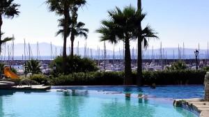
View from the pool at Hotel Coral
Our friends from Endurance were going to town, so I asked them to mail a letter to my brother (actually, a check – Wayne was depositing live checks into our account for us). Rosé had asked for stamps to day before at the marina and hotel, without luck. Later that afternoon, Kurt from Endurance came to visit us, and he told me a tale of woe related to my letter. To make a long story short, he told us that they needed pesos to buy the stamps, and that Steve had gone to an ATM. Trouble was, Steve left the card in the ATM. When he returned to the ATM that card was gone, so he had to call his bank to cancel the card. There were other details, but the saga made me feel really bad, and I promised them some really tasty blends to drown their sorrows. Now I’ll tell you what – I would never play poker with Kurt! He relayed this story with a totally straight face. He finally said that the story was BS – they simply asked the marina to mail the letter, which they did for no charge! Kurt definitely snookered me this time…
November 8th – 10th: Ensendada Marina Coral to Turtle Bay
We left the marina at 4:00PM, as scheduled. During the afternoon, while at the pool, we had seen a pretty large fog bank offshore, but it seemed to dissipate. Well, it came back with a vengeance. As soon as we left the marina, the fog came up like a gray wall. Visibility was probably a tenth of a mile, so once again we relied on the radar. Endurance was behind us by about a half of a mile, and Koumba Bang was on our starboard aft, but really close. Salacia stayed at Cruiseport, and left a few miles ahead of us. The Bang was close enough to make me nervous. Later, I asked them why they stayed so close – they told me they were trying to keep us in visual range. Anyway, we finally got some good spacing and slogged through the fog, which stayed pretty thick for about four hours.
For the watch schedule, we decided on four hour watches. Rosé was smart enough to immediately claim the 8:00PM to midnight watch, so Ron agreed to take the midnight to 4:00AM, and I would take the 4:00AM to 8:00AM. This worked out pretty well. Because of Ron’s experience on fishing boats, he could easily sleep on board, allowing him to have a couple of hours rest before the midnight watch. As the fog cleared, so did the seas. By morning, we had virtually flat seas, with no wind, no waves, and almost no swell. These were great conditions for the Baja coast.
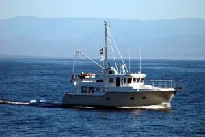
Endurance enjoying flat seas and warm sunshine off the Baja coast
The seas actually got flatter as the day went on, with the water and air temperatures rising as we cruised south. This was a cruiser’s dream! Well, at least those of us who rely on power. There wasn’t enough wind to sail. We saw Razzle Dazzle on our AIS, and they were obviously motoring. We started fishing, but we only caught a couple of skipjack tuna, which Ron said were marginal eating. We decided to keep one of them to test out his claim. Towards sunset on the ninth, we took some pictures of Endurance, and they did the same for us. These would be the first pictures we had of Tropical Blend on the open sea. We settled in for an easy night on watch.
Position at destination: 27°41’ N, 114°54’ W
Air temp: 80, Water temp: 72
Nautical miles for this leg: 281.8 Total: 855
November 10th – 11th: Turtle Bay
We arrived at Turtle Bay a little before noon on the 10th. We were greeted, as is customary, by a dolphin that puts on quite a display, jumping out of the water and seeming to enjoy the arrival of boats. We decided to anchor on the western side of the bay, which seemed to have more protection from the wind. When we arrived, it was pretty calm, but early in the afternoon the wind picked up and the chop in the bay was substantial. Endurance also anchored with us, as did a Nordhavn 55 called Insignia.
Salacia had arrived a little before us, and had chosen to anchor in the east end, closer to the town. Most of the fleet would anchor here. We lowered the Little Blend, and went off to visit Salacia. After that, we decided go into the village for lunch. The dock at Turtle Bay is notorious. It has gaps in it, and the stairway from the floating section to the fixed dock above is really treacherous. At the previous FUBAR in 2011, the weather was up, and many of the people decided not to risk their limbs making the leap from the floating dock to the stairway. Today it wasn’t too bad, but as they say, watch out for that step!
The village at Turtle Bay is pretty small, with no paved streets. It was really dusty in town, and apparently only one restaurant was open. We ran into our friends from Endurance – they had gone in earlier and beached their dink. There aren’t many dinghy docks in Mexico and Central America, so in order to beach the dinghy; you need something light enough to haul it up and down. That wasn’t going to be possible with the Little Blend, so we would either need a dock, or anchor out past the surf line. For the trip to Mexico, Endurance had replaced their normal dink with an 8.5’ that had an inflatable bottom and a 2.3hp motor. It was light enough for them to carry it up onto a beach.
Despite the limited menu, lunch was really good. We then set out to find a tackle store that was supposedly in town, but we couldn’t find it. We headed back to the mother ship for dinner, including our skipjack sashimi – it was OK after all. The next morning, Ron and I decided to go fishing off of the kelp beds. Rose took her paddleboard out for a ride, and we decided to make some water. Amazingly enough, I hooked a calico bass on my first cast – beginner’s luck!
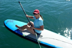
Rosé takes her board out for a spin around Turtle Bay
Ron and I had some more luck fishing around the kelp beds – we caught and released a few more of the calico bass. About an hour after we started, Rose called us on the radio to let us know that the water maker had stopped. We returned to the boat and re-started the water maker. Sure enough, it stopped after running for a few minutes, with the low pressure alarm on. This meant that the low pressure pump wasn’t running, so no sea water was getting into the system. I guessed that it might be related to a clogged filter, dating back to our adventure through the oil slick near Santa Barbara. We had plenty of water, so we didn’t need to troubleshoot this immediately. Ron and I went back to fishing, and this time we hooked a couple of yellowtail. They fought tremendously, and were a lot of fun on our light tackle. We ended up keeping two yellowtail and two calico bass.
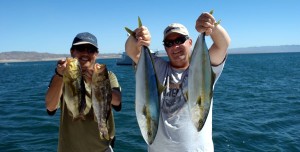
Fish kept from our Turtle Bay angling adventure
The wind kicked up again that afternoon, and we needed to secure the Little Blend to the boat deck. We had heard that this was a much more difficult job when the wind was up, and this turned out to be very true. As we hauled it up the port side, it was swinging quite freely. Fortunately with Ron, we had two people to hold the forward and aft lines for the dinghy, so we managed to get the job finished without too much difficulty.
That evening there was an organized dinner on shore, at Enrique’s restaurant on the beach. We were supposed to be there at 5:30, and there was supposed to be a panga service. We started calling for the service at 5:00. We called, Endurance called, Insignia called – no response. As a matter of fact, pretty much the whole fleet called, with little in the way of response. Finally, around 6:00, a panga came to our cove and picked us up. By this time, the entire fleet was already onshore. There was no organization at all. There were tables and chairs on the beach, but we had to find our own. We asked around, and found out that the food was being served in the restaurant (and I use that term very loosely) upstairs. Apparently we had a choice of chicken or carne asada. By the time we made it to the line, they were out of food, so we had to wait another 15 minutes or so. This dinner was only marginally better than the one at Ensenada. We decided to leave at around 7:30, and went out to the pier. There was already a long line of Fubaristas waiting for a panga. There was only one panga operating, and that was even questionable. The rumor was that this was Enrique’s revenge for the fleet not buying the fuel they had ordered, which had increased in price greatly from the original promise. We must have waited on the pier for a half an hour, then one of the larger tenders for a fleet boat showed up and volunteered to take us out to Nordhavn Cove – very nice of them!
The original plan for the slug boats was to leave at about 4:00AM the next morning. But, we decided that we wanted to get into Magdalena Bay by noon, so we decided to leave that night, at around 10:00. After some discussion, Endurance and Koumba Bang elected to stick to the original plan, while Salacia agreed to leave with us. After returning from dinner, we ended up leaving a little after 9:00, with Salacia not far behind.
November 12th – 13th: Turtle Bay to Magdalena Bay
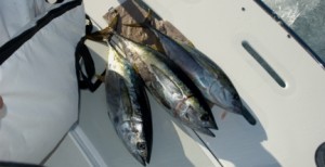
Since the wind had picked up, the sea wasn’t the lake that we had enjoyed on our trip to Turtle Bay, but they weren’t overly rough, either. I guessed they were around three to four feet – piece of cake. The evening watches were uneventful, and by dawn the seas were pretty flat again. We had a very easy day, driving from the flying bridge and enjoying the sunshine. We put the lines out again, and we caught and released a few more skipjacks. That afternoon, we hooked three decent sized yellow fin tunas – we guessed they were around thirty pounds. They fight much harder than the skipjacks, and it’s an effort to land them. Ron taught Lucky how to fillet a tuna, and we had fresh maguro sashimi for dinner – it was fabulous! Strangely enough, Captain Quincy wasn’t interested in it, but he did eat a little of the grilled calico bass. Ah, the fickle nature of cats – he must have some of Morris the Cat’s DNA in him…
While on watch that evening, we heard quite a saga unfolding over the VHF. One of the fleet boats, an Offshore named Sparrow’s Point, reported that they were taking on water. It wasn’t totally clear to us, but we think that the water was building up in the transom, getting in through a crack in the swim platform. They reported that the bilge pump had burned out. One of the boats had some underwater epoxy on board, and they would give it to Sparrow’s Point when they caught up to them. This saga went on for hours, well into the following day. We couldn’t follow all of the details since we were well ahead of them, but it sounded pretty dicey. Eventually they decided to stop short of Magdalena Bay to fix the problem, with several other fleet boats.
At dawn, we went inside Cedros Island. This area is notorious for fish traps, but we were OK with this passage since we were there in daylight. We were fishing again, and this time we hooked a marlin. Ron said it was a black marlin, which wasn’t good eating, so we were planning to release it. I learned just how hard a marlin can fight. Based in the size, we estimated it at 100 to 125 pounds. To land the marlin, you have to grab onto its bill and haul it onto the platform. Just as Ron got the bill, the leader broke and the fish released itself. Since we had the leader in hand, it counted as an official catch. But I remarked that I didn’t want to catch any more of those bad boys – it really wore me out!
Late that morning, we arrived at Magdalena bay, and made our way to Man ‘O War Cove. Mag Bay is really big, about the same size as San Francisco Bay. It was very flat inside the bay and the Man ‘O War Cove anchorage was huge. We were the first boats from the fleet to arrive.
Position at destination: 24°38’ N, 112°08’ W
Air temp: 80, Water temp: 78
Nautical miles for this leg: 258 Total: 1113
November 13th – 14th: Man ‘O War Cove, Magdalena Bay
It was very calm and peaceful inside the cove, with fleet boats were arriving all afternoon. We decided to troubleshoot the water maker. We took out the 5 micron filter that filters the raw water, and sure enough, it was clogged with raw petroleum. The smell was very strong, and there was about a quarter of an inch of raw petroleum sludge in the bottom of the filter canister. We installed a new filter element, and that did the trick. Fortunately, we have quite a number of these spare elements on board. On the radio, we heard a number of other boats complaining about water maker issues, so we felt good that we solved ours so simply. Late that afternoon, we visited one of the 62’s in the fleet, Anna Mae. The 62 has an amazing galley and salon area, and a huge bow deck on it. When we visited, Anna Mae was taking on water (since theirs wasn’t working) from the Spring Day, an N76. On the way back, we stopped to visit the other N62, Infinity. I had shared some e-mail with Infinity’s owners – they were on a similar track as us. They had the boat for about ten months, had made significant changes to it, and decided it was time to go cruising. Andy and Julie, from Vancouver, were cruising with their daughter Chloe, who was on sabbatical after graduating from college – now that’s a smart kid!
The following day it was bright and sunny. In the morning, a panga came around collecting fish for the fish fry. A FUBAR tradition in Magdalena Bay is a fish fry from the fleet’s catch. We donated some of our tuna, and we asked that it be used for sashimi. The village here makes Turtle Bay look like a major metro area. I’m not sure that there is more than one road. We went to the only restaurant in town for lunch, which is right on the beach. The menu was even more limited than at Turtle Bay, but the food wa good, and the cerveza was cold. While we were having lunch, we noticed that a FUBAR boat, the N55 Sea Fox, was leaving the cove, followed closely by a non-FUBAR boat, Family Time. We had a portable VHF with us, and we heard the owner of Sea Fox say that his weather router had given him a forecast of rough seas and high winds for the following day, around Cabo San Lucas. FUBAR had engaged the services of the same weather router we used, Bob Jones (Omni Bob). He had a very benign forecast. A couple of other forecasts were also reported to be very benign. So, most of the fleet decided to stay, but ten or so boats high-tailed it out of the cove that afternoon. Oh well, more food for us!
The fish fry was very enjoyable, including reliable and prompt panga service! In addition to the fish, the restaurant had made rice and beans, salad, albondigas soup, and of course, cold cervezas and margaritas. This was by far the best FUBAR meal we had so far – but we didn’t see our tuna sashimi there… well, you can’t always get what you want. After the dinner, we got a panga ride back to the boat. The beach was a little ripe that night – the next morning was the opening of lobster season, and the bait was being assembled on the beach. We only hoped that our tuna wasn’t part of the bait.
November 15th – 16th: Magdalena Bay to San Jose del Cabo
We left at 6:00AM, just as the sun was rising. Most of the fleet would leave a little later, and many were planning to fish on the banks. We figured we would arrive around eight or nine the next morning, with the whole day to enjoy San Jose del Cabo.
The terrifying hurricane that was predicted by the rogue weather router never happened – it was another great day for cruising, with flat seas and light winds. Other than a couple of skippies, we didn’t have much luck fishing. In the morning, we saw a marlin playing around with one of the lures, so we hauled it in as fast as we could to avoid another catch and release that would wear us out. Most of the Nordhavns came together before rounding Cabo San Lucas. There was a pretty strong southbound current, so we enjoyed the big push. Tropical Blend was cruising at 7.5 knots, reminding us again that we needed to paint racing flames on the hull!
Cabo San Lucas is a highly developed tourist destination, with a lot of big hotels and resorts right on the beach. The marina is VERY expensive – said to be the second most expensive in the world, after Monte Carlo. Fortunately for our wallets, FUBAR was stopping at the very affordable San Jose del Cabo, about sixteen miles west of Cabo San Lucas. As we rounded the cape, the winds were non-existent, daylight was on us, and the fishing fleet had already gone out for the morning. It was pretty cool to see the AIS light up with all of the other Nordy’s in the fleet. There was a lot of radio chatter about our range with this current. Ah well, perchance to dream…
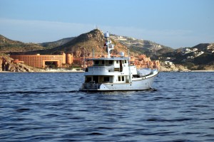
The N62 Infinity passing by the Westin resort at Cabo san Lucas
There was also a lot of radio chatter about slip positions at the Puerto Los Cabos marina – none of us had received assignments, and the faster boats were arriving before the marina office would be open. Fortunately, we got there a little after 8:00, and the office gave us an assignment. We were held up getting to our slip watching Infinity trying to shoehorn into an impossible slip. It looked like Andy had less than six inches on each side. After a few attempts, the marina agreed to get him a different slip, so we moved back towards ours. On the surface, Puerto Los Cabos is a nice marina. However, they have one glaring deficiency – the only marking on the slips is on the surface of the dock at the head of each slip. It’s beyond me how you are supposed to identify your slip when pulling in for the first time!
We were able to locate the slip by asking one of the dock workers, and we pulled in without incident. Although it was still early in the morning, it was plenty hot and humid, with no breeze. It was a very long walk to the marina office for check-in, but lucky for us, they had cold cervezas and water available gratis while we waited. As is usual in Mexico, despite the fact that we had previously sent all of our paperwork in, they wanted the originals for copies, and we had to fill out the very lengthy forms again. We finally finished around 10:00, and then we had breakfast at the small restaurant next to the office.
Position at destination: 23°04’ N, 109°41’ W
Air temp: 82, Water temp: 82
Nautical miles for this leg: 184.4 Total: 1297
November 16th – 17th: Puerto Los Cabos Marina, San Jose del Cabo
We had two days to spend in San Jose del Cabo (SJDC). The town has a lot of character, and it doesn’t seem to have much of a touristy vibe to it. After we finished breakfast, we returned to the boat to wash it down after the long trip from San Diego. At the marina, electricity cost is fixed, based on the boat size. I think we paid around $16 per day, so we could use the air conditioning without any concern on cost. Tropical Blend has two 30 amp shore power inlets. One is for air conditioning, and the other one is for everything else. On our boat, the inverter powers most of the ac circuits, with the exception of the water heater, water maker, and the washer / dryer. The Tropical Blend has three separate air conditioning units: the salon, the pilothouse, and the staterooms down below. So, I fired up the salon unit – check. Next was the pilothouse unit – check. Finally, the cabins – but then the problem started. The pump turned on and ran fine, but the compressor shut down shortly after starting. I tried it a second time, and briefly saw an error code, before all of the ac circuits in the boat shut down.
This was not good! I was able to reason out that running the third compressor required more than the 30A cord could deliver – each zone requires around 12A. I pulled out the boat manual, which is actually the best manual I have ever had for a boat. After reading about the ac power system, I determined that there was a master circuit breaker located in the master stateroom medicine cabinet. Sure enough, it was tripped, so I reset it. Now that ac power was back, I tried out the stateroom AC, and nothing else. Once again, the compressor shut down with the error code indicating that head pressure was too high. I checked the sea water through hull outlet, and nothing was coming out. There was some kind of blockage in the system. I walked over to ask our friends on Endurance if they were familiar with this, and sure enough, they knew this issue well. They said that sometimes small creatures (like baby barnacles) make a home in the pipes, and that they can be blasted out with a pressure hose. They had this kit called “Blast It Out” that allowed a garden hose to be secured to just about any hose inlet or outlet for clearing lines. They said they would bring it over the following morning.
After troubleshooting the AC and cleaning the boat, we took showers on board. The marina only had two showers that we knew about, located in a trailer pretty far from our slip. That was the second deficient point about the marina. Since we had gotten the water maker up and running, we had full tanks again. We had been advised that the water quality at the marina was good, but “not up to USA standards”, so we decided not to trust it. Neither did Endurance – they don’t have a water maker. They had ordered fifty gallons of pure water, which arrived in the form of ten five-gallon jugs. Then these had to be poured into the tank through a funnel. Since we already had our full complement of 300 gallons of water, we all took showers with impunity!
That night we were invited to a sundowner party on board the Giddy Up, an N55 owned by Anne and Jim from Calgary. We had first met them in Dana Point just before we left for Alameda. We had seen their boat in the marina, and we were amazed by how much bigger it looked than ours. After touring the boat, Ron remarked that it was like our boat, but on steroids. We love the flying bridge on the N55 – very spacious, and very high up. We got several of our ideas from Giddy Up. Most notably was the shoe rack in the cockpit. Rosé got the idea to redo our upholstery in black, and the idea of that table covers. Anyway, it was a fun party, with most of the Nordy crowd there, as well as many of our FUBAR friends. After the party, we went back to the marina restaurant for a late dinner. The restaurant food is pretty good, and the prices are reasonable, but they don’t have a lot of items on the menu. We had some tortilla soup, which was quite good. The following morning (Sunday) Kurt and Steve from Endurance came over with their Blast It Out. We started at the through hull – it was clear. Then, we checked the inlet and the sea strainer, and there was plenty if sea water coming in. Finally, we found the compressor, which is beneath the lower port bunk in the guest stateroom. It’s not exactly easy to get to it. First we blasted water from the outlet of the compressor, and found it was clear. This left only two options: there was a blockage in the compressor tubes, or there was a real problem with the compressor. I undid the sea water hose at the inlet, hooked up the blaster, and crossed my fingers. Ron and Rose were monitoring the through hull outlet, and they said a lot of black gunk came out, followed by clear water. I reconnected the water inlet, and we had a working air conditioner for the staterooms! The previous night we had slept using just the pilothouse AC. You’d think that in a boat of this size, that would be sufficient, but the staterooms were quite warm. We were pretty happy know that night we could sleep in the cold!
We went into town for breakfast and some shopping. Considering the short distance to town, the taxi fare was pretty high at 100 pesos, but what can you do? Ron was very familiar with the town, so we went to a hotel he recommended for breakfast, the Tropicana Inn. They had a fabulous buffet there, with a great selection of both Western and Mexican dishes. Once again I was able to get chilaquiles, which I thought was a great idea for a breakfast dish. After breakfast, we toured to town and did a little shopping. We picked up some produce at the public Mercado, at rock bottom prices. We ran into Salacia: Neil, Dianna, and their crew. I asked about an ATM, and they said they had seen on one the road into town. The only ATM at the marina dispersed US dollars – that made no sense to me. In a lot of the border and tourist towns, you can use US dollars – but the exchange rate is way below what it should be. For example, at that time, the actual exchange rate varied from 12.5 to 13.0 pesos per dollar. But you would be lucky to get an exchange rate of 12;1, and sometimes as low as 10:1. I was anxious to load up on pesos. We never did find the ATM, but we did find some air conditioned shops. I loved these, as the heat and humidity were way up, with little breeze to compensate. We didn’t have any luck finding the ATM, so I still had no pesos.
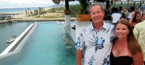
That evening was another FUBAR dinner, this time on top of the hotel at the marina, the Hotel El Ganzo. The view up there is fabulous, with a very cool infinity pool at the side of the roof.
The dinner, however, was another FUBAR fiasco. It consisted of finger food – taquitos with a hint of chicken in them, and some kind of slider sandwiches. At least this time we didn’t have high expectations. It was fun to socialize with the other FUBARistas, but the party shut down pretty early. We headed back to the boat to sleep in air conditioned heaven, with a planned 6:00AM departure.
November 18th: San Jose del Cabo – Ensenada de Los Muertes
We left at 6:00AM, prior to the sunrise. Ron said there was great fishing on the Gordo Bank, so we decided to troll there for a while before heading off to Los Muertos. We weren’t the only FUBAR boat with that in mind – there were quite a few out there, in addition to countless pangas. Sadly, we had no action, and started the trip north to Muertos. We had heard that there would be a small norther. These are winds that race down the Sea of Cortez when there is high pressure over the Great Basin in the USA. With nothing to get in their way, they can blow hard for a couple of days. Shortly after we made our north turn, the seas got ugly. We had short, steep seas directly on our nose, with the wind blowing at a steady 20 knots. We estimated the seas at five to six feet, but the period between the waves was so short, we just slammed up and down all day.
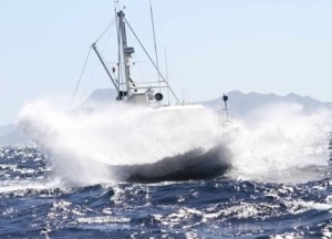
The Nordhavn N50 Worknot getting blasted
We slowed down to under six knots in search of a better ride. We were taking white water on the pilothouse windows, and the anchor was achieving zero-G. Ron braved the slamming to tighten the anchor down. There was a lot of chatter on the radio about the seas, and we decided to give the fleet a little concert from a famous Gordon Lightfoot song:
When suppertime came, the old cook came on deck
Sayin’ “Fellas, it’s too rough to feed ya”
At seven PM a main hatchway caved in
He said, “Fellas, it’s been good to know ya”
Captain Quincy was doing okay, but he was a little distressed by the pounding. At one point, he needed to use his litter box, and Rosé observed him as spread-eagled as he could possibly be to maintain his balance. She wanted to take a picture, but felt that he should be given some dignity. The crew of Giddy Up were in the spirit of the day, calling out a loud “yee-haw” on the radio. Earlier in the day, we had been making water, but I saw that it turned off, with a LP alaram, similar to what it had done with the petroleum. I figured that it was because with the violent motion of the boat, the intake was exposed to air periodically. We’d try it after anchoring.
We arrived at Los Muertos at sunset, one of the last boats in. Muertos is a pretty big anchorage, with good protection from the northers. After dark, the wind gave up the ghost, giving us a restful night. We tried out the water maker, but it wouldn’t operate. The low pressure pump sounded like a garbage disposal with a spoon stuck in it – I figured that the impeller was probably toast. Anyway, we turned in early – getting pounded by head seas really wears you out.
Position at destination: 23°59’ N, 109°50’ W
Air temp: 82, Water temp: 82
Nautical miles for this leg: 79 Total: 1376
November 19th: Ensenada de los Muertos to Marina Costa Baja, La Paz
We left at 6:00AM on this final day of the FUBAR odyssey. It felt like graduation day. It was dark when we left, and we followed the N55 Insignia out of the anchorage. Several other boats were behind us, as much of the fleet was anxious to get to La Paz early. The wind had calmed down considerably, and the seas were much nicer than on the previous day. Since there isn’t a real ocean swell in the Sea of Cortez, wave conditions can change drastically, depending upon the wind. We had an easy run around Punta Coyote and through the San Lorenzo channel. The closer we got to La Paz, the calmer the water became. Early in the morning in the lee of Isla Cerralvo, we were passed by one of the Baja ferries.
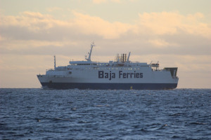
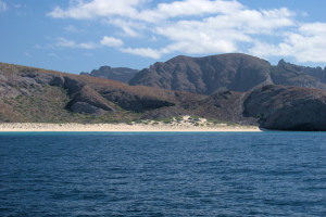
Once we got around Punta Coyote, the landscape was dominated by a series of bays with very fetching beaches inside them.
When we arrived at the Costa Baja marina entrance, the seas were totally flat. We had a slip assignment in the inner harbor, which is close to shopping and restaurants at the complex – but far from the marina office. After we docked, Ron and Rose went to work cleaning the boat while I hitched a ride on a golf cart to check in at the marina office. Once the cleaning and the formalities were done, it was time to relax! The marina is at the Costa Baja resort, which allowed us to use the beach club. This is a restaurant, bar, and pool next to a beach that is located at the entrance to La Paz harbor. The only downside to the beach club was the pool temperature – it was quite chilly compared to the ocean! We enjoyed the afternoon at the beach club, and there was a cocktail party for the FUBARistas there that night.
Rose enjoying the lounges in the pool at the Costa Baja Beach Club
After a few piña colodas and some socializing, Kurt from Endurance suggested that the Slug Boat Flotilla head over to Steinbeck’s restaurant in the hotel for a festive dinner. All of the owners and crew of the Salacia, Endurance, Koumba Bang and Tropical Blend were together for this dinner.
The Slug Boat crews from Endurance, Tropical Blend, and Koumba Bang
The following morning there was a seminar on cruising in Mexico, put on by Pat Rains. We had seen her talks before, and they were about the same – but there was supposedly a decent continental breakfast being served, so Ron and I joined in. It really was the same talk again, but I guess things don’t change that much. The food was quite good, which gave us hope that the final dinner that night would be an improvement. Well, it certainly was much better. There was some good arracherra beef, good fish, and good everything. It really was a great way to wrap up FUBAR. After this, we would start our own solo cruising adventure.
Position at destination: 24°13’ N, 110°18’ W
Air temp: 82, Water temp: 78
Nautical miles for this leg: 50.4 Total: 1426
The Sea of Cortez
November 20th – December 2nd: Costa Baja Marina, La Paz
We had originally planned to spend one week at Costa Baja, but the facilities were great, we were a little worn out from cruising every day, and we had some boat work to get done. We decided to spend two weeks at the marina. Most of the FUBAR fleet either left their boats at the marina and flew home, or moved to other marinas in the area. After a few days, there were only a few of us left at Costa Baja. The crew from Endurance stayed at the hotel for a couple of nights (taking very long showers, after living with water austerity for two weeks), and they invited us to join them on an afternoon cruise to Puerto Balandra. It was rather enjoyable to be cruising on someone else’s boat. Balandra is about twelve miles from Costa Baja. We anchored in the cove, had a little lunch, and then Kurt and Steve went snorkeling. Susan, Caro,l Rose, and I took their little dinghy across the bay for a beach walk. Since very few anchorages in Mexico have dinghy docks, Endurance decided to leave their regular tender home, and bought a small 8.5’ dinghy with an inflatable floor and a 2.3hp motor. This was light enough to carry up onto a beach. Most of the sailboats here have small dinghies with retractable wheels on the stern, so they can be rolled up and down beaches. We had considered this idea, but it just wasn’t practical for us to carry two dinghies. The motor on the Endurance dinghy didn’t have gears – when it started, is was in forward gear. This took some getting used to, as you can’t rev the engine up after it catches. Also, it was completely impossible to steer it in a straight line. We wandered all over the bay, and it actually tired me out to steer it.
We had a nice walk on the beach where we collected some unusual shells, but then the wind had picked up, so it was time to go back. It wasn’t easy to launch the tiny tender into the breaking surf, get everyone on board, and start the motor. Rose held on to the mighty ship while I pulled the starting cord. To get it started, I had to give it enough gas such that it kicked up and ran into Rose – she would have a big bruise on her leg to remind her of Balandra! It was a very wet ride back to the Endurance. We cruised back to Costa Baja for some sundowners and appetizers, and then we bade farewell to our friends, since they were flying back to L.A. the next day.
We really liked La Paz – it had a nice combination of Old Mexico, with just a t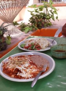 ouch of modern style. There were tons of great restaurants, good grocery stores for provisioning, and lots of cold cervezas at good prices. On Thanksgiving, there is an annual cruisers pot luck dinner where for a very small price, turkeys are provided, with the expectation that everyone brings a side dish. We elected not to join, so we had a very traditional Thanksgiving dinner at a small restaurant in town.
Our friends Neil and Diana from Salacia were also staying for the two weeks, so on many days we went into town with them. Costa Baja ran a free shuttle every other hour that dropped you off at the cathedral in the center of town. One of our favorite restaurants was Rancho Viejo. They are famous for their arracherra tacos, which is a type of skirt steak. The main restaurant is actually open twenty-four hours, and there is a smaller one on the Melacon in the tourist area.
And then there was boat work. At the top of the priority list was the water maker. We got the name of the top water maker expert in town, but he was pretty busy. A lot of the FUBAR boats had water maker issues, so he was working on their much larger systems. We finally got him to our boat. He did the same diagnosis as I had – checked to see that there was water coming into the boat through the strainer, observed that the LP pump wasn’t working, and then did something really simple that I should have thought about: he flushed the system twice. It was highly likely that we did have air in the system, and the flush back-filled water where it was needed. After this quick fix, and 400 pesos later, we were back in business.
The other important item was to adjust the stuffing box for the wing engine. I had discussed this with other small Nordhavn owners, and they all agreed it was a pain. Endurance had cut a wrench in half with a hack saw to allow access to the very tight space. I borrowed that tool, and I was finally able to get the nuts loose. I banged the gland out a bit, started the engine and adjusted the gland until there was some water dripping out. In order to finish the adjustment, we would need to have the boat cruising, so I called an end to that exercise for now. I also figured out how to get a socket wrench around the lock nut, allowing for adjustment of the gland.
Other than those items, we enjoyed a relaxing stay in La Paz. We had dinner with cruising friends a number of times, visited the marine stores, got haircuts, spent a lot of time at the beach Club, and generally enjoyed ourselves. One of the highlights was swimming with whale sharks outside of La Paz harbor. Apparently the juveniles come into the harbor to feed at this time of year, so we took a tour boat out. There had been a mild norther blowing for a couple of days, so we were waiting for a good day. We thought we had it, but even though the wind had died down, the waves were still annoying, at about three feet, close together. There was also a lot of murkiness in the water, lowering visibility to a few feet. Despite this, we had a great time swimming with these gentle giants. We tried to take some underwater movies with a GoPro, but visibility was just too poor. Kurt and Steve from Endurance had gone out on a much better day, and they had very good video that they shared with us. Basically, the boat driver looks for the sharks. At thirty feet long swimming along the surface, they aren’t hard to spot. The swimmers jump in ahead of the shark, and then swim along with it as it feeds. Now I realize that they are filtering out plankton, but there is something spooky about being next to the mouth of a thirty-foot shark!
Exploring the southern Sea of Cortez
December 3rd: Marina Costa Baja to Playa Bonanza (Isla Espiritu Santo)
We decided to buddy-boat with Salacia in the Sea of Cortez for a while. We departed Costa Baja on December 3rd for Isla Espiritu Santo. This island is close to La Paz, and it is a major cruising haunt. It’s oriented north-south, with most boats concentrating on the western side. There are over thirty anchorages on the island. We decided to start with a large bay on the southeast side, known as Playa Bonanza. Salacia decided to take on a full load of fuel at Costa Baja, so we ambled out into the Sea at just five knots, waiting for them to catch up. The sea was completely flat that day, making for a fine passage. A Mexican Navy patrol boat passed right in front of us, but they weren’t interested in boarding.
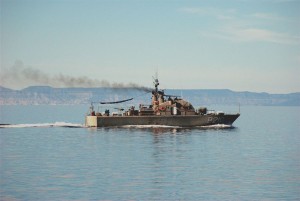
A patrol boat enjoying the very flat seas
Because we started out slow, the 16.5nm trip took three hours. Playa Bonanza is a beautiful white sand beach in a broad three-mile half moon bay.
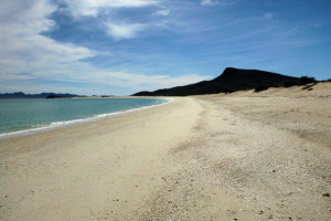
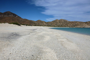
View from the beach at Playa Bonanza Looking north on Playa Bonanza
The surf was almost non-existent here, so we had no trouble taking the Little Blend close to shore, anchoring it just off the beach. Salacia joined us, and they brought their little dog Chewie to run on the beach. This beach is also a paradise for shell collectors – Rose found quite a few pieces of sea glass for her collection. After an afternoon on the beach, we took Little Blend up to the reef at the north end of the bay for some snorkeling. The water was a little chilly, and the visibility wasn’t great, but there were a lot of fish on the reef. We also got the chance to use our dinghy ladder for the first time. If you have ever had to climb into a dinghy from the water, you’ll know what I am talking about when I say that it is close to impossible for a full-grown (especially an extra-grown) adult. You grab on to one of the handrails, pull for all you are worth, and desperately try to swing a leg over the side. You resemble a cross between a beached whale and a trout on ice, as you struggle mightily. The dinghy wants to roll over on top of you, and there is no leverage for your feet. On one of our charter trips to BVI, we took a folding ladder. It was relatively useless, since as soon as you stepped on it, the ladder would swing directly underneath the dinghy. We attended the Strictly Sail show in Alameda in 2013, and we saw what looked to be a serviceable ladder. This was the first chance we had to use it, and it worked like a charm. I was able to hoist myself up with relative ease. On a related note, this was the first time we used our dinghy anchor, the world’s smallest Bruce – held like a champ!
We returned to the Tropical Blend for dinner and an exquisite sunset.
-
- The next morning Lucky tried his luck fishing, using the same plastics that caught fish in Turtle Bay. The first cast yielded a strong strike, with the tail bitten off of the plastic. The second cast had a similar strike, and now half of the body was gone -so much for fishing. A little while later, some park rangers showed up in a panga to check our permits. In Mexico, most islands are National Parks, requiring permits to visit them. We had heard something about this in La Paz, and we had purchased annual permits. We also heard that you can buy them direct from the rangers without paying a fine, so… We spent another lazy afternoon on the beach. We were anchored at about the mid-point of the beach, and other than Salacia and ourselves, no other boats were hooked. There were a few sailboats anchored in the southern half of the bay, which is apparently more sheltered from northers. We only had a light east wind, that tended to shift west after dark. All in all, it was very comfortable there.
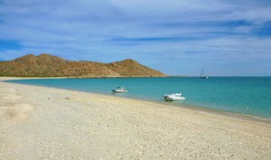
Little Blend and friend at Playa Bonanza
December 5th: Playa Bonanza to Bahia San Gabriel
We decided to head to the other side of the island, going just around the southern point for Bahia San Gabriel. This is another bay with a beautiful beach in it, although it wasn’t as large or wide as Playa Bonanza. The waters near the beach are quite shallow and shoal, so Lucky took a ride in Little Blend to check it out. Although it was pretty shallow, we figured that we could make it to shore, even if we had to get out and pull Little Blend to the shore. We carried all of our beach paraphernalia with us: the Tommy Bahama chairs and umbrella, a large folding cooler and portable speaker for Christmas music. Dianna and Rose went down the beach in search of shells. After a half an hour or so, Neil noticed that his dinghy wasn’t really floating anymore. We had underestimated the speed of the tide – it was going out fast! We realized that if we waited much longer, we were going to be stuck. At San Gabriel, there are a series of sandbars running parallel to the beach, so we couldn’t go straight out either. We piled all of the beach stuff back on the tenders, yelled for the girls, and started hauling the dinks in search of deeper water. We could see that towards the south end the water looked darker, so we pulled the tenders until we felt there was enough of a channel to make it back into the bay – one small bullet dodged! We took a little tour of the bay – it’s quite delightful, and only one other sailboat was anchored in it.
Beautiful white sands of Bahia San Gabriel
As a side note, for the short hops in the sea, both of us had decided to tow the tenders instead of hauling them up to the boat deck each day. By this time, we were slowly developing a routine to raising the Little Blend, but if there is any wind, it’s a real pain, as it can swing pretty wildly. We weren’t too concerned about security in these waters; although we did cable lock the Little Blend to the swim platform each night. After we returned from our bay tour, we noticed that Salacia was hauling their tender up to the boat deck. I called to ask why, and Neil said they had sprung a leak in the fiberglass bottom. He had previously sealed a hole, and scraping the bottom along the sands of Bahia San Gabriel apparently loosened the patch – oops!
Position at destination: 24°25’ N, 110°28’ W
Air temp: 82, Water temp: 77
Nautical miles for this leg: 10.0 Total: 1453
Departed at 10:00am, arrived at 12:00pm
December 6th: Bahia San Gabriel to Caleta el Candelero
We made the short run up to Caleta el Candelero in the morning. This is a smaller cove with a towering rock in the center of the entrance – hence the name Candelero. It was an overcast day, but still quite pleasant. We anchored on the northern side of the rock, and then we picked up Neil and Dianna (their tender patch was still curing) to head for the beach. There was a small fish camp on the beach, which is divided into two sections by a rocky outcrop.
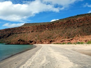
Anchored at Caleta el Candelero Beautiful beach at Caleta el Candelero
Our friends from the sailing vessel True North were anchored in the cove, near the candle-like rock that splits the cove. They said the snorkeling was quite good around the rock, but we were too far from it to swim over, and we couldn’t find a sandy spot to anchor Little Blend. That night, Neil and Dianna came over for dinner and some Liar’s Dice. Since their dinghy was still curing from the patch, we chauffeured them over and back.
Position at destination: 24°30’ N, 110°23’ W
Air temp: 82, Water temp: 77
Nautical miles for this leg: 6.6 Total: 1460
Departed at 10:15am, arrived at 11:45am
December 7th: Caleta el Candelero to Partida Cove
On Pearl Harbor Day, we Tora! Tora! Tora’d over to Partida Cove, said to be the most popular anchorage on Espiritu Santo. It’s a much protected bay that splits the island. To the north is Isla Partida. There is a small channel between the two islands that can be traversed by dinghy at high tide. As the island went, it was busy, with about a dozen boats anchored. Since it is such a large bay, there was no feeling of being crowded. We took Little Blend to the beach, where we were joined by Neil and Dianna in their newly repaired tender.
Beach that separates Isla Espiritu Santo from Isla Partida and the anchorage
We took the dinghies through the channel that separates the two islands. The water was very clear and full of schooling fish. There are a number of fish camps on the south end of the cove, and the pangas flew through the channel at breakneck speed. After our beach tour, we decided to lift Little Blend to the boat deck, since we had a twenty-two mile cruise across open water planned for the next day. Unfortunately, we got one of the tender lines wrapped around the prop as we got to the Tropical Blend. I tried to undo it in the water to no avail. Once we had the Little Blend secured on the deck, it was easy to unwrap the line. Whew! Partida Cove seems to be a popular weekend destination, as there were quite a few Mexican power boats in the cove. They tend to play music pretty loud, but not so much to disturb our sleep. It’s nice to see local people enjoying their beautiful country.
Position at destination: 24°31’ N, 110°23’ W
Air temp: 82, Water temp: 77
Nautical miles for this leg: 3 Total: 1463
Departed at 10:00am, arrived at 10:45am
December 8th: Partida Cove to Isla San Francisco
The next morning we joined Salacia in a cruise to Isla San Francisco. There was a Norther forecast for the following two days, and the west side of the island (The Hook) is well protected. The bay is much smaller than it looks in the cruising guides, but there is easy room for about a dozen boats to anchor in a single line. We anchored in the far north part of the bay, close to the mountain side for protection from the Norther. This is a very picturesque bay, with a perfectly formed semi-circle beach. We took Little Blend to shore, where we discovered that the beach was primarily constructed of pebbles. Flip-flops were required here. We also discovered a concrete block on the beach, which was much better for tying up the bow line that the PVC pole we had been using – we decided to keep the brick for the future.
Isla San Francisco beach Blends on the beach
After learning that dogs aren’t allowed on the islands in the Sea, Neil and Dianna would leave their cute little dog Chewie on board. Chewie didn’t like that, and he had a habit of endless barking when left alone. Neil was concerned about this, so I suggested that he use his handheld VHF to yell at Chewie from the beach. The barking would start, Neil would use the radio to say, “Chewie, NO!”, and there would be silence for a few minutes. Now, every time we hear a dog barking on a boat, we look at each other and say, “Chewie, NO!” I decided that we needed more than beer for such a beautiful beach, so I went back to the boat and blended up some strawberry daiquiris for the beach.
Position at destination: 24°49’ N, 110°34’ W
Air temp: 79, Water temp: 77
Nautical miles for this leg: 21 Total: 1484
Departed at 8:30am, arrived at 12:00pm
December 9th – 10th: Isla San Francisco
The forecasted Norther came in, but it was fairly light – at least in the protected bay. We saw gusts to twenty knots, but not too much. We went back to the beach again for some R and R. At the southern end of the beach, we saw a couple of small children cavorting about on the beach with no apparent adult supervision. Had they gone into the water, we were prepared to go down there and watch them, but finally an adult came to shore on a kayak. From what we could tell, the kids had been told NOT to go into the water, and they had obeyed. Still, you have to wonder… These people were on a catamaran anchored at the southern end of the beach. Dianna would later tell us that the crew walked around naked on the boat. Fortunately, we never saw them. Most people don’t look like supermodels when naked. Later that afternoon, Neil and I decided to snorkel the wall at the north end of the bay. The water was a bit chilly at 77°F, making me wish that I had put on my shortie wet suit. We did see quite a lot of fish, so it was worth it.
The next day, I got the bug to climb to the top of the hill that overlooks the bay. Rose sensibly decided that she didn’t have that bug. For the first time in over a mo
nth, I put on shoes and set off on the hike. I could see a trail going up the hill, so I walked down the beach to find the trailhead. This trail ended up going pretty much straight up the hill – easy to go up, but all the loose rocks had me concerned about coming back down. After just ten or fifteen minutes, I got to the top. The southern wall is a sheer drop down to the ocean, and the trail is right on that edge. The view from the top was fabulous! As it turns out, by walking this trail to the west, there is a gradual path that goes back down to the beach, so I didn’t have to worry about slipping.
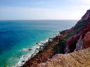
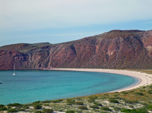
Watch out for that first step! A perfect half-moon bay
Neil and Dianna had decided to go back to La Paz. They felt that with the frequent Northers, it was getting a little cold. Since they would be back in the Sea the following spring, they felt it was time to go. Dianna wanted to be in a metro area for Christmas, so they would probably cross to Mazatlan. Since this was the only foreseeable time we would be in the Sea, we planned to keep going north. Our plan was to go as far as Bahia Concepcion , then cross to Topolobampo.
December 11th: Isla San Francisco to Bahia Amortajada
Salacia left for La Paz in the morning, while we cruised around the south end of the island, heading for Isla San Jose. There is an anchorage on the south end of the island with a mangrove estuary, said to be a great place for a dinghy tour. The guidebook said to enter just before high tide, but we didn’t have the luxury of choosing our time. We anchored at Bahia Amortajada, with some difficulty. There is a shallow shelf that extends quite a ways out and
then drops off quickly. Trying to find the sweet spot was challenging, but eventually we were satisfied. We were towing the Little Blend, so we jumped in to find the bar for the estuary. As we got close, and the water got shallower, we could tell that the tide was going out – FAST! We located the bar, and I jumped out to tow us over, as it was too shallow to motor in. It was quite a struggle, but we eventually got into water deep enough for the motor. I had to give it a lot of gas to get over the bar, but once we were inside the estuary, it was like another world. The water was clear enough to see to the bottom, at about twelve feet. There were quite a few fish, but not so many birds, as promised in the guidebooks. Still, it was a different experience, and we were glad to have made the side trip. It was easier getting out – I still had to tow the dinghy, but the tide was pushing us.
Position at destination: 24°53’ N, 110°34’ W
Air temp: 79, Water temp: 77
Nautical miles for this leg: 7.8 Total: 1492
Departed at 9:00am, arrived at 10:20am
December 11th: Bahia Amortajada to Mangle Solo
After a quick lunch, we pulled the anchor and cruised north up Isla San Jose to our anchorage for the night at Mangle Solo. This is a long beach that faces west, with a little protection from north winds. There were only two other sailboats anchored there. With drinks to go, we went ashore to do some shell collecting. There are a couple of fishing camps here, and an amazing cactus forest just off of the beach. This seems like one of those hidden gems, where few cruisers venture. We found it to be a beautiful and peaceful place.
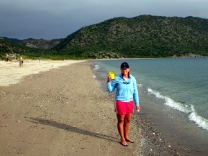
Drinks to go at the cactus forest near Mangle Solo beach
Position at destination: 25°01’ N, 110°41’ W
Air temp: 76, Water temp: 75
Nautical miles for this leg: 11.8 Total: 1504
Departed at 12:30pm, arrived at 2:30pm
December 12th: Mangle Solo to Bahia Tembabichi
This cruise would take us across the San Jose channel to the eastern coast of the Baja peninsula. Tembabichi is a wide bay with some protection from north winds. We left early in the morning, still towing Little Blend, to light winds and calm seas. These conditions didn’t last long – soon we had a Norther whacking our nose, with a strong opposing current. We were only making 4.5 knots at 1700 rpm’s, and we were pitching pretty violently. We definitely wished that we had the Little Blend secured on the boat deck, but there was nothing we could do about it. We continued to get slammed all the way up the channel until we reached the protection of the point north of Tembabichi. T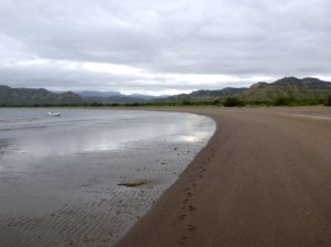 here were two other small sailboats anchored in the bay – we took a position in just twelve feet of water, still a quarter of a mile off of the beach – this is a very shallow bay. Since we had protection from the wind, we took the dinghy to shore for a beach walk and more drinks to go. We also decided to put out the flopper stopper, since there was a refracted swell causing a little bit of rolling.
Position at destination: 25°16’ N, 110°56’ W
Air temp: 73, Water temp: 74
Nautical miles for this leg: 21.3 Total: 1525
Departed at 8:00am, arrived at 11:40am
December 13th: Bahia Tembabichi to Puerto el Gato
We had a grand plan this day, with several stops along the way to Agua Verde. We left early in the morning to medium winds. A soon as we rounded the point, we got hit with a 20 knot wind on our nose, but the seas weren’t up too much yet. It was only three nautical miles to Puerto el Gato, which has very stunning sandstone rocks around it. We anchored in the middle of this small bay as the only boat. There was some protection from the north wind there, and no rolling. Rose decided to take the paddle board to the beach, while I donned my wetsuit and snorkeled in. It was probably about a quarter of a mile to the beach.
The sandstone rocks tr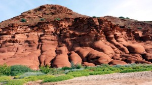 uly are stunning, with a very vivid red coloring. There are lots of large oyster shells on the beach, as well as underwater. The snorkeling around the rocks was the best I had seen so far. I saw a large moray eel and a lot of sculpins on the bottom. The water was chilly at 74°F, so I was glad to have the wetsuit. We took a bunch of photos, and Rose collected quite a few shells.
We returned to the boat to continue our journey north to Agua Verde. However, as soon as we rounded the point out of the bay, we were slammed really hard by the wind and waves. It was blowing at twenty-five knots, with very short and steep seas at six feet. Clearly, this was not going to be comfortable. We decided to seek protection. Rose wasn’t comfortable staying at el Gato due to the proximity of the rocks, so we decided to go back to Tembabichi.
Position at destination: 25°18’ N, 110°57’ W
Air temp: 73, Water temp: 74
Nautical miles for this leg: 7.1 Total: 1532
Departed at 8:15am, arrived at 9:00am
December 14th – 16th: Bahia Tembabichi to Bahia Agua Verde
We returned to our same anchorage spot, where we didn’t have much protection from the wind, but the fetch was quite small. Again, there was some rolling due to the refracted swell, so we put out the flopper stopper, dampening the roll. We would spend three days here as a big Norther raged on. We saw peak gusts of forty knots, and most days the wind was sustained at twenty-five to thirty knots. We never dragged, but we did sail around the anchor somewhat, which led to some rolling. We didn’t really do anything, but being in the wind like that really wore us down. You can actually feel exhausted by it. The second night we were there I notice that the water pump was running when there was no demand. We have a pressure water system – there is a one gallon pressurized tank that delivers fresh water throughout the boat, kind of like a city water hookup. This reduces the number of times that the pump starts and stops – it kicks in when the pressure in the tank drops below a set level.
The next morning I started to troubleshoot the problem. According to the manual, this happens when the accumulator tank is bad, or when the pressure switch in the pump is bad. I assumed it was a tank problem, since with the pump off, that tank would not deliver water a few minutes after being pressurized. I asked some of my Nordhavn friends about it, using the Iridium phone to send out an e-mail. They also believed that it was a faulty accumulator tank. With the frequent Northers and colder water and air temperatures, we decided to change our plans. The wind was supposed to lay down on the 16th, and we really wanted to see Agua Verde . I didn’t think that we could find parts to fix our water pressure issue at Puerto Escondido (near Loreto), but I was confident we could get it done in La Paz. We decided to abort our plan, and only go as far as Agua Verde, and then head back to La Paz.
The wind had indeed laid down that morning, so we weighed the anchor and headed off to Agua Verde. It was only twenty miles, so we were confident this would be an easy cruise. Although the winds was much lighter, the head seas were still up somewhat. It was a much better ride than we had experienced in the San Jose channel, but we still pitched a lot. Rounding the point where we turned west to Agua Verde, we saw a small Hobie cat sailing along. This was crazy – the seas were at least five feet, and they would have to get back to wherever they came from. Some days, you just can’t fix stupid.
When we got the Agua Verde, there were no other boats anchored. We anchored near the panga beach on the north side, and it was very calm. This is a very beautiful bay, named for the greenish tint of the water. We wanted to visit the very small village behind the beach. During a radio conversation, a sailboater had told us about getting fresh goat cheese at the village – we wanted to find it. So, we lowered the Little Blend and took off for the beach. There was a decent swell up that day, so we couldn’t land on the beach. However, we did see a road heading up into the hills from the panga beach where we were anchored, so we speculated we could walk that road to the village. There was absolutely no surf at the panga beach, so we anchored the Little Blend. There was a small house on the beach, with an elderly man who had a dog named Lola and a little kitten in his lap. I took him a beer and asked him to watch the dinghy. He actually offered us lunch, but we had already eaten. We were touched that this stranger who had very little had offered us lunch.
We hiked up the road, and took some great photos of the Tropical Blend.
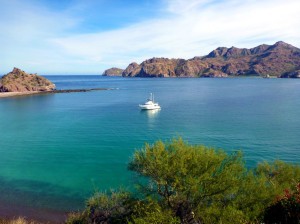
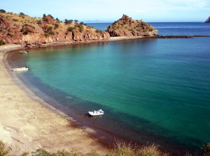
This turned out to be quite the hike. The road took us inland for a while before it joined up with the main road leading to the village. We were impressed by the level of greenery. Having lived in Arizona for a long time, we were quite familiar with deserts. But this area had a very nice green hue to it.
As we descended to last hill into the village, we dreaded having to climb back up. This was a really small village, with no paved roads. There may have been a tienda, which may have been open, but we elected to give it a pass. We never did see the goat cheese lady. We did see the ever-present Mexican army – a newer pickup came driving through the village, with two soldiers armed with automatic weapons in the back. We walked along the beach, and Rosé speculated that we could walk all the way back to the panga beach. There are cliffs on that side, and we could see some walking areas, so we decided to take a chance. It turns out that here instinct was correct, and we were able to walk along the rocks back to our panga beach. Late that night, under a brilliant full moon, I watched a couple of panga fisherman use the same walkway to get back to the village- with no flashlights.
Position at destination: 25°31’ N, 111°04’ W
Air temp: 72, Water temp: 73
Nautical miles for this leg: 20 Total: 1552
Departed at 7:20am, arrived at 10:30am
December 17th: Bahia Agua Verde to El Cardonal
We departed early in the morning to get as far south as we could during the daylight. The weather was pretty nice, with winds varying up to 15 knots, and a light swell. There wasn’t much traffic in the water – just a couple of fishing boats and a few sailboats. We were planning to spend the night at Isla San Francisco, but with a strong current pushing us, we decided to make for Partida Cove. We figured that we would be there just after sunset. The wind picked up after we passed San Francisco, slowing us down considerably. It was well after sunset when we arrived at what we thought was Partida. It turns out that we were actually in El Cardonal, just north of Partida. The C-Maps chart was so far off, it showed us on land between the two bays. Cardonal looks like a small version of Partida, especially in the dark. We set the anchor without problem, and turned in early for the night.
Position at destination: 24°33’ N, 110°23’ W
Air temp: 72, Water temp: 73
Nautical miles for this leg: 73 Total: 1625
Departed at 7:45am, arrived at 6:15pm
December 18th: El Cardonal to Marina Costa Baja
We awoke that morning to a dead flat sea – not a hint of a breeze or a ripple on the surface. We pulled the anchor and left Cardonal, turning south towards La Paz. 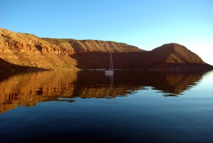 Since this was such a calm sea, we figured that this would be a good time to exercise our wing engine, and adjust the stuffing box. Since the engine has a V-drive transmission, it’s quite difficult to access the nuts for adjusting the stuffing box. We would run the engine, observe what adjustment was required, stop the engine, adjust the nuts, and wash, rinse, and repeat. After a few cycles, I felt that we had the adjustment down pat, with a reasonable temperature on the coupling – about twenty degrees over the raw water temperature. We were surprised that the boat made so much speed with a 27hp engine. We were humming along at close to four knots, at 80% of WOT. Since the wing engine has its own shaft and propeller, which are offset, the autopilot is a little confused, but it worked fairly well in these flat conditions.
As we approached the La Paz channel, boat traffic picked up considerably, including a pass-by from the ever present Armada de Mexico patrol boat. We called Costa Baja on the radio, and they had exactly the same slip that we had in November for us. We docked without further incident, and set out to fix our water pressure problem.
Position at destination: 24°13’ N, 110°18’ W
Air temp: 75, Water temp: 73
Nautical miles for this leg: 22.4 Total: 1647
Departed at 7:45am, arrived at 11:00am
December 18th – 25th: Marina Costa Baja, La Paz
We checked in with the marina without incident, and since it was early in the afternoon, we took the shuttle to town with the intention to walk over to Lopez Marine. This is the largest marine store in town, and we had a fuzzy memory that the walk from the Cathedral (where the shuttle dropped us off) wasn’t so far. However, the sun was blazing down on us with no wind, so we got quite hot on the walk. We finally got to the store, and asked about an accumulator tank. The only tanks they had were the small Jabsco ones, or a two gallon Shurflo. I took a long look at the Shurflo, and figured that I could probably fit it in to our system. We asked about ordering the Groco direct replacement. But with Christmas coming up, they said we couldn’t get it until mid-January. I decided to keep searching for the replacement, as the Shurflo was $350 with a lot of work needed to fit it in.
We continued walking to several other stores, with no luck. Since we were in the area, we decided to visit a grocery store. We went to the CCC store. We thought it was very odd to have people selling produce just outside of a grocery store, but once inside, we realized that this store had dry goods only. Instead, we decided to head over to The Cow. We found The Cow to be a pretty complete store, although small and cramped.
The next day I started investigating how we could get the accumulator tank shipped quickly. Someone on the net told me about an express delivery service, where you have an item shipped to their San Diego office, and then they take it to Tijuana, load it on a truck, and ship it twice weekly. They simply ass 30% to the invoice of whatever you buy. Since the replacement tank cost around $100, this seemed reasonable. However, getting it shipped quickly to San Diego wouldn’t be cheap. Plus, I called the express service and found out their deliveries would happen only once per week during the holiday period, and they wouldn’t guarantee delivery even if we got the package to them two days prior to the scheduled ship date. This wasn’t looking good.
The next day on the net, I found someone that had a slightly used Shurflo tank – the same one that I had seen at Lopez Marine. He offered it to me for $200, so I decided to go with that option. In the meantime, we thought that our friends Kurt and Susan on Endurance would be around, as they were planning to spend the week before Christmas on their boat. We tried to call them on the radio, but no answer, so we figured they were out cruising. We had lunch at the Breeze Mart – chicken burritos that were actually soft tacos, but delicious nevertheless. In the middle of lunch, in walked Kurt and Susan! We agreed to meet at the Italian restaurant for dinner that night. We had pizza and calzones, which were huge and delicious.
The next day I started to install the Shurflo tank. It was a piece of cake to remove the old tank, but in order to mount the new one on the side of the ballast box, and I had to take out some of the lead bars in the box. Did I say they were really heavy? Other than that, mounting the new tank was pretty easy, but I realized I needed a male-to-male fitting to hook it up to our water system. I found the largest plumbing supply store in town, and took a taxi to save time. This being the Saturday before Christmas, traffic was terrible, so the ride took a very long time. It also cost 300 pesos – to buy a fitting that cost 49 pesos. D’oh!
I installed the new fitting and hooked up the tank, but there was a leak in the fitting. I tried every which way but loose to stop the leak, without success. Exasperated, I finally decided to test the system, since stopping the leak might require a permanent bond. And yes, you guessed it – the pressure would not stay up! I had wasted around $250 to fix something that wasn’t broken. I went back to the first suggestion, that the pressure switch in the pump was faulty. I replaced the pump, and lo and behold, we had water pressure again. Arrgghhh! Stubbornly, I decided to keep the Shurflo tank, leaks and all, for an emergency backup. I still hadn’t learned to try the simple, direct solutions to problems first.
Anyway, our week was filled with a little more boat work – changing engine oil and generator oil. That didn’t go so smoothly, as I decided that I could drop the main engine filter into a one gallon zip lock back, instead of the much larger trash bag. When it fell into the bag, heavy with oil, the bag turned downward, spilling oil on the side of the block and under the engine. It took us about an hour to clean up that mess. The generator change went off without a hitch. The last job was the transmission oil and filter change. That filter is upright, so I anticipated issues. I punched a hole in the old filter to try to get all of the oil to drain out of it, but the oil still spilled all over the place, forcing another extended cleanup. With all of the fluids changed out, we were ready to continue our journey.
We took Kurt and Susan to Rancho Viejo, where we continued to enjoy the arracherra tacos and queso fundido. We decided to depart La Paz on Christmas Day, bound for Muertos and then across to Mazatlan. We said our goodbye to Kurt and Susan on Christmas Eve, and prepared to make our passage over to the Pacific Coast. We contacted our friends Neil and Dianna – they were staying in Marina La Paz, and not enjoying it at all. They were looking to move to El Cid. We called El Cid, and made a reservation.
Pacific Coast of Mexico
December 25th, 2014: Marina Costa Baja to Ensenada de Los Muertos
We checked out of the marina on Christmas Eve, since the office would be closed on Christmas Day. I was told that we could give our gate keys to one of the dock workers that would be there. I asked if he could come over at 8:00. Well, we didn’t see anybody on the docks, and no one responded to our radio hail. I asked (in my bad Spanish) one of the security guards to find him. By 8:30, no sign of him. Finally at 9:00, I saw a couple of guys talking up by the gate. I asked them about our missing worker, and they said he wasn’t working that day. Fortunately, one of the workers came by on the Gator cart – at least he said he worked there, despite not having the uniform. I decided to take him at his word, and gave him the keys. Ah well, we were living in the land of mañana.
We finally shoved off at 9:15. The weather forecast was good, with mild offshore winds. We had dead calm seas and a beautiful sunny day cruising through the San Lorenzo channel. However, once we turned south around Punta Coyote, all Hell broke loose. We had a large beam swell hitting us with a very short period. The stabilizers couldn’t keep up with the fast moving swells, and we rolled considerably. Lots of things were clanging and banging in the cabin, and Quincy was not a happy kitty. We had to adjust our course to tack away from the swells, which reduced the rolling. The winds were on our port beam at around twenty knots all the way through the channel. We tried running closer to the lee of Isla Cerralvo, but that didn’t give us any shelter from the beam swell. Late in the day we finally reached the point and headed into Los Muertos. The wind was still howling, but the bay was pretty calm, so we were fairly comfortable. There were only two sailboats in the anchorage, so we were able to anchor with the best protection. We had phone service, but no network access, so Rosé called her aunt and sister to wish them a merry Christmas.
Position at destination: 23°59’ N, 109°50’ W
Air temp: 70, Water temp: 74
Nautical miles for this leg: 50.7 Total: 1698
Departed at 9:15am, arrived at 4:45pm
December 26th – 27th: Ensenada de Los Muertos – Mazatlan (Marina El Cid)
We left Muertos early in the morning to make the twenty-nine hour crossing to Mazatlan. One of the two sailboats anchored in the cove left shortly before us, but we quickly passed them. The wind was around fifteen knots, with a mild swell hitting our port bow. This died down in a few hours, and for the rest of the crossing, the seas and winds were very calm. We didn’t see any other boats all day. What was really strange was that we had network access for about the first twenty miles, so I was able to download a few forecasts. I say it’s strange, because in the cove at Muertos, we had no network service – but no problem on the open sea!
This was the first overnight passage that we made as a cruising couple. We agreed to keep to the four hour watch schedule. I would take 8:00PM to midnight, Rosé would take midnight to 4:00AM, and I would take 4:00AM to 8:00AM. Generally speaking, Rosé is a much better sleeper than I am. She was able to conk out shortly after dinner, while I was wide awake. I was enjoying the crossing, what with the stars shining brightly on the moonless night. When she came up for her midnight shift, I told her that I was wired and wide awake, so she went back to bed, understanding that when I tired, I would wake her up. This turned out to be a regular pattern for us. Shortly before midnight, we were met head on by one of the Baja ferries. That was the only traffic I saw all night.
At about 5:00AM, I gave out and asked Rosé to take over, allowing me to take a small siesta. During her watch, she also came across a westbound ferry. In the morning we were greeted by a lot of humidity. La Paz had been around 50%, but here it was up to 75% – that made a big difference in the heat index. We saw some whales close to Mazatlan, but they were boat shy, so no close-up. Marina El Cid is located at the south tip of Mazatlan’s Gold Coast, a very developed stretch of beach, with many high rise hotels. We identified to marina’s breakwater, and hailed them for a slip assignment – without luck. I tried several times, but there was no response. Finally I called them on the mobile phone, and they gave us an assignment.
Some boaters had told us the bar entrance to El Cid and Marina Mazatlan has shallow with surge, but we had an easy time of it. Once we got into the marina harbor, the dock workers told us that they had changed our assignment to the end tie off of A dock, the first dock. There was plenty of space there, so we were pretty happy. Once we tied up, we noticed that several boats had chains and nylon straps holding them at the dock. The boat next to us had a very elaborate set of tie-downs – they told us it was because of the surge. Sure enough, we saw our braided lines stretching back and forth. We decided to use the one-inch monstrosities from the previous owners. Almost all of the lines were one-inchers when we bought the boat; Dan and Whitney told us they got them because of the surge in Marina Coral. They were really difficult to use with normal cleats, but we decided to keep them anyway. We learned that they were indeed useful when there is a lot of surge. We checked in, and went out to explore the marina.
Position at destination: 23°16’ N, 106°28’ W
Air temp: 79, Water temp: 79
Nautical miles for this leg: 190.5 Total: 1888
Departed at 7:40am, arrived at 12:30pm (next day)
December 27th – January 2nd: Marina El Cid (Mazatlan)
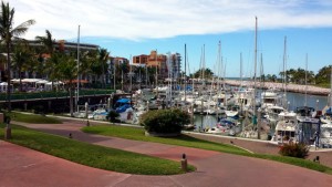
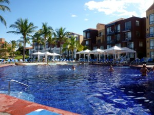
View of Marina El Cid The main pool
We first walked over to C dock to visit with Salacia – they had moved over from Marina La Paz a could of days earlier. Being in this marina had improved their opinion of Mazatlan immensely. We joined them at one of the two pools. This being the week between Christmas and New Years’, the resort was pretty busy, as were the pools.
As marina guests, we got a twenty-percent discount on food and beverage – a pretty good deal, but the prices were pretty reasonable anyway. To our pleasant surprise, there was a happy hour already, so we got two-for-one drinks. In addition, our waiter brought us a free round when we got the check – excellent! Neil told us about getting around by bus. There are two bus systems there: one of them is an air-conditioned bus that basically goes from the Gold Coast to downtown – it costs ten pesos. The standard buses cost only six pesos. We were really starting to like Mazatlan! The marina had laundry service – either do-it-yourself, or paying a small charge to a lady who would wash, dry, and fold laundry on site. There was also a small tienda selling Pacifico’s for ten pesos (sweet!) And a couple of clothing stores. The marina had two pools, what we called the main pool and the rock pool. The rock pool was closer to us, and it had a big jacuzzi and an artificial rock cliff you could dive off of. But, Dianna correctly advised us that the water at that pool was pretty cold. In addition, there was a beach club accessed by a free water taxi. That would also give you access to the public beach at the Gold Coast.
We agreed to join Neil and Dianna for dinner that night, since they would be leaving shortly. Neil had a coupon for a free round of drinks at a restaurant within walking distance. On the way, we were approached by a lady calling herself Mary – she was a timeshare tout. We explained to her that we were living on boats, and timeshares weren’t on our agenda. We proceeded to the restaurant, which was a large place serving seafood. We found that they had very good Happy Shrimp (stuffed with cheese, wrapped in bacon; mmmm, bacon!). The waiters and some of the patrons were singing, using a wireless microphone. I couldn’t follow the words enough, but I think they were people celebrating something. On the walk back to the marina, a car suddenly stopped in front of us, and out jumped a woman touting timeshares – yep, it was Mary again. I guess all of us gringos look alike!
We had a nice day at the pool on Saturday. Neil told us about a weekend tradition in the old town, where a bunch of restaurants surrounding a square move their tables into the square for Friday, Saturday, and Sunday nights. So, we decided to head to town to check this out. The bus route goes down the very long Malecón, which was very pretty at sunset. We got off of the bus in the old town, then walked through the large public market. This is a very traditional Mexican market, with some items that we found over the top, such as whole cow heads and whole pig heads. I suppose you could use them as a soup base, but seeing them hanging in the open air, eyeballs and all, was quite an experience. We picked up some cash, and headed to the square. It was early, so the restaurant tables were pretty empty. Each one had a menu posted, and each one pretty much had the same choices – lots of shrimp, steak, and chicken. We picked one, and ordered shrimp, of course. Dinner was very good, and the square was quite full by the time we left. Neil suggested that we find the Best Western Hotel on the Malecón, which has a rooftop pool. On the way, we walked past a bar where a cover band was doing an excellent rendition of some Doors songs. We found the Best Western, and took the very old elevator to the roof. It really creaked and groaned, and when we got to the top, you could see the motors. I’m pretty sure they were vintage 1930’s; we weren’t so confident about taking them back down. The view of Mazatlan by night was fabulous, and we had a round of drinks. After that, it was time to find the ten peso bus back to the marina.
Neil and Dianna left the following day, so we took the water taxi to the beach club and walked up the Gold Coast beach. I was very surprised that there were no beach bars along that stretch – most of the high rise towers were condos. We were hoping to find a sports bar that might have the Chargers game on (they were fighting for a playoff spot), but no luck. We went back to the marina, and I watched, or rather tried to watch, the game on streaming. We have DirecTV Caribbean, from Trinidad, but they don’t carry CBS – a dispute over the rate they pay. The bandwidth at El Cid was pretty poor, typical of most of the networks in Mexico. We’d see a play just get started, and then the stream would freeze. It was a long, frustrating game – both from the perspective of the stream and the lackluster effort by the Bolts – but they finally prevailed to get the last playoff spot! We had a nice shrimp dinner on board – the water taxi driver had brought me two kilos of cleaned shrimp for 440 pesos.
On Monday, we wanted to do some provisioning, so we decided to take the bus to Soriano. First we walked down the road past the marina, near Marina La Paz, where we heard there were some chandleries. We were hoping to find a spare fresh water pump, as well as a manual gray water pump (ours had started to leak). We found a couple of chandleries, but they didn’t have what we needed – not a real surprise. But we also found a sports bar – we probably could have watched the game there… We knew that Soriano was near Home Depot and Walmart, so we asked a couple of buses if they were going to Soriano. We boarded a six peso bus that was supposedly stopping at Soriano. But, it kept going east from the marina area, to a brand new shopping mall that was net to a brand new Walmart. We weren’t aware that there was a new Walmart, and we thought that the driver was mistaken about Soriano. The bus then headed back to, and past, the marina, eventually getting us to Soriano. This is a very nice grocery store, with a lot of other items as well. We stocked up on a number of items, including ricotta cheese, which we never saw in La Paz. We also bought some Mexican cat food for Quincy – a Purina brand called, “Felix”. It turned out that on most days, he would eat that one! We were able to take the bus back with all of our bags – a cheap expedition!
On New Year’s Eve, we decided to go back to the mall and the Walmart, looking for more cat food, as well as a couple of kitchen gadgets. While waiting for the right bus, one of the open-air taxis offered to take us for 30 pesos, so we agreed. Those taxis remind me of the Mokes that are rented in Barbados.
January 2nd – 3rd: Mazatlan to Matanchen Bay
We decided to take on fuel before leaving Mazatlan. El Cid’s fuel dock is small, angled, and busy with charter boats. We waited until the dock was clear, and then motored over to take on fuel and check out. We decided to take on 1600 liters, at a price of about $3.95 per gallon. After fueling, we went to the office to check out, and to pay for our fuel. The marina office there also takes care of the day charters: fishing, cruising, and little outboard fun boats. In the middle of paying, someone called to ask about one of the charters, in Spanish. The senorita proceeded to discuss options with them in excruciating detail, answering endless questions, while we were waiting to pay our bill. Another boat was waiting to get to the fuel dock, but we had to wait fifteen minutes for the charter conversation to finish. We have noticed that customer service in Mexico operates on the squeaky wheel principle – there seems to be no sense of finishing a job. Ah, the land of mañana…
We were finally able to pay our bill and get on our way. We were blessed with another beautiful day, clear skies, light winds, and calm seas. We left just about at noon, had some sandwiches, and settled in for the long cruise to Matanchen Bay. We decided to skip over San Blas, since we had heard horror stories about the marina there – very hot and sticky with a big tide that could hold us up in the marina. Despite the warnings about the jejenes (no-see-ums) in Matanchen Bay , we decided that would be our next destination. Just outside of the entrance to El Cid, there are a couple of pretty little islands that are popular weekend destinations for the locals.
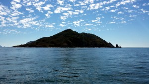
Isla de Pajaros
The cruise down this coast was uneventful, but we did see a number of whales. Towards sunset, we saw some whales doing full breaches way ahead of us, but they were too far away to take pictures. For dinner, I got the insane idea to recreate the Happy Shrimp using hot dogs. I quickly learned that bacon on a grill is a really bad idea – flame on! I had to finish them up in the microwave to avoid torching the boat. We had been told to watch out for long lines, but at night there’s nothing much you can do about them. Long lines are fishing lines hanging from a main line, possibly spread out over miles. Sometimes they are marked with small pennants or buoys, and sometimes they are just invisible. At night, you just hope that you don’t run across them, and if you do, you hope that the shaft cutters do their job and slice them up before they wrap around the prop.
I took the midnight watch. There was a lightning storm behind us on the coast, and the pyrotechnics were fun to watch. We were also in prime shrimp boat territory. They are well lit, and they easily show up on radar. They don’t like changing course, so you have to play a little dodge ‘em. At about two in the morning, I picked one of them up on radar, heading straight for us. I altered my course once we got close, but then the shrimper also altered course to match ours. It also changed direction to match ours. I continued to alter course, and my shadow followed me. This went on for about a half an hour, and finally I put the hammer down and got away from that crazy skipper. Eventually, I figured that he was bored and was screwing with us – kind of confirmed talking with some other boaters.
Just after dawn, I finally saw one of the long lines, marked with a black pennant. I have no idea why they use black, it’s barely visible during the day, and completely invisible at night. Anyway, we cruised past San Blas and into Matanchen Bay. It’s a very large and shallow bay. We headed for the recommended anchoring position to find the only other boat in the bay anchored there. We moved off by about a quarter of a mile and dropped the hook.
Position at destination: 21°31’ N, 105°14’ W
Air temp: 84, Water temp: 80
Nautical miles for this leg: 132.9 Total: 2021
Departed at 12:00pm, arrived at 9:00am (next day)
January 3rd – 5th: Matanchen Bay
It was noticeably warmer in Matanchen than it had been in any other place during our trip – for the first time, it actually felt like the tropics. The northern part of the bay is ringed with endless restaurants on the beach – and under water, at high tide!
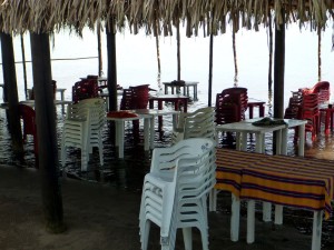
Matanchen beach restaurant at high tide
We lowered Little Blend and went for a tour of the bay. It was about two miles to get to the east side of the bay from our anchorage point. We surveyed the beach in front of the restaurants, and observed there was virtually no surf, so we decided to head in for lunch. First, we stopped at the sailboat near us, called Happy Dance. We met the owners, Marty and Sue, from Seattle. They said that they had been in the bay for a couple of days, and had not had any bug problems. We talked about the jungle tour, and agreed that we would take it the next day. They had dinghy wheels, so we could hitch a ride with them. Since the bay is so shallow, the tide exposes huge amounts of beach, so we couldn’t anchor Little Blend for a long period of time.
We headed to one of the restaurants and anchored just off of it, wading to shore in a couple of feet of water. The restaurants specialize in fish and shrimp, so Rosé ordered a whole fried fish, while I wanted to try shrimp empañadas. While we were waiting, a local vendor came through with fresh baked goods, so we bought a loaf of banana bread – a specialty in this area, given all of the banana plantations. Rosé saw a pickup truck drive past with a load of watermelons, and we both wished that it had stopped. Lunch was delicious – my first date with shrimp empanadas was a smashing success! The watermelon truck came back by, so we flagged him down, and bought a small watermelon for fifteen pesos – a little more than a dollar! It was a seedless melon, and it was absolutely delicious. Towards the end of our lunch, Rosé saw that a couple of kids playing in the water decided it would be good fun to lob mud at our dinghy. I ran out and told them to cut it out in my best Spanish, and only then did their parents tell them to stop. They made quite a mess with all of the mud, and it’s beyond me to figure out why that was fun. Apparently vandalism is a universal trait for teenagers.
We went back on board for a quiet afternoon. A couple of other boats came in to the anchorage, but it still felt deserted. The restaurants were open that night, but not too busy, considering it was Friday. The next morning, Marty and Sue picked us up and we headed into the beach. I had my first experience hauling a dinghy on wheels – their tender was 9.5 feet, with a 10hp motor. Still, it wasn’t a walk in the park to walk it up the beach, since we had arrived at low tide. We paid a local restaurant guy thirty pesos to watch the boat, and set off for the Rio Tovara jungle tour. We had read that this was a panga expedition up the Rio Tovara esturary, with lots of crocodiles on the beach. It was about a half an hour walk, and we passed by a lot of roadside stands selling banana bread, smoked fish, fresh fruit, and other goodies. The four of us got our own panga and guide – I think we were the only gringo’s there that day. The guide spoke a little English, and we spoke a little Spanish, so the tour was muy bueno. When we first set out, we were in a tunnel of mangroves.
Our guide had very sharp eyes – throughout the tour he would spot birds, lizards, plants, turtles, and of course, crocodiles, which we would sometimes struggle to see. We saw a lot of crocs sunning themselves – many had their mouths open, which is how they cool down. Who would have known that crocodiles pant like dogs?
After touring the preserve, we got back onto the panga and headed for the freshwater river pool for lunch. They have the river fenced off to keep the crocs out, and there is a jungle swing int the pool, but we were more interested in cervezas. The restaurant had no power that day, so the food was limited to ceviche – but it was very tasty! After lunch, we boarded a panga with a lot of local people for the cruise back. We stopped at some of the roadside stands to get some more banana bread, and we also bought some jaka fruit, the local name for jackfuit. We hiked back to the restaurant area, and decided on shrimp all around. The no-see-ums may have been around, because the waited placed a smoking coconut husk near our table. There was a large group of Mexicans next to us, and one of the men introduced himself to us. He had lived in the Bay area for a while, so we shared some stories, cervezas, and danced to local music with his big extended family.
The previous day we had heard the old “Alley Cat” song coming from shore, and we thought it was a popular local song. Turns out it was the music on the local ice cream truck, which looked like this:
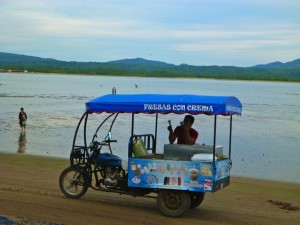
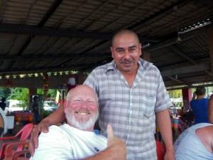
Ice cream cart Marty and his new best friend
After lunch / dinner, we hauled the Happy Dance tender down the beach and returned to our respective boats. We planned to go to San Blas town the next day, which was Sunday. We made some vanilla peach ice cream that night, which we planned to share with Marty and Sue.
The next morning we went back to shore with Marty and Sue, and caught a taxi to San Blas. Our first stop was the old fort that overlooks the town. The taxi ride was cheap, at fifty pesos. It was well worth it, considering that the driver took us all the way up the very steep hill to the fort. The ruins of the citadel are very cool, with a museum in the old buildings. There are great views of the town of San Blas from this location. The citadel and the nearby church date back to the late 1700’s, although the fort was damaged heavily in 2002 by Hurricane Kenna. When we walked to the old church, we were mobbed by mosquitoes, so out came the Off. After enjoying the ruins, we walked down the hill to the town.
View of San Blas Old cannon at the citadel
We spent some time exploring the museum and taking a lot of photos. And then we hiked a little bit down the hill to the ruins of a very old church.
Ruins of “Our Lady of the Rosary” church
We quickly found out that this ruin was infested with mosquitoes – the Off was sprayed fast and furious, but not much deterred this little bastards, so we hustled down the hill to the town. San Blas is a charming Mexican town, with lots of tiendas, restaurants, and vegetable markets. Even though it was Sunday, most of the stores were open. We were seeking a restaurant called McDonald’s that was recommended in the cruising guide. And no, it isn’t THE McDonald’s. Someone cleverly named their restaurant, and I guess that the mega chain’s lawyers don’t know, or don’t care, about the copyright infringement. Or more likely, it’s Mexico. Anyway, we found the restaurant, and had a very nice local lunch. It had wifi, and I was able to get the ESPN Gamecast for the Chargers – Bengals playoff game. I promised Marty and Sue that I would pay for the beer if we could stay there and follow the game. After much arm-twisting, they reluctantly agreed! Amazingly, we won the game with some ease, so we were thrilled, if not a little drunk. It’s a little hard to see in the picture, but I was proudly representing the Chargers that day. We found a couple of produce markets and tortilla factories to add to our ship’s stores, and then we caught a taxi back to Matanchen.
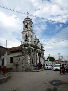
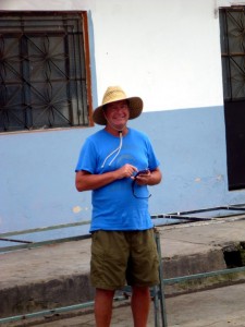
Exploring the streets of San Blas
Matanchen is infamous for its jejenes (no-see-ums), but other than a few in the restaurants on shore, we hadn’t seen them, or felt them. However, on this night, we were invaded by a horde of mosquitoes. They came from nowhere at dusk, so we closed up the boat, turned on the A/C, and started the slaughter. We killed around twenty-five of them over a few hours. Somehow the swarm missed Happy Dance, lucky them!
January 6th: Matanchen Bay to Chacala
The next morning we departed for Chacala, the next recommended destination in the cruising guides. The pictures of it looked like a sub-tropical paradise, with a beautiful pink sand beach fringed with palm trees. When we arrived at the bay, it didn’t disappoint, looking very much as shown in the guides. There were around ten boats anchored in the bay, and it was large enough to accommodate two or three rows of boats. There was one powerboat on the left hand side of the bay, and the rest of the boats were small and medium sized monohulls. We noticed that quite a few of them had stern anchors out, but the bay was quite calm, so we didn’t deploy ours. The wind was blowing from the west, so we were stern-in to the beach.
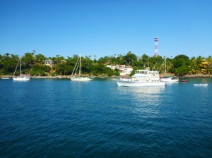
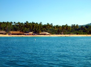
Chacala anchorage Beach restaurants
On the north side of the bay, a concrete dock held a ton of pangas, so it was obvious that we couldn’t tie up the Little Blend there, but there was a calm, protected beach area just inside of the dock. We lowered Little Blend and anchored in that small cove. The main beach at Chacala has small breakers, but the cove is well protected. The Port Captain’s office was right by the cove, but it was closed, as this was one of many Mexican holidays. The beach has about a half a dozen restaurants on it, and a small village is just behind the beach. We found a couple of markets there that had fresh produce and cheap beer. We had a fabulous shrimp lunch at one of the restaurants, and then walked up the beach.
We were very 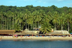 surprised at the number of gringos on the beach. We had never heard of this place outside of the cruising guides. We asked one couple how they had heard of Chacala – they said that there was a large retreat on the south end of the beach, and that they take a bus from Puerto Vallarta to get there. As this was a holiday, there were a lot of Mexican tourists enjoying the beach, an
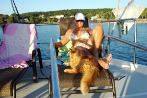 d late that afternoon, some of the strangest mariachi bands we had ever seen appeared. They had full brass sections, including tubas, along with marching-band drums. The mariachis we were familiar with had guitars, bass guitars, violins, and trumpets – but no tubas and drums. The songs sounded like you would expect a Mexican marching band to sound like. We returned to the boat for sundowners, and Quincy actually joined us up on the boat deck.
Position at destination: 21°09’ N, 105°14’ W
Air temp: 82, Water temp: 81
Nautical miles for this leg: 22.3 Total: 2043
Departed at 9:40am, arrived at 1:10pm
January 7th – 8th: Bahia Chacala
After dark, the wind shifted, and so did we. Unfortunately, we were beam to the swell, and started rolling. It wasn’t too bad, but we decided that we should deploy the stern anchor the next day. I read through some of our “how-to” books that discussed stern anchors, but none of them provided a procedure for deployment. Our stern anchor is a large Fortress with 30’ of chain attached to the Quickline nylon strap on a roller. It was a little big to take out on the dinghy, so we decided to let out a lot of extra chain on the bow anchor, then back down, deploy the stern anchor, go forward and then take back in the extra chain. This worked out fairly well, and the stern anchor was easily set – all swinging ceased. We went to the beach again for the day.
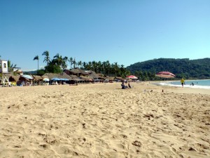
Beautiful beach at Chacala Tropical Blend lying off of Chacala
As we were enjoying the beach, we watched another trawler anchor in the bay to the right of us. It turned out to be Antipodes, from the FUBAR. When we left the beach, we went over to visit with Nancy, Randy and Adam to catch up. They had crossed over to the mainland a little before we did, and they had gone out to Isla Isabela for diving. Randy said that he didn’t have any problems anchoring there, which was the prime reason we decided not to stop there. This was the first time we had been on board their boat, so we got the tour. It’s a custom 55’ steel trawler, with a nice cockpit area. They have two young and overactive cats, Oreo and Fiddlesticks. Adam is twelve years old, and is being home-schooled during their voyage. They are taking a sabbatical with relatively fuzzy plans. Randy is a very experienced fisherman, and they gave us some dorado they had recently caught.
We had originally planned to stay two nights at Chacala, but since we loved it so much, and Antipodes was there, we decided to stay another night. They joined us on the beach and for lunch the next day. The cove where we anchored the dinghies was around some rocks and out of sight. Some of the local people use the small beach there for picnics. When we returned to the cove that afternoon, we found the local kids using our dinghies as a play platform. At least they weren’t tossing mud at them like in Matanchen, but they managed to get a lot of water into the battery and fuel tank compartments. Their parents were right there with them – I guess that parents in Mexico don’t care what their kids do to other people’s property. It was worse for Randy – they had Mustang life jackets on board, and the kids decided to inflate them, leaving Antipodes with no CO2 cartridges. We invited Nancy and Randy over for sundowners. They were going to leave early the next morning for La Cruz, planning to fish offshore along the way.
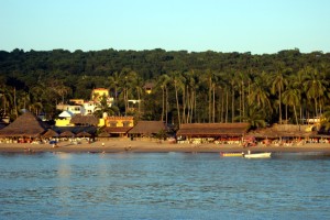
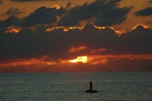
Dusk settles over the beach Sunset at Chacala
January 9th: Chacala to Punta de Mita
We got an early start that morning, since we needed to pull up the stern anchor. The advantage of the Fortress is its light weight, being made of aluminum. However, I grossly underestimated how heavy thirty feet of 3/8” chain is when pulling by hand. We let out the bow anchor chain, and then backed down on the stern anchor as I pulled it in. At one point, I was convinced that it was stuck on a rock. Debbie backed down past the anchor, and I was finally able to haul it in. Clearly, we didn’t need that much chain on the stern anchor! Our destination today wasPunta de Mita, just inside of Banderas Bay. The coastline on this cruise was lovely,with long palm tree beaches ever present.
There are a few anchorages along the way mentioned in the cruising guides, but we decided to skip them as they weren’t well protected. Along the way I did a fuel burn test. Tropical Blend has a day tank, which I believe holds forty or fifty gallons. We can select either of the main fuel tanks to feed the day tank. By shutting off supply from both tanks, the day tank will start to drain. There is a highly sensitive sight gauge for the day tank, marked in increments of 1/10th of a gallon. By doing a timed run, you can easily calculate the fuel burn for a give RPM. We ran increments of twelve minutes, and determined a burn rate of 2.1 GPH at 1600 RPM’s, and 2.6 GPH at 1700 RPM’s. This indicated a range of around 3600nm at 1600 RPM at a speed of 6.4 knots. The longest run we have contemplated is crossing to the Marquesas Islands in the South Pacific, a distance of around 2600nm, depending upon the launch point. Even at 5.5 knots, we have a range of 3100nm – good news if we get serious about a circumnavigation.
The original owners of our boat, when it was Island Magic, cruised to Alaska and then down to Costa Rica. Their waypoints were still in the old plotter, and I had referenced them a few times. This day I used them when I shouldn’t have done so. There is a reef around Punta de Mita, and I had laid in a course around the reef. But as we were getting closer to the point, I noticed an Island Magic waypoint closer to shore, so I decided to use that one to save some time. We were getting very close to the waypoint when I saw rocks visible below the boat, and the depth suddenly went from fifty feet to less than ten. At the same time, a panga was racing towards us frantically waving their arms. Too late, I stopped forward thrust, and then we hit a rock with a big clunk. I reversed the boat, and we brushed another rock. The guys on the panga showed us the way off of the reef, which was my original waypoint. Rosé rushed below to make sure that no water was coming into the boat, which it wasn’t, and everything else seemed to be OK – no vibrations, full power, full steering. We continued on to our anchorage. I looked up the waypoint from Island Magic, and found that they had labeled it, “Punta de Mita rock”. I learned a valuable lesson here – always enter my own waypoints and be 100% certain. The cruising guides use waypoints to mark dangers, but I never enter them into the plotter to avoid any confusion. I’m not sure why you would do this, as long as you had a safe course entered.
Immediately after we anchored, I dove down to inspect the keel and rudder. Apart from some chipped paint, I didn’t see any real damage, so we seemed to have dodged a big bullet. We had lunch, but we were too rattled to lower the dinghy to explore the shore. There is a very 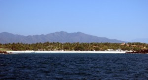 expensive Four Seasons resort here, and somewhat of a town along a long beach. The anchorage is quite large, though it’s not well protected. We had a fairly strong wind keeping us aligned into the swell, so we weren’t moving too much. Through the binoculars, we spotted another Nordie from FUBAR, the N50 Worknot, owned by Gale and Mary Plummer. White beach at Punta de Mita
Position at destination: 20°42’ N, 105°18’ W
Air temp: 81, Water temp: 80
Nautical miles for this leg: 33.5 Total: 2077
Departed at 7:45am, arrived at 12:45pm
January 10th: Punta de Mita to Nuevo Vallarta (Paradise Village)
We left the following morning for the short run to Paradise Village Marina in Nuevo Vallarta. We cruised past La Cruz and lined up for the entrance to Nuevo Vallarta. Once we spotted the entrance, we contacted the marina. This is a very popular marina, and it is often full. Salacia had been told that they couldn’t get in until January 20th. While we were in Mazatlan, I sent an email request to PV Marina for a January 10th arrival, and they confirmed it immediately – beginner’s luck, I suppose. The marina winds up a natural channel, with many of the slips along the side of the channel. We were advised to proceed up the channel to the section called E dock. It was a 73’ slip, and we might have to move after a day or two. We easily tied up in the slip, and then made the very long walk to the marina office to check in. In addition to the marina, there is a yacht club that accepts marina tenants, a full-service resort, and a modern shopping mall.
After checking in at the marina and convincing Dick Markie, the marina manager, to let us stay in the extra-large slip, we checked out the resort. It’s a little dated, but the grounds are gorgeous, there are three swimming pools, and a large beachfront with a bar and restaurant. We decided to have lunch at the beach bar. We were shocked at the prices – beers were 46 pesos, about three times what we had been paying. I told Rosé that we weren’t in Kansas anymore… A basic lunch for us, with one beer and one cocktail, cost $35. Looking around, it was easy to see why – the resort is patronized strictly by gringos, most of them Canadian. We would have considered these prices reasonable in our landlubber days, but we had been spoiled by remote Mexico prices. We spent the afternoon at the beach, where we flaunted the signs that said you couldn’t bring your own food or drink.
Position at destination: 20°42’ N, 105°22’ W
Air temp: 82, Water temp: 81
Nautical miles for this leg: 14.4 Total: 2091
Departed at 8:50am, arrived at 11:15am
January 10th – 18th: Paradise Village Marina
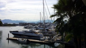
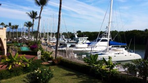
The docks at Paradise Village Marina
This view is from the yacht club, which is about halfway up the docks. Looking forward are C, B and A docks, including the docks for the megayachts. We found our friends Julie and Chloe on board the N62 Infinity and stopped by for a visit. Andy was still working in SE Asia, and Julie and Chloe were busy with boat work. We noticed there was a lot of surge on the forward docks. Julie told us that it took a lot of effort to get Infinity stable in the dock, and there were a lot of cargo straps and chains used to tie up the boats. Our position on E dock had very little surge.
During our stay at PV Marina, we planned to do some major provisioning at Costco, and attempt to get some boat supplies at Zaragoza Marine, said to be an excellent source for parts. In particular, we needed to get a replacement for our manual gray water pump, which had developed a leak. Amazingly enough, Zaragoza did have the replacement Whaler pump. They also had the Groco accumulator tank, but I decided not to get it, since I was convinced replacing the fresh water pump had solved that issue. They didn’t have a replacement for the Flojet fresh water pump, but that wasn’t surprising. We did buy a few more items at Zaragoza. We also had our anchor line snubber re-spliced at the small marine store at PV Marina, as it had started to fray badly. We also expected to get the zincs received that we had ordered when we were in Mazatlan. I was quite surprised to find out that they still hadn’t left the USA, considering that we placed our order on December 30th. The only shipping choice was USPS, which I found out is terrible for shipping into Mexico. The post office said that because of customs issues, shipments can take up to thirty days!
Another item we were looking for was a laser range finder, typically used on golf courses. Rose and I see distances much differently: she sees them as very short, and I see them as very long. This has caused a lot of controversy when we anchor, as Rose is convinced we are too close, and I am convinced we have plenty of room. To settle the controversy, I thought we could get a range finder. We tromped through a lot of likely stores, but never found one. It wasn’t too hard to get into Puerto Vallarta from Paradise Village. There is an occasionally air conditioned bus for fifteen pesos that runs direct from the resort to downtown PV, stopping at the Walmart and several other locations along the way. But, it can only stop at designated places, so it can’t be taken direct to Zaragoza.
Unlike other marinas we had used in Mexico, PV Marina can’t check you in with the Port Captain. Their office is just across the inlet, so you take a water taxi that has random pricing and may or may not wait for you – a real pain. And the office is closed on weekends and Friday afternoons. I checked us in on Monday morning, but this actually took about an hour and half, with the water taxis.
Basically, we spent most of our time shopping or lounging at one of the pools. There were two chandleries at the marina, and Zaragoza in town, but as in the rest of Mexico, it’s hard to find what you want. In addition to provisioning at Costco, there is a decent supermarket in the mall at the resort. The prices aren’t Mexico cheap, but they have a decent selection, and some import products that you can’t find elsewhere. There is a Laundromat in the mall, staffed with señoras that will do it for you, or you can go with self-service. They sell you tokens for the machines, but the machines for self-service are limited.
A few days before we were due to depart, Salacia arrived, as space had opened up. We were happy to greet them, but we found that Dianna was sick. She had been running a high fever and had some gastrointestinal issues. Rose checked her out, and then suggested that she visit the hospital that was next to the resort. She was quickly admitted, and it took doctors several days to diagnose her illness, which turned out to be dengue fever – ouch! She was in the hospital for five days, and had first-class care in a very modern facility.
We used the shower facility at the north end of the docks. Along the way, we saw another Nordhavn, the N40 Chinatsu. I observed a strange site – two full-grown Alaskan Huskies were on the bow! I introduced myself to the owners, Richard and Olive. Originally from England, they now live in Canada and Singapore, and keep their boat in Nuevo Vallarta. They stay on it in the winter with their dogs. I noticed that Richard had a full-size BMW motorcycle on board, which he lifts using the boom. We invited them over for drinks, together with Julie and Chloe from Infinity. Nordie owners have somewhat of a cult following – we easily make friends, sharing information and sea stories. We made some sashimi appetizers, which Chloe thoroughly enjoyed. She told us about a beach town called Sayulita, located north of Punta de Mita. She went there for a weekend with a crew from one of the megayachts, and really raved about it. We made a mental note to get to Sayulita when we stayed in La Cruz.
January 16th was my birthday, and as luck would have it, the yacht club was sponsoring a potluck full moon dinner. We spent a lazy day at the pool, and took some brownies to the potluck dinner. They had the BBQ set up, and you brought your own meat. After dinner, Dick Markie asked people to share their sea stories, with a prize to be awarded for the best ones. I told the story of our circuit breaker failure when we transited from San Diego to Ensenada. But I was legitimately trumped by two better stories. The second place winner was a couple that had returned to San Francisco for Christmas, to see new grandchildren. While in the area, they had expensive fishing gear stolen from their SUV, their SUV itself was stolen, and their credit card literally went down the drain at a sidewalk restaurant in San Francisco. The winning story was a fish tale, told by a sailboater. With little fishing experience, they had a crewman with a lot of fishing knowledge join them for the crossing from Mazatlán to La Paz. At about five in the morning, the crewman had gone off watch, and suddenly they hooked a large dorado. They brought the dorado up the sugar scoop. If you have ever caught a dorado, you know that they are relatively calm in the water, but once you bring them out of the water, they go insane. Well, their first dorado was no different – he said that the fish got off of the gaff and was flopping everywhere. They had an aft cabin, and the fish spotted the open hatch, being a dark place that resembled the pre-dawn ocean. It flopped in through the hatch, and proceeded to share its blood throughout the master cabin, soaking their brand-new mattress in fish blood! It was also on the walls and ceiling. There was no question about that story as the winner.
The next day (Friday morning), we checked again on our package of zincs, which had finally left the USA. We were preparing to check out, and the marina told us that they could forward the package to us at our next marina, Barra de Navidad. I took a water taxi for the check-out cha-cha, since they aren’t open on Friday afternoons or Saturday. On the way back, there were some land tourists on board, talking about a beached boat. They showed me a picture of an Azimut, probably around 70’ long, sitting high up on the beach just south of the Nuevo Vallarta inlet. The story was that both the woner and captain had fallen asleep while the boat was on autopilot, and it drove itself right up on the beach. Fortunately, it missed the rocks. I decided that we needed to cruise by for a look when we left the next afternoon.
Before we left on Saturday morning, we went over to the hospital to visit with Dianna. The hospital was very modern, very clean, and very impressive. Dianna was very tired, and had obviously been having a hard time of it. We were glad that she was under very good care, and it was fortunate that the hospital was so close, so Neil could easily spend time with her. We returned and got underway for the short trip to La Cruz.
January 18th: Paradise Village – La Cruz
We left Saturday afternoon for the quick run up to the La Cruz anchorage. Once we cleared the inlet, we turned south to check out the beached boat. By this time, a backhoe was digging a trench underneath it. We figured that the plan was to dig the trench to the ocean, and float it out under high tide.
Since it was Saturday afternoon, Banderas Bay was quite busy. There was a sailboat race under way, and many boats were out for the day. Some annoying birds were determined to drop their loads on our newly cleaned boat, which they managed to do despite our efforts to drive them away. We were starting to develop a healthy dislike for these birds. They would fly overhead, and then dive bomb the bow before hitting the water to fish. When we got to La Cruz, it was very busy – we counted fifty boats! We recognized a couple of boats from FUBAR, including Worknot and Context. The anchorage is huge, so we had no problem dropping the hook. There was a decent fifteen knot NW wind holding us in place, but the wind did a 180° flip after sunset. This seems to be the norm in this part of Mexico. Fortunately here, the wind was perpendicular to the swell, so we barely rolled, making for a comfortable stay.
Position at destination: 20°45’ N, 105°22’ W
Air temp: 82, Water temp: 80
Nautical miles for this leg: 8.0 Total: 2099
Departed at 1:30pm, arrived at 2:45pm
January 19th – 20th: La Cruz
On Sunday morning, John from Context came by for a visit. He told us that his group would be having breakfast at Philo’s, a cruiser’s hangout in La Cruz, and then they would be going to the Sunday Farmer’s Market, which is well-known. We decided to join them, so we took Little Blend into the La Cruz marina, where they have an area for dinghies from the anchorage. You are supposed to pay 50 pesos for the privilege, but we couldn’t find anyone to take our pesos, so we tied up and walked to town. On the way, we ran into Gale Plummer, and he introduced us to Becky and Bernard from Worth Waiting 4, the trawler we had seen at Chacala. We arrived at Philo’s and met up with John, his wife, and her sister for breakfast. While we were there, we saw Richard and Olive from Chinatsu, in the biker’s Sunday best. Every Sunday they get together with other bikers for a ride – it’s a small world!
Afterwards we went over to the market, which is very large, and very busy. It’s a mixture of food and handicrafts. We bought some fresh produce, some bread, and some fancy flip-flops. While walking through, we ran into Jim and Anne from Giddy Up. They were back at PV after spending the holidays in Calgary – small world, indeed!
The next day we went to see Sayulita. To get there, you walk up to the main highway in La Cruz, about ten minutes from the marina. You catch a local bus to Bucerias for ten pesos. The driver lets you know where to exit for the Sayulita bus, and then you walk across the very busy highway 200 to catch the second bus. I believe that one cost 14 pesos. It’s about a half an hour to Sayulita, but we were delayed by a small fire on the side of the road. We arrived at Sayulita and walked through the town, which has some small produce markets, some restaurants, and a lot of beachwear shops. The surf is usually good here, so there are a lot of surfers here during the winter months. You can live quite cheaply here, so young surfers were everywhere. It’s fun place to spend a day, and easy to get to from Banderas Bay.
We went to the beach and settled in at a restaurant that provided beach chairs and an umbrella. Being uncommonly thirsty, I ordered a buck of beer, which I figured I could somehow finish it myself, as Rosé is not a cerveza drinker. The surf is strong, and the beach has a steep slope to it.
After the ubiquitous camarones lunch and a few drinks, we got into the swing of things and thoroughly enjoyed our Sayulita mini-holiday. On our way back to the bus stop, we picked up some very inexpensive local produce. That night in the boat I checked on the status of our zinc package, only to find out that they had been shipped from Guadalajara and were now in Bucerias, before being delivered to Paradise Village. Had I known this, I could have stopped at the correos office to pick them up…
January 21st: La Cruz to Yelapa
The next major leg of our voyage was heading south to Barra de Navidad. Along the way, we would stop at several prime anchorages which make up the Gold Coast, a very popular cruising ground. Between Banderas Bay and Bahia Chamela, the first big anchorage, there are some marginal stops that we decided to skip. One of the obtacles to this section is Cabo Corrientes, which some people call the Point Conception of Mexico. It’s where you turn 90° to the south after exiting Banderas Bay, and there can be some strong currents and winds around the point. It’s recommended to make this passage at night, or very early in the morning. We decided to spend a night in the Banderas Bay anchorage of Yelapa, and then depart at 5:00 in the morning to get around Cabo Corrientes.
The cruising guides said that Yelapa was a very deep bay, with a very steep slope. There are some moorings in the bay, but we didn’t trust those with our heavy boat. Before we got into the bay, we were greeted by a panga, looking to promote services in the bay – the cruising guides said this would happen. The panga driver spoke perfect English, and Rosé had a running conversation as we approached the bay. After explaining our weight, he agreed that we should not take a mooring, but that he would guide us to a good anchoring position. We were only about 200’ off of the beach, but we still found ourselves in 80’ of water. We dropped anchor when we got to 70’, and laid out 300’ of chain. The panga driver took our stern anchor and set it close to the beach, so we felt about as comfortable as we could be. It turned out that the panga driver had lived for some time in our former home town of San Jose, CA, which explained his English proficiency.
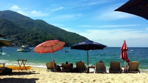 After settling in, we took a water taxi to the beach for lunch. Yelapa is quite busy on the weekends with tourist boats from Puerto Vallarta, but this Tuesday it was quiet. A couple of vendors came by, including one with a big iguana. He offered to take pictures of you holding the iguana. He asked the wrong person – Rosé is not too big on rodents and reptiles! Midway through our lunch, an elderly woman came walking through asking for money. Well, not exactly asking – she was saying, rather emphatically, “give me a peso”, and then muttering a curse in Spanish. This didn’t exactly endear her to us.
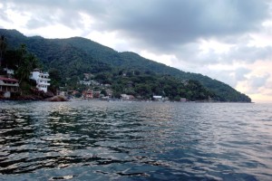
Yelapa is a narrow, deep bay. On the north side there are some moorings, and a sailboat claimed the one closest to our port side. To starboard, we had a rock wall, as shown in the picture here. I decided to pull the stern anchor, since we were planning to leave in the dark the next morning. It wasn’t too rough in the cove, so I took the dinghy to the anchor, but I didn’t have enough leverage to pull it up. Fortunately, a panga with hard sides came by and we were able to retrieve it.
Shortly after sunset, all Hell broke loose. The winds shifted 180°, and we were suddenly rolling rather violently. We were concerned about both the moored boat next to us and the rock wall on the other side. We discussed leaving right then, but Rose was very concerned about getting out of the bay, given the narrow confines. I was confident that we could follow our track out, but we agreed to ride it out until morning. The refracted swell kept growing and the waves off of the wall sounded louder and louder. Finally at midnight, we decided to get out while the getting was good. Since we were turned completely around, we had to reorient the boat to pull the anchor. Between the rolling, bobbing, and weaving, Rosé had a difficult time bringing up the anchor, but she prevailed. We followed our old track out of the bay and set course to round Cabo Corrientes. There is a saying in the cruising guide – “it’s better to have a palapa in Yelapa than a condo in Redondo”, but we would heartily disagree!
Position at destination: 20°29’ N, 105°27’ W
Air temp: 82, Water temp: 80
Nautical miles for this leg: 16.6 Total: 2116
Departed at 9:30am, arrived at 12:15pm
January 22nd: Yelapa – Bahia Chamela
As mentioned earlier, after midnight we decided to get the hell out of Dodge. It took some time to get oriented, come up with an emergency plan (should the swell knock us towards the rocks, beach, or moored boats), pull the 300’ of anchor chain, and carefully follow our track out of the dark, moonless bay. We are pleased to report a successful exit, although it was a little harrowing. We rounded Cabo Corrientes to a gentle sea with long period swells and light winds. There wasn’t too much traffic that night, but we did pass a northbound cruise ship about eight miles off our starboard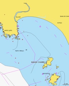 . It’s amazing to see these ships that resemble floating Christmas trees.
After a smooth day, we entered Bahia Chamela. This is a large bay that is well protected to the north. And of course, the wind had shifted to the south… There were quite a few boats in the anchorage, including Worth Waiting 4. We anchored in about twenty feet of water, but the wind was blowing at twenty knots or so, and we were actually pitching up and down. There was nothing we could do about that, so we poured some sundowners, and enjoyed the rest of the day reading in the flying bridge, cooled by the steady wind.
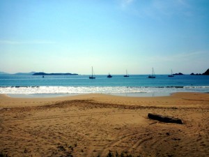
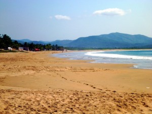
Anchorage at Bahia Chamela Beach at Bahia Chamela
There is a beautiful pink sand beach here, with a few hotels and a small village. There is even an RV park here. As usual, there is no dinghy dock, and the surf was up a little bit, so we decided to take the kayak on shore. This was the first time that we had used the kayak. It’s an ocean two-person kayak made by Hobie, the Kona model. We bought this one because it was the smallest tandem kayak that we could find. Given our limited space on the bow railing, this is very important. We had a stainless steel rack fabricated to hold it, and it fit perfectly. To launch and retrieve, we would just need to lower and raise it using lines on its bow and stern. It weighs about 78 pounds, but we could manage to manually muscle it up. We experienced our first surf landing in a kayak, which is very much like surfing. If you time it right, you get carried into the beach, hustle off and grab it. Of course, we were a little slow getting off so wet was the order of the day. We had lunch at one of the many cantinas on the beach – being a weekday, it was fairly deserted. We had heard there was a tienda in the village, so we walked up to the main road. There were a couple of tiendas, but very minimally stocked. Other than a prodigious amount of Bimbo bread, water, and beer, there wasn’t much there. Fortunately we weren’t in need of any serious provisions.
Position at destination: 19°35’ N, 105°08’ W
Air temp: 86, Water temp: 82
Nautical miles for this leg: 85.2 Total: 2201
Departed at 1:00am, arrived at 2:30pm
January 24th: Bahia Chamela – Isla Cocinas
 Bahia Chamela is quite large, and the southern end has several islands that contain anchorages. After a couple of nights at the Playa anchorage, we decided to venture to the islands, where there was supposedly clear water and good snorkeling. We ended up off of the northeast corner of Isla Cocinas, which gave us some protection from the south wind. There are some primitive camps on the beach, and one family was enjoying the beach.
  The waters weren’t so clear, and the waves were still running, so I decided against snorkeling. That night the wind died off, and I noticed something that would happen again in many Mexican anchorages. We have underwater lights – blue LED’s. The only fish we attracted were trumpet fish, plus some small baitfish. During the evening, we heard a couple of heavy splashes right next to the boat. The splashes were caused by freeloading pelicans, taking advantage of the fish attracted to the boat lights. For some reason, they really annoyed me. We turned off the underwater lights, but the fish were still hanging around, as were the pelicans. I shone the spotlight on the pelicans to shoo them off, and tons of fish started jumping out of the water wherever the light hit the surface. They looked like flying fish, but I never did make a positive identification. We would see these fish many more time, providing lots of entertainment for a simpleton like me. It doesn’t take much to distract the village idiot…
Position at destination: 1933’ N, 105°06’ W
Air temp: 84, Water temp: 83
Nautical miles for this leg: 2.7 Total: 2204
Departed at 12:30pm, arrived at 12:50pm
January 25st: Isla Cocinas to Paraiso
The next stop on our tour of the Gold Coast was Paraiso. This is a nar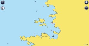 row anchorage in a bay that has numerous rock islands with blow holes and sea caves. The entrance was straightforward, and there were no other boats in the anchorage, so we dropped the hook deep in the bay, as shown by the “A” in this chart.
We had a hundred or so yards to the rock walls on either side, and the swell in the bay was fairly light, so we felt comfortable. The bay itself was very beautiful, with red rock islands strewn everywhere.
There is supposedly a very expensive private resort on the beach, and we saw what appeared to be a photo shoot going on there.
We explored most of the bay on the kayak, and then stopped at the tiny little beach to the south of our anchorage. To the north of us, the big rock contained several blowholes. Despite the apparent calm of the water, the blowhole action was pretty big.
Early in the afternoon, a small sailboat anchored just in front of us – Cupcake. We had heard this boat’s name before, and we thought it was rather amusing. Only a sailboat would be named Cupcake. And to top it off, there was another sailboat in the area named Cake. That one was owned by a baker, so at least there was a reason. Cupcake only stayed for a couple of hours, so we had the anchorage to ourselves. The rocks looked like an inviting snorkel place, so I gave it a try. The visibility was poor, and the fish we scarce, so I gave it up early. The waterline of the boat was getting awfully green – it hadn’t been cleaned since Mazatlan. I decided to snorkel around the transom to clean off the moss and growth. I had no idea that it would take so long, and take so much energy. I had a suction grab bar which made the job possible, but I had new respect for those that clean the bottom. Sooner or later, I would need to break out the hookah and clean the entire bottom by myself.
Shortly after dark, something bad happened: there was a wind shift to the east, typical for this area, but then the swells started to pound us on both our beam and our bow. The swells suddenly seemed to be refracting off of the rock wall south of us, and we commenced to rolling quite severely. Given that it was after dark, and the roll was pretty bad, we decided not to try to deploy the flopper stopper, instead hoping that the wind would calm down after dark.
It didn’t, and the roll persisted all night. The main water tank is under our berth, and when the water level is at a certain point, it sloshes over the baffles during rolling. And of course, it was at the optimal point for sloshing that night. Rosé is a great sleeper, but that noise drives her crazy. She abandoned the berth early in the evening and moved up into the salon, but neither of us got much sleep that night. At first light, I climbed out of the cabin and said, “Let’s get the Hell out of here!”
Position at destination: 19°28’ N, 105°04’ W
Air temp: 81, Water temp: 82
Nautical miles for this leg: 6.1 Total: 2210
Departed at 8:45am, arrived at 9:45am
January 26th: Paraiso to Bahia Tenacatita
We were delighted to leave the beautiful, but rolly Pariaso. We had originally intended to make Careyes our next stop, but the cruising guides say that it is more rolly than Paraiso, 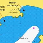 so we gave it a miss. Instead, we continued south to Bahia Tenacatita, one of the most popular anchorages on the Gold Coast. The guides list two primary anchorages – one is just around the first corner, nicknamed The Aquarium, and the other is at the main beach. Since we hadn’t yet had any decent snorkeling along the Mexican coast, we headed straight for the main anchorage. It was busy, with about forty boats present, but there was plenty of room. We anchored in about thirty feet of water, and settled in for a long stay.
Position at destination: 19°18’ N, 104°50’ W
Air temp: 86, Water temp: 84
Nautical miles for this leg: 24.9 Total: 2235
Departed at 7:40am, arrived at 11:30am
January 26th – 30th: Bahia Tenacatita
We ended up spending the entire week at Tenacatita. It was very calm, and the community of boaters there was delightful. Every day there was a VHF net that covered Manzanillo, Barra de Navidad, Santiago, and Tenacatita. We couldn’t hear boaters from Manzanillo or Santiago, but someone was always able to relay messages. After this net was finished, there would be a low power net just for the Tenacatita contingent. On the beach, there was an outdoor restaurant that was open every day except for Tuesday. There was also a park there for camping, which had garbage cans – great news for those of us spending extended time on the hook.
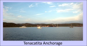 Many of the boats at Tenacatita have been coming there for years. There was a de facto “Mayor” of the anchorage named Robert. Every Friday was the Mayor’s raft-up, where dinghies would assemble to share food, music poetry, and whatever. Sadly, we weren’t there on Friday, but we heard great stories about it. Every afternoon on the beach there were bocci ball games, beach walks, and Mexican Train (a game similar to dominoes) at the restaurant. Following the bocci ball games, we would assemble at the restaurant for cervezas and story-swapping time. We ran into Bob and Sherri from Nirvana, who we had last seen at paradise Village (and originally next to us at Costa Baja). Although we were one of only two powerb
 oats at the anchorage, we were quickly welcomed into the community. We had a problem with our forward head overflowing because the water level solenoid wasn’t working, and another boater quickly came on board to help me with it. He suggested exercising the solenoid manually, and I eventually found a very small particle in it that was keeping it opened – problem solved without spending money!
We used the kayak for beach access, since the surf was relatively high. We did get swamped one day, so we were glad not to have tried the Little Blend. We did launch it for a bay tour. There are a number of resorts around the bay, some of them deserted. Near the Aquarium anchorage, there used to be a number of beach restaurants, but those have been removed for some new resort that doesn’t seem to be getting built anytime soon. The guards at the property are very aggressive. Some people had gone under the fence, only to be chased off by guards, including a demand to erase any pictures of the construction site – really, in Mexico? There is a small jungle river that runs from the Tenacatita beach to the Aquarium anchorage beach, but it can be very shallow crossing the bar. Once morning I decided to take the kayak up the river, and left about two hours after high tide. I thought that the current would be down, but I was wrong. It was quite a struggle paddling against the tidal current, but coming back was fun. I didn’t see any crocs in the river, but it was a beautiful river surrounded by mangroves. There were a lot of pangas ferrying people back and forth, but they were really polite and cut their motors to idle when they went past me.
We passed a lot of time not doing much of nothing at all. We thought about going across the bay to La Manzanilla, a town where some of the cruisers go for provisions. There is a croc sanctuary there that has some really big boys. But, we were told that the beach landing can be very hairy, even for the wheeled dinghy set, so we decided not to go. At the eastern end of Tenacatita Beach there is a pair of resorts – one is called Blue Bay (all-inclusive) and another one around the rocks that is clothing-optional. We heard that you can buy a day pass at Blue Bay, but at $50 it seemed awfully pricey.
One afternoon while sitting at the restaurant, we saw a small catamaran cruising through the anchorage. The owner was well known to the community, and they said he always sails through an anchorage before finally anchoring outside of it – and he uses a stern anchor only. We laughed while watching him get close to all of the boats, but later the joke was on us. A small sportfishing boat came in and anchored in what seemed to be very close to us, just to our port side. We wondered why, with all of the room in the anchorage, he would get that close. Later, we would see that it wasn’t too close, but still there was no reason for it. While watching this, I noticed that Little Blend was behind our boat. Normally, we tie Little Blend up next to the port cockpit entry door, so it doesn’t stick out past the platform. But we were seeing it well behind our cockpit. When we returned via kayak, we were shocked to see that one of the lifting eyes (the one we used for the stern tie) had some completely out of the transom, and was in the water at the end of the line. It must have slowly vibrated out, and we felt very fortunate that it had not come out during launch or retrieval. After that, we would check both eyes every time we picked up the dinghy. That was a real “whew” moment. On our last day, I decided to clean the entire waterline using the snorkel. It took me about two and a half hours, and wore me out.
January 31st: Bahia Tenacatita to Barra de Navidad
After a delightful and fun week in Tencacatita, it was time to move on to Barra de Navidad, which we had been looking forward to for most of our trip. There marina is part of a big hotel that is set into a hillside. The captain that helped us take our boat from Dana Point to Alameda had told us that it was one of his favorite destinations, as had Ken Williams (owner of the N68 Sans Souci) in his book on cruising Mexico and Central America. It was a short sixteen mile cruise to the harbor entrance and marina. This entrance is a little bit tricky, as there is a big shoal inside the harbor. Boats that try to cut corners here run aground in mud, and only high tide can lift them out.
You can see the marina, and we only had to follow the marked channel, which does come VERY close to the wall by the hotel. Continuing past the marina is the lagoon, which is very shallow. Many boats stat there for free, but just about every day you hear a call on the VHF for a boat that has broken loose. Given the shallow water and tight spaces, not much chain can be let out, and with poor holding mud, any kind of wind prompts breakouts. Plus, there are mozzies in the lagoon, and the water quality is very toxic-looking. At just $0.70 per foot per night, it was an easy decision for us to stay in the marina, with the resort privileges. The marina doesn’t take reservations, and they don’t respond to the VHF, so you just pull in to an empty-looking slip and check in at the office. We did that, but sure enough, there were plans for a different boat to occupy the slip we were squatting in, so we had to move. We ended up in a double slip by ourselves, with one of the brand-new Nordhavn 63’s, True Blue, in the next slip over. Also in the marina was Antipodes. They were planning to leave the following Monday, so Randy suggested that we go together to the Port captain, which isn’t easy to find. We went with the Antipodes crew to the pseudo-marina located in the fingers northeast of the harbor, and walked over to the Port Captain’s office, which is nowhere near the port. After we checked in, Randy gave us a quick tour of Barra town, and we had tacos from a street vendor. Barra is a great little town – many restaurants and shops line to two streets of the town, but it doesn’t have a tourist trap feel at all. There are a lot of ex-pats living there, but it still feels like a small Mexican town with Mexican prices.
Position at destination: 19°12’ N, 104°41’ W
Air temp: 86, Water temp: 86
Nautical miles for this leg: 15.7 Total: 2250.5
Departed at 8:40am, arrived at 11:00am


