


May 9th, 2015: Old Port Cove Marina – Boynton Harbor Marina – Lake Worth Inlet
The boat was shiny, the windows were corrosion-free, all pumps were working, and the weather was fine, so it was time to get the Hell out of Dodge! We had decided to take a twenty mile cruise down the Intracoastal Waterway for fuel. The fuel dock at Boynton Beach Harbor Marina was the cheapest in the area, at $3.11 per gallon. OPC’s price was $3.87, so it was a substantial savings for the 500 gallons we planned to purchase. We only needed to pass through five bridges, so we thought it would be an easy day. We planned to leave at 9:00 in order to catch the 10:15 Flagler Avenue Bridge opening, about seven miles south of us.
The best laid plans… Having stayed up late to watch the Warriors NBA playoff game, we got up close to departure time. Then we discovered that Quincy had the runs, and he had stepped in some and tracked it through the cabin. We quickly cleaned up what we could find, and cast off lines to depart. Just after firing the engine, I noticed some soot particles on the boat surface – and they were everywhere! All over the boat deck, the dinghy cover, the cockpit and swim platform. We quickly took advantage of the dock water to clean off as much as we could find, which delayed our start a bit. The soot was oily and smeared a lot, but we did the best we could in a short amount of time.
They say that bad things come in threes, right? Well, after we cleaned up the bulk of the soot, we left the marina just a little late. We ran south down the ICW channel through Lake Worth. The first section has no wake restrictions, and the channel is narrow, so we were getting tossed by the big wakes put out by sport fishing boats. Soon enough, a really big one rolled us violently, and a full glass of iced tea that Rosé had place on the galley countertop tumbled onto the salon carpet and spilled: bad thing number three.
We made the opening for the Flagler Bridge on time, as well as the nearby Royal Park Bridge fifteen minutes later. The next one was the Southern Avenue Bridge, about two miles away. We had two guides for the bridges – an Intracoastal Waterway guide, and a laminated sheet for all the bridges in Florida. Both were left on the boat by the original owners. For the Southern Blvd. Bridge, one guide showed openings on the hour and half hour, while the other one showed them on the quarter and three-quarter hour. Just as we cleared the Royal Park Bridge, we heard a tug calling the Southern bridge for the next opening. Based on this, we believed the bridge opened on the quarter hour. Since this would be another thirty minutes, we poked our way down to it. Once there, we called the bridge tender only to find out that it opened on the hour and half hour, which we missed by just a few minutes. Apparently the earlier opening was a special opening for the tug Arrgghhh… So we jogged in place for about twenty-five minutes.
The next bridge was Lantana, a little over six n.m. away, so we expected to make the 1:00PM opening easily. However, I neglected to calculate the Lake Avenue Bridge, which opens on demand – but still takes close to ten minutes to clear. By the time we cleared the Lake Avenue Bridge (which opens on demand), we only had fifteen minutes before the next Lantana Bridge opening, which meant we needed to make 8.8 knots. We put the hamm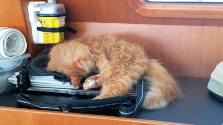 er down, and called the bridge tender when we were a half a mile out, at 12:55. I thought that given the delay in actually lifting the bridge, the tender might slot us in. But, no other boats were waiting, and he wasn’t going to fudge the opening time, so once again we jogged around for a half an hour. This was not a fun day, and Quincy was not impressed.
Once we cleared Lantana, it was just three bridge-free miles to the marina fuel dock, which faces the waterway in a no-wake area. One yacht was just departing, so we easily pulled in to the dock. The price had gone down to $3.109 per gallon, and we ended up taking 520 gallons – a great deal! Returning to the Lake Worth inlet was uneventful, as we knew the correct opening times and distances for the bridges – no extended jogging was required. Once we arrived at the inlet, we found a decent place to anchor to await our very early departure.
Position at destination: 26°46.034’ N, 80°02.734’ W
Air temp: 83, Water temp: 84
Nautical miles for this leg: 33.85 Total: 7739.3
Departed at 9:15am, arrived at 4:45pm
May 10th, 2015: Lake Worth Inlet – Old Bahama Bay Marina (West End, Grand Bahama)
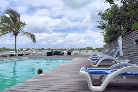
We left very early at slack tide to make the inlet run easy, and to arrive in daylight at West End. The inlet was pretty smooth, and the entire crossing was pleasant. There was a light SE breeze and the swell was only a couple of feet, so this was a very easy crossing. We called the marina, and they had space for us. Docking was pretty easy, although there were a lot more boats in the slips than we had seen in January. We decided to stay for two nights so we could enjoy the pool, and get the boat de-salted with the water for which we had to pay $15 per day. The rate was also much higher – in January, it was $1.75 per foot (plus $30 for power and $15 for water), but now, in high season the rate was $2.99 per foot – ouch!
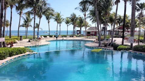

Old Bahama Bay pool and grounds
 The resort was as pretty as we had remembered it, and now the water was much warmer, so we really enjoyed the pool. On Monday morning, we spent a few hours cleaning the residual soot and salt off of the boat, so we were once again at the zero-clean state. As a bonus, we were able to watch the Warriors take care of game 4 in Memphis – go Dubs!
Position at destination: 26°42.069’N, 78°59.489’W
Air temp: 87, Humidity: 62% Water temp: 84
Nautical miles for this leg: 57.17 Total: 7796.5
Departed at 3:10am, arrived at 1:10pm
May 12th, 2015: Old Bahama Bay Marina (West End, Grand Bahama) – Mangrove Cay
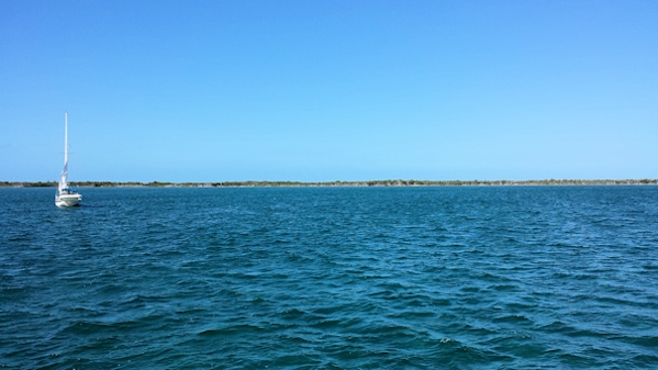
We needed to cross the Little Bahama Bank to get to the Northern Abaco Islands. Just northwest of West End there is a channel near Indian Rock that provides a fifteen mile shortcut. However, the bar to get into the channel is pretty shallow, at around six feet. We decided to wait for high tide to cross over, which meant that we couldn’t get to Great Sale Cay in daylight, which is the typical stopover in the Little Bahama Bank. High tide was around 1:00PM, so we decided to just go as far as Mangrove Cay the first day, since it was just twenty-file miles across the bank. We crossed into the channel easily, never seeing less than eight feet under the keel. Late in the afternoon, some squalls passed through. Interestingly, the wind picked up after the squall passed us, but it was still a pretty smooth day. We anchored off of mangrove cay, and there were eventually a dozen boats there. A small sailboat off our port bow dragged quite a bit, so we were thankful they didn’t return directly in front of us.
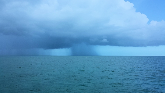
Dodging squalls crossing the Little Bahama Bank Mangrove Cay anchorage
Position at destination: 26°54.793’N, 78°37.321’W
Air temp: 83, Humidity: 71%, Water temp: 84
Nautical miles for this leg: 25.75 Total: 7822
Departed at 12:30pm, arrived at 5:00pm
May 13th, 2015: Mangrove Cay – Allens Pensacola Cay
We continued our trek across the Little Bahama Bank to the upper cays of the Abacos. Most of the dozen or so boats anchored at Mangrove Cay had departed by 8:00, when we hoisted the anchor. It was a smooth and sunny day cruising across the bank at depths ranging from twelve to eighteen feet. There were a few sportfishing boats out and about, and the green waters were crystal clear. One oddity we saw was a couple of locations where an almost white section would appear in the water. At first, we thought they were sand bars, but the depth never changed as we crossed over them. Very interesting, as Arte Johnson would say. Late that afternoon, we  dropped the hook in the company of a few boats. We discovered that the setting sun was pretty intense, forcing us to close the salon door until after sunset. Allens Pensacola Cay had been considerably talked up by an experienced Abaco boater we met at the Old Bahama Bay pool, but we didn’t see anything extraordinary about it. Nice enough, but not remarkable.
Position at destination: 26°59.383’N, 77°41.377’W
Air temp: 86, Humidity: 60%, Water temp: 85
Nautical miles for this leg: 52.9 Total: 7875
Departed at 8:00am, arrived at 5:00pm
May 14th, 2015: Allens Pensacola Cay – Powell Cay
 The next stop on our cay-hopping tour of the Abacos was Powell Cay. We waited until early afternoon to make the short fourteen-mile run. We had anchored in pretty shallow waters (seven feet at MLW), and Rosé wanted to have more water under the keel when departing, so we waited for high tide. After our few encounters with the bottom of the Exuma Bank, better safe than sorry! The distances in the Northern Abacos between cays are short, but with a deep-draft vessel, you have to cruise well to the west of the cays to find decent depth. Anyway, we arrived at Powell Cay to find another pretty, yet unremarkable cay.
Position at destination: 26°54.086’N, 77°29.099’W
Air temp: 84, Humidity: 63%, Water temp: 86
Nautical miles for this leg: 13.8 Total: 7889
Departed at 2:15pm, arrived at 4:45pm
May 15th, 2015: Powell Cay – Manjack Cay
We decided to make one more stop at a Northen Abaco Cay before heading to the bustling metropolis of Green Turtle Cay. We picked Manjack because it was renowned for long beaches on both the bank and ocean sides. There are several choices of anchorages at Manjack, and we chose the northernmost one. The path to cross over to the ocean side beach wasn’t defined anywhere, so we made a guess that it would be at the narrow part of the cay. There were two other powerboats anchored close by us. We had decided to stay at a marina the next couple of nights in Green Turtle Cay, so we just took the kayak on shore to avoid launching and retrieving Little Blend.
There was a long white sandy beach, but it was bordered by heavy turtle grass, so not so good for swimming. Rose decided to walk the beach for shells, and I searched for the passage to the ocean side beach. The narrow interior of Manjack is densely covered by pine trees, so bushwhacking across was very difficult. I walked down to the beach to a decrepit old dock, where I found a promising trail. However, the trail didn’t go directly east, but it meandered to the southeast, to it took quite some time to find the ocean beach. At the beach, someone had built a nice covered veranda. I had read that the official kickoff party for the July regatta was on Manjack – perhaps this was the party HQ. The beach itself was decent enough, but nothing like the ocean beaches we had seen in the Exuma’s. I returned to join Rose on her beach walk, where we discovered that the bay was a barracuda nursery. We saw a large number of juvenile barracuda’s, all around a foot long. They must have been from the same batch of eggs. Each one had staked out a territory along the beach.
Position at destination: 26°49.950’N, 77°23.185’W
Air temp: 85, Humidity: 59%, Water temp: 85
Nautical miles for this leg: 9 Total: 7898
Departed at 10:15am, arrived at 11:45am
May 16th, 2015: Manjack Cay – Green Turtle Cay (White Sound)
We had decided to treat ourselves to a small cruising vacation, staying at the Bluff House Marina in the White Sound of Green Turtle Cay. We had heard and read a lot of great things about Green Turtle Cay, so we wanted to stay for a few days. Based on Active Captain reviews, we decided to try out the Bluff House Marina, which was also a resort with a pool and a couple of restaurants. Getting in to the sound involved going through a very tight, but well-marked channel. According to the marina website, the channel had been recently dredged to a controlling depth of 7.5 feet. However, we entered at mid-tide, and we saw a low depth of seven feet, so we wouldn’t really want to navigate the channel at low tide. The second point about the marina is the orientation of the slips. Several reviewers had commented that it was difficult to get into the slips, but that the dockhand was very helpful. The slips have almost non-existent fingers, and they are diagonally oriented. Fortunately they are fairly wide, and there was no current and little wind. We initially approached the slip from behind, but we just couldn’t get the boat turned enough to back in. We tried going in from ahead, and that allowed us to get in. A few boaters on the dock lent a hand, and the dockhand was all over the boat tying up every line we had to the numerous pilings. This was not a cheap marina, at $2.75 per foot per day, plus water at $0.35 per gallon.

Docks at the Bluff House Marina The pool deck
Position at destination: 26°46.673’N, 77°20.274’W
Air temp: 84, Humidity: 62%, Water temp: 83
Nautical miles for this leg: 5.6 Total: 7903.5
Departed at 9:10am, arrived at 10:15am
We checked in, planning to stay for three nights, and explored the grounds. There was a nice large pool on the deck facing the bay, but it had some algae issues. We had to walk up a steep hill to get to the bank side of the resort, but we never did find the second restaurant. We decided not to rent a golf cart, which was $50 per day. The main settlement of New Plymouth is easily accessed by water, anchoring in front of it, so we didn’t see the need for a cart. The showers at the marina were not air conditioned, and there was zero air flow into them, so once you emerged from the shower, it was sweat city. Rosé did get all of our laundry done, at $5 per load – kind of standard in the Bahamas.
We had planned to stay for three days, and had considered renting a golf cart for a day (at $50) to go to the main settlement of New Plymouth, but considering that the pool and restaurants weren’t thrilling, we decided to just stay for two nights and then cruise over to the anchorage off of the town. We undid the Gordian Knot of lines, and departed at high tide.
May 18th, 2015: Green Turtle Cay (White Sound) – Green Turtle Cay (New Plymouth)
It was not more than a stone’s throw to the New Plymouth anchorage, which had a handful of boats in it. We launched Little Blend and cruised in to the town. “Town” is an exaggeration. One of our missions was to get our Bahamas phone topped up with data, and we knew there was a BTC office in town. We walked on the golf cart street up a hill to where the office was supposed to be, and only found a closed building with a communications tower. We were trying to figure out if we were in the wrong place when a local guy came along in a golf cart. We asked him, and he said that the BTC office was only open on Thursdays. I might add that this was Monday morning, but the settlement was devoid of people and activity. He told us that we could get the top-up at a take-away down the hill, and offered to give us a ride – people in the Bahamas are very friendly.
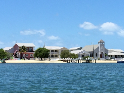
New Plymouth shoreline
We went to the take-away and got the data topped up. We had a map, and walked around the settlement – the few shops that were there seemed to be closed, and we only found one café that was open for lunch. We asked the lady in the restaurant if there were more shops in Black Sound, and she didn’t seem to understand where we were talking about. We did have a decent lunch, and we bought some coconut banana bread with chocolate chips, so it wasn’t a complete bust. We took the dinghy around the corner to Black Sound, which was a collection of semi-derelict boats, with a couple of small marinas and a boatyard. No stores, bars, or shops were evident. We were really scratching our heads wondering why so many cruisers think that Green Turtle Cay is the best place in the Bahamas. We returned to the boat, and decided to leave the following morning.
Position at destination: 26°45.625’N, 77°20.202’W
Air temp: 82, Humidity: 58%, Water temp: 84
Nautical miles for this leg: 1.2 Total: 7905
Departed at 9:10am, arrived at 9:30am
May 18th, 2015: Green Turtle Cay (New Plymouth) – Great Guana Cay
The next morning we weighed anchor for Great Guana Cay. This route required us to go through a cut into the ocean, as the route through the sound is impassable because of shoaling. The cruising guides and the local cruisers’ net makes this cut, Whale Cay Passage, sound very dangerous. I suppose when a healthy norther is blowing, it might be difficult, but we had very calm conditions. At one time, a cruise ship line had plans to set up an anchorage at Great Guana Cay, so there is a deep marked channel as you approach and parallel the cay. According to the guide, this cay has only recently been developed, and there are plenty of big houses and big sport fishing boats to be found. We found easy anchorage, and proceeded to the town dock to make our way to Nippers, a well-known bar on the ocean side of Great Guana Cay.


Big houses at Great Guana Cay View from our anchorage
Position at destination: 26°40.097’N, 77°07.291’W
Air temp: 85, Humidity: 62%, Water temp: 82
Nautical miles for this leg: 14.8 Total: 7919.5
Departed at 8:45am, arrived at 11:20am

All signs point to Nippers Transportation after you have a few too many Nippers
There was a large small boat dock with a sign for Nippers on it. At the end of the dock, a guy on a golf cart offered us a ride over, as well as another couple that had just docked. It was a short distance away, and we were taken right away with the place. It’s got a pool, multi-level decks, and a fabulous view of the ocean and beach. We took some lounges at the pool, where there were already eight people from two different power boats enjoying some adult beverages. I asked for a drink menu, but they didn’t have one. They said the house specialty was the Nipper, several different rums with several different fruit juices, served frozen – that was good enough for us!


Nippers pool Rosé posing with Nipper
There were a number of dogs roaming around, relatively friendly and polite. After downing a few Nippers, we decided to have lunch on the ocean deck. Shortly after we got our food, a large black and white cat took up residence by our feet. The waitress warned us that he wasn’t always  friendly, so we decided against rubbing his ears. More people came with a medium-sized white poodle, which created excitement with the other dogs. There was a bit of noise, but no fighting, but it was enough to get the attention of our Badass cat friend. He started to stalk the poodle, who went into as state of panic. The other dogs gave Badass a wide berth – I think they knew him. He continued his march towards the stunned poodle, back arched, hair standing on end, and when he let out a loud hiss, the poodle practically soiled itself. Satisfied, Badasss sauntered over to the side of the bar and laid down in the shade. We were laughing our asses off, and the poodle had taken refuge between the bar and the legs of a patron on a barstool. Every now and then, it would peek around the corner, see Badass, and return to hiding. It was really funny to watch. We had a couple of more Nippers and decided it was time to go. I had never asked about the price of the drinks, but they turned out to be $10, so our total bill was over $100. Have I said that the Bahamas are expensive?
 On the way back, Rose did a little shopping, and I noticed a very unique wave runner sitting on the bottom at low tide. I guessed that the motor had died, and someone ingeniously just attached an outboard to it. I’m not clear on how the steering works, but necessity is the mother of invention.
The ocean off of Nippers had a good-sized reef about a half-mile or so offshore, and we could see that there were a number of rock or coral formations in between the beach and the reef. I thought there might be some good snorkeling, so we went back the following morning. The beach is beautiful, but the snorkeling was  worthless. There were very few fish and coral to be seen, similar to so many places in the Bahamas. I really wonder if the fisherman have killed off the reefs – we had heard stories about using bleach (which kills coral) to get lobsters. Of course, this practice was blamed on Dominicans, but we think that’s quite a stretch, considering the long, rough passage to get to the D.R.
May 19th, 2015: Great Guana Cay – Marsh Harbour
Done with Great Guana Cay, we departed for Marsh Harbour, the bub of the Abacos. As we approached our destination, a rain quall hit us that lasted all the way into the harbor. There are a couple of marinas in the harbor, but the depth into them is pretty shallow. We didn’t want to be constrained to leave at high tide, so we decided to anchor. There were plenty of boats anchored in the harbor, both power and sail. I had read about a small area near the dinghy dock were the depth drops to eleven or twelve feet at low tide (as opposed to the five to seven common throughout the harbor), so we sought that out. There was room for us in that small hole, so we dropped the anchor with about seventy-five feet of chain out. The downside to anchoring here is the very numerous ferries that come by carrying masses of construction workers. They watch their speed, but they often come with ten feet of us, making it a little nerve-wracking.
Position at destination: 26°32.747’N, 77°03.520’W
Air temp: 85, Humidity: 62%, Water temp: 82
Nautical miles for this leg: 9.6 Total: 7929
Departed at 11:50am, arrived at 1:30pm
We found the dinghy dock very close to our anchoring position. It was a small floating platform, an improvement from climbing ladders and stringing long painters that is endemic to the Bahamas. Onshore, we knew there was a large grocery, a big liquor store, a BTC office that was actually open every day, and for Quincy, an honest-to-God KFC. We had neglected to bring a map with us, so we got a little disoriented searching for the main street identified as “Don McKay Blvd.” Like most people, we pronounced it as “Mc-Kay”. We asked a local woman who was leaving a store, and she gave us a confused look. She asked what places we were looking for, and we told her the BTC and KFC. To this, she knowingly said, “oh you mean Don Mackie”. OK, local dialect, I suppose. As was customary for the friendly folks of the Bahamas, she offered to give us a lift. We decided to go to the BTC office first. I thought that there was a way to top-up the phone from the phone, but the woman at the office explained to me that I would have to create an online account for the top-up. That works great if you top-up before the data plan expires, but it useless if you wait too long. At least I now knew how to do it. After that, we walked over to Maxwell’s, said to be the best grocery in the Bahamas outside of Nassau, and it was. We were very impressed, but we only picked up a few items at that time. We walked back over to “Mackie” Blvd. to the KFC, but the menu was nothing like any KFC we had ever seen, including the one in Nassau. We bought a six-piece order, which is just chicken, and strange cuts at that. The pieces were quite small, with a strange breading. We wondered if it was legitimate. Ah, the things we do for our very spoiled cat! At the liquor store, I found an actual bargain on a one liter bottle of Cruzan at a 20% off price. We returned to the boat to give Quincy his surprise.
Hope Town
 The following day we took a ferry to Hope Town. It’s about six miles from Marsh Harbour. Rosé had heard about this town from some boaters we had met in West End back in January, and they really talked it up, saying that they usually spent weeks there every season. The entrance to the harbor is very shallow, and at low tide, we couldn’t pass over the bar. Instead, we decided just to take the ferry over for the day. The ferries leave from their dock at the northeast end of the town. On the map, it didn’t look too far, so we decided to walk. It turned out to take almost a half an hour, and we were soaked with sweat by the time we got there, just a few minutes prior to departure. The ferry was a bigger version of the Donnie ferries we had seen, with just a dozen or so passengers. There were numerous trips scheduled throughout the day, but pretty pricey at $30 round-trip. We crossed the sound in about twenty minutes, and the ferry stopped at numerous docks in town before we departed. We went to restaurant on the edge of the harbor for lunch. The food was good, but expensive even for The Bahamas. After that, we walked through the shopping district, which wasn’t very impressive, other than the air conditioning inside. We really didn’t get what the Hope Town fuss was all about. We walked a couple of blocks to the ocean side, where there were some beautiful pink beaches, and what appeared to be coral reefs just offshore. We walked down the beach a ways, and then went through a beach hotel / bar / pool area to get back to the ferry dock. It would have been nice to have lunch here, although we figured it would be more expensive than Nippers. Hope Town was nice, but it rated a “meh”.

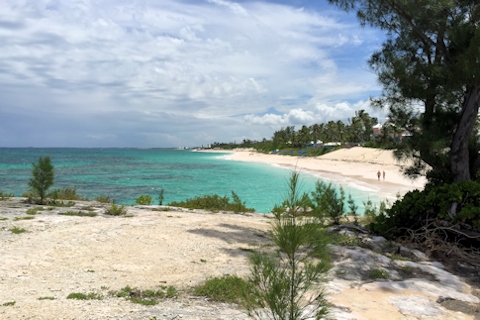
Pink sand beaches of Hope Town
Quincy uses up life number eight
The next day, we decided to try out some flea shampoo on Quincy. He had never had fleas in his life, but we are pretty sure that he picked them up at the apartment we had stayed at in West Palm Beach back in January. It was a very dog-friendly place, with dogs in the properties, and across the street in a dog park. We had noticed him doing a lot of licking and scratching a couple of weeks after that, which got worse over time. We had never seen any fleas on him until we had returned to Florida. We tried the drops on him, but that didn’t seem to help much. Against his wishes, we gave him the flea bath. He tolerated it relatively well, and didn’t seek vengeance on us by crapping in our shoes. However, coincidence or not, the next day he didn’t have much of an appetite, even for the faux KFC. Two days later, he wasn’t eating anything. He was diagnosed with CRF (chronic renal failure) more than a year before we started our voyage, not uncommon for a cat of his age. Other than losing a lot of weight and drinking excessively, he had done very well. By the third day not eating, we realized that he was in serious trouble. We knew there was a vet on “Mackie” Blvd., so we walked there for a discussion. Given his age and symptoms, the vet said that he was probably at the end, but that we could try giving him some IV fluids. He gave us a prescription as well as the kit for administering the fluids, at no cost. We offered him a $20 donation for his neuter and spay clinic, which we had read about in the Abaco Times. He also gave us some large needles that he admitted were usually for livestock, but cautioned that smaller needles might clog up. There was no way that we were going to stick Quincy with those monsters, so we got some smaller ones. He tolerated the IV fairly well, although he pulled away before we got the full recommended 200ml in him. Amazingly enough, within an hour, he wanted to eat, and did eat some cat food. Within a day, his appetite was back to normal. We don’t know if there was any coincidence with the flea shampoo, but we decided not to find out. This is one resilient cat.
Go Warriors!
Coming from the Bay Area, we are big fans of the Golden State Warriors NBA team, and we always went to a few games each year. Of course, the year that we left, they started to play very well, after years of sucking. This year they had the best record in the NBA with new coach Steve Kerr, a graduate of our hometown University of Arizona. Sadly, we hadn’t been able to see too many games. Our satellite TV is DirecTV Latin America, and it doesn’t carry sports on its TNT channel. The ESPN channels are mostly soccer and cricket, and they have blocked all of the USA network programming. Plus, there is a donut hole in the satellite coverage that covers most of the Bahamas. We had been able to listen to radio broadcasts on the NBA smartphone app, but we had only been able to see a couple of games while we were in Florida.
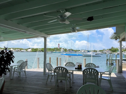
There was a typical Bahamas bar called Snappa’s not too far from our boat, and it had a dinghy dock. We went there for lunch one day, and we asked if they would be open late to show the NBA game (a lot of bars in The Bahamas close by 9:00PM!). They said they would, so we returned that night to watch the Western Conference Finals game 3 against Houston. We had great seats, and were able to see the entire game, albeit without sound. This was on Saturday night, and there was a band playing in the bar. It was quite crowded, the band was good, but nobody danced. We won the game in a blowout. We watched two other games there later – games 4 and 5. Game 5 was on a Wednesday, and we are happy to say that we won the series that night. For some reason, the crowd at the bar that night was young and white, and we think they brought their own music. It was hardcore rap, played at ear-splitting volume. We still enjoyed the game…
New friends, bad dinghy captain
Rosé went to the Harbour View marina, next to Snappa’s, to do some laundry. While there she met a couple who were anchored on a trawler, so we made a date to share some sundowners on our boat with them. Linda and Brian were on the Gulfstar 44 Destination. We found out that they had been to many of the places in our future plans – Turks and Caicos, Dominican Republic, Puerto Rico, and the Virgins. They gave us a lot of good information, and we really enjoyed meeting with them. We met at Snappa’s to watch Game 5. The following day, we made a provisioning trip to Maxwell’s, and they had arrived at the dinghy dock just as we were preparing to leave – they were going to pick up a repaired computer. Unfortunately, we couldn’t get our motor to start, a very new Honda 20hp. It would crank, but not start, very similar to the problem we had in Alameda, which was caused by gummed up fuel in the carburetor. It was hard to believe that this could be the problem, but Brian said that we had to clean out his carburetor, and that he could come by later to help me. They towed us back to our boat, and I started to see what I could do. I did find a Honda outboard dealer in town, so I could call them if nothing else. I checked all of the fuel connections, since the problem seemed like fuel starvation, but fuel was definitely going through the hose. Finally, it dawned on me that this was a very simple problem – I hadn’t connected the kill switch. D’oh! I thought when the kill switch was off there was no electrical connection, but in actuality, it cuts off the fuel supply to the carburetor. In the words of Bugs Bunny, I was a real maroon!
Marsh Harbour
The harbor is pretty big, and fairly full with anchored boats. It’s quite shallow in places, so you have to be aware of the tides when anchoring. There are a couple of marinas well inside the harbor, but again, the approach is shallow and tide-sensitive. The town has the best grocery store we had seen in the Bahamas, Maxwell’s. There are only a handful of restaurants that we could find. Mostly this seems to be a residential town – we were told there were 30,000 people living in Marsh Harbour. There are a couple of large hardware stores, and a number of marine repair facilities, but no real chandlery. The liquor store was OK, good for the Bahamas. Other than the ferry wakes, the harbor is well-protected in the prevailing east winds, and would probably be a good place with northerly or southerly winds. I’m not sure about westerlies, since it is fairly open to the west. Overall, it wasn’t a bad place to spend a week on the hook. The water didn’t look very clean, so we elected not to make water while we were there.
Marsh Harbour anchorage
May 29th, 2015: Marsh Harbour – Lynard Cay
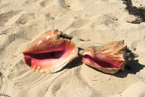
The weather window to the south opened up, so we started our voyage out of the Bahamas. Our first leg was to stage for the long trip across to Eluthera. It was a zig-zag course down the Abaco Sound to get to the cut at the bottom end of the sound. We decided to anchor off of Lynard Cay. We were still towing Little Blend, so we ran on shore to take a quick luck. The Cay is very narrow, probably only fifty to one-hundred feet at that point, so we could take a short walk to look at the ocean conditions. Rose walked the beach, and I kicked back under the pine trees, where a very curious curly-tailed lizard checked me out. Rose found some beautiful conch shells on the beach, but we left them there, as we had no room for more of these.
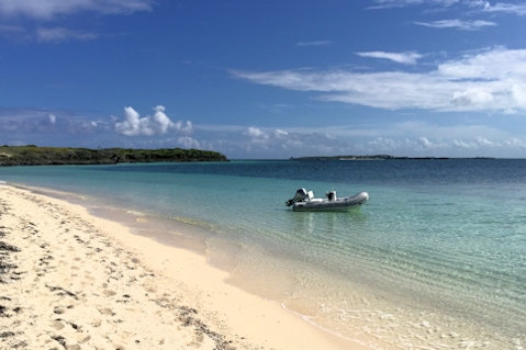
Little Blend at Lynard Cay Conch shells at Lynard Cay
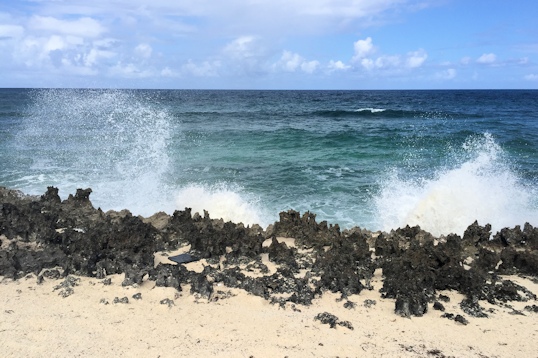

Surf on the ocean side Curious Curly Tailed lizard
Position at destination: 26°21.373’N, 76°59.191’W
Air temp: 84, Humidity: 60%, Water temp: 83
Nautical miles for this leg: 22 Total: 7951
Departed at 9:30am, arrived at 1:20pm
May 30th, 2015: Lynard Cay – Royal Island (Eluthera)
We left early in the morning to catch slack tide through the cut, and it was very smooth. The entire trip to Eluthera was comfortable, as we had picked the right day. I wanted to anchor off of Egg Island, which is at the far southwest corner of Eluthera. The cruising guide discussed a shipwreck located just off of Little Egg Island. It was a freighter, carrying a load of fertilizer, which started to take on water. Unable to stop the leak, the captain drove the Arimora as close to shore as he could and beached the ship. The guide said that initially the fertilizer killed the reef, but years later the reef came back strong, with a large collection of fish. I wanted to snorkel the wreck, and we thought we would get protection from the east wind by anchoring off the west side of Egg Island, however, the swell was wrapping around, resulting in an uncomfortable roll. We decided to cruise a couple of miles up the eastern shore to the completely protected Royal Island Harbor. At one time, there were gr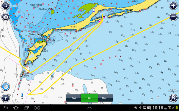 andiose development plans for Royal Island, but they fell through. Today, there is just a large all-weather anchorage inside the harbor. You can see the harbor on the attached map, at the upper end. On the lower left, the blue pin marks the wreck of the Arimora. There were only a few boats in the harbor, so we had no problem getting anchored for a peaceful night.
Position at destination: 25°30.928’N, 76°50.702’W
Air temp: 87, Humidity: 56%, Water temp: 84
Nautical miles for this leg: 57.2 Total: 8008
Departed at 7:00am, arrived at 4:15pm
May 31st, 2015: Royal Island (Eluthera) – Spanish Wells
We decided to take the Tropical Blend close to the wreck site, as the chop was up a bit, and it was a three and a half mile ride to the site. We dropped the Little Blend, despite a little bit of a roll from the swell (we should have dropped the dinghy inside Royal Island Harbor) and anchored just off of the wreck. It was pretty cool, although there weren’t as many fish there as I was expecting. The debris filed was very large, considering that the wreck dated to 1970. A few hurricanes have probably scattered the wreckage. I did see a really big lobster scurrying about (but they were out of season), some large schools of yellowtail snappers, a lot of sergeant majors, and a host of other small tropical fish. It was worth the time, but not really outstanding. We haven’t been anywhere in the Bahamas that had great snorkeling. When we finished snorkeling the wreck, we took the boat seven miles northeast to anchor off of Russell Island and the town of Spanish Wells. We were hoping to get a pilot the next day to take us over the Devil’s Backbone to Harbour Island.
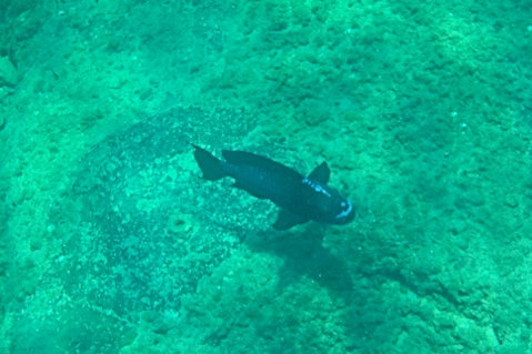

Unknown large blue fish A really big lobster
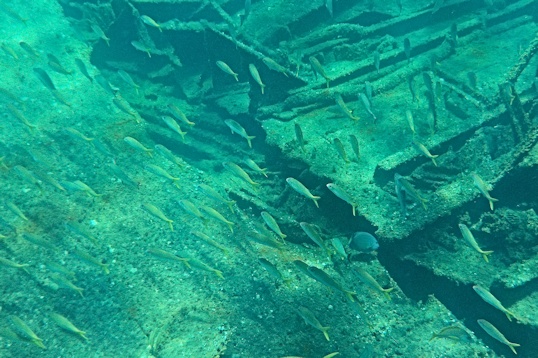
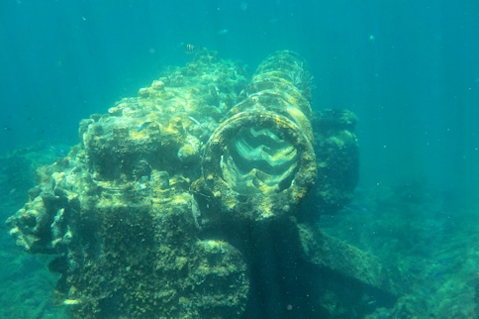
Lots of snappers Maybe part of the engine?
Position at destination: 25°32.184’N, 76°46.217’W
Air temp: 86, Humidity: 57%, Water temp: 82
Nautical miles for this leg: 10.9 Total: 8019
Departed at 10:45am, arrived at 2:00pm