


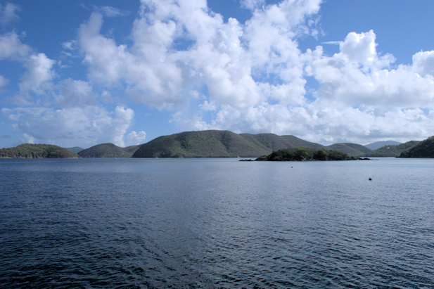
August 30th: Puerto del Rey – Ensenada Honda, Isla Culebra
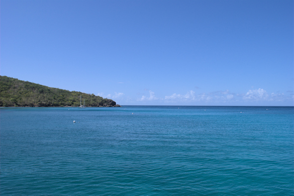
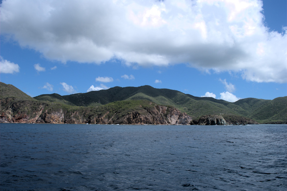
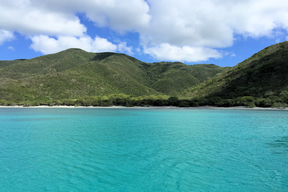
We waited for Lasata in the morning, but they were taking care of some issues and planned to stop at the fuel dock, so we left before them for Isla Culebra. It’s only twenty-three miles to Culebra, which we heard gets very busy on weekends. Leaving Sunday morning, we expected to arrive after the crowds left. It was a fairly easy passage, with two to three foot waves on our bow, but plenty comfortable. We had decided to proceed to the Dewey town anchorage inside of Bahia Honda, which adds a few miles to the trip. Once we arrived, we dropped the hook, dropped Little Blend, and prayed that it would start after not being used for three months, since we left Harbour Island on Eleuthera. Fortunately, it quickly caught, and we headed straight to the Dinghy Dock Restaurant. We took the portable VHF and waited to hear from Lasata. We didn’t hear from them until around 5:00 – they got a really late start. They had decided to pick up a mooring on the ocean side of the town. We took the dinghy through the narrow passage and picked them up for a night of eating and drinking.
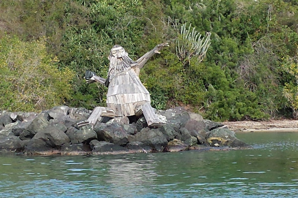
Culebra Man DInghy Dock Restaurant
Position at destination: 18°18.309’ N, 65°17.877’ W
Air temp: 90°, Humidity: 63%, Water temp: 89°
Nautical miles for this leg: 23.0, Total: 9014
Departed at 11:00am, arrived at 3:00pm
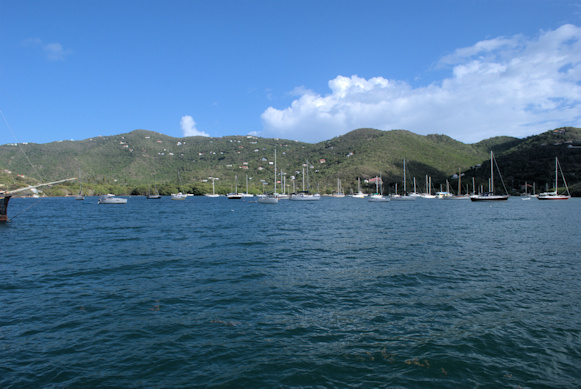
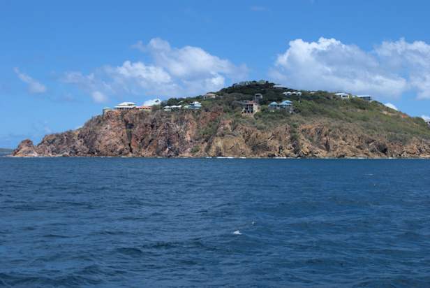
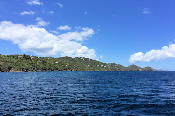
August 31st: Culebra – Yacht Haven Grande, St. Thomas
We made a reservation at the superyacht marina in St. Thomas, Yacht Haven Grande. The winter rates are really high at $4.00 per foot, but they have a huge discount for the off-season, at $1.50 per foot. They have forty-six slips over one-hundred feet long, and several over 300 feet long. Ralph and Stacy were looking for a cheaper long-term alternative, so they were going to check out the marinas around Red Hook, where Ralph was planning to take some yachting classes.
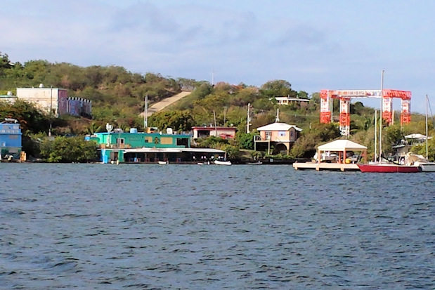
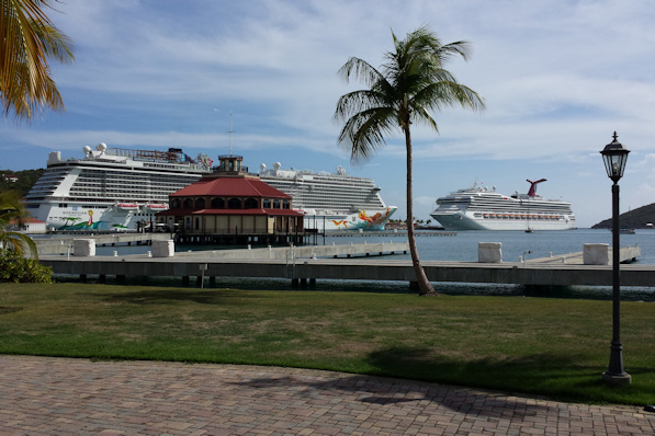
It was another good day for passaging, with almost flat seas. We pulled in to the Charlotte Amalie harbor, and we were surprised to see two cruise ships in port. The cruise ship dock was right next to the marina. There were only three other boats in the entire marina, and we were assigned to one of the three-hundred foot docks. We had to go all the way in to get to the power pylon. Dwarfed by the dock, we side-tied to begin our stay.
Position at destination: 18°20.163’ N, 64°55.248’ W
Air temp: 92°, Humidity: 57%, Water temp: 87°
Nautical miles for this leg: 23.5, Total: 9037
Departed at 9:30am, arrived at 1:15pm
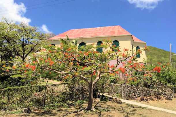
August 31st – September 3rd: Charlotte Amalie, St. Thomas
We stayed at Yacht Haven Grande for three days to celebrate Rosé’s birthday. The pool was really nice, and we enjoyed using a pool for the first time since early July. There was an upscale shopping complex around the marina, and a cruise ship riff-raff shopping center close by. We had lunch at the Naked Turtle restaurant, which featured the best-named drink we had heard of: Where the #%!@ Did I Park My Boat.

Great name for this drink Busy cruise ship dock
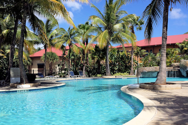
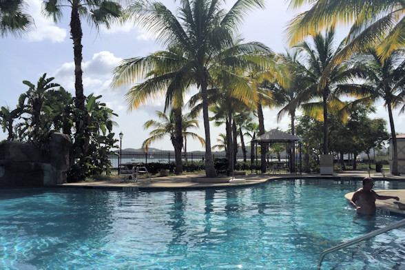
Great pool at Yacht Haven Grande
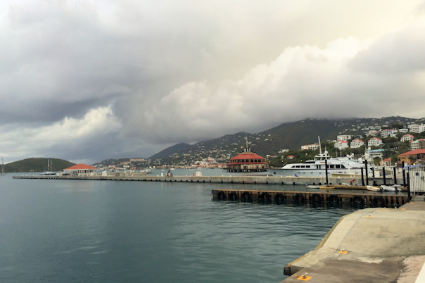
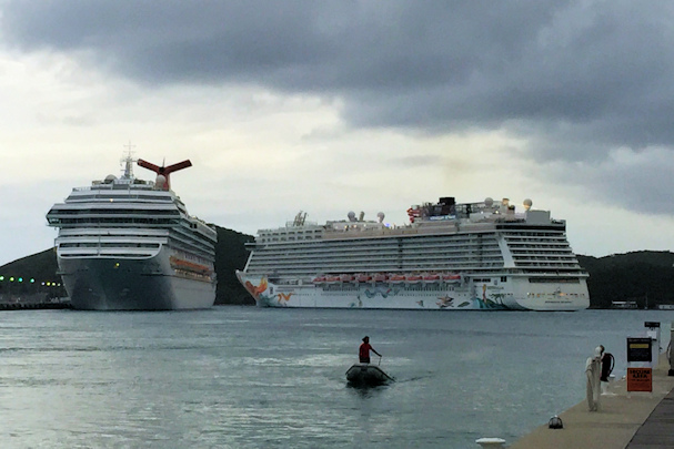
Charlotte Amalie harbor Traffic jam
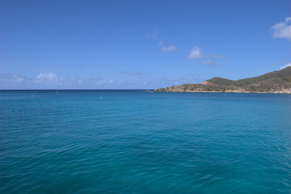
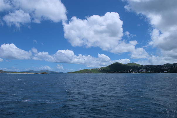
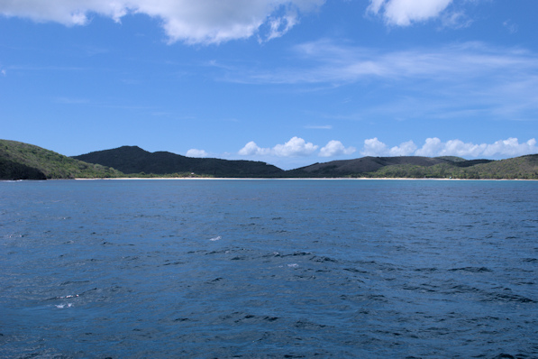
September 3rd: St. Thomas – Hawksnest Bay, St. John
When we were leaving, there was a strong east wind pushing us into the high-walled concrete dock. Because of the wind, I was not able to gain separation from the dock. One of our fenders rolled up, and we got a big scrape about three feet long on our port bow.
The rest of the passage was much less eventful. We motored around the southeastern corner of St. Thomas and used the narrow cut between Water Point and Great St. James Island. The current through this restriction can be quite strong, but we went through easily. From there, we crossed over to St. John, taking a mooring in Caneel Bay. We took the tender around to Cruz Bay, the main settlement on St. John. We had lunch and looked in a few shops, before visiting the ranger station to get additional information about the Virgin Islands National Park.


Approaching the narrow cut Western shore of St. John
After returning to the boat, we saw Lasata, and together we proceeded to Trunk Bay, our planned destination for the night. We picked up some moorings and went to the beach. Shortly after arriving, someone claiming to be a park official (she was wearing a Baywatch suit) came over and admonished us that glass was not allowed on the beach (we had a couple of beer bottles in cozies). She then proceeded to tell us that we were not allowed to use the moorings for overnight stays. I argued that the cruising guides said nothing at all about that, and neither did the park map. She insisted that we could not stay. Later I would confirm that overnight mooring is allowed; I have no idea why she claimed it wasn’t. Anyway, I took the tender back to the boat to get some cans of beer. On the way to the beach, the motor suddenly died – as in completely dead. It would crank, but not catch. I double checked the fuel and the kill switch, but nothing. I had to row the rest of the way in, which is pretty difficult in an RIB. Later Ralph towed us back using Banana Split. We decided to backtrack a mile to Hawksnest Bay to take moorings, since the Trunk Bay Mayor had told us off.

Hawksnest Bay anchorage
Position at destination: 18°21.299’ N, 64°46.283’ W
Air temp: 91°, Humidity: 52%, Water temp: 89°
Nautical miles for this leg: 12.2, Total: 9050
Departed at 10:30am, arrived at 12:30pm
September 4th: Hawksnest Bay – Cinnamon Bay
Ralph came over to help me with troubleshooting Little Blend’s motor issue. We checked a number of things, and we eventually confirmed that there was no spark, so we guessed that the ignition control unit was faulty, and there was nothing further we could do. For the rest of the tour of St. John, we would have to be towed by Banana Split. Embarrassing.
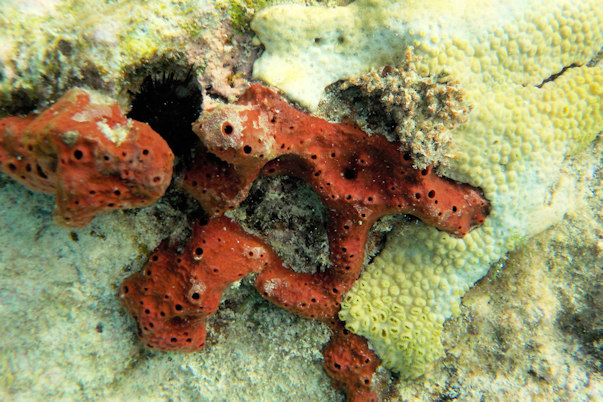
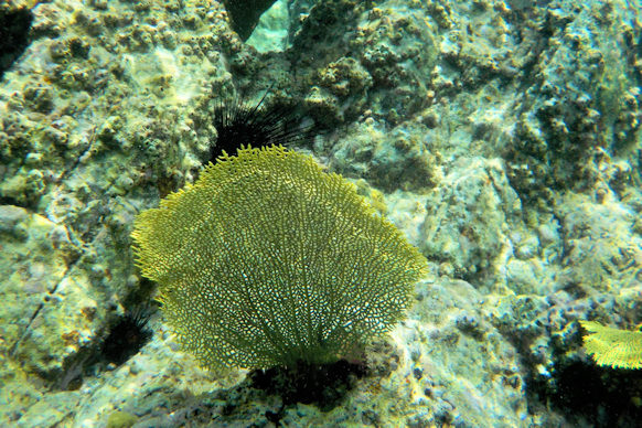
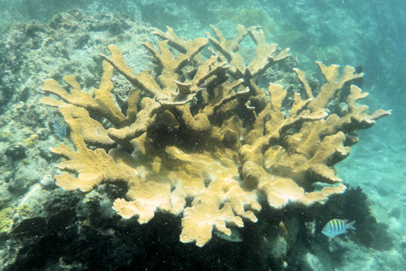
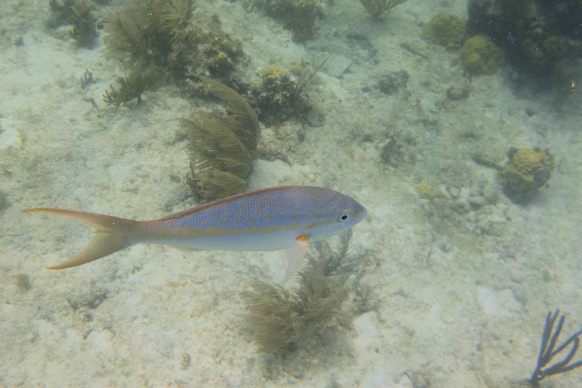
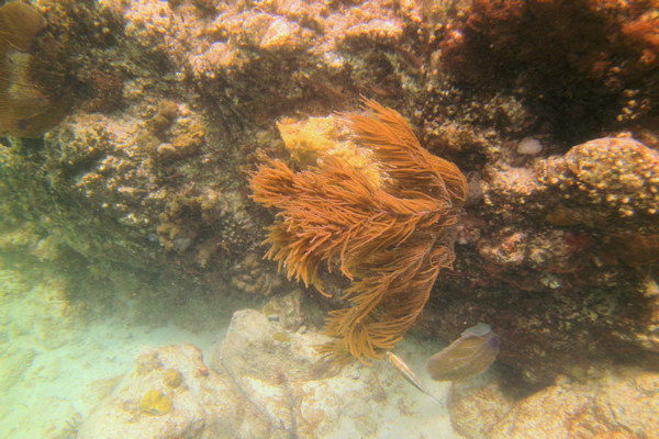
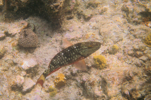
After finishing with the motor, we returned to Trunk Bay. The main attraction is the underwater snorkeling trail. The beach can get pretty busy, as cruise ship passengers take excursions here, but it was not busy the day we were there. We found the snorkeling trail, and followed it to the beach. The water was very clear, and the reefs were very healthy.


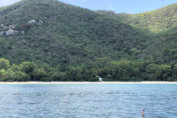
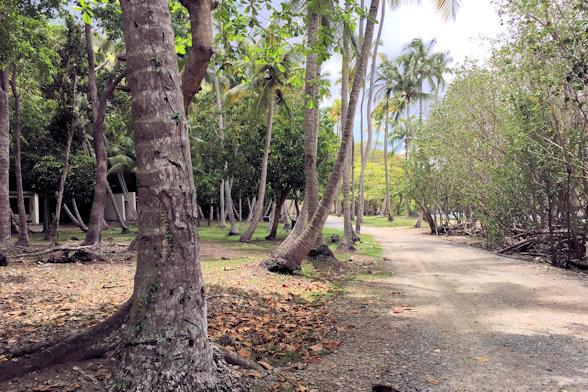
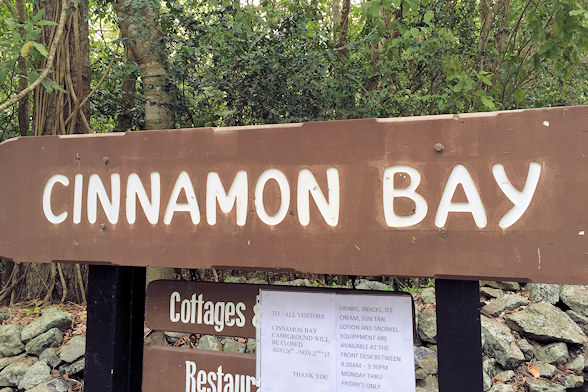
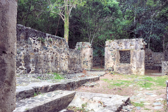
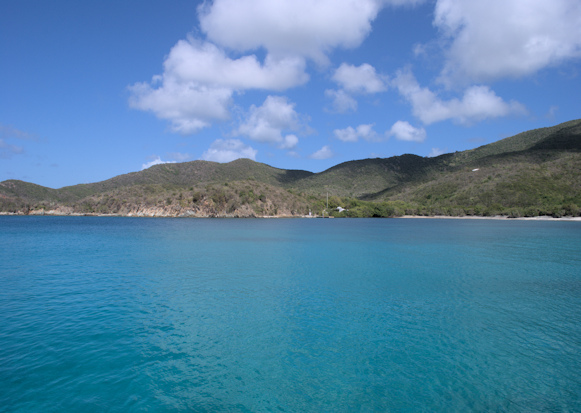
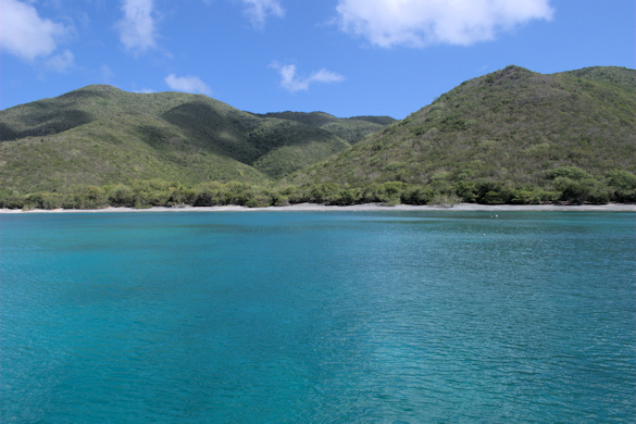
After our snorkeling adventure, we headed around the point to Cinnamon Bay, made famous in the Kenny Chesney song, “This Old Blue Chair”. It’s a large and open bay, and the weather was perfect. We were towed to the beach, and we did some exploring. There is a campground just off the beach, with a couple of stores that were closed for the offseason. Just up the road were the ruins of an old sugar plantation.
Position at destination: 18°21.261’ N, 64°45.217’ W
Air temp: 89°, Humidity: 61%, Water temp: 89°
Nautical miles for this leg: 2.5, Total: 9052
Departed at 12:00pm, arrived at 12:30pm

Towed to the beach -d’oh! Area around Cinnamon Bay campground

Self-explanatory Expensive houses around the bay


In and around Cinnamon Bay

One last look out of the bay Moon jellies came into our lights that night
September 6th: Leinster Bay – Coral Harbor
We motored around the eastern end of St. John into the protected Coral Harbor, home to the second-largest village on St. John. Being this was Sunday, and offseason, there wasn’t much open in the town. The harbor was full of local boats, many looking like derelicts, so we had to anchor well off from the town dock. We decided not to wait for the Banana Split towboat, and we rowed in, which wasn’t difficult with the wind to our back. Once ashore, we found that most of the restaurants and bars listed in the cruising guide were closed either for Sunday or the offseason. We did manage to find a small sandwich shop that was open for lunch, as well as a larger bar and restaurant on the west side of the bay. It felt really hot that day, with the sun beating down on us relentlessly. When it came time to row back, we really struggled against the wind and chop. Fortunately another boater took pity on us and towed us the rest of the way. We didn’t have much good to say about this stop, but perhaps it is better during high season.

Lasata rounding the east side of St. John Coral Harbor
A busy anchorage, but lots of derelicts Interesting tree
Position at destination: 18°20.491’ N, 64°47.704’ W
Air temp: 90°, Humidity: 61%, Water temp: 88°
Nautical miles for this leg: 8.6, Total: 9064
Departed at 8:50am, arrived at 10:20am
September 7th: Coral Harbor – Great Lameshur Bay
Ralph and Stacy were going back to Red Hook, as Ralph’s classes were starting. We said goodbye, and we went to Great Lameshur Bay on the south side of St. John. There aren’t too many anchorages on the south shore, but this one was well worth the stop. As long as there is no southerly component to the winds, it’s well protected, as it was for us. The snorkeling was decent, and we had a very relaxing day. We were the only boat in the bay that night.
Position at destination: 18°19.012’ N, 64°43.303’ W
Air temp: 89°, Humidity: 61%, Water temp: 89°
Nautical miles for this leg: 5.7, Total: 9069
Departed at 8:30am, arrived at 9:45am
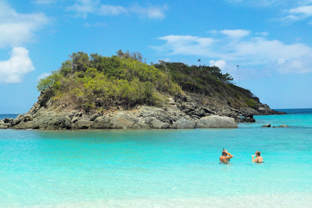
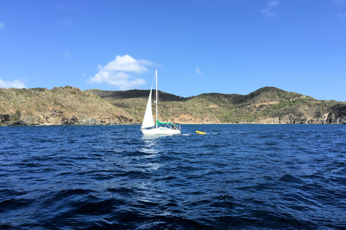
September 8th: Great Lameshur Bay – Bahia Montecito, Culebrita
We planned to cruise to the north shore of St. Thomas and anchor in Magens Bay, a deep well-protected bay with a fabulous beach. It’s a very popular day stop for the cruise ship riff-raff, but they usually leave by 3:00 or so. We cruised off the south shore of St. John, which is much more rugged than the north shore, and eventually turned to the northwest towards St. Thomas. That section of St. Thomas has numerous resorts, including Sapphire Beach and Sugar Bay.

Southern coast of St. John
Homes on the southside Jost Van Dyke, BVI, in the background

Nice day for a cruise Between St. Thomas and Thatch Island
We entered the very long Magens Bay and proceeded towards the beach. The bay is quite deep until you are almost at the beach. Unfortunately, a number of watersports boats were moored in the area where we wanted to anchor, so we decided to move on. Amazingly, one of the watersports outfits hailed us on the radio after we turned away to ask if we wanted to purchase some activities – a pretty dumb question to ask of a trawler. We decided to take a look at the bay next door, Hull Bay. It was overrun by moored fishing boats, so again we moved on. Looking at the charts, the next choice was Sandy Bay, at the northwest corner of St. Thomas. When we got there, it was fairly rough, and it just didn’t seem like a good anchorage, so we decided to cruise back to Culebra, this time stopping at Isla Culebrita.

Sugar Bay Resort Megans Bay
Rounding western St. Thomas Isla Culebrita
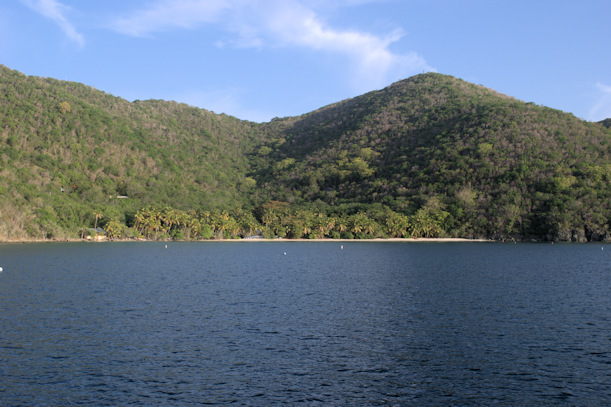
Culebrita is a small island off the north side of Culebra. The anchorage has a few mooring balls, but we anchored in good-holding sand. There was just one reef to get around, and as long as there is no north swell, it is a very comfortable anchorage. The local mooring technique was interesting – we saw a couple of boats that tied the mooring to the stern, and use the bow anchor to get them out of the swell.
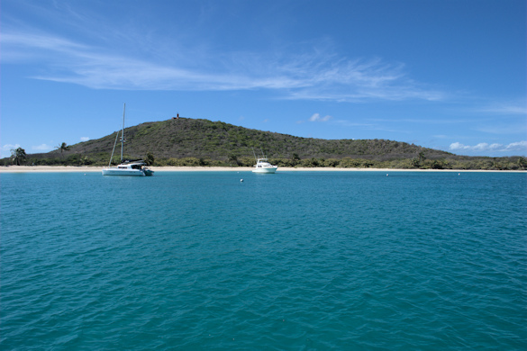

Beaches and boats at Bahia Montecito, Culebrita
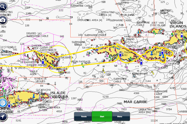
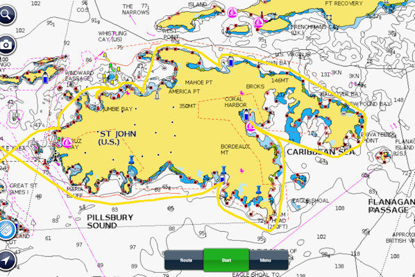
Track for our September vacation Around the island of St, John
Position at destination: 18°19.197’ N, 65°13.684’ W
Air temp: 90°, Humidity: 59%, Water temp: 89°
Nautical miles for this leg: 36.2, Total: 9106
Departed at 10:20am, arrived at 4:10pm
September 9th: Culebrita – Marina Puerto del Rey
After a peaceful night on the hook at Culebrita, we set off on our last leg back to Puerto del Rey. We passed by a few beautiful Culebra beaches before entering the channel back to Fajardo. It was another easy, but hot, day of cruising. We returned to our slip without incident and started to work on getting Little Blend back in action.
Approaching Marina Puerto del Rey
Position at destination: 18°17.326’ N, 65°38.018’ W
Air temp: 93°, Humidity: 56%, Water temp: 90°
Nautical miles for this leg: 24.6, Total: 9130
Departed at 10:00am, arrived at 2:00pm