


May 3rd: Port Antonio – Discovery Bay
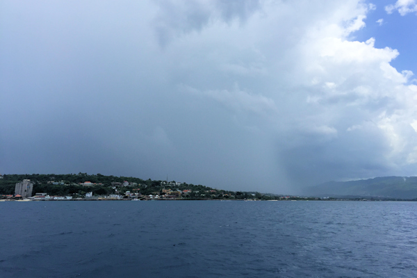
In order to transit around Jamaica, one has to get a “coastwise clearance” and a “customs transire”. These are issued free of charge, but you do need to get them in advance. As our journey would include an overnight stop in Discovery Bay, which did not have a customs office, we were cleared to Montego Bay. I have to say that the officials in Jamaica are very courteous, but getting clearances can be rather time-consuming. We notified the marina of our departure plans twenty-four hours in advance, and we did not see customs for the clearance forms until very late in the afternoon. Armed with our forms, we left Port Antonio at first light (and first rain) to cruise westward off the north coast of Jamaica. We were sorry that we didn’t have time to stop at the anchorages originally on our itinerary, but we were a little anxious to get back to Florida. We had a quiet day cruising, and anchored inside a very calm Discovery Bay.


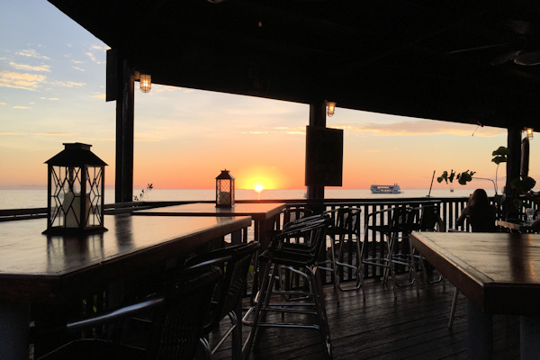
Discovery Bay Sun setting on Symbiosis
Position at destination: 18º27.876’N, 77º24.108’W
Air temp: 88, Humidity: 69%, Water temp: 79.5
Nautical miles for this leg: 61.26 Total: 11,850
Departed at 6:00am, arrived at 5:00pm
May 4th: Discovery Bay – Montego Bay Yacht Club
The following day we made our final journey through Jamaica, just thirty-five miles to Montego Bay, where we would check out. It was a very calm day, although when we were approaching Montego Bay, we dodged several ominous-looking squalls. Along the way, we passed the airport, which has a runway right on the beach – the airplanes appeared to be landing in the ocean. We turned in to the harbor and made our way to the yacht club anchorage. It turned out to be very tight, with most of the space taken up by local, moored boats.
Position at destination: 18º27.661’N, 77º56.979’W
Air temp: 85, Humidity: 60%, Water temp: 79.5
Nautical miles for this leg: 35.44 Total: 11,886
Departed at 6:00am, arrived at 12:00pm


On the left-hand image, the bottom dropped off steeply outside of the moored boats, so we didn’t have an option to go further into the bay. From the picture on the left, our tracks, and the moored boats, are shown. We initially anchored towards the southern side, but after being there ten or so minutes, a harbor patrol boat came out and told us we had to move, as we were too close to the cruise ship dock. We felt our way around, and eventually found a location on the north side where we had sufficient swinging room without being too deep. The top track is our final anchored position. We headed ashore to the marina, and asked them to call the officials for us. We had a nice lunch, and once the officials arrived, we were able to clear out with no problem. We decided to take a taxi to a nearby grocery store, which was a small warehouse store, Mega Mart. We knew that provisions would be expensive in the Caymans, so we stocked up on what we could.

Rain squalls as we approached Montego Bay The anchorage at the Montego Bay Yacht Club

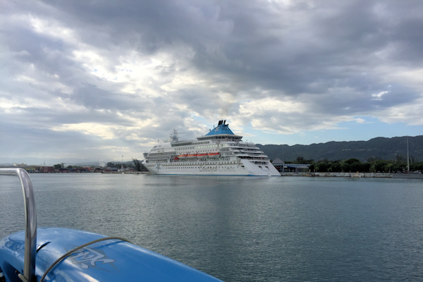
Waiting for customs… A cruise ship did dock that day
May 5th – 6th: Montego Bay – Cayman Brac, Cayman Islands
We left under very calm seas at 8:00am for the passage to Cayman Brac, which would take around twenty-three hours. After our last horrendous overnight passage from Haiti to Jamaica, we were apprehensive, but the forecast was good, and this part of the Caribbean is generally calmer than the Windward Passage. About an hour out of part, we saw a Jamaican Defense Force cutter closing in our stern, and we received a hail about a boarding. They sent over a launch, and an officer came on board, accompanied by the ubiquitous very young sailor carrying an automatic weapon. It was a traditional boarding, inspecting our paperwork. They were almost finished when they got a call from the mother ship, which suddenly turned back to port at high speed. The boarding party had to catch up to them in the launch. Amazingly, about four hours later, we saw the cutter again, and this time they boarded Symbiosis. We were probably thirty to thirty-five miles offshore at that time. Of course, some squalls were coming through, and the seas picked up, so it wasn’t easy for them to get on board the pitching sailboat. I’m not sure why they burned the fuel to return this far…


Stock photo of JDF cutter Smooth waters on departure
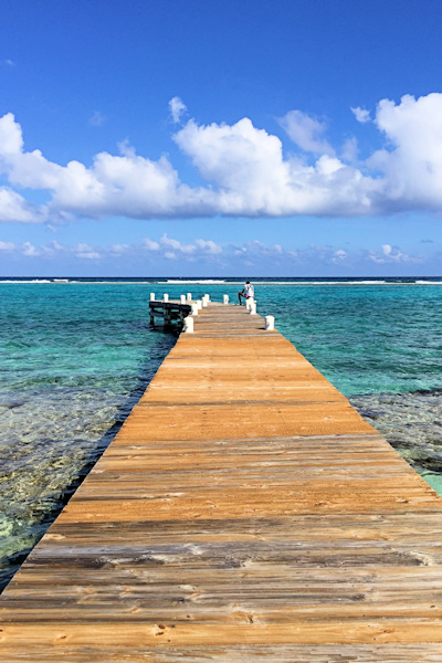
The rest of the passage was uneventful, and fairly calm. At daybreak, we could see the eastern landfall of Cayman Brac Island, the easternmost island in the Caymans. As we traveled along the northern coast, we hailed the authorities. We were initially told to dock at The Creek for clearing in, but as we approached that anchorage, they asked us to proceed to Scott’s Anchorage on the northwestern shore, and dinghy ashore to meet the officials. We were planning to anchor there anyway, so that worked out. We picked up moorings, as the water was deep, and covered with reefs – anchoring in that area is not allowed.

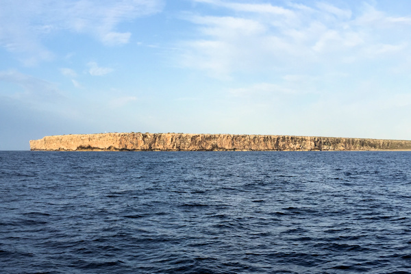
The bluff on the east end of Cayman Brac
Position at destination: 19º41.965’N, 79º52.624’W
Air temp: 87, Humidity: 66%, Water temp: 79.5
Nautical miles for this leg: 138.6 Total: 12,024
Departed at 8:00am, arrived at 6:45am
May 6th – 7th: Cayman Brac
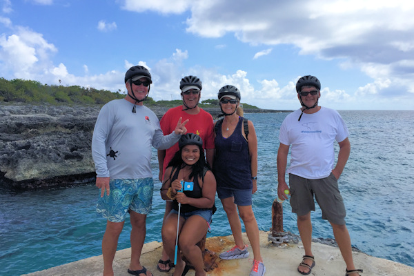
We had to wait for a couple of hours until the authorities called us to meet them at the jetty. We picked us Scott and Noi and motored over to the jetty. Customs and immigration were there in a pickup truck, and the check-in process was easy and enjoyable. The officers gave us some info on the island, and they were very friendly. After we finished the process, we looked around a bit – Scott needed to find some oil, as Symbiosis was still using copious amounts. He found a guy that would bring him five quarts in a little while. We walked up the road to see what was around – and the answer was not much. We found a small grocery store where I was able to get a C.I. SIM card, with some difficulty. We also found a sports bar where we could watch Game 3 of the Warriors – Jazz game that night. We also ate a pretty decent lunch at a local restaurant. Amekaya was already in the anchorage – they had come straight over from Port Antonio, and Maris had already been diving. We wanted to spend a week or so before proceeding to Grand Cayman.
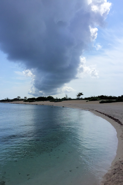
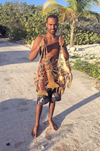

Clouds over the beach Those are some big lobsters The local beer – White Tip Lager


Customs and immigration “office” Now why didn’t we buy these?
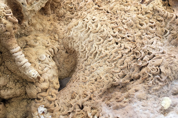

Coral formations preserved in limestone – not fossils, but close
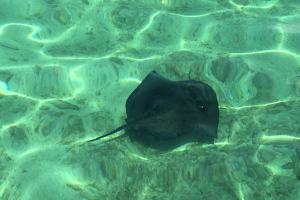

Big sting ray off of the jetty View of the anchorage
That night, Scott and Noi joined us at the bar, Barracuda’s Bar and Grill. We had pizza for dinner, which was surprisingly good. The game was a big win for the Warriors, as they continued their drive for the title. When we left, we noticed the swell was up a bit. The small dock area on the jetty was a little dodgy, and it was wide open to a north or west swell. Getting into the dinghy wasn’t the easiest thing in the world, but we all managed. In the morning, we were woken up pretty early by some serious rolling. The north swell had picked up during the night, and it was right on our beam. We couldn’t use a stern anchor, so we thought about deploying the flopper stoppers, but first we hailed Scott and Maris to discuss the weather. Scott had listened to God (a.k.a. Chris Parker) that morning, and the forecast was not good. I had checked weather on the phone, and it was clear that the swell was going to get worse during the week. We looked at the charts and consulted the cruising guide to see if there were any protected anchorages on Cayman Brac. There was only one anchorage on the south side, Dick Sesinger’s Bay. The entrance was very tight, and the cruising guide said not to enter the bay under rough conditions. Maris hailed us, and he told us that he had a friend who had a mooring in Owens Sound at Little Cayman, about twelve miles away. The sound was shallow, at six to seven feet, but he thought it was an option. He decided to go down there, and to call us with a report. After a couple of hours rolling away, Maris called to say that he was able to get into the sound easily, and there was plenty of anchoring room We felt fine going there with our draft (5’), but Symbiosis carried six feet, so Scott was concerned.
May 7th: Cayman Brac – Owens Sound, Little Cayman
We made the passage in about two hours. With the stabilizers, the trip was smooth. Once we got into the lee of Little Cayman, the swell declined a lot. Before we left, we attempted to contact customs in Little Cayman, but they told us we would not need to check in again. We found the opening and proceeded through the reef. Once inside, the water was very calm, and incredibly clear. We could not tell if we were in one foot or twenty feet of water, but the sounder said we were carrying six to seven feet. We moved past Amekaya, and laid out just fifty feet of chain on the anchor. We relayed our experience to Symbiosis, and they proceeded into the sound. Scott said he kissed the bottom gently a couple of times, as we were there at low tide.
Position at destination: 19º39.546’N, 80º04.424’W
Air temp: 89, Humidity: 62%, Water temp: 84
Nautical miles for this leg: 12.03 Total: 12,036
Departed at 11:45am, arrived at 2:00pm

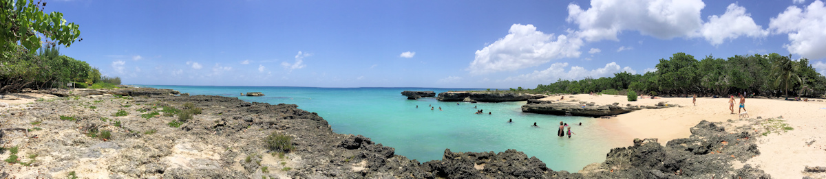
Views of the anchorage at Owen Sound – unreal water color and clarity
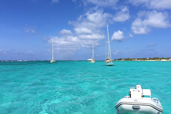

Symbiosis and Amekaya were behind us Finding the perfect spot to anchor
May 7th – 12th: Little Cayman Island
After we were secure, we picked up Scott and Noi and went ashore to the Little Cayman Beach Resort. It had a dive boat dock, but it was difficult to get up it, as it was a very high dock without a ladder. We could not get to the beach because of the weeds, so we decided to simply use one of the docked boats, crawling into the cockpit. The resort is small, but very attractive, with a pool and bar. The bar was full of mementos from visitors, and we were surprised to see a cozy from the University of Arizona. We noticed that you could rent scooters at the resort, so we decided we would all go on an island tour the following day.
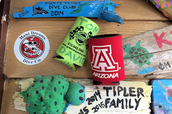

U of A cozy at the beach bar Little Cayman Beach Resort pool
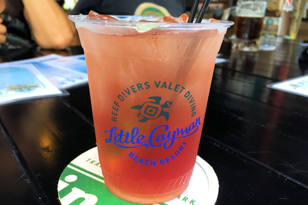
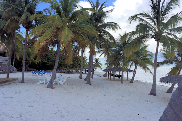
Mmmm, rum punch Lovely grounds
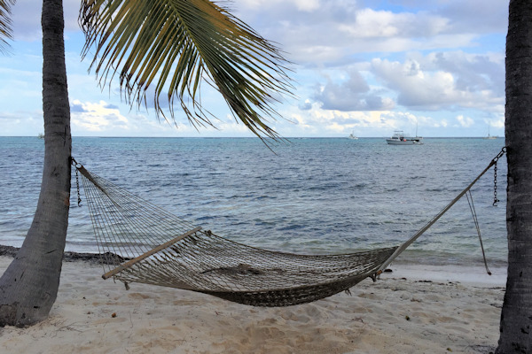

Hammock time!


Noi, the coconut climber We never got tired of staring at the anchorage
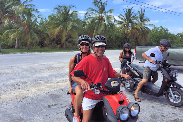
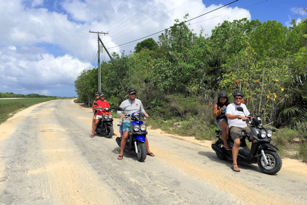
Island tour on scooters
The following day we picked up our rides (scooters) and decided to make a clockwise tour of the island. We passed by the airport, which had some of the most unusual signs we had ever seen.
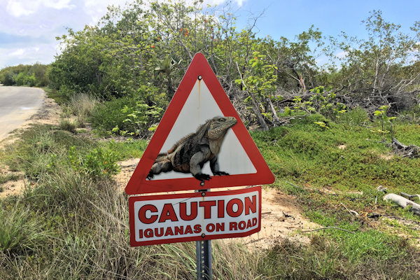
Get your motors runnin’! Only in Cayman Brac
Along the northern coast was the island’s “dock”, where the supply boats come in. As far as we could tell, the ship has to med-moor to offload.
Little Cayman’s Outlaws Posing at the “port”
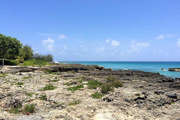
The north shore doesn’t have any beaches, as it is all limestone with quick drop-offs. Maris recognized a couple of spots where he had gone diving. On the east end, there is a lighthouse of a sort located on top of the island’s tallest mountain – I guessed it was fifty feet high (the hill, not the lighthouse).


Rocky beaches were typical on the North Shore The east end lighthouse


Island flowers Is that pink sand?
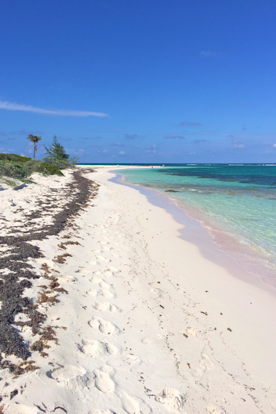
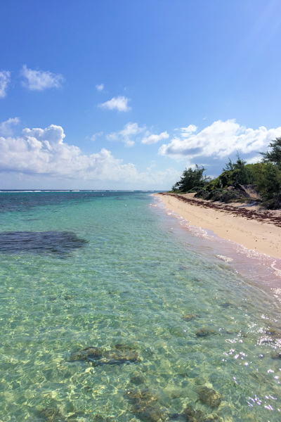
The beach on the northeastern shore – calm and sandy
Along the southern shore are several small dive resorts. There isn’t much of a reason to come to Little Cayman other than diving. At the end of our tour, we visited the Hungry Iguana, a sports bar across from the airport. We decided to go there that night for pizza and the Warriors game. The guy we had rented the scooters from told us to just leave the bikes, with the keys in them, in the resort parking lot. Little Cayman doesn’t have a crime problem, needless to say.


Sights and drinks at the Hungry Iguana
Scott and Noi joined us that night at the bar. The pizza was actually quite good, and it was another great win for the Warriors, as they continued their march towards the title.

One of the dive resorts The gang at the Hungry Iguana
Happy hour on Amekaya One more beautiful view
Death stalks us in the water
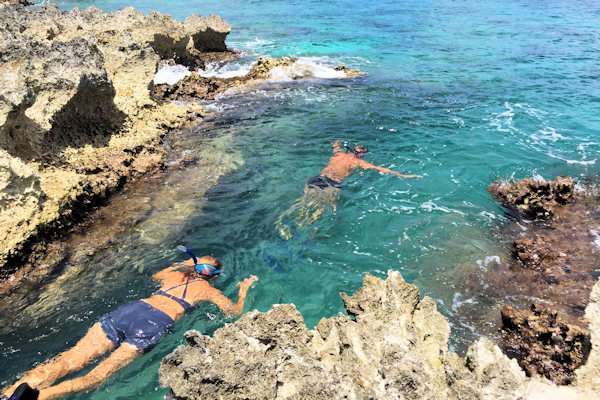
The waters around us were incredibly clear, and we were close to the reef, which was a good snorkeling spot. One morning we decided to swim out to the reef and snorkel along it to the sound entrance. That part worked out pretty well, but coming back was another story. The tide was going out, and it was very strong. It was worse than the tidal current we had experienced at Thunderball Grotto in the Bahamas. We could barely make any headway, and we decided to swim over to Symbiosis for a break. Even swimming at a right angle to the tide was exhausting. We finally made it to their boat, and Noi thought we were stopping for a chat. Rosé had to tell her a couple of times to put down their ladder so we could climb aboard. Scott offered to put down his little tender and take us back, but we thought we could make it. We decided to go one at a time, so Rosé went first. I could see that she was struggling, but she did make it across. I went next, but I only made it about two-thirds of the way before I succumbed to complete exhaustion. It reminded me of hoe I felt when I have chased after the runaway dinghy in The Grenadines. I let the tide carry me back to Symbiosis, and hauled myself up to their deck. I hailed Rosé on the radio, and I asked her to bring Little Blend over to pick me up. For some reason, she had never started it, so she wasn’t sure on the procedure, but I talked her through it on the radio, and she was able to come get me. It was a pretty frightening experience – if Symbiosis had not been there, we would have been in real trouble. Later we all went over to Owen Island for more snorkeling, but we made sure to go at slack tide.
May 12th – 13th: Little Cayman to Cayman Brac to Barcadere Marina, Grand Cayman
After six days in our little slice of paradise, the weather window looked good for the seventy mile crossing to Grand Cayman. But first we had to return to Cayman Brac to check out. There are no customs facilities on Little Cayman. Strangely, even though we were staying in the country, we still had to clear out with customs, but not immigration. We asked why, and we were told that because of the distance between the islands, we would be traveling through international waters. We jokingly told the officer to look at our boats, and guess if we had time to go to Cuba, pick up some contraband, and return to Grand Cayman with our illicit booty a scant fourteen hours later. He got our point, but the rules are the rules. We also asked if we would be able to check in at the marina in Grand Cayman, but he didn’t know. The marina was in the North Sound, and it takes around an hour to get in from the sound entrance. Sometimes customs will come to the marina to check in a boat, but you have to hail them once you arrive at the entrance. We would be there at eight in the morning, to catch high tide – the entrance is tricky and shallow. We were optimistic that we would be able to go straight to the marina.
The swell was still coming in from the north, so getting the tender hauled up was not easy. Scott came over in his dinghy to help. I used the thruster to line us up bow-first into the swell, and then we raised the dinghy up. The roll was so bad that the dinghy would have been swinging violently if we had stayed with the beam swell. Not without difficulty, we accomplished the task, and departed at 5:00PM for Grand Cayman, passing by the now familiar Owen Sound just around sunset. Amekaya was staying for another day or two, so Maris could dive some more, and then they would be joining us at the Barcadere Marina.
The passage was pleasant, and we arrived at the entrance to North Sound at around 8:30 the following morning. We hailed customs, and we were very disappointed to find out that they expected us to come directly to Georgetown to check in. It would take us around two hours just to get there. 😡
 We proceeded to the main port at Georgetown, where the customs dock was located. We were given ambiguous directions, and it took some time to figure out where to go. We finally located their dock, which had a bare concrete wall, and a fixed dock with a lot of surge. There was a tour boat dock on the opposite side, and in the middle, there was a large rock. There was only one security guard present, and he had no intentions of offering us any assistance. We put out every fender on the boat, then eased over to the dock. There was a lot a surge, so Rosé stood on the dock and pushed on the boat for some extra leverage. After a few minutes the customs officer arrived, and she didn’t seem to know what she was supposed to do. I showed her our clearance from Cayman Brac, and she said that were good to go – a colossal waste of time.
When we left, I decided the best course of action was to go forward, around the giant rock – the depth was okay. We managed to get off the dock and around the rock without damaging the boat. We were pretty upset, as we considered the whole exercise to be dangerous and pointless. We hailed Symbiosis as they were approaching to apprise them of the situation, and we waited for them in the anchorage. As a lighter boat, they had an easier time. As we were leaving, we were cracking jokes about the dock and the futility of the check-in, but we forgot we were on the official channel, so an official stepped on us with a nasty remark about our complaining. After that, we stuck to the hailing channel.
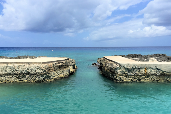
 It took us a long time to get back to the sound entrance, and now the tide was low, making it trickier. I had put together some tight waypoints, and we felt our way through the opening very carefully. We saw some pretty big rocks below us, but we never got closer than two feet from the bottom. Even after clearing the entrance, we had to stick to a well-defined channel that forced us to take a long route in, as can be seen in the chart above. The marina provided waypoints for navigating the entrance and the sound, and they worked well.
As we approached the marina entrance, I saw some markers, but I could determine their purpose. As I was trying to work out what they were, I suddenly noticed that we were at zero feet. We had managed to wander out of the narrow channel, which carried ten feet, to the sandy bottom of the sound at five feet. We quickly returned to the channel without hitting the bottom. I then realized that the markers were the white poles with faint red and green stripes on the top – pretty hard to see. We entered the marina and tied up. In the meantime, Symbiosis was approaching and made the same mistake, leaving the channel. Unfortunately, with their deeper keel, they went hard aground and got stuck. This was not an uncommon occurrence, so the marina dispatched a power boat to pull them off. Soon, Symbiosis joined us in the marina. We checked in at the office, and they told us that our customs check-in was not completed. I think that if we were told to return to the dock we would have exploded. Fortunately, customs said they would come to the marina to collect the forms that the marina provided to us. The detour to the customs dock had cost us five hours.
Position at destination: 19º18.098’N, 81º21.521’W
Air temp: 91, Humidity: 55%, Water temp: 84
Nautical miles for this leg: 116.1 Total: 12,164
Departed at 5:00pm, arrived at 3:00pm
May 13th – May 27th: Barcadere Marina, Grand Cayman
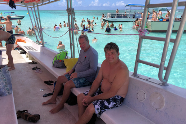
We settled in at the Barcadere Marina, home of the Georgetown Yacht Club. After our frustrating day, we were in sore need of some welcome cocktails, so we went to the bar, sitting outside. We saw a fishing boat come in that offloaded some nice Dorado’s. We weren’t much in the mood for cooking, so we had dinner at the marina restaurant. The food was decent, and not too expensive – the Caymans are legendarily high-priced. There was a small but nice pool, and very large, but sparse showers. We were thinking about staying for a week to explore Grand Cayman. Amekaya was supposed to be arriving the following day, so they would be joining us. The marina offered a shuttle service to a local grocery store, and we found out that car rental is the only super cheap thing on the island, at just $14 per day!

Flowers on the grounds of the marina

The marina pool Sunset from the restaurant

 As we were having our cocktails, a fishing boat arrived with a haul of mahi-mahi. I could not resist posing with one of those beauties. Noi and Rose decided to do some exploring the following day. They found the world’s largest flip-flop at the Margaritaville Resort. In the meantime, Amekaya arrived at the marina, so we welcomed Maris and Linda. We made plans for some excursions around the island. We had an unusual happening, with a small sport plane buzzing the marina a number of times. It was probably flying under one-hundred feet, and it made quite a few passes.
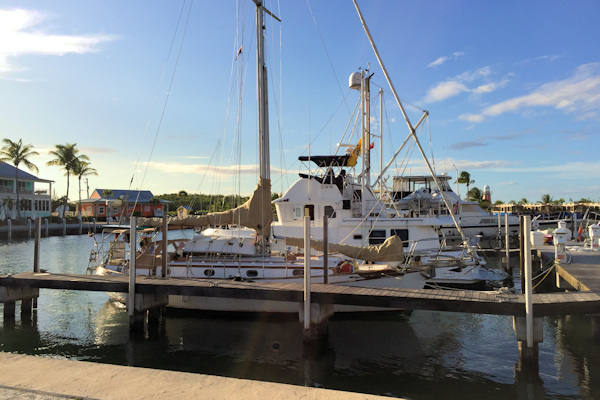

Tropical Blend with Symbiosis in the first slip Amekaya in the slip behind Symbiosis
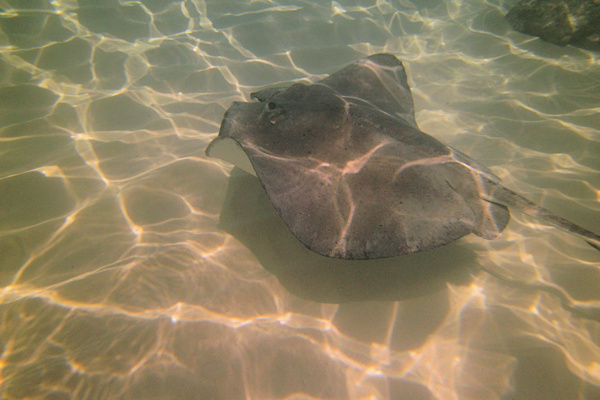
 We went with Noi and Scott to go to Stingray City, located on the western end of the North Sound. It’s a group of sand bars, with an average depth of three feet. The rays have become habituated to human contact, as they are fed at the sight. While it is troubling that wild creatures now rely on humans, it’s still a very cool experience. We had vacationed in the Caymans over fifteen years ago, when we first went to Stingray City. That was in November, which is a pretty slow season. Our first reaction was shock at the number of boats and people – it was mobbed!
We navigated among the hordes of people, and the stingrays didn’t care. Rosé did not come in the water – she does not like being touched by fish, so she gave it a pass. Scott and Noi took the time to “pet” one of the rays. After spending time with the rays, we moved on to a snorkel spot that was nice, but nothing spectacular. The water was amazingly clear, a feature that makes the Caymans one of the best dive locations in the world. Afterwards, we found a Thai restaurant, which Noi declared was very authentic. She loved talking with her countrymen.


One of many stingrays Scott and Noi got up close and personal with this ray
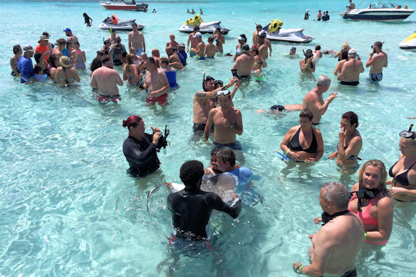

Seriously crowded! Lucky lines up a closeup picture

Rose and Noi Lucky and Scott

Very graceful under the water

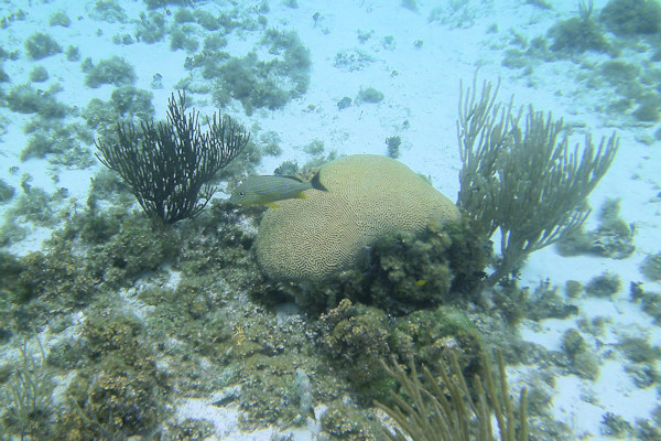
Some scenes from the snorkeling visit near Stingray City
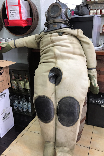
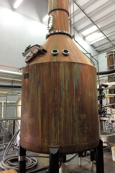
Maris was a rum aficionado like myself, and he wanted to take the tour at the Cayman Spirits Distillery, the maker of Seven Fathoms rum. Unique to this distillery, they also make a vodka, Gun Bay. It was located quite close to the marina. After the tour, we did some tasting. Noi enjoys cocktails, but she wants the liquor taste to be completely hidden, as can be seen by her reaction to trying a shot of vodka!

This guy had too much Paging the Bee Gees A pot still
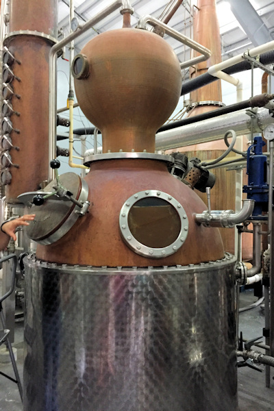

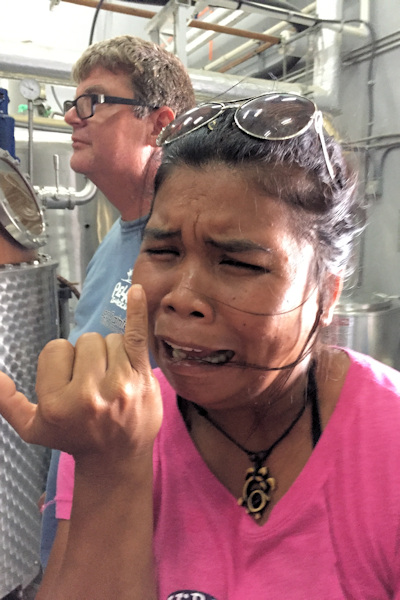
The vodka tower Isn’t that obvious? Straight vodka not good!


At the tasting bar Distilling area
Manna from heaven They use new barrels
Near the marina, on the western shore, there is a large public beach called Smith Barcadere, or Smith Cove. We visited the beach on a bright Sunday afternoon.
Panoramic view of the beach and cove


Noi found a new friend Chillin’ in the shade
Maris suggested we join him at a local dive center on the northwest side of the island, Divetech. It’s a dive school, with a training pool and a restaurant on-site. The pool has a narrow entrance that we swam out of – the surge made it an interesting experience. Unfortunately, there wasn’t much to see underwater in the area, as the reef was sparse.


The waters outside of Divetech The dive center and the ocean pool
The narrow entrance for the pool Maris and Linda making their way to the ocean
One afternoon, while at a bar, the subject of Aria, the boat that had been lost off of southern Jamaica came up. There had been a very strange development – the boat had washed up intact on the shores of Cozumel, Mexico, about six-hundred n.m. to the east of where it was abandoned. The owners had shut down communication on their blog. We speculated on what may have happened, but it remains mysterious. Here is a story about finding it in Cozumel, and another story with comments from Maris and Linda.
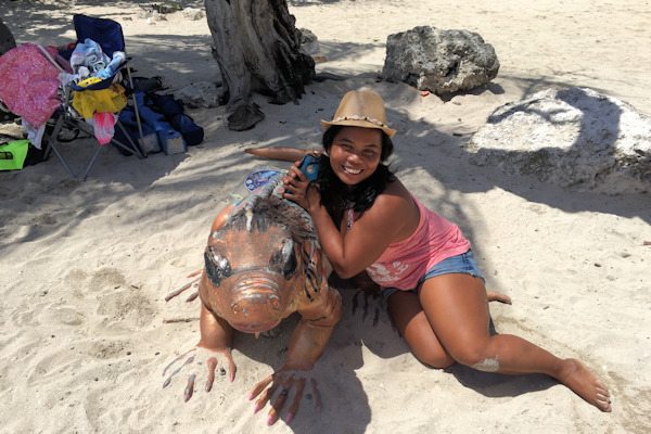
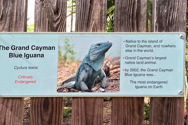
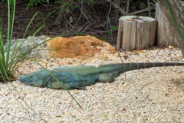
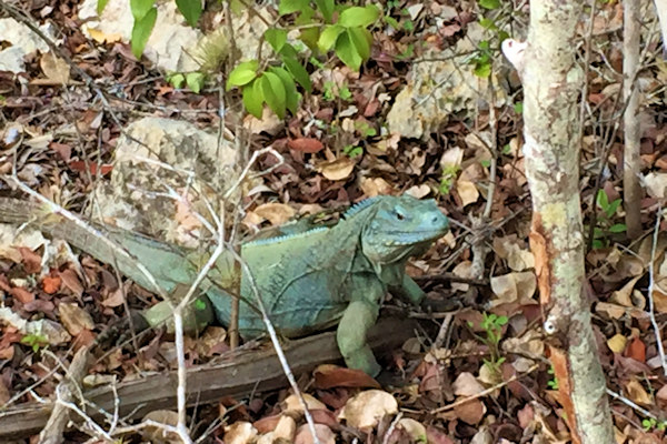
We stayed a little longer in the Caymans than originally planned due to weather, but we definitely enjoyed our time. Provisioning was easy, if a little expensive. With the very inexpensive rental car, we were able to see about everything on the island, including the beautiful Queen Elizabeth II Botanic Park. The gardens had a great collection of tropical plants, as well as local ones, and a number of very rare blue iguanas. These lizards live for over sixty-give years, and by 2003, there were fewer than fifteen of them left, wiped out by feral dogs and cats, as well as habitat destruction. A breeding program has been very successful, and they have re-established themselves in the wild areas of the island. The park maintains a breeding program, and we saw several of these beautiful, rare animals in the park. We took a ton of pictures – here are the ones of the blue iguanas. For the pictures of the plants and flowers, feel free to browse the gallery.

May 27th: Barcadere Marina – Main Channel Reef
All good things must come to an end, so when the weather window opened up, we got ready to cruise to Isla Mujeres on the Caribbean coast of Mexico, where we had previously visited in December 2014. Scott and Noi had not been to Mexico, so they were looking forward to it. We said goodbye to Maris and Linda, as they were planning to send the summer at Rio Dulce in Guatemala. In order to make our passage window, we needed to leave at 3:00 in the morning. We did not want to venture through the narrow opening of the sound in the dark, so we left in the afternoon at high tide, made our way through the channel, and took moorings outside of the sound until our very early morning departure. Neither of us ran aground nor hit the reef – a good day!
Position at destination: 19º23.028’N, 81º19.509’W
Air temp: 89, Humidity: 63%, Water temp: 83.5
Nautical miles for this leg: 6.87 Total: 12,171
Departed at 2:30pm, arrived at 3:50pm
May 28th: Main Channel Reef – Marina Puerto Isla Mujeres, Mexico
We woke up in the pre-dawn darkness to set off for Isla Mujeres, a long 330 nautical miles away. The seas were very calm, and the winds were light – great for us, but not so good for Symbiosis. During the fifty-five hour passage, we did run through several squalls with rain and gusty winds, but conditions overall were quite nice. We only saw a handful of vessels during our passage – this is a lonely part of the Caribbean. We spent almost the entire passage in the pilothouse. On a couple of occasions, I went up to the flying bridge, where I noticed a high accumulation of soot. I chalked that up to the light winds coming from behind us. At five to ten knots, we figured the soot was constantly blowing back over the boat, motivating us to stay inside. We saw land at around 8:00am two mornings later, and made our way around the northern end of the island to get into the marina, which is located in a lagoon. We tied up without incident, in pretty much the same place that we had been almost three years earlier, and proceeded to the long task of checking in.
Position at destination: 21º14.101’N, 86º44.255’W
Air temp: 90, Humidity: 57%, Water temp: 84
Nautical miles for this leg: 330 Total: 12,501
Departed at 3:00am, arrived at 10:00am