


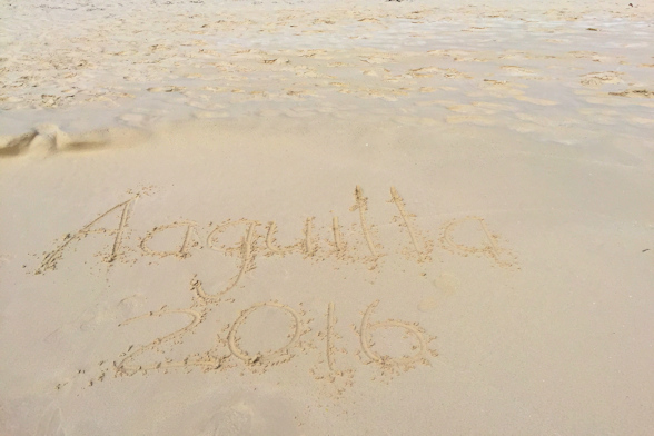
January 31st – February 4th: Road Bay, Anguilla
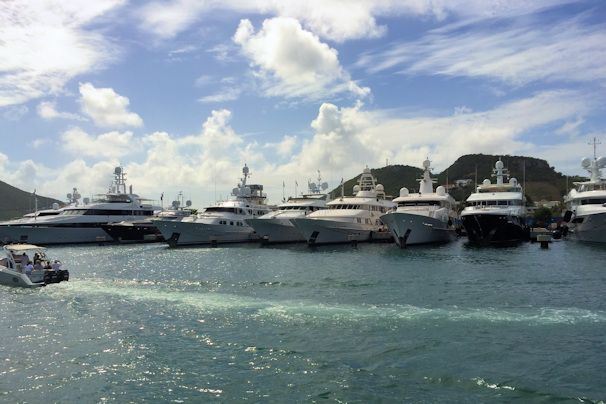
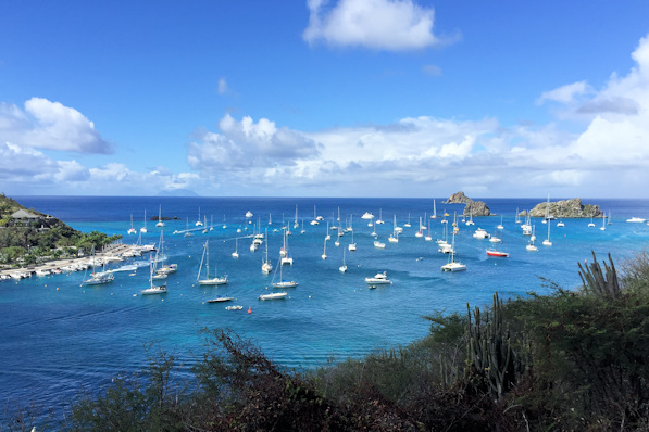
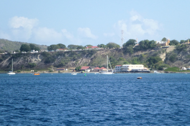
On Monday morning, we went ashore to check in. There is some confusion about the cruising permit in Anguilla. When we first read the guide, it sounded to us like we had to have a cruising permit, which for Tropical Blend would cost $150 per day – yikes! But upon re-reading, we figured out that if you kept the boat at Road Bay, no cruising permit was necessary. Our check-in cost turned out to be $16. Once checked-in, we checked out the beautiful beach at Road Bay.


Road Bay Beach “Dud’s” at Road Bay
We found a great beach bar, Dad’s, which had the best wi-fi bandwidth we had experienced in a long time. For some reason, Rose kept calling it Dud’s.
One warning in the cruising wide was not to anchor in the channel that led to the government dock, where ferries and freighters came in. On our second morning in the anchorage, we were awakened at dawn by a very loud ship’s horn. We ran outside to see that a freighter was blasting away at a sailboat that had anchored in the channel. Once that boat had moved, the freighter continued towards the dock, and then started to turn around. There was another sailboat anchored just outside the channel, but as the freighter turned, it was clear that it was going to hit the sailboat. They were on deck, and once they figured out the freighter was not going to stop turning, they quickly cut their anchor rode and got out of the way. They proceeded to the outside of the harbor, and tied to the back of another sailboat, then came in on their dinghy to snorkel in search of their anchor. They spent about an hour looking for it, and finally found it. They returned with some dive gear and retrieved the anchor. The moral of that story is to stay well clear of the channel, not risking the wrath of a freighter captain.

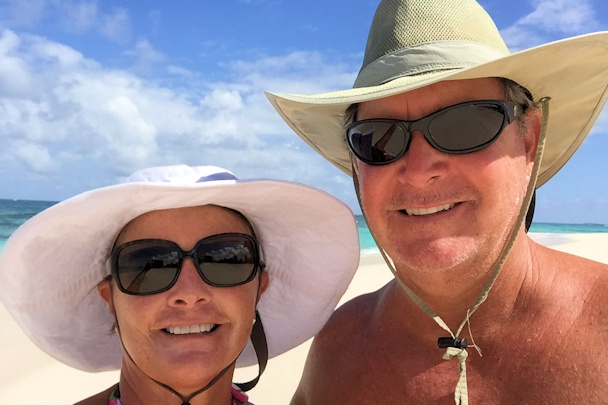
Watch out for that freighter! Beach selfie
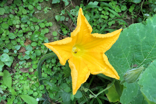
We rented a car to explore the island, which was a lot cheaper than getting a cruising permit. The car cost $29, but being a British island, we had to get a $20 local drivers’ permit. We visited several of the very beautiful beaches, and had lunch at the Sunshine Shack on the south side. Anguilla is a small island with some gorgeous large beaches – we are glad that we made the stop.
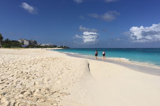

Shoal Bay East Beach – two miles long!
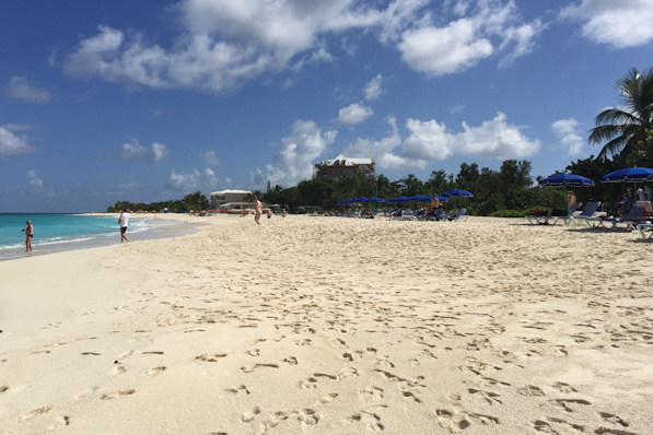

More of Shoal Bay East Beach

Rendezvous Bay The Sunshine Shack

Shoal Bay West Beach
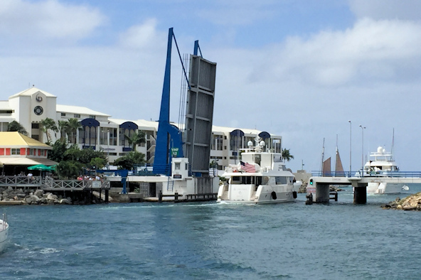
February 4th: Road Bay – Simpson Bay Marina, St. Maarten
At 4:00 in the morning on the 4th, we woke up to a very rolly anchorage. It was clear that we were in a north swell, which makes the Road Bay anchorage untenable. We decided to get out that day, instead of the following day as we had planned. The cruise to St. Maarten was actually calm and enjoyable – the swell in the ocean wasn’t too big, and it was mostly following us. We arrived too early for the 3:00 Simpson Bay Bridge opening, so we anchored outside, which was actually calm. Anchored outside was the Eclipse, the second-largest yacht in the world, at five-hundred and thirty-three feet long. It’s owned by a Russian tycoon/criminal who has a home on St. Barth’s. Apparently he has it here every winter to shuttle guests from St. Maarten to St. Barth’s. It’s probably the world’s most expensive ferry…
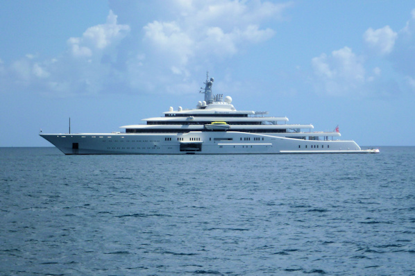
Maho Bay, with the airport Eclipse, the 2nd-largest private yacht in the world
We wanted to have the dinghy down while we were in the bay, so we decided to tie it to the bow to make a stern-in approach easy. Just before the scheduled bridge opening, we started to cruise in, but we had issues with the way we had tied up the dinghy – we had never done this before. We had to re-tie it in a hurry, as the bridge was opening. We hustled up in the line, but we were late. Fortunately for us, a sailboat in front of us was poking along, incurring the wrath of the bridge tender. He was screaming at them to hurry up. We were able to catch up to them and be the last boat through.
Once through the bridge, we were met by a tender from the marina to guide us into our slip. Despite the fact that we had made a reservation on the web, identifying Tropical Blend as a power boat, and confirming our power boat status on the phone, the marina office told the dockmaster we were a sailboat. As such, they had us wedged impossibly tight into a double slip with a sailboat next to us. The dockmaster told us with two sailboats, there was plenty of room fore and aft, but since our boat had an even beam all the way to the stern, it was really tight. The dock fingers are very short, and we could barely get to the dinghy from it.
February 4th – 18th: Simpson Bay Marina
We had our honeymoon in St. Martin back in 1995, with a return trip to the island a few years later. The island had definitely grown up since then. The marina is well-located at the south end of Simpson Bay. There is a great grocery store just across the street, and a fabulous liquor store (Booze It Up) next door, which had better prices than the USA. After suffering from high priced provisions in the BVI, it was a joy to be here. Just across the bay from the marina are two chandleries, Budget Marine and Island Water World. Both are well-stocked with reasonable prices. There are also a lot of Chinese resturants, as well as Italian, seafood, BBQ, and just about anything else you might want. Staying at the IGY Simpson Bay Marina gave us the rights to use the pool at IGY’s superyacht marina, Isle del Sol. It was just a short dinghy ride over. The pool is flanked by the Fat Turtle Restaurant, geared to serve the crews of the superyacht charter fleet, so prices and atmosphere were great.

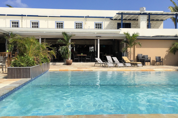
Floating pool palm The pool at the Fat Turtle

Superyacht row at Isle del Sol Lucky thinks he’s a big cheese
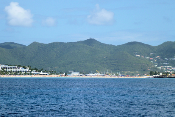
St. Maarten is a great place for provisioning. They have a Cost-U-Less, and several Le Grande Marche supermarkets. The prices are what you would find in the USA, and the selection is every bit as good. Liquor is also very cheap – we got a one liter bottle of Ron Barcelo rum for $7, among the other buys at Booze it Up. It is quite a way from Simpson Bay to Cost-U-Less, so we rented a car for that, as well as an island tour. We went to downtown Philipsburg, which mainly caters to cruise ship riff-raff, but again, prices were surprisingly low for both the beach bars and the shops.
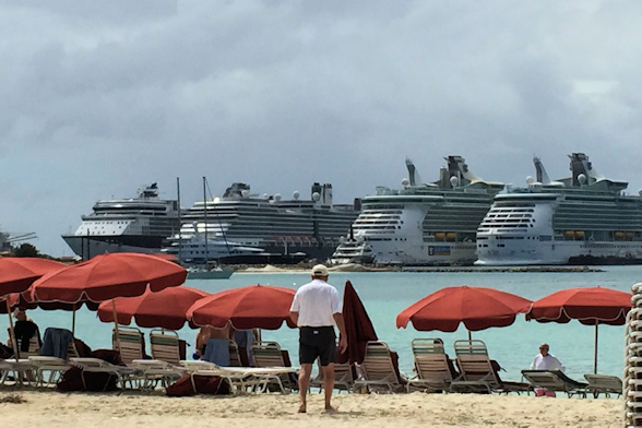
Lots of cruise ships in port Philipsburg beach
On our tour, we found that either our memories weren’t so good, or things had really changed. We remembered Orient Bay being small and remote, but now it is very well developed. We had lunch at a nice French restaurant, and the food was picture-worthy.

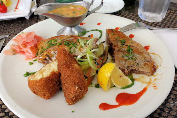
Lobster salad Grilled tuna with potato croquettes
We took advantage of the car to visit a couple of the nicer casinos at night. Again, our memories weren’t so good about the places, but we managed to win enough to pay for a few dinners and the car. We did some serious stocking up, including duty- and tax-free fuel, and prepared to continue the voyage.
February 18th: Simpson Bay Marina – Gustavia, St. Barth’s
We planned to depart in time for the 10:30 bridge opening. There are only three openings per day for outbound traffic: 8:30, 10:30, and 4:00. So, you need to be well prepared. I notified the marina office that we were checking out a little after 8:00, but they didn’t get the meter readings and the bill ready until almost 10:00. We had already taken up the shore power cords and moved the dinghy to the bow, so we were able to shove off at 10:00. There were already a number of boats lined up for the opening: three large motor yachts, a couple of smaller power boats, two sailing cats, and four monohulls. We were waiting behind the third large yacht, and just before 10:30, one of the monohulls bulled its way in front of us, and another one attempted to cut us off as well, but we weren’t having it. We knew we wanted to carry a lot of speed through the bridge opening, as it is narrow and prone to some interesting tidal currents. After our experience coming in through the bridge following the very pokey monohull, we wanted to avoid being behind a small sailboat. Now maybe we are prejudiced, but in our experience, the most obnoxious boaters we have run across are small sailboats under power. They seem to think that they always have the right-of-way without understanding that when they are under power, they are equal to other power vessels.

Yachts approaching the Simpson Lagoon Bridge
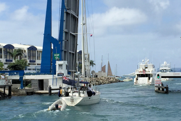

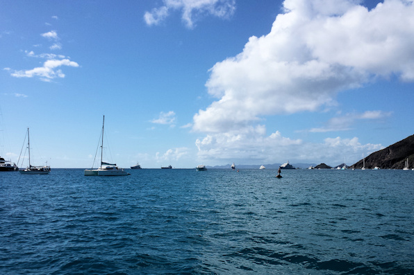
Anyway, the bridge went up, but the first super yacht really crawled through, slowing us all down. Rosé said she could see a tender going through with it prepared to nudge its bow if necessary. The lineup was moving really slow, and I was surprised that the bridge tender wasn’t throwing a fit of rage like he did when we came through. The sailboat in front of us picked it up, so we were able to go through without incident at more than five knots. Once outside, we waited until we were clear of the anchored boats before moving the dinghy to the stern. The sailboat that was behind us now tried to cut us off to port – a real piece of work! Once we turned to the ESE course to St. Bart’s, the seas were pretty much on our nose, but they weren’t too bad at four feet or so. Overall, the trip was okay. Once we approached St. Bart’s, we could see a sea of masts – there were more boats there than we had seen in Georgetown the previous winter. We called the Port Authority, but he told us there were no mooring balls available in the harbor. There were three anchoring fields – boats in all of them were pitching and rolling. We ended up anchoring just off the channel between Gros Islets and Fort Oscar.
Position at destination: 17°54.047’ N, 62°51.394’ W
Air temp: 87°, Humidity: 60%, Water temp: 83°
Nautical miles for this leg: 18.33, Total: 9623.5
Departed at 10:00am, arrived at 2:00pm

Outer harbor anchorage at Gustavia
February 19th: St. Barth’s
 After securing the boat, we headed in to Gustavia to check in and to do a little exploring. We found the port office, where you fill out the check-in forms on a PC. Unfortunately, the keyboards were not exactly QWERTY: the Q and W keys were transposed with the A and S keys. That drove me crazy, as I had to make a lot of corrections. Secondly, for the home ports, they had drop-down menus that of course did not include Kona, or the state of Hawaii, or other, and anything that would help. It did have Tucson, Arizona, our former home town. I ended up selecting Hilo, HI and San Jose, CA. After completing the form, you print them out for the port officer. I made the mistake of listing the length of Tropical Blend in meters, but used feet for the beam and draft. The officer said that we must have a very strange boat – nice to have an officer with a sense of humor. He corrected this for us, and then told us that we would pay the fees when we checked out. They are different depending upon where you anchor or moor, but they sounded pretty reasonable. A patrol boat checks out the boats every day, which must take a long time, considering the amazing amount of boats. After completing check-in, we wandered around Gustavia a little, and stopped for a couple of drinks. Before leaving, we went to the AMC supermarket, which was very well stocked at reasonable prices.
When we went back, the pitching and rolling was a lot worse, so we decided to deploy the flopper stoppers. We hadn’t used them in a long time, and we hadn’t been very pleased with their performance, but we decided to try them. It turns out they worked really well. They don’t stop rolling, but they do reduce the amount and intensity of the roll, greatly improving comfort at anchor. Looking around at the other boats, we were much better off. We had a very restful night.
Anchored just next to us was an odd-looking sailboat that Rosé declared was Banana Split’s mother. Banana Split was the dinghy from Lasata that towed us around St. John’s when Little Blend’s motor had failed. It was homemade, split into front and back halves for stowage on deck, and was painted banana yellow. We sent a picture to Stacie, and she agreed with us. Speaking of yellow, we saw the Yellow Submarine, a semi-sub (like a glass-bottomed boat) that does tours out of Gustavia.
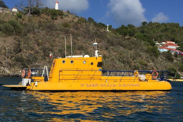
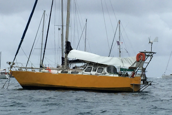
We don’t live in a Yellow Submarine… Banana Split Senior
On Friday we tried to find Le Ship, said to be a very good chandlery. The cruising guide waxed on poetically about its quality, but neglected to say where it was. There was no web site, and we couldn’t find it using the map apps on the phones. We did find it on a sign, but the direction was totally a mystery. Every other direction on the sign was left, right, or straight. The marine store direction was down? We asked someone at a restaurant, and they said it was on the opposite side of the harbor, so we trooped over there under a burning sun. We didn’t see the store, but we did see a marine tours store (jet ski, diving, etc.) and we asked them about it. They told us it was above a restaurant that was just across from the ferry dock, and of course right next to the dinghy dock. So we trudged back through the heat and stopped at the wine store across from AMC first. We decided to get a nice bottle of champagne (Bollingers) for our upcoming anniversary. While there, we saw a VERY large bottle of Cristal with a VERY large price of €14,000!!! We decided to come back for the champagne, as we didn’t want to carry it around, but the shop closed from 1:00 to 3:00. We went to where Le Ship was supposed to be, and we saw some vague signs that indicated there might be a store there, but no directions as to how to get upstairs. We found some ratty concrete stores to the right of the restaurant, but they just led to two locked doors with no signs on them. We guessed that the door on the second floor might belong to the store, and we saw an advertisement that said the store was closed from 12:30 to 2:00, so we decided to go back to the boat for a while.
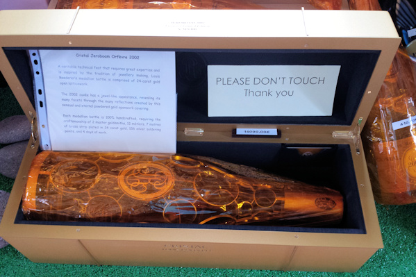

The €14,000 bottle of Cristal Which direction is that Marine Store in?
At 3:30, we returned to the marine store that was now magically open, and it was a well-stocked store. We needed a French courtesy flag, and we also picked up one for Saba. After that, we picked up the champagne and nice bottle of white burgundy. We had never worked so hard to find a chandlery.
On Saturday we rented a scooter to explore the island. Back in Anegada, we had a 50cc that was fine for the flat roads. In St. Barth’s, we rented a 125cc to negotiate the many hills. Immediately I noticed how much heavier it was, and I had a hard time turning it immediately after starting. I took a ride around a few blocks to make sure I was comfortable on it, and then assured Rosé that I wouldn’t kill her. Our first stop was St. Jean, to see the airport and to find a bikini shop that Rosé was looking for.
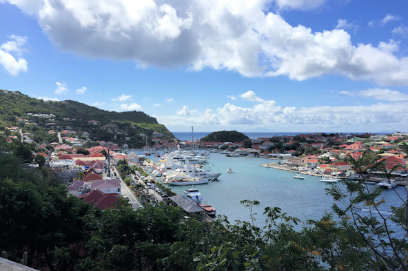
The inner harbor The outer harbor. Tropical Blend is at the upper right-hand side
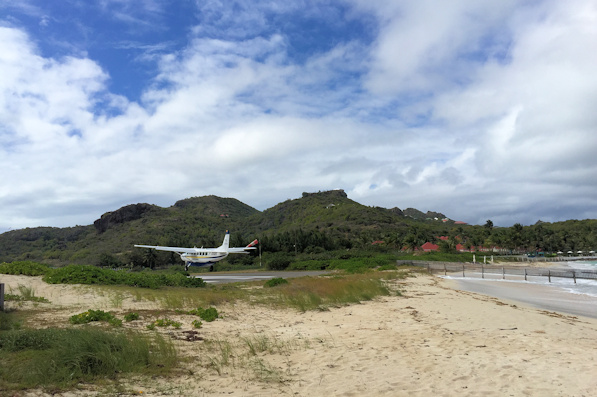
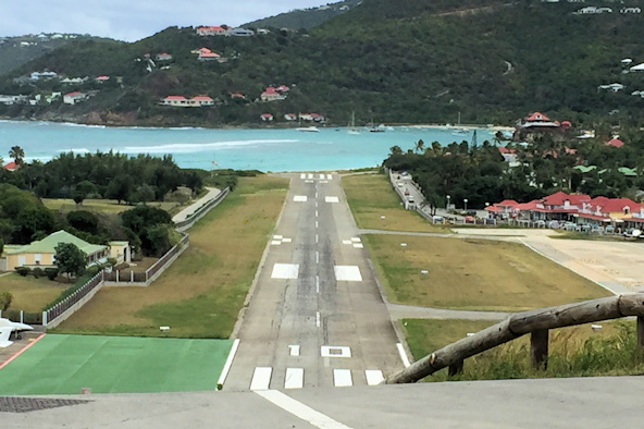
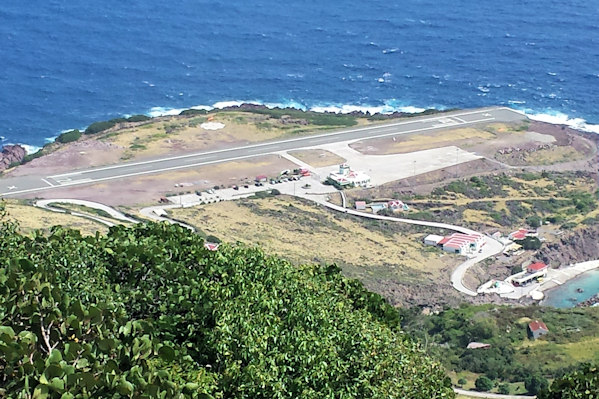
There is a roundabout at the pass that separates the east and west sides of the island. From the top, you get a great view of the airport and you can really see the slope in the runway. This is one of the ten most dangerous airports in the world, due to the runway’s proximity to the beach and the hill to the west of the airport. Incoming aircraft have to drop like stones on a 180° approach in order to hit the end of the runway and stop in time. Near the airport was the village of St. Jean, where we found a pharmacy that would provide medications with us just showing the original bottles – no current prescription needed. After that, Rose found the bikini store she was looking for in Nikki Beach, and scored a very original and reasonably priced suit. We decided to go out to the beach areas on the northeast side for lunch.
Besides the weight of the larger scooter, there are some really big hills and a lot of twists and turns in the road I had to negotiate. I had a very hard time turning from a dead stop, but we safely found our way to a beach restaurant at Anse de Grand Cul-de-Sac. I had one of the best steak au poivre ever, and Rose had a delicious crab salad. The nice thing about St. Barth’s is that it is like being in France, without the rudeness of the shopkeepers and waiters. All of the service staff we met were very helpful and polite, and all spoke excellent English. This is a very nice place to be.
After lunch, we continued down the somewhat dangerous road to Grand Fond, the most popular surfing beach on the island. There were long rollers coming in, perfect for boarding and surfing. However, getting out to them was quite difficult, as the beach was nothing but rocks.


The Grand Fond beach
Leaving Grand Fond, it was up another very steep hill to the middle of the island, and then down an impossibly steep hill to Lorient Beach. We parked the scooter just by the airport runway, and then walked to the beach to take some photos and video. It was really amazing watching the steep banks and turns required by the pilots. Crosswinds were also causing some problems, and some of the landing planes got sideways before touching down. Plane size is limited to twenty passengers due to the runway conditions, and we could certainly understand why. Since the planes were quite small, the frequency of aircraft movements was very busy – a mini-O’Hare!
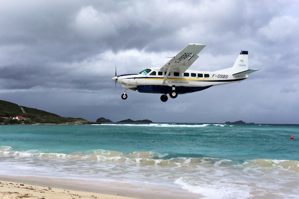
Landing at the famous airport at St. Jean
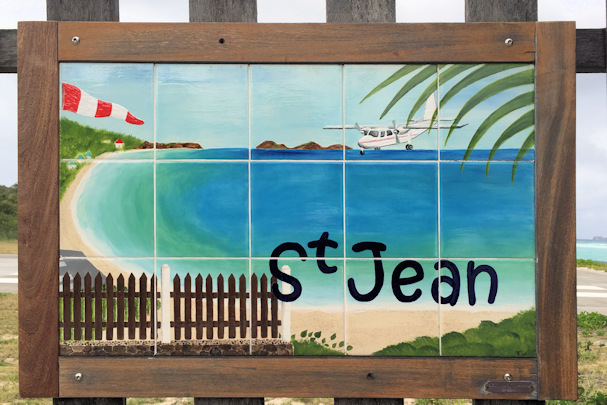
The pictures don’t really do it justice, but you can get some idea of how the runway slopes up from the beach. Each beach has its own “tile”, or artwork to identify it: St. Jean’s was pretty obvious.

While we were walking back to our scooter, a tortoise emerged from the woods at the side of the road. Figuring that it would get squashed if it ventured much further, we put it back into the woods. From the top of the hill, we got a really good view of the runway.

Runway viewed from above We hope we saved this little guy from certain squashing
We wanted to get a look at the anchorage of Columbier, a bay on the north side of the island. You can only get to the bay by boat or on foot, but we thought we could get a good look at it to see if the boats were rolling. We had to negotiate some more killer hills, and it started to rain. We were never able to see the bay, so we went back to Gustavia to see Shell Beach. This is just outside of the harbor, and it in the only beach on the island with shells. And when they say shells, it means it is all shells!
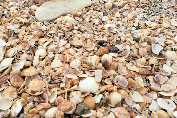
And that’s why it’s called Shell Beach
We had decided to leave for Saba on Tuesday, as some strong weather was on the way shortly after that. We needed to go back to the pharmacy by the airport, as they didn’t have all that we needed, and they had ordered the remainder for us. We took a taxi, expecting it to cost €5 or so each way – silly us! We were charged €30 for the round trip, which took all of five minutes each way. Had we known this, we would have told the pharmacy not to order the additional meds. After returning, we checked out. We were charged €74 for the five-day stay – pretty pricey for anchoring out.
February 23rd: Gustavia – Ladder Bay, Saba
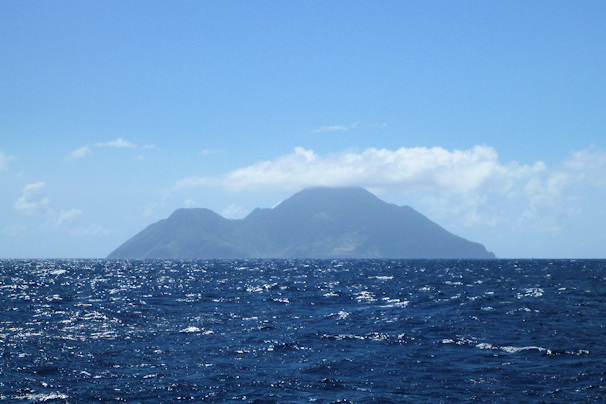
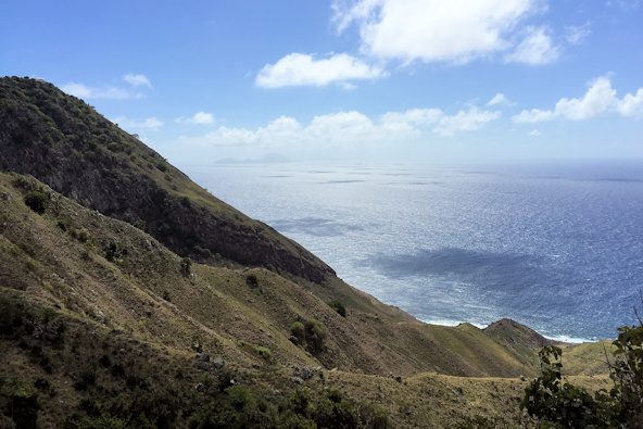
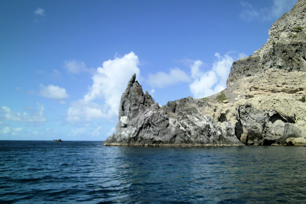
We thought that we had a nice day for our cruise to Saba. The forecast was for winds out of the NNE at 12 – 15 knots, and seas from the east at three to four feet. When we first left the anchorage, it was pretty smooth, but shortly after that, we had a beam sea that was running five to six feet, and our stabilizers had a hard time compensating. We ended up altering our course by about 20° to get the swells off of our direct beam, even though it would add some time. Before we did that, we had some violent rolls that opened our galley refrigerator/freezer door a couple of times, and we were taking a lot of spray on our port side. We even had one big wave that sprayed us up in the flying bridge – not a pleasant day at all. Our course alteration took us around the south side of Saba, the longer route. Saba is an extinct volcano that pokes straight up from deep seas, and it is pretty stunning.

Leaving St. Bart’s Approaching Saba

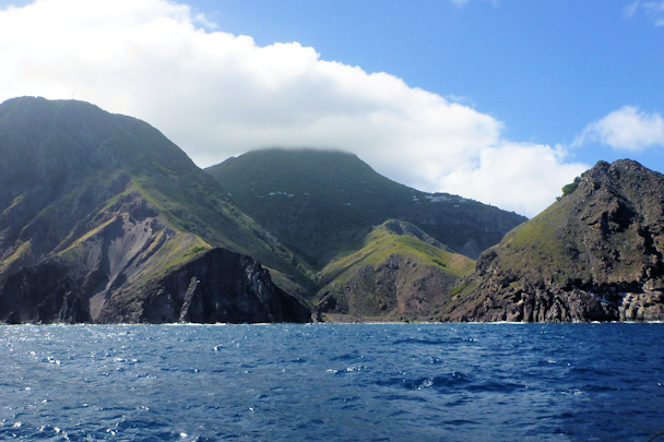
Saba airport at the lower right The windward, wet side
As we rounded the island, we passed by Fort Bay, which is the port of entry. There are some mooring balls there for checking in, but looking at the sea conditions, there was no way that we were going to tie up. We decided we would dinghy in from our hopefully protected anchorage the next day. Once we started to turn north, the sea state calmed considerably. We were planning to take a mooring ball off of Ladder Bay. Supposedly there were ten balls, but we only counted five. Fortunately, only two were taken.
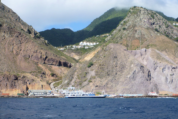

Fort Bay, Saba’s only harbor Tropical Blend on the mooring at Ladder Bay
Position at destination: 17°38.397’ N, 63°15.334’ W
Air temp: 81°, Humidity: 68%, Water temp: 81.5°
Nautical miles for this leg: 33.97, Total: 9657.5
Departed at 10:00am, arrived at 3:30pm
February 23rd – 27th: Saba
A few minutes after we stopped, I switched off the ac breakers for the three refrigeration units to check the battery levels, and suddenly the inverter stopped working. This same problem had happened while we were waiting for the bridge opening to Simpson Bay a few weeks earlier, but I was able to restart it on the remote panel in the pilot house. This time, I had no success restarting it from the panel, so we had no ac power. I started the generator, and noted that the charger was not working either. There is an inverter bypass switch in the electrical panel, so I switched that over so we would have ac power from the generator.
I pulled the manual for the inverter, but it wasn’t helpful. The troubleshooting section didn’t reference faults at all. I went into the lazarette to look at the inverter, but its panel was totally off. I tried to reset it using the small momentary switch, but had no luck. We were facing the prospect of having to return the next day to St. Maarten for repairs, not something we wanted to do at all. I played around with the remote panel some more, and finally found a fault menu to indicate what the fault was – it was overheating. According to the manual, you can reset this fault by restarting the inverter, but there is no master reset on it. I decided to try disconnecting the battery cables for a hard reset, and voila! It worked! I really don’t know what set of events caused this fault, but we were happy to be running again.
The next morning we took the dinghy into Fort Bay to check in. Despite the high winds, the ride wasn’t bad until we turned the corner east. It was blowing 20 to 25 knots most of the time. We used the flopper stoppers again, minimizing the rolling. There is a small harbor at Fort Bay, used for the supply boats and dive boats. It actually had a very nice dinghy dock that was easy to tie to.
Check in was simple. We filled out forms for customs and immigration, and paid $20 at the Port Authority office upstairs. After that, we paid $12 to cover the moorings in the National Park, and we were done. We asked about an island tour, and the Customs Officer called and arranged it for us the next day. There is virtually nothing in Fort Bay – just two dive shops and a small restaurant and bar, the Deep End. We decided to have lunch at the restaurant, which had a very unique bar.
Close to us was the famous ladder, which was the only way to bring in supplies before the harbor was built. It’s supposed to be 800 steps to the customs house, but we didn’t care to check it out in person.


The ladder, with the Customs House about halfway up the hill. 800 steps – d’oh!

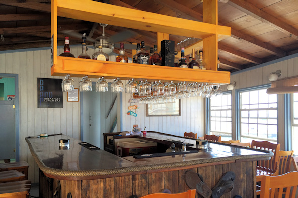
The bar at the Deep End restaurant
The following day we went back for our island tour, after having a very inexpensive breakfast at the Deep End. At 10:00, we met our driver, Cornelius Richardson (taxi #10, 416-5764). The only requests we had were a stop at a bakery and a visit to the glass shop at Windwardside. Cornelius gave us a great tour, lasting over two hours, for just $50. There are four settlements on Saba, all at different levels. You definitely have to think in 3D to understand Saba. The first settlement, Bottom, is close to Fort Bay, but definitely not at a bottom elevation. The government offices are in Bottom, as is the Medical School, which houses around 500 students.
The road itself is a big part of the tour. It’s an amazing feat of engineering, designed and built by Sabans without heavy machinery. Saba keeps the road in very good condition, and the views are spectacular. At Bottom, we stopped at a shop that sells Saba Spice, a locally made kind of spiced rum that is very unique. We bought a bottle that was recommended for adding to desserts.
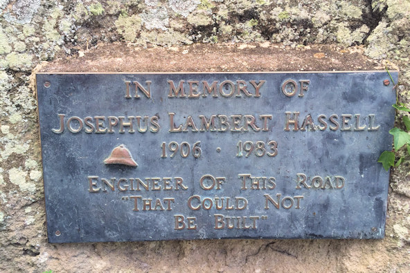
Monument for the road builder The view from St. Johns
We continued to climb up The Road to the settlement of St. Johns, where the public school is located. After that, it was up to Windwardside, which seemed to be the largest and busiest of the settlements.
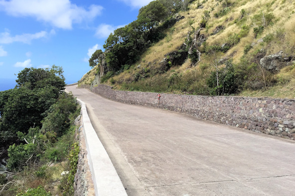
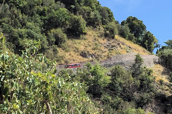
Views of the road, which is simply called, “The Road”
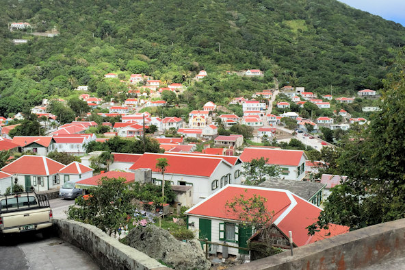

Windwardside settlement
Just outside Windwardside, we visited a glass shop, Jobeans, which makes blown glass jewelry at reasonable prices. We bought a couple of items and continued our tour, picking up some fresh bread in Windwardside. After that, we rode down a little to Zion’s Hill where we got a great view of the airport. Just to the right of the airport is the island’s only beach, such as it is.

Saba airport The lone beach
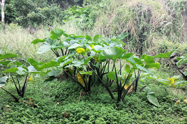
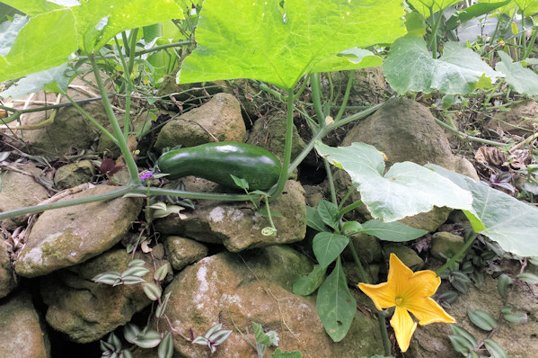
After Zion’s Hill, Cornelius took us to the Rainforest Ecolodge, and suggested we take the short walk through the forest to the lodge. This was the densest forest we had walked through since Panama, and it was really beautiful and peaceful. The lodge has a working farm, and we saw some really large squash.

On the way back to Fort Bay, we got a great view of Bottom.

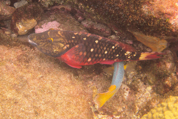
There were a number of dive boat moorings near us, so we tied up to one of them for some snorkeling. With a depth of ten to twenty feet, and crystal clear water, the snorkeling was excellent. There wasn’t too much coral, but the rocks underwater were enormous, having rolled off the steep cliffs over the years. We did see a couple of large schools of blue tangs, and the ever-present parrotfish.

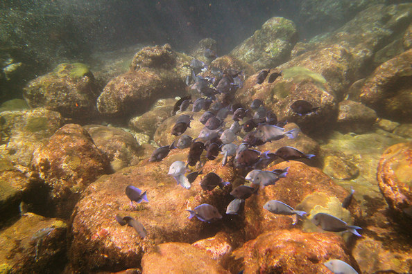
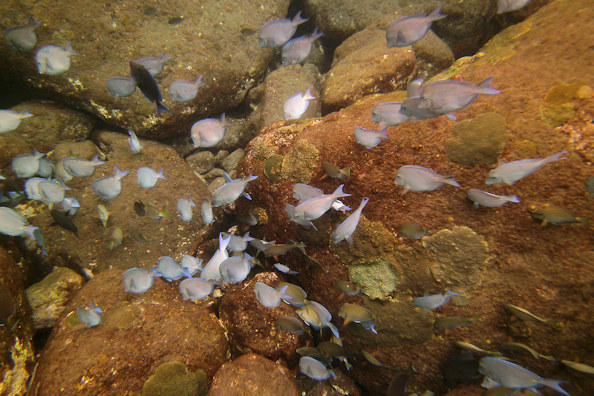

A big school of blue tangs savaging the reef
We spent one more day at Saba. We checked out after we finished our tour – they don’t mind doing checkouts days in advance. After we were back on board, we received a visit from the Dutch Coast Guard. They just checked our papers, and they were enthralled with Quincy – they couldn’t believe that such an old cat was cruising with us. The forecast called for the wind to drop down to the ten to fifteen range, so we felt comfortable moving on to Statia.
February 27th: Saba – St. Eustatius (Statia)
We left with lighter winds and calmer seas for Statia, a little less than twenty miles away. We hadn’t read anything exciting about Statia, but we thought we would check it out as it was directly in the path to St. Kitts. The Free Cruising Guide gives it only one page, closing with the statement: “This stop is for the very curious or those with a large surplus of time on their hands.”
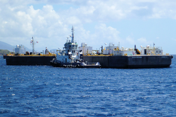
As we got close to Oranjestad Harbor, we noticed a number of oil tankers moored in the area. It turns out that the Statia economy is largely driven by a huge oil storage depot on the island. On shore, we could see the pipelines leading from the tanker docks to the storage tanks. There were also a lot of tugs in the area, very similar to the ones we saw at the Panama Canal. Once we reached the harbor, we looked for mooring balls – the guides say that you are supposed to use them, and that they are plentiful. They weren’t so plentiful, and most were occupied, but we did find one that was close to the customs and immigration offices. We tied up to it, and immediately began to roll, despite the appearance of flat water. We deployed the flopper stoppers, and settled in. Since the officials weren’t around on weekend afternoons, we could wait until Sunday morning for check-in.
Position at destination: 17°28.880’ N, 62°59.327’ W
Air temp: 84°, Humidity: 64%, Water temp: 82°
Nautical miles for this leg: 19.56, Total: 9677
Departed at 9:00am, arrived at 1:00pm
February 27th – 29th: Statia
To say that we weren’t overly impressed by Statia would be an understatement. We went in to the dinghy basin to check in. It was actually busy – a group of four chartered cats had come in the previous evening, and they were doing a check-in, check-out. We were told the procedure was to start at the Port Authority, where we paid a $20 fee for the mooring buoys. After that, we proceeded to the customs and immigration building, where we had to fill out a pretty long form and wait for our turn. We talked with the charter group – they had come from Antigua, and stayed at St. Kitts and Nevis. They told us about the preferred anchorages where we wouldn’t be rolling very much.
We weren’t in love with Statia, so we decided to leave the following day, but we weren’t able to check out at that time. We returned to the boat, and we were rolling pretty bad. The water was shallower than we had in Saba, so we had shortened up the depth of the flopper stoppers. We could see them, and one of them didn’t seems to be working. We pulled it up to find that the rigging for it had worn completely through, so it was not able to open and close. We decided then to lay out the stern anchor. As was the case in Cane Garden Bay, we had to reset the stern anchor a few times, but still couldn’t eliminate the rolling. We had lunch ashore at one of the restaurants that appeared to be close to abandoned, and decided that would be the end of our Statia adventure.


Approaching Statia, with St. Kitts in the background One of the many moored tankers


The oil storage tanks – lovely Looks like the volcano blew its top off
The tugs looked just like the ones in Panama The anchorage in front of Oranjestad
February 29th: Statia – St. Kitts
We checked out first thing in the morning, and then went to pull the stern anchor, which would not budge. I had to use the dinghy to force it loose, but we finally got it back aboard. We left for Basse-Terre in St. Kitts, where you have to check in. There is a much better anchorage, White House Bay, on the southern end of the island, but you aren’t allowed to anchor there first. It was a pretty smooth day for cruising, but we had to dodge a large number of floats around St. Kitts. We weren’t sure if they were for lobster traps or diving, but they were set in abundance. We cruised down the long western coast of St. Kitts, finally arriving in Basse-Terre harbor around 1:30.
The harbor looked smooth, but we started rolling immediately, which is why no one wants to anchor there. According to the guides, you need to dinghy in to the Port Zante Marina to the dinghy dock (where you are supposed to pay $5 for the privilege), and proceed to check-in at the cruise ship dock just south of the marina. Calling this a marina was a stretch. It was almost all local boats, moored stern-to the seawall. There was no dinghy dock. We had to tie up to the seawall, which was about four feet above water level. We exited the marina, and actually asked out the docking fee – the guard told us we would need to go to the dockmaster to pay it. We continued over to the cruise ship dock. We found immigration, but the office wasn’t staffed. The guards told us that it would open “some time later”. Opposite the immigration office was the Port Authority, which was open. We checked in there, and paid a fee of $13. They told us to go back to customs, which is at the marina. We walked back to the marina, and found the customs office, where we paid another fee of $12. Then it was back to immigration. Just as we got there, the officer arrived, so we were able to check in. In all, the process took over an hour.
We wanted to do a little provisioning, and perhaps get to a chandlery for some line to re-rig the flopper stopper. From the cruising guide, we identified a chandlery south of town. But once we started walking, we realized it was probably at least a half an hour’s walk, and we needed to get to White House Bay before dark. Instead, we went back to the town to an ATM to get some local currency. After that, we picked up some fresh produce at a medium-sized grocery store. Coming out, we saw a KFC, and decided to get a treat for our spoiled cat. Once we got there, the line was large, and the pace was slow, so we decided to go back on another day. Our last stop was at a small store that sold SIM cards, where we picked up a Digicel card and some pre-paid data to replace our worthless Chippie card. We high-tailed it back to the boat, deciding not to find someone to pay the $5 docking fee, given that there was no dock. It was about four and a half miles to White House Bay, and we arrived at 4:30 to drop the hook.
Position at destination: 17°15.035’ N, 62°39.557’ W
Air temp: 80°, Humidity: 72%, Water temp: 81.5°
Nautical miles for this leg: 25.36, Total: 9702
Departed at 9:45am, arrived at 4:30pm