


December 2nd: Leverick Bay – Cooper Island
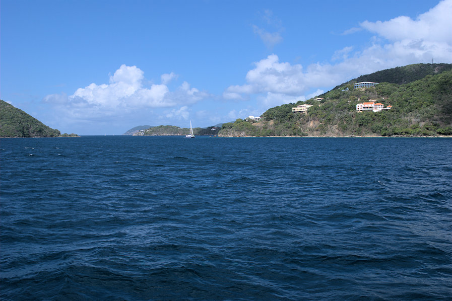
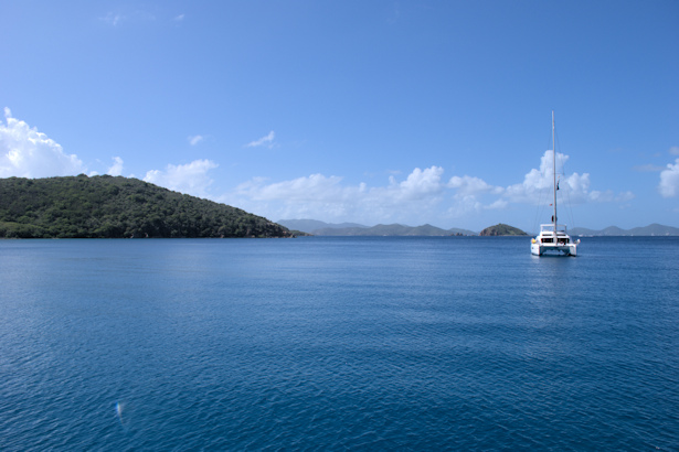
We left the North Sound for Cooper Island, with a stop at Spanish Town on the way. Spanish Town is the main settlement on Virgin Gorda, with a marina, a bank, several restaurants and several grocery stores. Since we were only staying for lunch and a little shopping, we took a mooring outside of the yacht harbor. On our first charter trip, we had taken one of these moorings, and we remembered it was rolly, accentuated by the many ferry wakes that slam your beam – I don’t know how anybody can spend the night there. Anyway, we tied up to a mooring and took the dinghy into the yacht harbor.
We had lunch at the harbor side restaurant, the Bath and Turtle. Unfortunately, the wifi didn’t work at all – none of our devices could get an IP address. It’s really tough to find a decent wifi signal throughout the BVI. Given how many people are here on boats, I am surprised by this. Maybe the charterers rent BVI-based smart phones for the week for some outrageous price. After lunch, we walked through the town a bit, but didn’t find much of interest. We found a place to dispose of garbage, and went to Buck’s Market at the marina. It turned out to be a pretty good grocery store, much better than the small ones at the North Sound. It had a good produce section, so we were able to obtain some fresh fruit and veggies. The prices were BVI-high, but not insane – we definitely recommend this place.
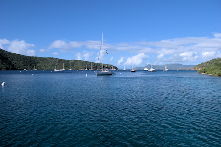
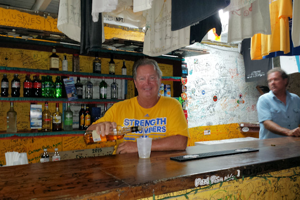
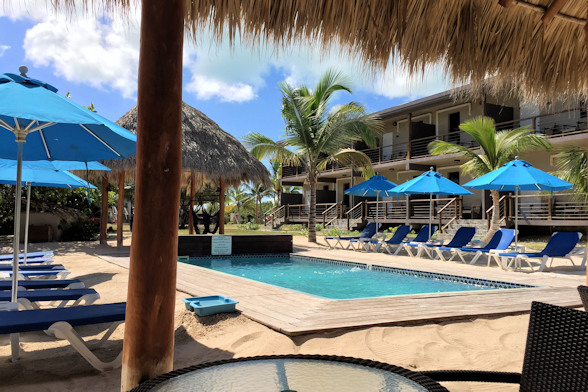
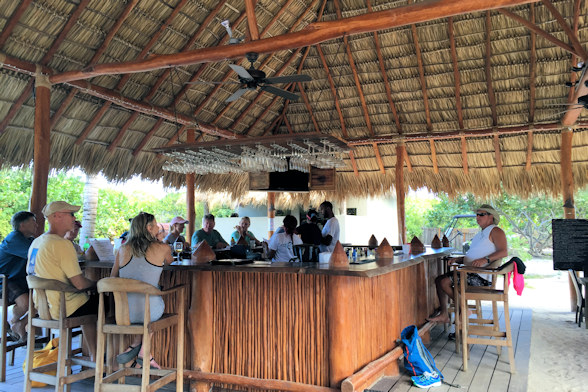
We left for Cooper Island. We remembered issues with rolling in the wintertime, so we were apprehensive and hoping to find a place to anchor so we could deploy a stern anchor. Like many anchorages in BVI, the number of mooring balls has exploded. Trying to respect the custom not to anchor in turtle grass, we decided to go ahead and take a ball. Arriving at 3:00, there were only a few left, but we tied up. We saw Alternate Latitudes and tried to raise them on the radio without luck. We went over to their boat, but again no response – we guessed that they were sleeping. We went on shore, and we saw that the Cooper Island Beach Club had been extensively renovated. Previously it was little more than a shack with a sand-floor restaurant. Now there are several bars and restaurants with wooden walkways between them. Our only complaint was about the docks – they were really high for dinghies, but they were designed for ferries and dive boats. We took advantage of Happy Hour and started drinking. After a couple of drinks we saw John outside of Alternate Latitudes, so I decided to dinghy out and give him a ride. Stacie said that they were up now and would join us soon. We had several more rounds of drinks, and then headed back to the boat in the dark. I didn’t feel drunk, but I must have been. Somehow when I stepped out of the dinghy, I ended up in the water, and I also pulled Rose down as she crashed onto the swim platform. I have no idea how that happened, but I did hold on to the keys! After drying off, we had a little soup and basically passed out. We hadn’t done that in a long time…

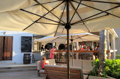
Sunset view from the Beach Club One of the bars at the Beach Club
Position at destination: 18°23.201’ N, 64°30.868’ W
Air temp: 86°, Humidity: 69%, Water temp: 89°
Nautical miles for this leg: 13.9, Total: 9335
Departed at 10:15am, arrived at 3:00pm
December 3rd: Cooper Island – Great Harbour, Peter Island
As we were concerned, the rolling was pretty unpleasant at Cooper. It wasn’t steady or overly violent, but it was bad enough to disrupt normal sleep, so we were glad to depart. Alternate Latitudes left early for Road Town, as they were planning to meet up with their friend John’s parents, traveling through on a cruise ship. After that, they planned to go to The Bight at Norman Island. Just as we were leaving, one of the D-rings we use to tow Little Blend popped off – it looked like the glue bond just gave out. Fortunately, the other ring held, and we relocated the two line to the through-hull U-bolt – something else to fix once we got to St. Thomas.

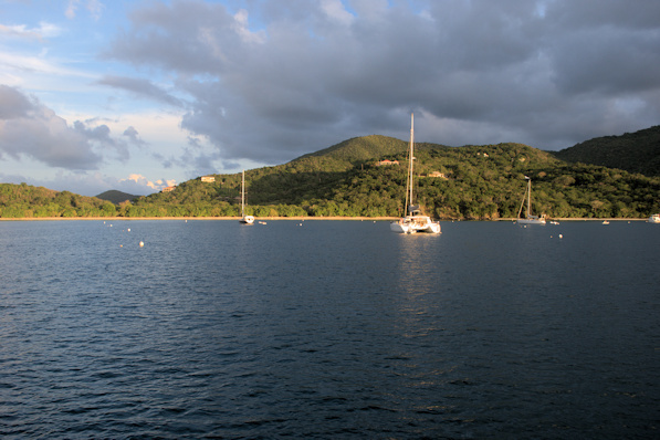
We decided to make the short hop to Great Harbour on Peter Island for a couple of peaceful days. It’s a very large anchorage, although fairly deep – most of the anchorage is more than fifty feet deep. In the southwest corner is a resort that never seems to have any guest, and a line of mooring balls along the southern end of the bay. We searched along the northwest side of the bay for a good anchoring spot. There were quite a few boats already occupying the few shallower areas, so we ended up dropping the hook in fifty feet of water near the entrance of the bay. We were well protected there, experiencing some wind but no waves. The southern side of the bay has some very good snorkeling reefs. At the mouth of the bay, there is a ship’s mooring that is used at random times by a variety of ships. We saw several come and go, both during the day and at night. It’s purpose was a mystery to us.
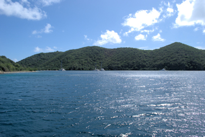
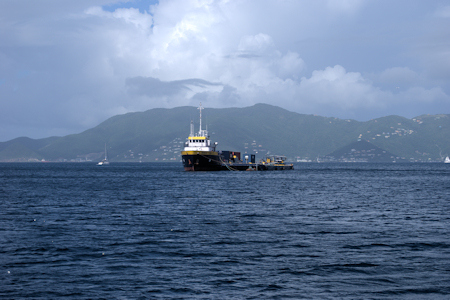
Great Harbour, Peter Island Mystery ship’s mooring at mouth of Great Harbour
December 3rd: Great Harbour – The Bight, Norman Island
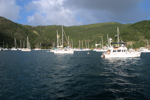
After a couple of peaceful nights and heavy rainstorms, we moved on to The Bight. This is a large anchorage on Norman Island, close to Road Town, and a very popular anchorage for those just starting or finishing charters. It’s been almost completely filled with mooring balls, unless you anchor in 60’+ water close to the entrance. Form reading Active Captain, we felt that the best place to anchor would be near the floating Willie T restaurant on the south side of the bay. We took a look at it, but the available anchoring area was quite small. The one place where we wanted to anchor was already occupied, so we ended up anchoring next to the Willie T in a fairly tight space. We then took the dinghy to the end of the bay for lunch at the Pirate’s Bight restaurant, and we saw what looked to be a promising anchor area between their dock and the mooring field. We didn’t really want to stay right next to the Willie T, as the noise from late night partiers can get pretty old by one in the morning. We pulled the anchor and went down to the end of the bay. The space was just big enough for us, and we dropped the hook in fifteen feet of water. We were pretty close to the mooring ball behind us, but even at maximum swing, we had about a 20’ buffer, so we decided to stay put.
Position at destination: 18°19.112’ N, 64°36.863’ W
Air temp: 86°, Humidity: 65%, Water temp: 90°
Nautical miles for this leg: 5.0, Total: 9340
Departed at 10:30am, arrived at 11:30am
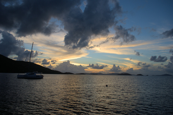
December 5th – 8th: The Bight, Norman Island
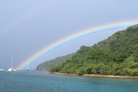
Early morning rainbow The Bight
It was very calm at our spot, even as frequent squalls blew through. We saw two or three squalls every day that would bring wind gusts to 30 knots, and brief heavy rains. A particularly long one came in early one morning, and we saw a spectacular rainbow over the Drake Channel. Most of the mooring balls were taken each day, as charter boats moved in and out.  One morning before the restaurant opened, a flat-topped catamaran crawling with people cruised on to the dock. We guessed that they were from a cruise ship. We had decided to go to the beach, but the cruise ship riff-raff occupied all of the available lounges. The facilities at Pirate’s Bight were rebuilt (very nicely) a couple of years ago after a fire. On the left side was a smaller restaurant and bar that were apparently going to be the “upscale” section, but it wasn’t really opened yet. We decided to take our chairs and some drinks to that side of the beach. After we had been peacefully sitting there for quite some time, and after the riff-raff had left (only stayed for an hour or so), a guy that we assumed was the restaurant manager talked to us. First, he told us that we weren’t supposed to have a cooler on the beach, since it was a private island. Next, he told us that we weren’t supposed to anchor where we were, claiming that it was an FPA (fisheries protected area). We commented that unlike Great Harbour, there was no sign indicating this, and he acknowledged that he hadn’t seen anyone fishing in the bay in over twenty years. He said that he wasn’t enforcement, but just wanted to advise us. He said that the south side of the bay was a no-anchor zone. We found this very strange, since there were mooring balls everywhere along that shore. Since the restaurant owns the balls, we figured that he was trying to intimidate us onto a ball.
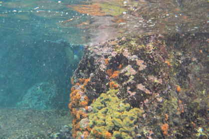
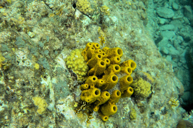
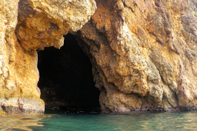
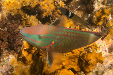
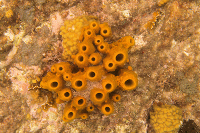
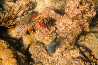
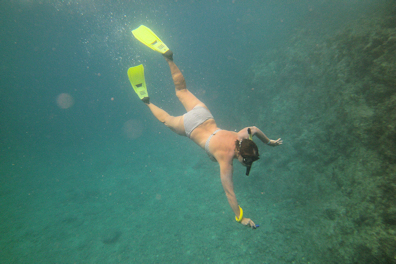
It was calm enough to run the dinghy out to The Caves and The Indians for some snorkeling. These are two very nice, and very popular, snorkeling locations just outside of The Bight. The reefs were very much alive and colorful. The fish were plentiful, but there weren’t any large ones for some reason.


December 9th: The Bight – Soper’s Hole, Tortola
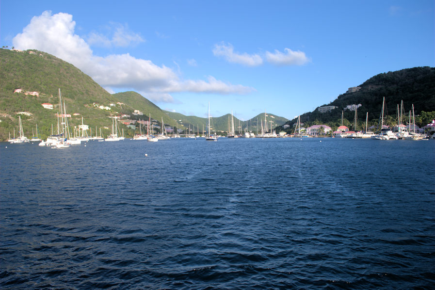
After a few fun days at The Bight, we moved on to Soper’s Hole, the anchorage at West End, Tortola. Rose was flying back to the states to visit her sister for Christmas, so we needed to be back at Red Hook by the 15th. We decided to visit Soper’s Hole before proceeding to Jost Van Dyke for clearing out of the BVI. We had a fast cruise down the channel between St. John’s and Tortola, aided by a current of around one and a half knots. Soper’s Hole is a very deep and crowded anchorage. Most of it is full of mooring balls (surprise, surprise), and the only available area to anchor was about seventy feet deep, so we decided to take a ball. We went in for lunch and a little shopping. They do have a decent small grocery there, so we picked up some fresh produce. The dinghy dock was very full, and it was entertaining watching people try to squeeze in. We were able to offload our garbage – this is a big problem for long-term cruisers in the BVI. There are very few places where you can dispose of trash, so after many days at Cooper, Great Harbour, and The Bight, we had a pretty full large bag. There is a dumpster near the ferry dock, so we took advantage of it. Later in the afternoon, one of the Sea Dream Yacht Club small cruise ships anchored outside. These are frequently seen in BVI during the winter. We were amazed how much it swung with the wind.
Position at destination: 18°23.149’ N, 64°42.253’ W
Air temp: 86°, Humidity: 65%, Water temp: 89°
Nautical miles for this leg: 7.1, Total: 9347
Departed at 10:40am, arrived at 11:45am
I previously mentioned the entertainment watching people try to grab mooring balls. It’s not difficult, and I don’t know why some boaters can’t grasp the basic concept. One way to easily identify charterers is when there is a gaggle of people, six or more, on the bow as they attempt to grab a ball. Well, a Moorings monohull came up beside us to grab a ball. On their first pass, they actually tried to grab it by hand, leaning over the bow. Seriously folks, that’s what the long rod with the hook at the end of it is for. On their second pass, they did try using the boat hook, but the driver went by the ball at race car speed, so they failed again. Then, they launched a dinghy, and the people in the dinghy were able to grab the painter, but they had the boat hook, and were unable to pass the painter up to the bow. On the fourth pass, the ballet was correct, but again the driver tore the painter out of the hands with his blazing expedition of speed. Finally on the fifth try they got it right. We really had to wonder how they thought they could grab it by hand…
Approaching West End Crowded anchorage at Soper’s Hole


Looking out from the Soper’s Hole entrance Sea Dream small cruise ship
December 10th: Soper’s Hole – Little Harbour, Jost Van Dyke
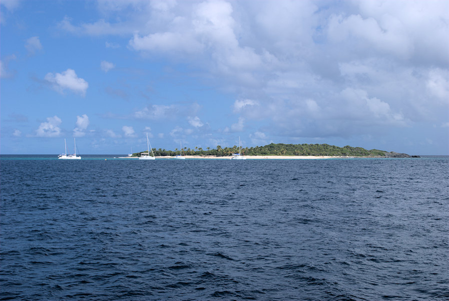
We decided to check out Little Harbour, which has a couple of good restaurants without the hype of Foxy’s. On the way over, we planned to stop at Sandy Cay for some snorkeling. This is a tiny island off the northwest coast of JVD. Years ago when we chartered, this was an anchoring only spot. Now, we saw it had National Park balls, so the charterers were swarming around it. There was a sizeable swell running perpendicular to the wind, so we were rolling pretty hard after we dropped the hook. We jumped in Little Blend and headed to the shore. We could see pretty big breakers on the beach, so there was no way we could do a beach landing. Even anchoring off was out of the question, so we decided to give it up. We returned to the boat, and cruised the short distance to Little Harbour. Like Great Harbour, it’s been inundated by mooring balls, but we did find a good spot to drop the hook. There were only two other boats at that time, but more arrived through the afternoon.

Sandy Cay Little Harbour, Jost Van Dyke
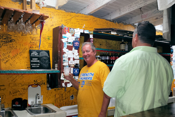
Shortly after we anchored, something surprising happened – a boat came by to give us the menu from Sidney’s Restaurant. This was the first time any restaurant had done any promotion while we were cruising. To further the point, Cynthia from Harris’ Restaurant came by about a half an hour later. We weren’t originally planning to have dinner ashore, but a lobster did sound tasty. We decided to go to Sidney’s Peace and Love. We ordered one large lobster that we could split. We found out that there was an honor bar: woo-hoo! They had a notebook where you entered your order and kept track of your drinks. I’m pretty sure we kept good track of our drinks, but based on the final bill, I think they build in pilferage to the price… Anyway, the dinner was delicious, and we were glad that we had it.
Position at destination: 18°26.412’ N, 64°43.226’ W
Air temp: 86°, Humidity: 65%, Water temp: 90°
Nautical miles for this leg: 5.0, Total: 9352
Departed at 11:30am, arrived at 12:45pm
You’ve got to love an honor bar
December 11th: Little Harbour – Cane Garden Bay
The next morning the wind and swells from the east were running large, and we were pitching a lot. We had originally planned to hop over to Great Harbour, but we thought that it would also have a pretty big swell running, so we decided to go to Cane Garden Bay, which would provide protection against the prevailingconditions. There were a lot of whitecaps, but as soon as we entered CGB things calmed down considerably. Unlike our earlier visit, the anchorage part of the bay was deserted, so we were able to get fairly close to the beach. Once again, the shoreline was crowded with cruise ship riff-raff, mostly German from what we heard. We went to Tony’s (formerly Stanley’s) Welcome Bar for lunch, and we found the burgers to be just as good as when it was Stanley’s. On a sour note, a grumpy old cruiser at the table next to us said some really ugly things. He said BVI would be a great place if it weren’t for the people, and he hoped his burger wasn’t made from goat road kill. I hoped the waiter heard him, and added some nice spit to his lunch.
We spent two nights here. While we didn’t have as many issues with rolling as we had previously experienced, it did get a little worse on the second day. We decided to deploy a stern anchor to keep us aligned with the swells, but it was really hard to identify which direction they were coming from, so this only helped marginally. CGB just isn’t a good anchorage in the winter. While we were working to deploy the stern anchor, I tried to realign the boat using the bow thruster. It suddenly cut out, and I couldn’t get it to work. Unlike the previous failure, this time the motor wouldn’t run at all. I suspected the automatic battery switch was bad, but we had replaced it in the summer of 2014. I wasn’t able to find anything obviously wrong with it, so we’d have to wait until we could contact the manufacturer – d’oh!
Position at destination: 18°25.543’ N, 64°39.555’ W
Air temp: 86°, Humidity: 62%, Water temp: 89°
Nautical miles for this leg: 4.3, Total: 9357
Departed at 10:20am, arrived at 11:30am
December 13th: Cane Garden Bay – Great Harbour, Jost Van Dyke
After a restful, roll-free night, we cruised across to Jost Van Dyke’s Great Harbour, our last BVI stop. The winds were down from the previous day, making it an easy passage. We decided to get lazy and take a mooring ball. We needed to create a float plan for our entry to the USA. We are signed up for what’s called “local boater option”, which usually allows us to check in over the phone, as long as we file the float plan first. We went to Foxy’s to use their wifi. The website to create the float plan is terrible, and I exhausted the battery power on the laptop before completing the form. Back on the boat, we were able to use the network service from our AT&T phone to complete the float plan.
Position at destination: 18°26.582’ N, 64°45.043’ W
Air temp: 87°, Humidity: 55%, Water temp: 89°
Nautical miles for this leg: 5.7, Total: 9362
Departed at 10:30am, arrived at 11:30am
December 14th: Great Harbour – Francis Bay, St. John’s USVI
Our plan was to cruise over to Hawksnest Bay for the night to call US Customs. Looking at the chart, we expected this bay to be protected. However, once we arrived and picked up a ball (we were the only boat there) we started to roll quite a bit. We decided that we would go ahead and check in, and then backtrack to Francis Bay where we were confident we would be protected. I called the local number for US Customs in Cruz Bay. The guy answering the phone seemed to be confused as to why we were calling, put us on hold, and promptly disconnected us. I then tried the toll-free number for USVI check-in, but it was actually some kind of company, not US Customs. I tried calling the local number again, and a different guy answered that at least understood we were calling to check in. After providing him some basic info and letting him know we had a float plan, he put us on hold for over ten minutes. When he finally came back on line, he said that we were cleared. I actually had to ask him for the reference number. I wasn’t asked any questions at all about weapons, food, and garbage, etc. – very strange. Anyway, we left for Francis Bay, which was much calmer, for the night. It was busier than when we had stopped over on our way to BVI, but still less than half of the balls were occupied.
Position at destination: 18°26.582’ N, 64°45.043’ W
Air temp: 87°, Humidity: 55%, Water temp: 89°
Nautical miles for this leg: 5.7, Total: 9362
Departed at 10:30am, arrived at 11:30am
Afternoon at Francis Bay Just another sunset
December 15th: Francis Bay – American Yacht Harbor, Red Hook, St. Thomas
We had reserved a slip at AYC before we left for our BVI cruise. It’s pretty full there during the season, what with tons of charter boats. Plus, we guessed it would be even fuller around the holidays. They only had two slips available for the two weeks – one was in a very shallow area where we would just have a foot of muddy water under our keel, and the other one was right next to the fuel dock. At least the fuel dock slip was large and deep, so we reserved that one. We had a very calm day going to St. Thomas, with the wind picking up (never fails) shortly before arriving. We called the marina, but they told us that we’d have to take a different slip for the first night. Considering that our bow thruster wasn’t operational, that was no surprise… Anyway, we managed to back into the slip without too much difficulty. I remembered how to handle the boat sans bow thruster from my 2014 experience.
Position at destination: 18°19.464’ N, 64°51.141’ W
Air temp: 87°, Humidity: 51%, Water temp: 88°
Nautical miles for this leg: 6.7, Total: 9377
Departed at 10:30am, arrived at 11:30am
December 15th – 29th: American Yacht Harbor, Red Hook
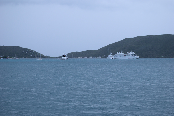
We decided not to stay in Jost van Dyke for New Years, after realizing how many boats would be coming in for the party at Foxy’s. We didn’t relish the idea of being rammed by some drunken morons at three in the morning. Our plan was to go to JVD, check in, spend the night, and depart for The Bight at Norman Island. As we approached Great Harbour, we could see a sea of masts. The amount of boats already anchored was staggering. It took us quite some time to find a spot where we thought we could lay out enough chain without being in danger of swinging into another boat. We saw boats rafted up on moorings, which is not allowed. We saw boats anchored with very little scope, and we hoped they wouldn’t break loose and get into us. And this was still a day away from New Year’s Eve, so things would only get worse.
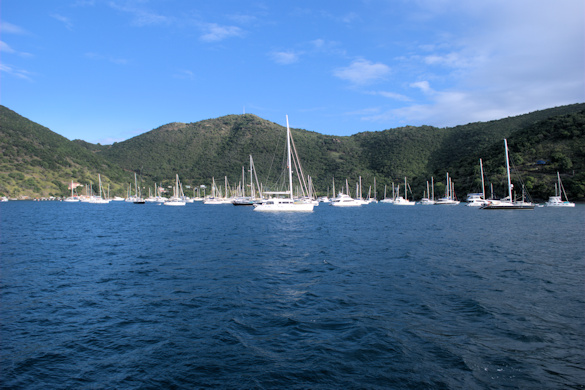
A sea of boats in Great Harbour for the party at Foxy’s
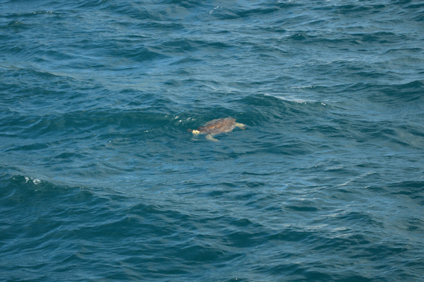

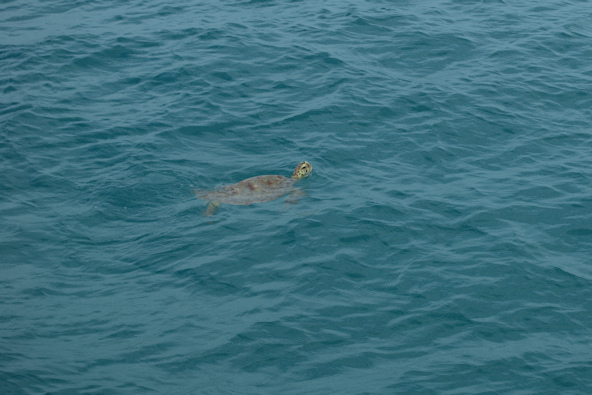
This turtle braved the jumble of boats
We took Little Blend into the government dock to check in. On our way, we passed by an area in the northwest side of the harbor, that was past the mooring field. On our last trip, we looked at that area, and we thought it would make a good place to anchor for one or two boats. Now, we counted no less than twelve boats anchored in that tight area. After checking in, we ventured over to Foxy’s for lunch. After a few minutes, we figured there was no table service. I went to the bar and asked to order food, but I was gruffly told there was no food. We had previously gotten food in mid-afternoon there, and the crowd was sizeable. We decided to walk down the road to find some food. At a much friendlier place, the owner said they were finished with lunch, but they would be glad to cook some burgers for us. Foxy’s has definitely gotten too big for its britches. While we were eating, some people with limited English came by, and they were convinced that our boat was dragging. How they knew we which boat was ours, and why they thought it was dragging, was beyond us. I actually took the dinghy out to be sure, and it had not budged. Anyway, we survived the night without getting clobbered.
Position at destination: 18°26.455’ N, 64°45.117’ W
Air temp: 87°, Humidity: 55%, Water temp: 87°
Nautical miles for this leg: 9.7, Total: 9387
Departed at 12:15pm, arrived at 2:10pm
December 31st: Jost Van Dyke – The Bight, Norman Island
We left early, as we were concerned about the crowd size in The Bight. We dodged a few squalls as we cruised over, and along the way, we met the Sea Cloud, a windjammer-type cruising ship – very cool. We had a full double rainbow off of the coast of St. John. The Bight was busy, but there were still a number of moorings available. We decided to anchor near the Pirate’s Bight restaurant again, where we had stayed on our previous stop.


Sailing ship Sea Cloud

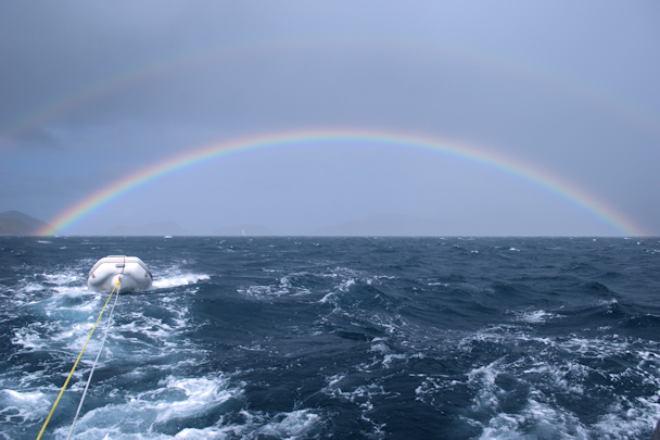
A full double rainbow lingered long after a squall
Position at destination: 18°19.107’ N, 64°36.961’ W
Air temp: 82°, Humidity: 68%, Water temp: 87°
Nautical miles for this leg: 11.1, Total: 9398
Departed at 8:00Am, arrived at 10:15am
We decided to have New Year’s Eve dinner at The Club restaurant, just by the original Pirate’s Bight restaurant. It was supposed to be the upscale place, but with a simple open-air dining area on the beach. We asked about dinner that night, and were told there were two seatings – at 6:30 and 9:00. We made a reservation for the 6:30 seating. It turned out that we didn’t really need a reservation, as it was just us and one other group at 6:30. And the other group had several small and very rambunctious children. Not only were they running and screaming throughout the dining area, they started to grab beach sand and throw it at each other, inside the dining area. It really ruined the dinner, and the parents clearly weren’t going to do anything about it. Finally the waiter told the parents to stop them from running inside the restaurant. The food was okay, but small and quite expensive. Anyway, we made the best of it, and toasted in 2016 back aboard Tropical Blend.
The next day we visited Ralph and Stacy on their charter cat. The guests were off snorkeling, so we checked in to see how things were going. There was an additional boat carrying other guests of the same charter group, so Ralph was taking a back seat to the navigations and planning.
The third day we were in The Bight, the wind shifted for a while, and we got closer to the dock at the restaurant. After this, the manager (who also collects the mooring fees) came out and advised us that we weren’t allowed to anchor in The Bight, as this was a “fisheries protected area”. He even trotted out some 8th generation copy declaring that it was an FPA. We pointed out that we have always seen boats anchored outside of the mooring field, and that we had never seen any fishing vessels in the area. He acknowledged that he had no authority to enforce the FPA restriction, and he left. We think that he was trying to intimidate us into paying for a mooring. We checked then, and since then, and we have never found any reference to The Bight being a no-anchor zone in any publication, cruising guide, charter guide, etc. But we decided to leave, to avoid the possibility of giving them any more business.
January 3rd, 2016: The Bight – Benures Bay
We decided to hop around the corner to Benures Bay. We had never anchored there before, and it turned out to be a beautiful spot. It was a little deep, but we found good holding in about twenty-five feet of water in the eastern side of the bay. There were seven boats anchored, but spaced well apart. That is, until the second day we were there. A catamaran with some British people on it came in and anchored very close to us for no reason – I was pretty sure they were right over our anchor. You really have to scratch your head when cruising in the BVI – so many boaters seem to be utterly clueless about how to anchor and maintain separation from other boats. When we left, there was only one woman on board. I took the tender over to tell her that I believed they were on top of our anchor, but she assured me that her husband had checked, and they were not on top. I told her that boats swing, and that we were ready to leave, so she better have a fender ready as we came up on our anchor. Of course we wouldn’t really run into them, but I was pretty pissed at their cavalier attitude. We probably came within twenty feet of them to retrieve our anchor. Stupid people – there was absolutely no reason to anchor so close.


Position at destination: 18°19.305’ N, 64°36.322’ W
Air temp: 83°, Humidity: 60%, Water temp: 87°
Nautical miles for this leg: 2.2, Total: 9400
Departed at 3:05pm, arrived at 3:30pm
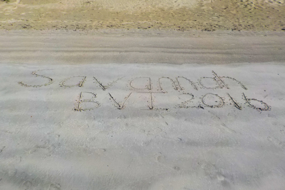
January 5th: Benures Bay – Savannah Bay, Virgin Gorda
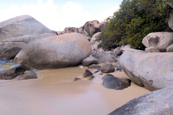
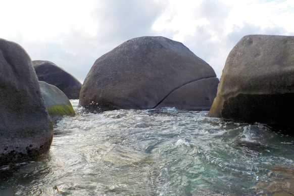
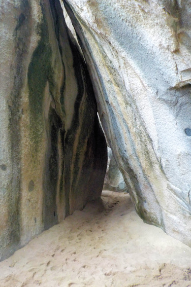
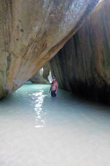
After a peaceful stay at Benures Bay, we moved on to Virgin Gorda. We decided to first stop at The Baths. Since it is usually impossible to find a mooring ball at The Baths, we took one outside of Spanish Town and used a taxi to visit The Baths. We had not been there since our first charter trip back in 2005. It was an easy hike down the hill to the beach, and we spent some time exploring the area.


Lucky and Rosé enjoying the stunning scenery at The Baths


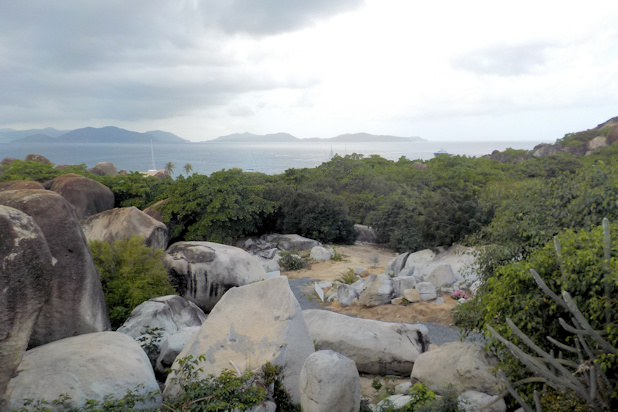
View from the “Top of the Baths” restaurant – lots of squalls in the area
The squalls were all around us, but somehow we dodged them. We took a taxi back to Spanish Town, picked up a few provisions, and then left for Savannah Bay. We have never stayed at Savannah – it’s off limits to charter boaters, due to the entrance. The beach is guarded by a long reef, and you have to enter on the far west side of the bay, then make a hard port turn to the anchorage. It is child’s play with a chartplotter, but the charter companies don’t want to take any chances. We entered the bay and anchored off the beach at the east end. There were just six or seven other boats in the anchorage.
Position at destination: 18°28.234’ N, 64°24.949’ W
Air temp: 85°, Humidity: 61%, Water temp: 87°
Nautical miles for this leg: 16.4, Total: 9416.5
Departed at 11:00am, arrived at 4:30pm
January 7th: Savannah Bay – Leverick Bay


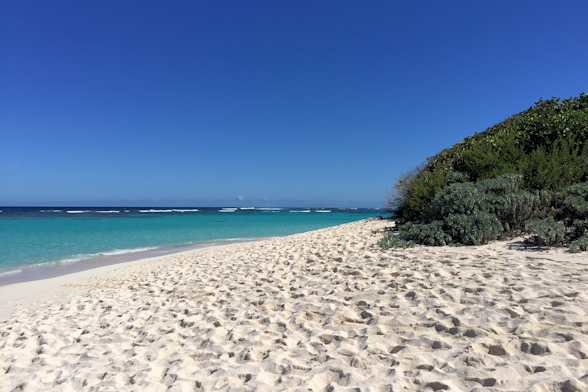
We went ashore to the beach, which is a very long stretch of white sand. We got chased off the beach by a squall, but nothing of consequence. However, the following morning, we were awakened by the pitching of the boat, and we could hear a lot of noise coming from the stern. Savannah Bay is wide open to the north, and a north swell had rolled in early in the morning. The wind was still blowing from the southeast, so our bow was being held in place off of the beach. We had cable-locked the dinghy to the swim ladder, and the violent pitching of the stern as the big swells rolled in had caused the ladder to become unlatched and deployed off of the swim platform. The noise we were hearing was the ladder pounding up and down on the swim platform. We quickly decided that staying was dangerous, and we made preparations to leave. The surf was breaking strongly on the reef, just about two-hundred feet behind us. When we left, there were only two other boats remaining, and they followed us out. Now we knew all about an untenable anchorage.
It was relatively smooth getting out, due to the partial protection of the reef. Once we cleared the reef and turned east towards the North Sound, the ride was comfortable. The swell was long period, so it was hardly noticeable. I think it’s the swell breaking on the reef at Savannah that causes the problems. We entered the Sound through Colquhoun Reef and headed to Leverick Bay. Surprisingly, there were fewer boats moored or anchored in Leverick than in our previous visit.
Position at destination: 18°29.894’ N, 64°23.333’ W
Air temp: 83°, Humidity: 82%, Water temp: 87°
Nautical miles for this leg: 6.6, Total: 9423
Departed at 7:30am, arrived at 8:40am
January 7th – January 15th: Leverick Bay, North Sound
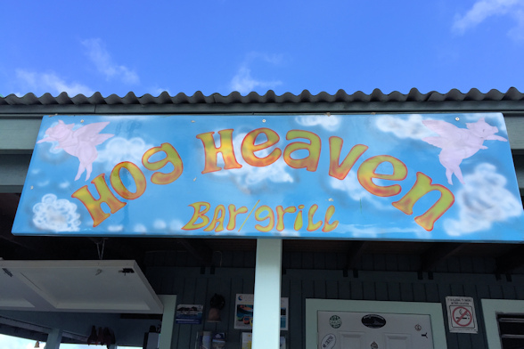
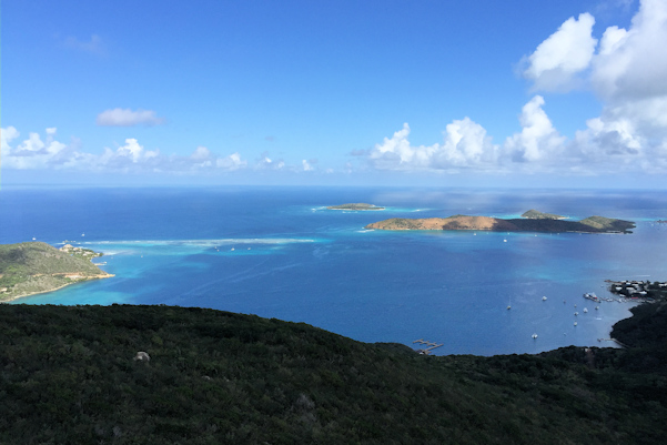
We spent a lazy week anchored at Leverick Bay. While at the pool one day, we were told about a special restaurant up on the hill overlooking the sound – Hog Heaven. We were told that the BBQ was quite good, and the view was stunning. On a cloudy Sunday afternoon, we took a taxi almost straight up the hill overlooking Leverick Bay, and the view really was a stunner. You can see the entire sound, and we could make out Anegada in the distance. The elevation was around 1,500 feet, and it felt a lot cooler up there. We munched on some ribs and chicken, and soaked in some rum and the view. This was definitely worth doing, and oddly, it is not mentioned in the cruising guides.


The views were spectacular

That’s Anegada in the distance

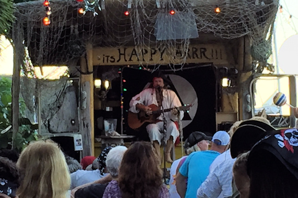 While at Leverick, we decided to take in the Michael Beans “Happy Arrr” show. During high season, he puts on several free shows per week. It’s quite popular with the charter boat population, but we enjoyed it. The show is a little cheesy, but it is fun. The charter boaters dress up in pirate gear, and the kids really enjoy the show.
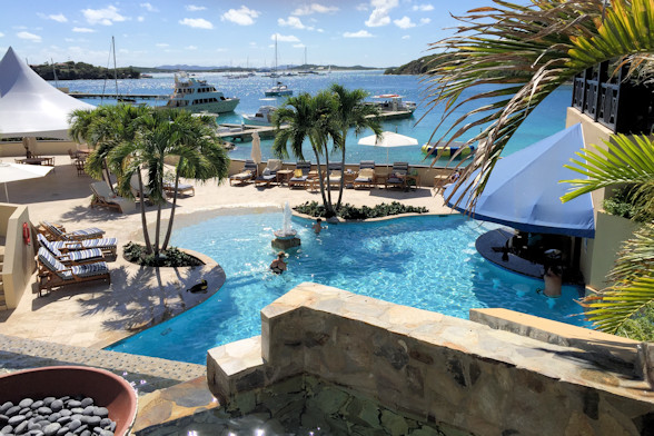
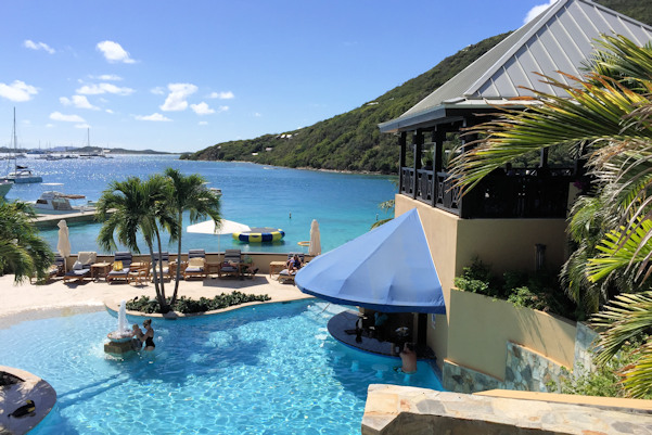
After spending a week doing not much of nothing at all, we decided to go on vacation. We went to Scrub Island Marina, the newest marina and luxury resort in BVI, for Lucky’s birthday.
January 15th: Leverick Bay – Scrub Island Marina
We tucked into our very shallow slip at the Scrub Island Marina and checked in for a couple of nights. The resort is very expensive, but the marina rate was $3.00 per foot, with a fixed price of $21.50 per day for electricity, and you get full resort privileges. Not cheap, but a lot less than it would cost for a room. The resort has a two-level pool with a swim-up bar and water slides. At the beach, they have kayaks, boards, and a trampoline. There are a couple of restaurants on site – we had a pretty good lunch, but a disappointing dinner – not much flavor for the fish. The cruising guide talks up the small grocery, but we found it lacking. It was mostly for soft drinks and beer. There was a deli where we got tasty and reasonable priced breakfast sandwiches. The air-conditioned showers were delightful. We really enjoyed our vacation, but it was too pricey to stay any longer.
Position at destination: 18°28.002’ N, 64°31.432’ W
Air temp: 83°, Humidity: 51%, Water temp: 87°
Nautical miles for this leg: 10.82, Total: 9434
Departed at 9:45am, arrived at 11:45am

The pool complex at Scrub Island

The beach in front of the resort
January 17th: Scrub Island Marina – Trellis Bay
We decided to make a stop at Trellis Bay, just across from Scrub Island. We had spent a lot of time there during our chartering days, checking in for the full moon party. We motored across and found a spot to drop the anchor, just outside of the crowded mooring field. It was a very quiet day at Trellis, and we went ashore to drop off some trash and pick up a few items at the grocery store, which had more supplies and better prices than the store at Scrub Island.
Position at destination: 18°26.802’ N, 64°31.873’ W
Air temp: 83°, Humidity: 59%, Water temp: 87°
Nautical miles for this leg: 1.48, Total: 9435
Departed at 11:05am, arrived at 11:25am
January 18th: Trellis Bay – Anegada
We cruised out to Anegada for a return trip. It was a very easy and smooth crossing, and we anchored to the east of the mooring field.
Position at destination: 18°43.285’ N, 64°23.012’ W
Air temp: 86°, Humidity: 53%, Water temp: 87.5°
Nautical miles for this leg: 23.92, Total: 9459
Departed at 9:00am, arrived at 2:00pm
January 18th – 22nd: Anegada
Instead of taking a taxi to the north side, we decided to rent a scooter for the day. The taxi cost $20 each way, and a scooter cost $50 for the day, allowing us to visit all of the beaches at our leisure. Neither of us had ever been on a scooter before, but the 50cc model was light and easy to handle. Since the island is totally flat, the lower power would not be an issue. We decided to skip Cow Wreck Beach, since we had been there on our previous visit, and we went to the new Anegada Beach Club, about halfway between Cow Wreck and Loblolly.
It was a longer ride than we had anticipated, but the dirt surface was smooth. The Anegada Beach Club has a hotel and some luxury tents, along with a pool and a nice pool bar. Steps away is the beach, but it isn’t as nice as either Cow Wreck or Loblolly. We sat on the beach for a while, watching a kite surfing lesson, then adjourned to the bar for some drinks and lunch. We met some people that were chartering, including the owner of a Moorings Powercat. He was fascinated by our journey, and we had a good time talking with this lively group. They were also on scooters, and we all headed off to Loblolly Beach.
Anegada Beach Club pool A lively crowd and Lucky at the beach bar

Enjoying our day Anegada Beach Club beach
After a short ride, we arrived at Loblolly Beach. It’s another beautiful white sand beach, with an offshore reef featuring good snorkeling. We spent a couple of hours doing not much of nothing at all, and then drove our blazing fast scooter back to the rental place. All in all, it was a great day.
Loblolly Beach
Anegada is famous for its many beach restaurants and lobster dinners. We didn’t have one on our previous trip, so we made sure to get some Anegada lobster while we were there. Based on reviews and the cool name, we decided to go to the Wonky Dog. We split a large lobster, and it was probably over two pounds. The portions were just right for each of us. Unless you have a huge appetite, we’d recommend splitting a dinner. IIRC, the total cost was around $60 – not bad for lobster in paradise (and in the expensive BVI’s).
January 22nd: Anegada – Leverick Bay
It was time to start thinking about leaving for points east and south, so we returned to the North Sound to stage for a weather window to Anguilla. We needed to wait a day for the weather to improve, so we anchored back at Leverick Bay. While there, we were entertained by turtles and one of the Windstar cruise ships.

Sea Dream Yacht Club ship Beautiful classic yacht at anchor in Leverick Bay

The ever-present sea turtles in Leverick Bay
Position at destination: 18°29.891’ N, 64°23.340’ W
Air temp: 83°, Humidity: 62%, Water temp: 81°
Nautical miles for this leg: 14.41, Total: 9474
Departed at 9:10am, arrived at 11:45am
January 24th: Leverick Bay – Nanny Cay Marina
The passage to Anguilla would take around fourteen hours. We planned to leave late Sunday night to take advantage of the weather window. When running the generator Sunday morning, it suddenly shut down. I restarted it, but it immediately shut down again. Then I noticed that the temperature was over 210°, which was forcing the shutdown. I let it cool down some, and restarted it again. I didn’t see any water flow out of the exhaust, so I checked the strainer for the intake, but it was pretty clean. I pulled the manual, and it suggested either a bad impeller or a thermostat stuck closed. I removed the impeller plate from the water pump, but the blades looked good. I guessed that it might be the thermostat, and we didn’t have a spare on board. We checked, and there was a Northern Lights dealer in Road Town, so we decided to back-track to Tortola, and we put in at Nanny Cay Marina.
Position at destination: 18°23.867’ N, 64°38.170’ W
Air temp: 85°, Humidity: 60%, Water temp: 81.5°
Nautical miles for this leg: 18.48, Total: 9492
Departed at 12:00pm, arrived at 2:45pm
January 24th – 28th: Nanny Cay Marina, Tortola
Nanny Cay turned out to be a pretty nice place to lay up for repairs. It was well-protected, but just inside the Drake Channel. Most of the boats were in charter, so it was pretty busy. There was a pool and a nice beach bar with an extended happy hour, so we were just fine. I called the Northern Lights dealer, and they said someone could come out on Tuesday. When the mechanic came out, I explained what was happening, but he didn’t think it was a thermostat, as they hardly ever stick closed. He went through the same steps that I did – observing no water discharge, checking the strainer, then removing the inspection plate on the impeller. Well, sure enough, the impeller blades were gone. I had seen the  nubs of the blades. Had I removed the impeller, I could have replaced it with our spare, and we would have been on our merry way. Another Homer Simpson moment for me… I had also heard a clicking sound coming from the anti-siphon valve, which of course turned out to be the remnants of the blades. We took our time fishing out all of the blade remnants, and we were good to go.
We waited another couple of days for the weather to improve, and then we were ready to check out. We used a taxi to take us for some provisioning, check out, and a trip to the Northern Lights store for some generator spares. Checking out of Road Town was much more difficult than checking in at Jost Van Dyke. Customs and Immigration are located in the building by the ferry and cruise ship docks. First we had to go to a window downstairs to pay departure tax, as we were told. After being in line for ten minutes, we found out that as private boaters, we didn’t need to pay the tax. Then it was upstairs to immigration and to get our clearance to Anguilla, which was painful. Then back downstairs and down a long hall to customs, where things didn’t go so smoothly. Despite there being a couple of officers present, we were told we had to wait for a different officer to stamp our clearance. After about fifteen minutes, we got that done. Free at last, we stopped at Riteway for some provisions, then made a visit to the Northern Lights dealer. While they had the spare impeller, they did not have oil filters for either our generator or our main engine – some parts department!
January 28th: Nanny Cay – Prickly Pear anchorage, North Sound
We made the eighteen mile trip back to the North Sound, where we waited for a day and a half for the weather. We cruised in surprisingly heavy seas, at four to five feet on our nose. The Drake Channel was definitely angry that day, but once we cleared Tortola, things settled down. We returned to our home away from home in the North Sound to stage for the passage to Anguilla.
Position at destination: 18°30.481’ N, 64°22.374’ W
Air temp: 84°, Humidity: 59%, Water temp: 81.5°
Nautical miles for this leg: 17.99, Total: 9510
Departed at 10:20am, arrived at 1:20pm
January 30th: Prickly Pear – Road Bay, Anguilla
We decided to depart at 2:00am, giving us time for a little sleep, and for the winds to die down. The entrance to the sound is well-marked, so we left without incident, cruising past Necker Island (owned by Richard Branson) and Eustatia, entering the Anegada Passage to the east. While not as feared as the Mona Passage between the D.R. and Puerto Rico, the Anegada Passage can be difficult. We chose our window well, as the night and the next day were fairly calm. We were glad that this was the last major eastbound passage we would have for a long time. As we approached Anguilla, we did have to navigate through a minefield of fish traps – not something we would want to try in the dark. We entered Road Bay, which was full of occupied moorings, and found a decent place to anchor towards the back of the harbor.

Our January track through the BVI’s
Position at destination: 18°12.046’ N, 63°05.658’ W
Air temp: 84°, Humidity: 59%, Water temp: 81.5°
Nautical miles for this leg: 77.54, Total: 9588
Departed at 2:00am, arrived at 4:00pm