


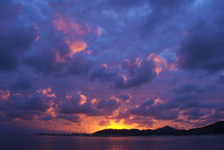
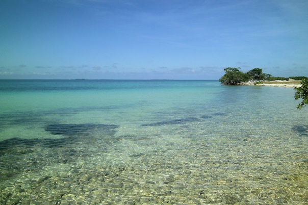
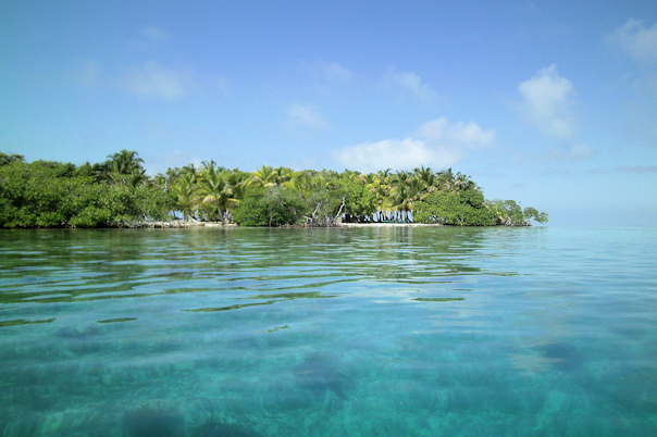
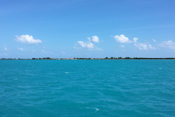
November 1st – November 7th: Providencia, Columbia
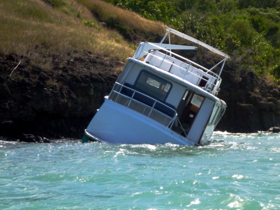
After our overnight passage, we were tired, so we settled in for some much-needed naps. I woke up around three in the afternoon, and I heard the guy in the small sailboat to our starboard whistling at us. I was a little disoriented, but then Rosé got up and she saw what he was whistling about. A powerboat that had been anchored off of our starboard bow was heading straight for us, dragging its anchor. I quickly fired up the engine and Rosé hoisted the anchor. We got out of the way just in time! We saw the boat continue to drag for a while, and then finally a dinghy came out, tied up to it, and moved back to its original anchored position. We were grateful for the warning that got us out of harm’s way. I watched as the driver of the boat dropped the anchor, and then hurriedly left the boat by dinghy. I remembered thinking that wasn’t a very sound anchoring technique.
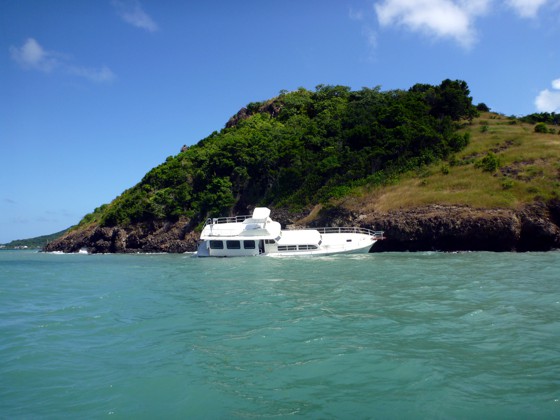
Since we had arrived on Saturday afternoon, we figured we would wait until Monday for our official check-in. Columbia requires foreign yachts to have an agent for check-in, and there is just one agent in Providencia – Mr. Bush. During the day on Sunday, I noticed that the drifting powerboat was no longer anchored in front of us. I figured that it had been moved to a safer location. At the same time, I observed some activity at the far northwest side of the harbor – a number of boats were anchored off of the rocks. Later that afternoon, the guy on the sailboat that had been whistling at us came over to introduce himself. His name was Kevin, from Colorado, and he was single-handing. He told us that the activity at the end of the harbor was salvage for the drifting powerboat. It had dragged again, and ended up on the rocks on the northwest side of the harbor, almost a mile away! The owner was in San Andres, and the guy trusted with watching it had done a completely negligent job anchoring it. The boats we had seen in that area were salvaging, or scavenging, what was left of the boat. A few days later, we took the dinghy over for a look – sad and frightening.
On Monday, we went into town to check-in. We found Mr. Bush, and started the process, which isn’t cheap. We had to do some negotiating about the fee in US dollars, as he claimed the exchange rate would cost him, the local banks don’t do money exchange, so he has to go to the grocery stores, where they have a very unfavorable rate. There are just two banks in town. The first one’s ATM required a chip-and-PIN card; we had a couple of these cards, but we never got a PIN number for them, and we couldn’t get a PIN over the phone. The second bank’s ATM would take our debit card, but it only worked the very first time we used it (before we needed a large amount of local currency to check in), and they wouldn’t accept our card inside. So, we had to resort to US dollars, paying a little more than we thought was necessary. We had heard that the agent fee was $80, with an additional fee of $30 for the cruising permit and tourist cards. Mr. Bush called immigration, and an officer came over on a motorbike (the primary means of transportation on the island). She filled out some paperwork, and took our passports away with her. While this was a little disarming, we knew this was S.O.P. – we collected the stamped passports the next day.
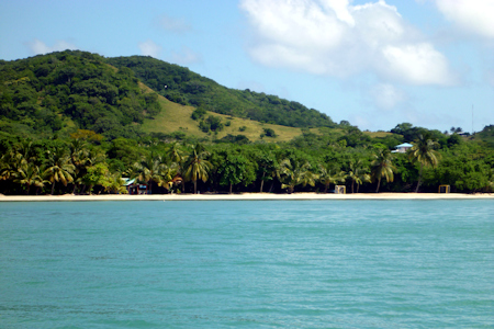
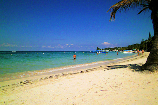
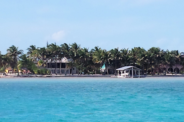
The town has a surprising amount of traffic and activity for such a small place. We found a couple of decent grocery stores where we could buy fresh produce, and there were a number of low cost local restaurants. We walked over to the neighboring island of Santa Catalina over the “Lovers Lane Bridge” for lunch. No vehicles are allowed on Santa Catalina, and it was a charming island.
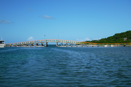
Isla Santa Catalina Lover’s Lane Bridge
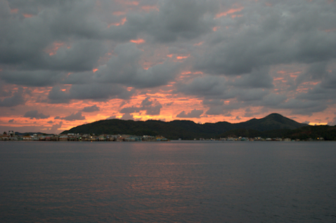
The weather report wasn’t great. Our next passage was to Guanaja, in the Bay Islands off the coast of Honduras. It was a long passage over three-hundred miles long, and a lot of it was over the relatively shallow Nicaragua Bank. We had started top monitor this passage when we were in Bocas, and there were many days with small craft advisories. Since we would be heading into the waves, we wanted to wait for as smooth a window as possible. Most days we were in Providencia the wind was blowing like stink out at twenty to twenty-five knots. The water in the harbor was pretty calm, with the protection of the island, but the passage to Guanaja looked ugly. It looked like it would be five or six days until we could get a window long enough to make the passage, so we settled in for a week’s stay. There was a dinghy dock in the harbor, so it was easy to get into town. We had a fish dinner on board with Kevin one night, and he told us that he got good Internet access at the local library. Despite his directions, we didn’t find the library. Kevin was leaving his boat in the harbor for a couple of weeks while he toured mainland Columbia.
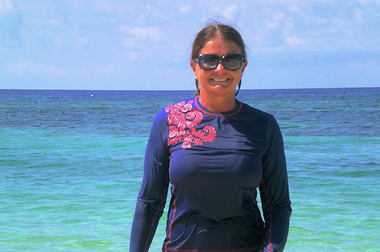
There are a number of beaches on the lee side of the island, and we went to Southwest Beach to a restaurant recommended by Mr. Bush. It’s the kind of restaurant where there is a single-item menu: the fresh fish of the day. We got a combination plate with a whole fried fish, and some mixed crab and lobster meat in a sauce – it was delicious! However, the beer situation was not so good. We had read in one cruiser’s blog that they had been to the small restaurant we had visited earlier, and the only beers available were Heineken, Old Milwaukee, and Miller Lite. We found the same thing at that same restaurant, but I figured there had to be some Columbian beer at the better restaurant. Wrong. The choices were Heineken, Old Milwaukee, and Miller Lite. The grocery stores also had the same selection of “Columbian” beers. On the bright side, I tried a small bottle of Columbian rum, Ron Caldas’ which was superb. I went back to buy a couple of full-sized bottles. At the same time, I saw some bottles the locally-distilled Old Providence Bush Rum. It had a very cool label, but the rum was atrocious. The smell was enough to convince me not to taste it. We saved it to use for putting fish to sleep.


Commercial dock Santa Isabel waterfront
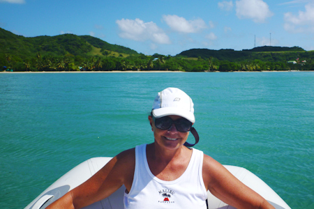
Southwest Beach Rose enjoying the rare sunshine


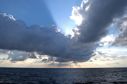
Squall approaching Providencia Morgan Head on Santa Catalina
We took a dinghy ride around the east side of the island. The east end of Isla Santa Catalina is called Morgan Head, supposedly because the famous pirate Captain Morgan used Providencia Harbor as a base for some time. We went as far south as Southwest Beach, where we had lunch a few days earlier. We never went snorkeling during our stay, as the water was just too rough with the high winds. It looked like a weather window was opening for departure on the 7th, so we went in the day before to arrange check-out. This didn’t cost anything, but we again had to surrender our passports for the day, and hope that they would reappear at Mr. Bush’s office by the end of the day, which they did.
November 7st– November 9th: Isla Providencia – Isla Guanaja, Honduras Bay Islands
We prepared for our long passage to Guanaja. We estimated that we would average 5.5 knots on the passage, with the opposing current and waves slowing our progress. Back-calculating, this dictated a very early departure time of 4:00AM. It took a little longer than we anticipated to get out, as the anchor was firmly buried in the mud of the harbor, and we had to break it loose using the boat’s thrust. The channel to the northwest was clearly marked with very intense beacons. It looked more like an airport runway than a shipping channel. There were actually four markers on the way out, with both sides of the channel identified. Our route would take us across the Nicaragua Bank, using waypoints from Albatross. The depth would be at least seventy feet, so we weren’t concerned about the reefs. Some boats opt to go all the way around the bank, but that’s not necessary.
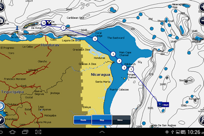
Channel exiting Providencia Harbor Our route to Guanaja
The passage was indeed long. By the middle of the first day, we hit a one knot current that set against us, and the waves were three to four feet on our bow, making for a mildly uncomfortable ride. We only saw a few fishing boats along the way. During the second night, when Rosé was on watch, a fishing boat got quite close, yelling something in Spanish. She guessed they were asking for cervezas, so she ignored them and they eventually went away. We had decided to turn our AIS off when crossing the bank – although there weren’t any reports of problems out there, with the remoteness we decided not to broadcast our presence.
On the morning of the ninth, during Rosé’s watch we crossed into Honduran waters. Shortly after that, we got hailed by the Honduran Navy, and they said to expect a patrol boat for a boarding and inspection. We saw the boat, a large launch, pull up behind us and we idled down to let them board, which they did via the swim platform. An officer came on board accompanied by a very young looking sailor with an automatic weapon. Before boarding, we had been asked how many people were on board, and if we had any weapons. Once they pulled up, they asked us both to present ourselves at the stern of the boat. The office spoke excellent English, and he said they were just doing a routine inspection. He told us if our AIS had been on, they would not have stopped us. Apparently they were looking for a boat from Columbia, and not knowing who we were, needed to stop us. The only inspection done was a request to open the small vertical locker in our pilothouse – we guessed that he thought it was the right size for a small rifle. When the officer saw Quincy, he declared that we had claimed we had two crew, when in reality we had three! He was very nice, looked at our documents, gave us a report of the visit, and they were on their way.
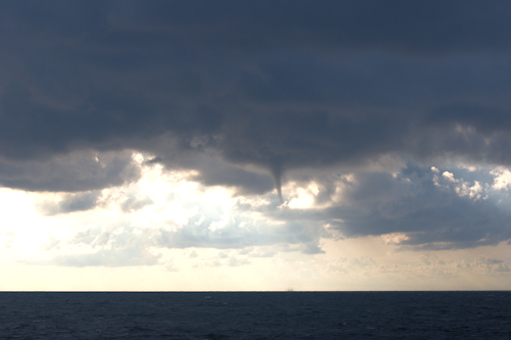
 Approaching Guanaja, we were greeted by a large squall line that contained the first waterspout we had seen on our journey – very cool, as long as it stayed far away. We proceeded into the anchorage area to the east of Guanaja Town. There are a number of reefs and rocks, but the water between them is fairly deep, so it took us a while to find a suitable anchoring site where the bottom was flat and less than forty feet.
Position at destination: 16°26.913’ N, 85°52.212’ W
Air temp: 86°, Humidity: 60%, Water temp: 83°
Nautical miles for this leg: 333.1
Departed at 4:15am, arrived at 4:45pm (two days later)
November 9th – 11th: Isla Guanaja, Honduras
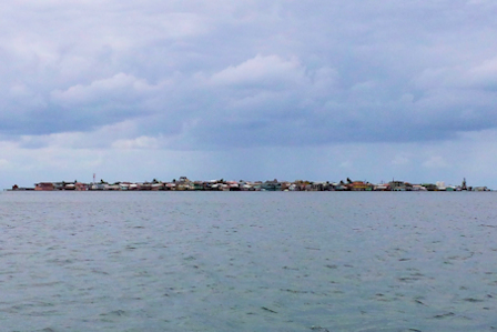

View of Bonacca Town from the anchorage Arial view of Bonacca
The next morning we put Little Blend in the water and went to the town to check in to Honduras. The town, called Bonacca, is a mostly man-made small island just off the Guanaja shore. There are no vehicles on the island, and it has a real rat’s nest of pedestrian streets and walkways. We found the small boat dock on the west side of the island and tied up. A local guy that spoke excellent English helped us, and he told us that he could take us to the immigration and Port Captain’s office to check in. I figured this would be worth a propina to him. It was easy checking into immigration, with just a $2.50 per person fee. Next our amigo took us to the Port Captain’s office. There we paid a $30 fee to clear in, and we wouldn’t need to check in at other ports in Honduras. We asked our amigo about fuel – he said that there was good clean fuel on the island at $4.00 per gallon. We decided to come back that afternoon to pick up five-hundred gallons. We agreed to a time, and went back to Tropical Blend.
There appeared to be a number of restaurants along the shore, so we went off in search of lunch. It was just a little after 11:00, so most of them weren’t open (this was also low season for tourism and cruising). We found the German restaurant Manati that Anton had raved about. It didn’t appear to be open, but we docked the dinghy to see if it had a sign about hours. Then the owners, Annette and Klaus, appeared. They told us they weren’t open yet, but then they decided we could come in anyway. It was a very charming place, with lots of cruiser paraphernalia on the walls. We decided to make it easy for the owners, so we both ordered the roast pork. The portions were huge, with delicious homemade mashed potatoes. It was scrumptious – we hadn’t had food like this since we left on our trip.

Lucky knows where we are Rose enjoyed a great comfort food lunch!
After a very filling lunch, we went back to the boat, hoisted the dinghy, and cruised into Bonacca for a fuel appointment. We were told to tie up next to a large boat that was already at the dock, and fueling commenced. We also took on some water. We were assured that it was of drinking quality, but it would have a slight yellow color from tannin, similar to what we had seen at El Salvador. Before filling, we tested a glass, and it was fine. During the fueling, I found out that we had to pay in cash. Our amigo took me to a bank on the island so I could get a cash advance. The bank had two armed guards outside, and they wouldn’t let me wear my hat or sunglasses inside – welcome to Honduras! Unfortunately, they limited the advance to 20,000 lempira (a little over $900 USD), so I had to provide the rest in US currency, which we did have in our safe. During fueling, some guys on the boat we were tied to were talking to us and looking into our pilothouse, where we had a laptop, phones, and cameras. Our amigo suggested that we should close and lock the door – welcome to Honduras, part dieux. On the way back from the bank, I cracked my head pretty hard on a beam that was supporting the upper deck of the boat we were tied to – this fueling was dangerous. To actually pay, we had to go to a beauty shop, where I guess they handle the currency for the fuel dock – welcome part three. Finally done, we left the dock and proceeded around the west side of the island before turning back to our anchorage. We were in forty feet of water that suddenly became six feet, and we were stirring up all sorts of sand. The chart datum was off a bit, and we had run across a very shallow sandbar. I reversed off of the bar very quickly, and we re-anchored without further problems. That night we had a fabulous sunset. We wished we could stay longer, but we were on a sort of schedule now, and we needed to get to Roatan the next day.


November 11th: Isla Guanaja – Barefoot Cay Marina, Roatan
We had perfect trawler weather for our short passage to Roatan – very little wind and flat seas. What a pleasure after our long slogs from Panama! We had decided to stay at the Barefoot Cay Marina, which was part of a resort not far from Coxen Hole, the main town on Roatan. After a smooth and beautiful passage, we had two near-incidents docking. Approaching the entrance to the marina, it is necessary to make a hard turn between two reefs. The depth was listed at around sixteen feet through the entrance. Just outside the reef, the depth is over five hundred feet. As we made our starboard turn, the bottom came up like a wall, suddenly at eight to ten feet. I had a moment of panic thinking that the charts weren’t accurate, so I quickly killed the throttle and reversed direction. After stopping, the depth matched the charts, so we proceeded. Maybe the very sudden decrease in depth caused a glitch in the depth sounder. We proceeded to the marina, and we were instructed to tie up in the first slip, a long and wide slip with a fixed concrete dock to starboard when we docked stern-to. As usual, I was steering from the flying bridge. Unfortunately, when I turned the wheel to reverse our position, I got no response from the rudder, and very little resistance in the wheel. I was aware that the steering gear had a hydraulic assist that could lose pressure. Fortunately, the wheel in the pilothouse still worked, so we got docked without further incident. Later I confirmed that the hydraulics had low pressure, which is easy to restore with a bicycle pump.
Position at destination: 16°20.251’ N, 86°28.532’ W
Air temp: 90°, Humidity: 62%, Water temp: 86°
Nautical miles for this leg: 33.8, Total: 5487
Departed at 5:55am, arrived at 1:00pm
November 11th – 18th: Roatan
Roatan is part of the Bay Islands of Honduras. Originally settled by English pirates, it’s been discovered by cruise ships and tourists now. We first visited in 2011, staying in a condo on the northwest side. There is a barrier reef just offshore there, part of the second largest barrier reef in the world. The beaches and the reefs are fabulous, and the island is still in the sweet spot between over-developed and third world. After reading up on Barefoot Cay, we decided that would be a good place to stay – not too far from Coxen Hole, swimming pool, beach and reef on site; our kind of place. It turned out that our boat was tied up literally about 20 steps from the pool. Being offseason, the place was really quiet, with a handful of guests and only two other boats. Just across the dock was a park-like area with grass, trees, and bushes. We set Quincy in that area, and he enjoyed feeling grass under his feet for the first time in a long time, and had fun exploring the area.

We were docked just steps from the pool at Barefoot Cay Resort
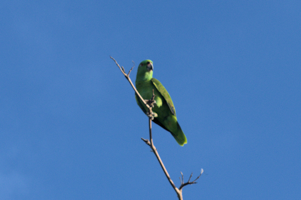
In the trees around the pool, the resort had a pet parrot called Chacarron. He was quite the character, with an extensive bilingual vocabulary. He took quite a shine to us – he would wolf-whistle at Rose when she walked out in her bikini, and he would wait for me to emerge early in the morning and would shout, “hello” and “what are you doing?” to me until I would acknowledge him and approach him. He liked to eat peanuts that the resort kept around, and he provided endless entertainment for all of us. Oh, and he told us many, many times that he knew he was a “pretty bird”.

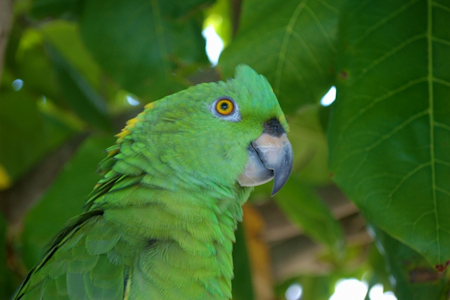
Chacarron, the multi-lingual star parrot
We rented a car for a few days to run some errands and to hit the beaches. There is a really good supermarket on the island called Eldon’s, with a wide variety of items at great prices. We found a local fried chicken joint, Bojangles, to get Quincy a special treat. We got laundry done, and picked up a lot of low cost medications. We spent one day visiting West End, the place where we had stayed during our previous visits. The first day we went a cruise ship was in, and the beach was pretty active. The second day, we were really surprised how deserted it felt in the shoulder season. There were no cruise ships around, and occupancy of the hotels was really low. We enjoyed one of the best beach pizzas ever, the pepperoni and jalapeno at the Infinity Bay resort. We went snorkeling on the reef, but the water wasn’t as clear as normal, what with some area squalls stirring up some sand.

West Bay Beach Barena, one of the local cervezas
Rose at West Bay Beach Port Royal, the better of the local cervezas


Snorkeling along the Mesoamerican Barrier Reef
A few days later, I checked out the snorkeling on the reef in front of the Barefoot Cay Resort – it was pretty good. They have a palapa over the water with a fresh water rinse, so it is very convenient. There was a sunken wreck, and a barracuda enjoying the shade of the platform.

Sunken wreck off of Barefoot Cay Resort Barracudas like shade
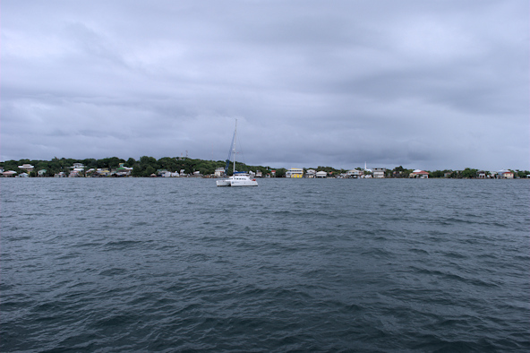
The next day, a 38’ Lagoon catamaran (Wildcat) came in to the marina, and we met the owners, a young couple (Candace and Carl) from Hawaii. Carl was an eye doctor that had accepted a position in Florida, and they were bringing their boat from Hawaii as a big adventure. They had a captain take the boat to San Diego, and then they joined it on a fast trip down the Pacific coast, through the canal, and across to Roatan. After Roatan, they would be handling the boat for the first time on their own. After comparing plans, we decided it would be a good idea to buddy boat together to Belize and Mexico. We had been concerned about the passage from the Bay Islands to Belize. This goes along the northwestern Honduran border, a lawless area where a couple of boaters had been killed in piracy incidents. It’s about ninety miles from Utila to the southern cays of Belize, approximately fifteen hours. We had decided that we wanted to transit during daylight as much as possible, and stay at least twenty-five miles offshore. By buddy-boating with Wildcat, we would feel comfortable with an overnight passage, enabling a daylight arrival into the cays.
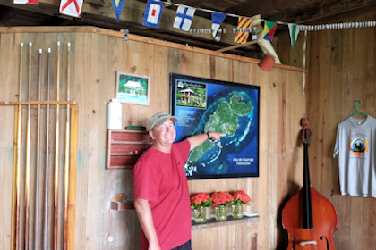
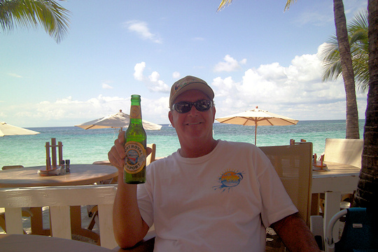
One afternoon at the pool, I decided to take a picture of some of our best friends, our rum collection. It had grown considerably since we started our voyage, with some very fine local rums added from Central and South America.
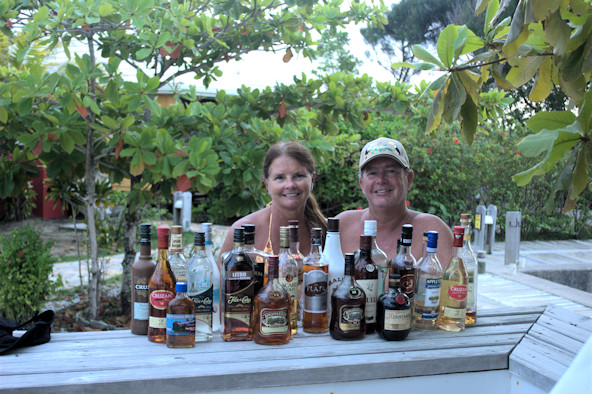
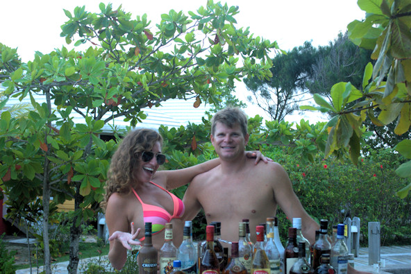
Proudly displaying our rum collection Candace and Carl


Rose with Chacarron just above her Chacarron starts to dive bomb Candace
Chacarron came over to see what was happening, and took a pose in the tree just above us. We decided to take some pictures. On the picture with Candace, you can see that Chacarron is a blur. For reasons unknown, he flew down into the back of Candace’s hair, causing some commotion. Afterwards, he was strutting around as if to say, “What are you looking at?”

You looking at me? Hello, what are you doing? Pretty bird!
November 18th: Barefoot Cay Marina – Isla Utila
Our plan was cruise forty miles to Utila, the westernmost Bay Island, and spend one night before departing the following night for Belize. Wildcat had actually checked in and out of Honduras in Roatan already, but we would check out in Utila. We agreed to leave at first light so we could enjoy the afternoon in Utila. Wildcat followed us out of the harbor at 6:00, and we started our passage. Shortly after that, I noticed that we had no voltage output from our inverter, so anything running on a/c power wasn’t working (primarily our refrigerators and freezers). I reset the inverter from the pilothouse, and looked at the inverter in the lazarrette, but there was nothing obvious. We decided to return to Barefoot Cay to troubleshoot it, and radioed Wildcat of our problem. They continued to Utila. We returned and tied back up to the dock. I connected shore power, but we still had no ac power on the boat. I remembered that there was an inverter bypass switch inside the electrical panel. Once switched, at least we had ac power on board again. The inverter was showing a fault condition, which was reverse polarity. I called Xantrex, and they said that sometimes when disconnecting shore power, the inverter can sense a reverse polarity condition. They said I would need to completely shut it down, disconnecting the inputs, and wait maybe a couple of hours for the internal capacitors to discharge. I disconnected the inputs as advised, but then thought that perhaps simply disconnecting the RJ-11 (telephone cable) remote control line. I had to disconnect that line the previous year to reset the remote control panel. Sure enough, that did the trick, and we were back in business. When we arrived back at the dock, Chacarron saw me and got very excited. This time he started saying “happy birthday” over and over again. It wasn’t either one of our birthdays, perhaps it was his…

Leaving French Harbor Wildcat follows us out
We resumed our journey to Utila at around 10:30. The weather had deteriorated somewhat, and we went through a couple of squalls and some snotty head seas. We arrived late in the afternoon to a large and relatively empty bay. Besides Wildcat, there were only a couple of other boats in the bay. Grateful to have dodged another bullet, we settled in for the night.
Position at destination: 16°20.251’ N, 86°28.532’ W
Air temp: 84°, Humidity: 69%, Water temp: 84°
Nautical miles for this leg: 38.5, Total: 5525
Departed at 10:25am, arrived at 3:30pm
 The next day we went in with Wildcat for lunch and to check out. They had already checked out in Roatan. We went to the immigration office first, and checked out with no problems. The office spoke English well, and he told us to go the Port Captain’s office next to get our Zarpe. We went to the Capitania, but he told us in broken English that we had to leave within two hours of receiving our Zarpe. We tried explaining that we were planning to leave around 10:00 that night, but he didn’t care. Finally, we said that we could leave by 7:00, and he told us to come back before 5:00. We noticed that he didn’t have a boat, so we figured we could just wait in the bay until our preferred 10:00 departure. We walked around some and did a little shopping, then we had a late lunch and a few drinks with Candace and Carl. Utila is popular with divers and backpackers, and considering it was shoulder season, the town itself was pretty busy.
The ocean was closed
We went back to the Capitania’s office around 3:00, figuring that was close enough. When we talked with him, he started telling us in Spanish that we could not leave, due to bad weather (mal tiempo). I showed him my Buoyweather forecast, and explained that we had a very strong boat, but he was adamant. We asked the immigration officer to intervene for us, but all he was allowed to do was translate. Rose suggested that we could pay to leave right now (a mordida!), but even that didn’t sway him. Finally, I suggested that we could leave right now, before the weather set in, and he agreed. He ended up charging us a small fee for the Zarpe, but we had our clearance papers. We went back and met Candace and Carl at the supermarket where they had docked their dinghy, and Carl suddenly thought that Wildcat was dragging. We hurried out to the dinghy, and the weather suddenly got bad, with a squall blowing through. We had a wet ride out, and decided that we would indeed leave at 5:00. A few minutes later, Wildcat called us and said they were having a problem with one of the sea water pumps, but they got is taken care of within a half an hour. By 5:30, we both headed out under heavily overcast darkening skies of the bay for the overnight passage to Belize.
November 19th – 20th: Isla Utila – New Haven Anchorage, Belize
The forecast we had for the passage wasn’t great, but it wasn’t bad enough to close the ocean. We were expecting winds of fifteen from the northeast, and waves of three to four also from the northeast. For the first seven miles, we had mostly a following sea as we cruised southwest to get around the reefs to the west of Utila. We then turned to the northeast to get some distance from mainland Honduras, and the conditions got a little rougher. After about twenty-one miles, we turned due east for Belize, and that’s where all Hell broke loose. We had winds of twenty to twenty-five knots, and NNE seas of six to seven feet, with an occasional ten-footer. Even with the stabilizers, we were getting knocked around pretty good. We had to close the starboard pilothouse door to keep the spray out, and it started to get pretty hot inside. We got off and on squall rains as well – it was turning in to a miserable night. As bad as it was for us, it was worse for Wildcat – Carl was exposed to the elements, and getting drenched from the spray and the rain. We both felt fairly sick, so we opted for one-hour watches. When not on watch, we couldn’t really sleep, but at least we could get horizontal in the salon. There were a few cruise ships out, including one that had so many lights on it was like a full moon came out. All in all, it was a lousy passage – maybe the Capitania had something, after all…
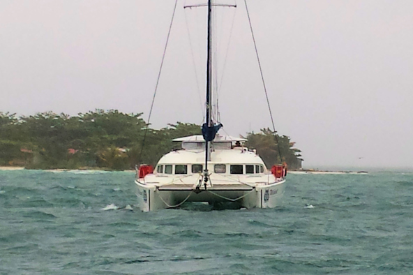
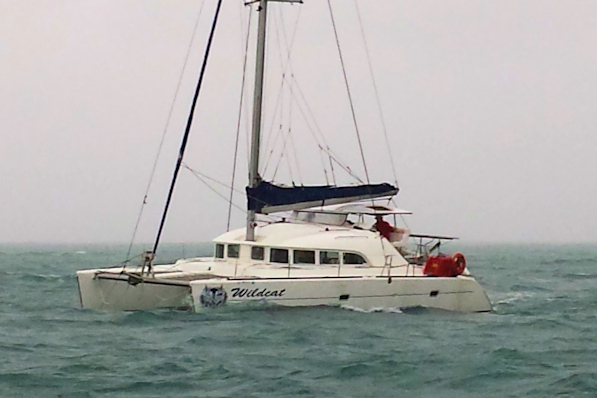
Wildcat with Hunting Cay in the background Carl spent the night exposed to the elements
Our plan was to drop anchor at Hunting Cay, on the far southern end of the southern group of Belize cayes. We planned to explore these cayes for a few days before heading to Placencia to check in. The weather improved slightly as dawn broke, but the seas were still pretty big. As we passed through the gap south of Hunting Cay, we could see big breakers on the western beach. We decided that the weather was too bad to stay out here, so we de cided to head an additional twenty-four miles to New Haven, a well-protected anchorage on the southern mainland. Anton (Albatross) had recommended this anchorage to us. As we crossed the sound, the weather gradually let up, and by the time we reached New Haven, it was very calm. The anchorage was protected and flat, and we were glad to be still. There were no signs of life on Wildcat – Carl had been up all night piloting it through the lousy weather. We also took some much-needed naps, and had an early dinner. Around 6:00, Wildcat called and asked us if we wanted to come over for fajitas, but we had already eaten.
Position at destination: 16°15.228’ N, 88°35.502’ W
Air temp: 77°, Humidity: 81%, Water temp: 83°
Nautical miles for this leg: 106.9, Total: 5632
Departed at 5:30pm, arrived at 12:00pm (next day)
November 21st: New Haven Anchorage – Placencia
We discussed plans with Carl and Candace. They had a hard date to meet his parents in Placencia on the 23rd, so they didn’t have much time to be exploring the cays. They wanted to take his folks down to the Rio Dulce in Guatemala before heading north. They had a hard date to be at an office party at Carl’s new firm in Orlando, so they didn’t have much time to dawdle. We also needed to be in Key West by mid-December to meet family for Christmas. So, we agreed to skip the southern cays and head to Placencia, which is the yachting center of Belize. It was a delightful cruise, no waves and a strong current pushing us north. Carl had wanted to stay at the Roberts Grove Marina in Placencia, which is a few miles up a twisty passage through the marshes. We weren’t too keen on that idea, and he couldn’t get them to respond to the VHF, so we agreed to drop the anchor in Placencia Harbor.
Position at destination: 16°30.521’ N, 88°21.866’ W
Air temp: 81°, Humidity: 76%, Water temp: 82.5°
Nautical miles for this leg: 27.2, Total: 5660
Departed at 8:30am, arrived at 12:10pm
The Belize check-in cha-cha
We needed to check in to Belize. According to our cruising guide, we could check in at the commercial port in Big Creek, just a little south of Placencia. If you took your big boat there, you had to pay a substantial anchoring fee, so we decided to dinghy down. We used Wildcat’s dinghy, as we hadn’t lowered Little Blend yet. Their dinghy was typical of a small cat, only nine feet long and powered by a 9hp motor. With the four of us, it was slow going, buy fortunately the seas were flat. It took us about a half an hour to get there, and while we were looking for a place to tie up, a security guard came out and told us we would have to pay $120 to tie up the dinghy. We gathered that they simply don’t want cruisers tying up down there. Not willing to pay, we took the dinghy back to our boats, and figured out that we could take a water taxi (the Hokey Pokey Water Taxi – no kidding!) from Placencia to Mango Creek, where we could take a taxi to Big Creek for check-in. This would still be substantially cheaper than the $120 docking fee, so we hurried to catch the last ferry that would get us to Big Creek in time, as the offices closed at 4:30. The water taxi fare was $5 one-way, and we got a taxi to take us to the offices for $20 for the four of us. We first went to the immigration office, and we quickly got checked in with a $10 per person fee. Next, the driver took us to a different group of offices, starting with the Port Captain. There, we had to pay $50 (port fee) plus $2.50 per day cruising permit. We didn’t really know how long we would be in Belize, so we estimated two weeks, but there is no refund if you leave early. The next office was where the fun really started – customs and agriculture. By now, it was a little past 4:30. The offices are open until 5:00, but they claimed that on Friday, they normally close at 4:00, and they were waiting on us, so there would be double charges for overtime. Since they had us over a barrel, what could we do? The customs agent told us they normally inspect boats in person, but he would do us a big favor and not do the inspection – for an additional $20 “overtime” fee, which went right in to his pocket. A similar story happened with health and agriculture – the overtime charges went into their packets. By this time, we didn’t have any cash left, and we had to borrow the water taxi fare from Carl. It is really expensive to cruise in Belize! And we’re still not sure how legitimate those fees are. According to Noonsite and other cruisers, the fees vary wildly. They may speak English, but it’s still Latin America.
We caught the last water taxi back to Placencia at 6:00, and had a nice dinner on shore. The anchorage was completely calm. We agreed that we would get together for some shopping the next morning, and head out to a nearby cay in the afternoon.
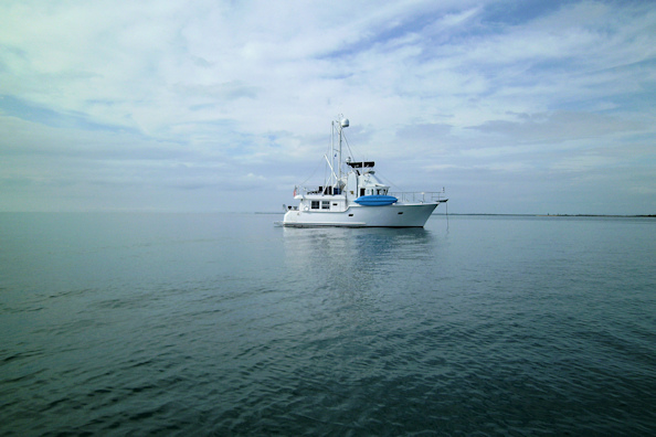
Tropical Blend at anchor at Placencia


Placencia shoreline Happy to be in Belize

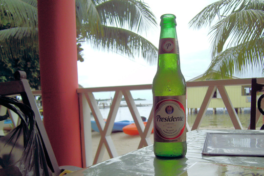
Busy streets of downtown Placencia Presidente, el rey de cerveza Caribe
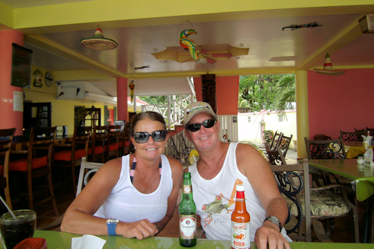

Presidente and hot sauce – it’s all good Our hostess shows off a bottle of local coconut rum
November 21st: New Haven Anchorage – Placencia
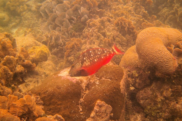
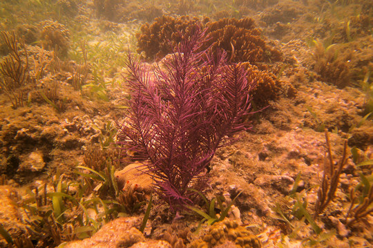
On Saturday afternoon we joined Wildcat in a cruise to Wippari Cay, the nearest cay that had good snorkeling. It was only nine miles out, so it would be easy for Wildcat to get back to Placencia the next day to pick up Carl’s parents. It was a nice cruise and a nice evening at anchor. For dinner, we went aboard Wildcat to enjoy the fajitas that Candace has been making. We didn’t go ashore, as it is a private island with some large guard dogs roaming around. But in the morning, we took Little Blend over to the north side to try out the snorkeling. The water clarity was amazing, and we did see a lot of interesting aqua life. While we were there, a small boat came along with a diver that removed some of the coral. We found out that they were growing coral here and transplanting it to other parts of the reef where the coral was needed.
Position at destination: 16°32.282’ N, 88°13.230’ W
Air temp: 85°, Humidity: 86%, Water temp: 82°
Nautical miles for this leg: 9.3, Total: 5669
Departed at 1:30pm, arrived at 3:15pm
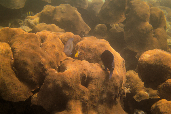
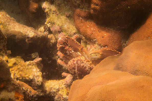
Clear and warm water This big crab was about two feet across


Live conch Big starfish
November 23rd: Wippari Cay – South Long Cocoa Cay
Carl and Candace needed to leave for Placencia to pick up his parents, so we said goodbye for a while. There was a good chance that we would meet up with them again in either San Pedro or Mexico. We planned to do some cay-hopping in a general northerly direction before making a brief stop in Belize City. We used the cruising guide to determine the best stops, based on scenic appeal, protection, and snorkeling. Our first stop was South Long Cocoa Cay, just three miles from Wippari Cay. One of the things about cruising in Belize is that you often can’t go in a straight line from place to place. Reefs are everywhere, so you have to use the chart to plan out safe passages. This was one of the rare passages where the straight line approach worked.
Position at destination: 16°29.691’ N, 88°12.811’ W
Air temp: 90°, Humidity: 62%, Water temp: 82.5°
Nautical miles for this leg: 3.4, Total: 5672
Departed at 11:50am, arrived at 12:30pm
The sun was pounding down, and it really felt hot. We went to shore to walk around. We found what appeared to be a development project that was stopped early on. There were piles of dead, white bleached coral on the beach, and some concrete blocks here and there. While the island looked pretty from the anchorage, this failed development detritus was rather disturbing. We later found out that during construction, the workers were illegally dredging up live coral for the seawall – very sad. I’m not sure if that was what killed the development, but it happened in 2011. The water itself was very clear, and there were still some mangroves on the island. On the southern end of the cay there is a large harbor with a dock and some dwellings on shore, but it looked to be private. Back on board, a large barracuda had taken refuge under our boat, along with a remora. We tried feeding the barracuda, but the remora was much quicker to the food.
West side of SLCC Dead coral piled up on the beach
November 24th: South Long Cocoa Cay – North Long Cocoa Cay
The next stop on our Belize Cay tour was North Long Cocoa (NLCC). There are a couple of other small cayes around NLCC, and after looking around at the area, we decided to anchor near NLCC. The bottom was sand with scattered coral heads, but we found an open area in about twelve feet of water. Off the north end of NLCC, we could see a couple of over-the-water cabanas, so we took the dinghy to investigate. They appeared to be in very good condition, but there were no signs of development on the cay. We went on shore to find an area with a large barbecue and paths lined with conch shells. We guessed that maybe it is used as a lunch stop for cruise ships, or perhaps the resort on the neighboring cay – although it seemed to be much too large for that. There was a dock that we used as well. After we were walking around a bit, we heard the familiar sound of a large dog coming our way, so we got the Hell out of dodge. We went to the cay to the south, called Rendezvous Cay on the charts, but not to be confused with the cay of the same name owned by Royal Caribbean in the northern cayes. There was a large seawall around most of the island, and a resort composed of individual cottages. It seemed to be mostly deserted. Between the two cayes there were a large number of pilings, but we couldn’t figure out their purpose. We decided to try snorkeling an area that had large coral heads, but there were only some small fish around the heads. This was a much more scenic place than South Long Cocoa Cay.
Position at destination: 16°33.554’ N, 88°06.373’ W
Air temp: 88°, Humidity: 68%, Water temp: 83°
Nautical miles for this leg: 12.6, Total: 5685
Departed at 7:50am, arrived at 10:15am

Very clear and calm water Overwater cabanas at North Long Cocoa
Conch shells marking the paths Mystery resort on Rendezvous Cay
November 25th: North Long Cocoa Cay – South Water Cay
The next stop on our tour was South Water Cay, which is right on the barrier reef. It’s very remote, but there are a couple of resorts on it. To get there, we had to go west to the Victoria Channel, then north about ten miles, and then hard east across some very shallow water to South Water Cay. This was really our first time cruising extensively in very shallow water – except for a few spots in the San Blas Islands, we had rarely cruised over water less than fifteen feet. Once we turned toward South Water Cay, we had between eight and twelve feet under us. We did have a marked route to cruise over, but it was still a little dicey going over coral heads in the very clear water. We anchored in sand at about ten feet deep, and went ashore. We went to one of the resorts for drinks, and we were able to get wifi access – what a luxury! We immediately checked the weather, and we saw that a cold front was forecast for the next three days, but it didn’t seem to be a bad one. Winds were forecast at fifteen to twenty, with seas of three to four – no big deal. Before we left, we talked with a local boater who also thought it would be a weak front. The next day, we planned to cruise to Belize City so we could have a place for a nice Thanksgiving dinner, and good phone service to call our families.

Carrie Bow Cay, just south of us South Water Cay resort
Position at destination: 16°48.824’ N, 88°05.082’ W
Air temp: 86°, Humidity: 75%, Water temp: 85°
Nautical miles for this leg: 24.4, Total: 5709
Departed at 9:00am, arrived at 1:15pm
November 26th: South Water Cay – Cross Cay
During the night, the north wind started picking up, and we started the pitch. In the morning, it was raining pretty hard and we noticed our position seemed to have changed. We confirmed that we had dragged to the south, the first time we had not held at anchor. I guessed that we might have anchored in shallow sand over rock. The wind was blowing around thirty, much more than forecast. We decided that given these conditions, we could not get to Belize City, but we couldn’t stay here, as we were totally exposed to the north. We looked at the charts to find a cay with a southern anchorage, and the nearest was Cross Cay, just ten miles due north of South Water Cay. We pulled the anchor and slogged our way north at about four knots.
We were again going over pretty shallow water, usually around ten feet, but the charts indicated the course was not over coral, so at least we felt good about that. Along the way, we passed several cuts in the reef, and the surf was breaking very hard. At the Tobacco Cay cut, we saw two charter catamarans anchored, pitching violently, and we wondered why they were still there. We got to Cross Cay, which is a very low mangrove cay that doesn’t slow down the wind, but it does eliminate the fetch in the water, so it was a fairly comfortable anchorage. We let out extra chain, one-hundred and fifty feet in fourteen feet of water. There was a fish camp at the cay, and after a couple of hours a boat came over to see us. There were a number of fisherman on it, and they offered us lobster and conchs. We agreed to buy some lobster, which was already cut into tails. They wanted $15 for five pounds, but they didn’t have change for a twenty, so they just added a bunch more lobster. We figured they were stuck here like we were, and had limited refrigeration, so they were happy to get something. They also asked us if we had an extra snorkel since they had lost theirs, which we did. We ended up getting enough lobster for four dinners for just $20 – quite a deal! By late afternoon, the wind increased to thirty-five knots, but we held fast. We decided to see what the weather looked like the next morning before making a decision to go.
Position at destination: 16°58.540’ N, 88°02.951’ W
Air temp: 81°, Humidity: 67%, Water temp: 82°
Nautical miles for this leg: 10.6, Total: 5720
Departed at 8:30am, arrived at 11:00am
November 27th: Cross Cay – Garbutt Cay
A.K.A. The gales of November
On Thanksgiving morning, the wind had abated somewhat, so we decided to try for Belize City, which was about thirty-seven n.m. to the northwest. As we crossed the bank to the channel, conditions weren’t too bad. But once we rounded the Fly Range Cayes and turned north into the channel, we were greeted by a heavy gale right on our nose. The peak wind gust we saw was forty-four knots, and it was sustained over thirty-five knots. The seas were right on our nose, estimated at eight to ten feet with a five or six second period. We pounded relentlessly and started to question our sanity. We were barely making three knots against the raging seas. Suddenly a fierce gust hit us, and we heard something clunking in the cockpit, and a lot of noise from the flying bridge. The wind had broken off our weather vane, which landed in the cockpit. On the flying bridge, the bimini top had snapped back, contorting the frame pieces around. We couldn’t possibly sustain this, so we decided to turn back. Even that was a white-knuckle experience, as we tried to time our turn when the swells were down. When we got a gap, we pounded the throttle and turned for all we were worth, and made it without a violent roll. We decided to head back to Garbutt Cay, which had similar protection as Cross Cay. Once we got there, the wind was howling fiercely, but we manage to at least secure the bimini top to avoid further damage. A set screw had come out, allowing one of the forward struts to snap back. We were glad to retreat to the cabin, and we decided to have lobster for Thanksgiving. The temperature dropped as low as 68° as the cold front raged through.
Position at destination: 16°57.930’ N, 88°05.083’ W
Air temp: 71°, Humidity: 65%, Water temp: 78°
Nautical miles for this leg: 6.4, Total: 5726
Departed at 10:00am, arrived at 11:30am
November 28th: Garbutt Cay – Fort George Marina, Belize City
The next morning the skies looked better, and using the satellite phone, the weather forecast looked good enough to go. When we first got into the channel, conditions were bad, but nothing like the day before. We had no wind instrument, but we guessed that it was down to twenty or so, and the seas were at four to five feet. Throughout the day, the wind and seas decreased, and by the time we got to Belize City, it was very calm. After reading the cruising guide, we decided the best place was the Fort George Marina. We called them for a slip along the way. When we arrived, it was hard to call it a marina. It was really a large wooden dock where big dive boats docked at the end, and a handful of small fishing boats were tied up in the “slips”. It was a high fixed dock, and the depth was extremely shallow at six feet. Our draft is five feet and the mud we kicked up while docking was amazing. They don’t have power at the dock, so we’d have to use our generator, and they wanted $0.25 per gallon for water, which they wanted you to pay for in advance. It wasn’t really a marina, just a dock, and for this, we had to pay $2 per foot per night. We had planned to stay for two nights, but after seeing the reality, we decided on just the one night. We did have a nice dinner at the Radisson, and made our phone calls, and we were glad to be still. It did rain heavily off and on throughout the night as the front died out.
Position at destination: 17°29.623’ N, 88°10.774’ W
Air temp: 77°, Humidity: 68%, Water temp: 73°
Nautical miles for this leg: 34.9, Total: 5761
Departed at 8:15am, arrived at 2:45pm


Dive boats at Ft. George marina Belize City harbor
November 29th: Fort George Marina – San Pedro, Ambergris Cay
It was a beautiful morning after the front passed through, and we were happy to get out of the Fort George mud marina. We had a long shallow passage to get to San Pedro. We had come a long way since panicking if we were under fifteen feet. For much of this passage we were at cruising speed with just eight feet under us. The course is well-defined in the cruising guide, but at times it was a little nerve-wracking. We arrived at San Pedro and found a good spot to anchor with about nine feet of water below us.
Position at destination: 17°54.867’ N, 87°57.681’ W
Air temp: 82°, Humidity: 58%, Water temp: 81°
Nautical miles for this leg: 29.8, Total: 5791
Departed at 9:15am, arrived at 2:15pm
November 29th:- December 2nd: San Pedro, Ambergris Cay
We had previously visited San Pedro for a land vacation in 1998 with four other couples. We had stayed in a house south of San Pedro called Casa Tortuga. We were able to identify that house as we cruised by, but everything else had changed significantly. A lot of development has happened since 1998. The beach along the entire cay has all been developed with hotels and homes. Previously, there were no paved roads – now they all are. There is a lot of tourist infrastructure now, with a lot of dive and snorkel trips available. There are several decent groceries and liquor stores, where we only remembered one of each back in 1998.
Cruising along Cay Caulker Casa Tortuga on San Pedro

Quincy didn’t want to know how shallow we were San Pedro at dusk

San Pedro sunset 16 years led to a lot of development
We did a little shopping, and we found rum cream for the first time in quite a while. It’s an essential ingredient in our frozen Monkey-La-La’s a drink that tastes just like a chocolate milkshake but it’s mostly alcohol. We picked up a little produce for the weekend and our trip to Mexico. Despite the development, there wasn’t much to do in town other than bars and restaurants.
The anchorage was okay, but the local ferries and fishing boats were driven by cowboys. They would zoom along throwing out a full wake within fifty feet of us at all hours of the day and into the night – very annoying. The second day we were in the anchorage, Wildcat arrived and anchored near us. They had missed the great gale, but they did have some rough seas when they tried to go outside the reef for the passage to San Pedro, forcing them back inside. We met Carl’s parents, experienced boaters who owned a Mainship trawler. We had hoped to leave by Monday, December 1st, but another weak (supposedly) front was working its way through us, so we decided to wait until first light on Tuesday.
We went ashore on Monday morning to check out. The port and immigration offices are next to the airport, and we found them with a little difficulty. It started to rain pretty hard while we were looking for the office, so we were pretty wet once we got there. Checking out was easier than checking in, although we did have to pay more fees, I think it was $5 each for immigration, and $7.50 for the port clearance. Anyway, just as we got into the dinghy, the skies really opened up, so we arrived back at the boat looking like drowned rats. We checked the weather again later, and it looked good enough to leave the following day.