


May 3rd, 2014: Marina Pez Vela – Playa Dominicalito
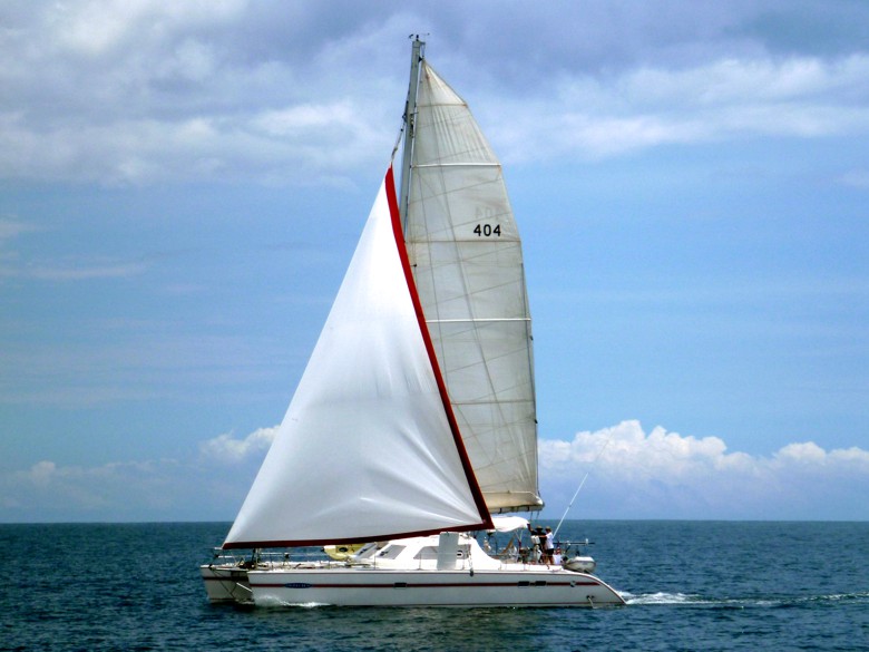
We woke up early Saturday to prepare the boat for cruising, topping off the water tanks and hosing all of the dead flying ants off of the deck. The long rain had brought them all out, but quite a few had drowned on the decks. I went to the office to check out and pick up our national Zarpe. Of course, it was sunny that morning, so we were sweating profusely. I was lucky enough to catch a golf cart ride back from the office. We said goodbye to the surge zone and shoved off at around 10:30 with partly cloudy skies and light winds.
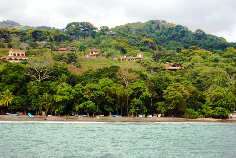
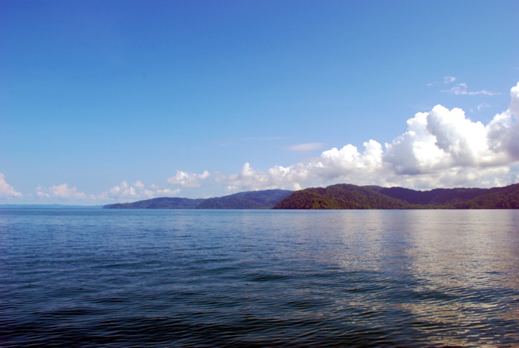
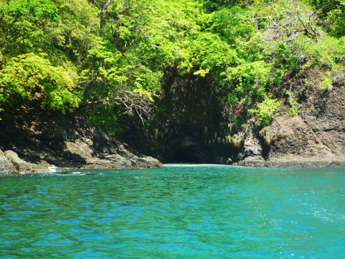
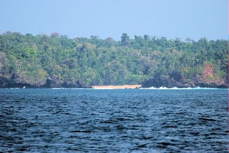
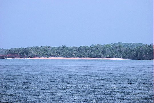
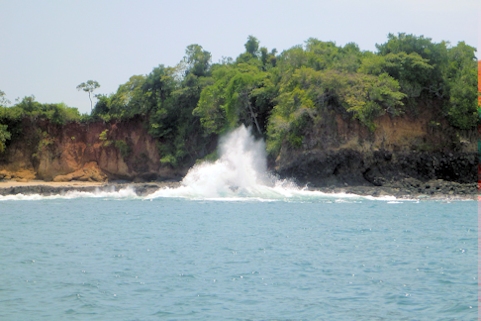
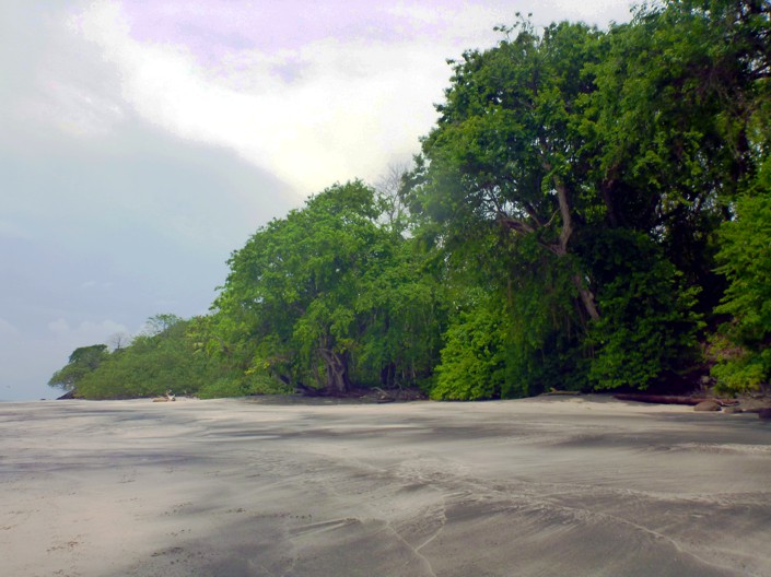
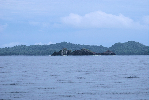
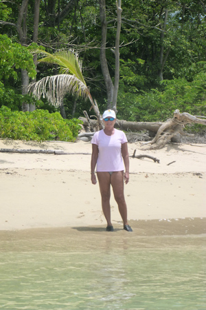
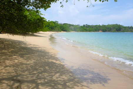
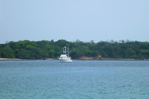
The cruise past Parque Manuel Antonio was very enjoyable, and some friends from the El Salvador Rally, Kim and David, called us on the radio – they were just arriving at Quepos. We shared our knowledge of the area and the park. They were planning to spend just a couple of days there before heading to Golfito, so we thought we might see them again. We noticed that our wind instrument wasn’t working – it was saying we had five knots of true wind speed, with an apparent speed of zero. The anemometer was spinning, so we figured it was a problem in the instrument – it’s always something! By mid-afternoon we arrived at Playa Dominicalito, which turned out to be a very beautiful small bay, with the very green rainforest running right up to the beach.
The surf was up, so several surfers were enjoying their Saturday on the waves. Given the short afternoon, we didn’t bother going onto shore. We were the only cruising boat in the bay. With the afternoon breeze, our bow was aimed directly into the swell, so we were pitching somewhat at anchor. We decided not to deploy a stern anchor or a flopper stopper. After dark, the breeze shifted, and our stern was onto the swell, resulting in some wave slap. I thought the night was pretty calm, but Rosé had a hard time sleeping.
Position at destination: 9°14’ N, 83°51’ W
Air temp: 88, Water temp: 88
Nautical miles for this leg: 26.5 Total: 3891.1
Departed at 10:40am, arrived at 2:45pm
May 4th, 2014: Playa Dominicalito – Drake Bay
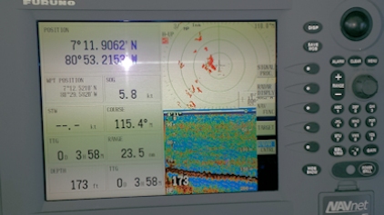
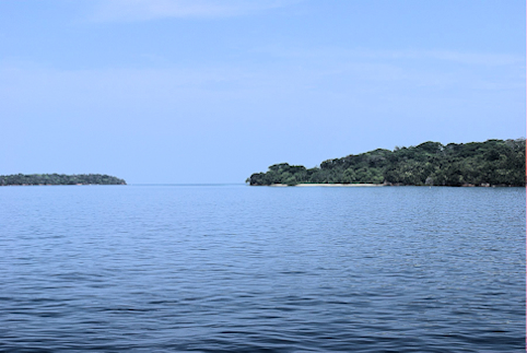
The morning breeze shifted us so that the swell was directly on our beam, so it was time to move on. We departed at 8:00am. The skies were full of clouds, so we anticipated rain, but the morning cruise was sunny and delightful, and the wind instrument was working correctly again. By mid-morning, the sea was almost flat, and we ran across a river of logs. This was a long stretch of logs, branches, and garbage that had collected together, running for about three miles parallel to shore. Some of the logs were full-sized trees, and we couldn’t see a good place to pass through it. We had to alter our course by about fifteen degrees to the west for about two miles before we finally got an opening.
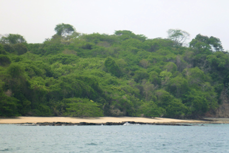
As we approached Drake Bay, a rain squall was dumping its load ri ght on the bay. We couldn’t see any lightning, but as it was still fairly early in the day, we decided to wait for it to clear. We changed our heading and reduced speed to run southwest of the cell, and after about an hour, it had cleared. We motored into the bay and dropped the hook. We were the only cruising boat in the bay on a lazy Sunday afternoon. There were quite a few boats coming in from Isla Caño (Cane Island), a diving hotspot that has the most lightning strikes in Central America. Most of the boats headed up into a narrow inlet that supposedly had a small dock in it. Those boats entered the inlet with the pedal to the metal, so maybe it was bigger than it appeared on the charts.
We spent the afternoon on board reading, then I experimented with making Costa Rican black beans using the Lizano salsa – they were pretty good, but not quite right. With the sun pounding through the back door, I decided to fire up the generator and turn on the air conditioning. Rosé went to bed quite early to compensate for her lack of sleep at Dominicalito. Later, I was starting to go to bed when I noticed that the salon carpet was wet – at first I thought that Quincy had an accident, but it was water. The drip pan for the salon A/C was overflowing, and running under the carpet. I couldn’t tell if the drain hose was plugged, or if the rolling motion of the boat was causing the water to spill. I sucked as much water out of the pan as I could, rolled up the carpet, and headed below. By that time, the skies were clear, so I assumed it would not rain that evening. Given the high temperature and stale air in the cabin, I elected to open the forward hatch. It was still pretty hot, so I brought in the portable fan to blow onto the bed.
Position at destination: 8°42’ N, 83°40’ W
Air temp: 91, Water temp: 89
Nautical miles for this leg: 35.5 Total: 3926.6
Departed at 8:00am, arrived at 1:30pm
May 5th, 2014: Drake Bay – Puerto Jiminez
We awoke at 5:00am to get an early start, but we were delayed by my error in judgment the previous evening. It was raining fairly hard that morning, and the open hatch allowed quite a bit of water in – oopsie. We spent quite a bit of time cleaning up the two water accidents, and finally left at 5:50am in a light rain. We had a nice current pushing us along at seven knots for a couple of hours, before we turned south around the Oso Peninsula. An opposing current cut our speed to 5.8 knots, so we jumped up to 1800rpm’s to maintain six knots. We wanted to arrive at Jiminez before dark, and at 65 knots, we couldn’t afford to drop below six knots.
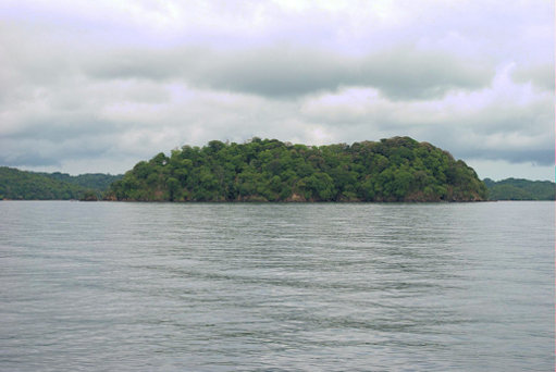
Thick forests of Parque Corcovado
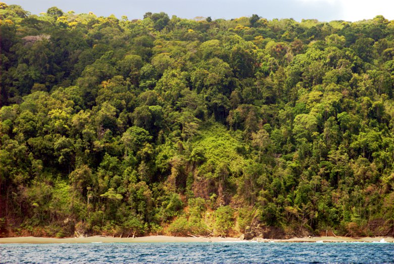
We passed by the Corcovado National Park. This was the densest forest we had yet seen. It’s hard to imagine the difficulties early Spanish explorers had in bushwhacking through this country. We turned into the Gulfo Dolce to be greeted by several rainstorms, although they decided not to dump on us. We arrived at Puerto Jiminez a little after 3PM, and started searching for a good spot to drop the hook. The cruising guide warned that the bottom slope here was very steep, and indeed it was. The bottom would drop from fifteen feet to sixty feet in a heartbeat. There were a number of boats on moorings, and there were small ferries from Golfito constantly plowing through the anchorage, so our choices were limited. We ended up anchoring in what looked to be a relatively flat spot with forty-five feet under us, so we played out over two-hundred feet of chain.
When I went to bed at about 10PM, I stopped to look at the depth finder, and I was shocked to see that we were at nine feet! I panicked a bit and rousted Rosé to help move the boat. We drove over several areas before we were satisfied that we had a flatter spot. At the time, I thought that our anchor had dragged. In retrospect, the tide was low, and the wind had shifted, moving us over a much shallower part of the bottom.
Position at destination: 8°33N, 83°13’ W
Air temp: 89, Water temp: 89
Nautical miles for this leg: 60.5 Total: 3987.1
Departed at 6:00am, arrived at 4:00pm
The squalls continued on and off into the night, accompanied by some loud thunder and spectacular lightning. Rose turned in early, and I stayed up until 11:00. Before going to bed, I checked the depth, and was shocked to see that we were in 9.9’ of water! I had the anchor alarm set, but I was convinced that we had dragged, given the slope of the bottom. I rousted Rose and we pulled the anchor, searching for a flatter spot. We dropped anchor in 40’, and our swing got us into 25’, much more manageable. In retrospect, we don’t think that the anchor dragged. With 200’ of chain out, we simply swung up the slope. At least the minimum depth we saw was at low tide. After the events of the late evening, we didn’t sleep so well, occasionally getting up to check the depth. We stayed above 20’, so our anchor reset worked out well. The morning brought bright sunshine and smooth seas for our short passage to Golfito.
May 6th, 2014: Puerto Jiminez – Golfito
With perfectly flat seas, we cruised the short distance across the Gulfo Dulce to Golfito. It was so flat, we ran using the wing engine for about an hour. The 27hp Yanmar engine can move us along at 3.5 knots, but it is tough to control, as the prop is off center to port, and there is no wash across the rudder. So, it’s a constant battle with the wheel to maintain course, as the autopilot is worthless when using the wing engine. We hadn’t originally planned to stop in Golfito. We had heard about a lot of crime in the area, and that it was an industrial port with no allure. But, when we are at Quepos, we found out that in order to check out there, we would have to get to Puntarenas for customs, about 120 miles away. Alternatively, we could hire an agent for $300+. The procedure for checking out in Golfito seemed pretty straightforward from the Sarana guide, so we decided to go for it.
Position at destination: 8°37’ N, 83°09’ W
Air temp: 91, Water temp: 91
Nautical miles for this leg: 12.3 Total: 3999.4
Departed at 8:30am, arrived at 10:45am
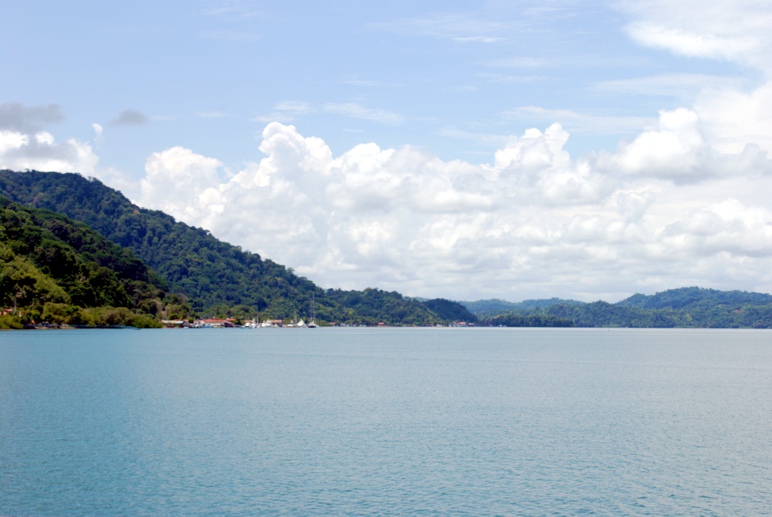
Golfito turn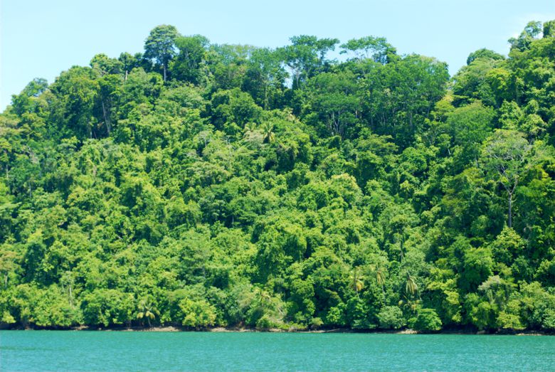 ed out to be a beautiful harbor, surrounded by mountains, with a charming town right outside of the dock. There are a few small marinas, and we stayed at the Fish Hook Marina, surrounded by big sportfishing boats. We caught the city bus just outside of the marina, and did a little provisioning in town. Of course, it rained for most of the afternoon, but we did finally see some scarlet macaws flying overhead – our first wild parrot sighting!

The next day we confirmed the checkout procedure with the marina office. First was immigration, a short bus ride down the main street. Then we would go to customs, located by the Zona Libre shopping area. After that, we would pay the Zarpe fee at a bank and then proceed to the port captain to get our Zarpe. We had originally planned to check out on Thursday, May 8th, but the office advised us that the 8th was inauguration day for the new President. Although not an official holiday, it was unlikely that the Federal offices would be open. We decided to expedite our checkout and hopped on the bus.
Once at the immigration office, we ran across Mary and Pete from Neko, one of the boats that had been at the El Salvador Rally. We compared notes, and since we had similar agendas, we decided to buddy boat to Panama together. We finished the immigration procedures and caught a taxi to the Customs Office. The driver didn’t know where the office was located, but we knew it was at the Zona Libre. This is a duty-free shopping area, where you have to get a ticket (free) but for the following day. Locals make a small industry out of selling tickets for immediate entry, and it was a bit of a zoo. We found the Customs office, filled out the forms, and proceeded to the bank. Central American banks are crowded and always have armed guards outside and inside. For some reason, they won’t allow you to wear a hat – maybe some gangsters hide pistolas under their hats… We paid the Zarpe fee, around $25, then proceeded to the Port Captain to pick up the Zarpe. We were free to check out the next day!
We showed Mary and Pete the better grocery store, and made a final visit to Pollos Hermanos. We had a couple of drinks with the Neko crew at their “marina”, Land Sea Services. The place offers mooring balls and a host of services at a very inexpensive price. Neko wanted to get fuel in the morning, so they would catch up with us somewhere in the islands. We had a final Costa Rican dinner on board and prepared to depart at first light.
May 8th, 2014: Golfito – Puerto Armuelles, Panama
We departed the Fish Hook Marina at 6:00AM for the sixty-five mile run to Puerto Armuelles, our first stop in Panama. This anchorage is an open roadstead, but we didn’t want to arrive at a better anchorage after dark. The swells were minimal, so we figured it would be OK. Although we were going out against the tide, we made reasonable speed at 1800rpm’s. After we got around Punta Bl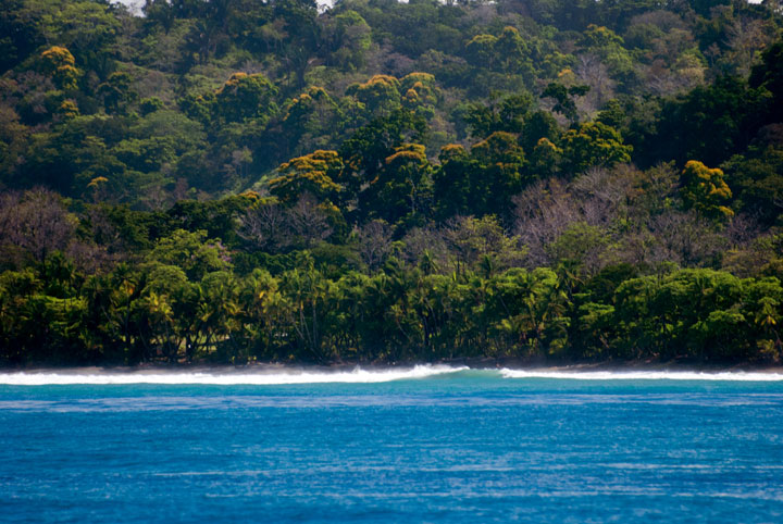 anco, exiting the Golfo Dulce, our speed jumped over seven knots. Woo-hoo! The swell in the ocean was light, but the surf was still running well as we passed by Pavones, a popular surfing area.
We continued due south around Punta Burica, crossing in to Panama. Just off the point is a small island, Isla de Burica. It was heavily forested with trees, and the spit of the end had some beautiful palm trees on the beach – this looked quite dreamy.
We rounded the point and turned due north into Golfo de Chiriqui. After facing head seas all day, we now had a very smooth following sea. This area has a long, fairly flat beach on the coast, but the depth is tremendous just offshore. We were in over six hundred feet of water barely a mile offshore. I did see some boats anchored offshore, so I rechecked the guide, to find there was an anchorage of sorts, another open roadstead called Punta Balsa. We had already passed it by a couple of miles, so we decided to continue to Armuelles. Thanks to our decent speed, we arrived at 3:30, about an hour before we expected too. We decided to anchor further south of the old banana boat pier than the cruising guide had recommended – the bottom looked flatter further south. We dropped the hook in thirty feet of water, and decided to deploy the flopper stopper, since we were in a medium beam swell.
Position at destination: 8°37’ N, 83°09’ W
Air temp: 91, Water temp: 91
Nautical miles for this leg: 63.0 Total: 4062.4
Departed at 6:10am, arrived at 3:45pm
Just after we finished settling in, we heard a hail in indecipherable Spanish on the VHF. The hail was repeated a couple of minutes later, and I got the sneaky feeling that despite being a mile from the town, the Capitania de Puerto was calling us. We had understood that when entering Panama with the intention of crossing the canal, it was acceptable to not check in until arriving in Balboa. Armuelles was an official port of entry, but we wanted to wait until Balboa for check in. A few minutes later I saw a large panga with a big Panamanian flag flying, and I told Rose that we were about to get a visit from the authorities. Sure enough, the boat was chock full of local authorities: the Port Captain, immigration, customs, and agriculture inspectors, as well as two boatmen. They tied up to our stern and came on board. Immediately the Port Captain pointed to our boat deck, waved his finger rapidly, and yelled, “Problem! Problem!” We hadn’t had time to take down our Costa Rican courtesy flag, and it was definitely offending the Port Captain. We explained that we had just entered Panama, and we hoisted the Q-flag, taking down the offending flag. I explained to the Port Captain that we planned to check in Balboa, but he was having none of it, insisting that we check in immediately. I later reasoned that the Port wasn’t busy these days, and the officials were anxious to justify their jobs.
So, they proceeded to assault me with check-in formalities. The Port Captain spoke a reasonable amount of English, and we were able to communicate effectively. The other officials were impatient, wanting to get their stuff done first. I had to provide them with copies of all of our documentation, and the customs and agriculture inspectors did a cursory examination of the boat. For the first time in our journey, the agriculture inspector wanted to see Quincy’s paperwork but all was well. And then came the fees – everyone had their hand out, but they did all give me receipts. At the end, the Port Captain said that I needed to come ashore to get the cruising permit, as well as for our passport stamps. He wanted us to anchor closer to town, where he said there would be less rolling. But they also wanted us to tow the panga. We pulled up the flopper stopper, raised the anchor, secured the panga, and took the entourage towards town.
 We anchored just north of the old banana boat pier, a rusting remnant of good times in the past. I jumped in the panga, and we went around to the south side of the pier. It was low tide, and there was no real ladder to get up the pier. The Port Captain explained that he and his crew would be climbing up the pier, but that it was too dangerous for me, so they would land me on the beach. I didn’t argue the point. They looked like spider monkeys clamoring up the rusty remains of the pier. Once on the beach, the Port Captain gave our passports to the immigration officer, and then he took me to his office. He proceeded to fill out more paperwork on an ancient typewriter, hunt and peck style. There were a couple of old computers and printers in the office, but they seemed to prefer using the typewriter with the multiple carbon copies. He created crew lists and a domestic Zarpe for us, of course accompanied by a fee.
Eventually a woman came into the office, apparently from the maritime authority. She created the cruising permit for us, which was quite expensive at $193. Here is a list of the various fees that we were charged, to the best of my memory:
Cruising permit $193
Port Captain Declaration $20
Immigration $25 (more on this later)
Agriculture inspection $35
Domestic Zarpe $15
Customs inspection $20
I was also charged $20 for the panga ride. The fees paid in Panama can vary widely according to the mood of the local authorities. Overall, I don’t think we were overcharged, especially since they could have charged us for overtime, since we didn’t finish until after 6:30PM. Noonsite has an excellent summary of the fees paid by cruisers.
Finally I was taken back to Tropical Blend in the dark by our friendly neighborhood boatmen, now $20 richer. Rose was anticipating my mood, and she had a dinner of salads and spaghetti and wine ready to go. We had a lot of laughs about the experience, especially the “Problem!” we had caused with our Costa Rican flag.
May 9th, 2014: Puerto Armuelles – Isla Parida
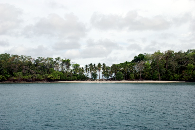
 Under clear skies, we left Armuelles bound for Isla Parida, part of the Gulf of Chiriqui Marine Park. As we were leaving, a fairly modern-looking fishing vessel, the Diva Maria, was anchoring off of Armuelles. With flat seas, we headed out to Isla Parida. Once at the island, we had to search a bit to find a protected anchorage, as the wind and swell had kicked up.
Based on the information in the Bauhaus guide, we had planned to anchor on the west side of the island, but those spots looked a little rough. We continued around the north end and found a great spot between Isla Parida and Isla Gamez on the east side. It was well-protected and calm, with a beautiful palm-tree encrusted beach just off of our bow. A few fishing boats were coming and going, but we were the only cruising boat anchored there. As we were relaxing later that afternoon, I heard the tell-tale sound of the fresh water pump cycling off and on. Apparently we had yet another failure of the Flojet water pump – changing it was getting really old. We had another spare on board, but I decided to wait until the next day to make the swap, being somewhat infected by Panamanian laziness.

Position at destination: 8°07.7’ N, 82°19’ W
Air temp: 87, Water temp: 87
Nautical miles for this leg: 35.2 Total: 4098
Departed at 8:10am, arrived at 1:30pm
May 10th, 2014: Isla Parida – Islas Secas
Our next destination was Islas Secas, a group of sixteen mostly private islands in the Gulf of Chiriqui. It was a short twenty-mile cruise, and we arrived before noon. We anchored next to Neko, down from Golfito. After lunch, I decided to tackle the water pump. I changed in the newest spare, only to find that we still weren’t getting any water pressure. I decided that the old accumulator tank had finally failed, and I decided to just by pass it. This wasn’t as easy a task as I was expecting, and it turned into a several-hour job. Mary called us on the radio and said they were going to shore with their dog Lucy, so we decided it was a good time for a break.
Position at destination: 7°59.6’ N, 82°02’ W
Air temp: 89, Water temp: 86
Nautical miles for this leg: 20.2 Total: 4118
Departed at 8:20am, arrived at 11:30am

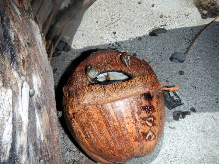
On shore there was a very narrow beach separating the two sides of the island. There was a lot of driftwood, including coconuts. We turned one over and found a hermit crab condo. The water was very warm, but murky, as the small swells were licking up a lot of debris. We tried to snorkel, but the visibility was very poor. That night we invited Pete and Mary over for some tuna sushi, and we learned that their dog Lucy had major separation anxiety: she stood on the bow barking the entire time they were on board.
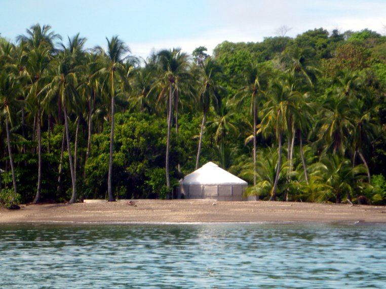
The next day we did some dinghy exploring of the island. There is a resort on shore that features very expensive tents that resemble Mongolian yurts. We also found a few small sea caves. Overall, Islas Secas were very beautiful, and fairly deserted.

May 12th, 2014: Islas Secas – Bahia Honda
After a couple of days at Islas Secas, it was time to continue our journey eastward to the Panama Canal. Our next destination plan was Ensenada Rosario, a cove on the mainland coast. On our arrival, the weather turned a little ugly with a small squall. We checked out the anchorage, but it seemed to be too rolly, so we continued south to Bahia Honda, a well-protected wide bay on the mainland.
We entered Bahia Honda and decided to anchor on the southeast side of the village, which is on an island in the bay.

Position at destination: 7°45’ N, 81°31’ W
Air temp: 86, Water temp: 88
Nautical miles for this leg: 40.7 Total: 4158.5
Departed at 8:30am, arrived at 3:00pm
There were a lot of local people paddling around in Cayucos, which are small dugout canoes. Shortly after we dropped anchor, a couple of canoes carrying teenaged boys showed up. Rose asked if they wanted something, and they nodded yes. She gave them a couple of packages of Chips Ahoys. A few minutes later, the word got out and an army of Cayucos bearing children were heading straight for us. Unfortunately, we had no more cookies to give, or any other candy, but the kids didn’t understand, and hung around for about a half an hour. No good deed goes unpunished. We heard from Neko on the radio – they were at the north end of the bay, near Domingo’s house. Domingo was mentioned in the Sarana guide as an older Panamanian that was always welcoming to cruisers. We decided to move and join Neko the following morning.
May 13th, 2014: Bahia Honda Village – Bahia Honda Domingo
The next morning we made a daunting voyage of two miles to Domingo’s house on the north end of the bay. We anchored near Neko, and we were the only cruising boats in the entire bay. We learned all about Domingo and his family from Pete and Mary. Domingo lived on one house, while his son had another one on the beach. His daughter worked in David, and came to the bay on occasion. Domingo lamented that not many cruisers came to Bahia Honda anymore, and he blamed it on the government’s increase of the fee required to visit the offshore islands for diving. He had asked to trade fresh produce for some items, including school backpacks, a winter coat or jacket for his wife, and a few other odds and ends.
Domingo had asked Neko for some help moving some things from his panga to his house, so we took the kayak to his beach to help. It turns out that he had a roll of chain link fence and a new 40hp outboard motor. Needless to say, it took all three of us to haul these items up the beach to his house. After mule duty was over, we talked with Domingo and his wife, in broken Spanish. He didn’t speak much English, but he was used to speaking with cruisers, as his Spanish was slow and simple, so we were able to converse. He had a farm, and he offered to give us some fresh fruit later, which we gladly accepted. We gave him some items off of our boat that we thought he could use. He offered to take us to a local village up one of the mangrove creeks later that afternoon.
After our visit we joined the Neko crew on a kayak tour of the area, paddling past the shoreline and up some of the estuaries. They had an inflatable kayak with the pedals – very cool.


The “Domingo” anchorage Mary and Pete and a dog named Lucy
The forest on the shoreline was incredibly thick, but we didn’t see too much wildlife. We did see a snake in a tree, and we found out that Mary has a “respect” for snakes… After lunch, Domingo picked us up for the ride to the village, using his brand-new Yamaha 40hp motor of which he was very proud. We motored up a long mangrove river to the village of Salmonete. There were some guys on a boat selling lobsters, so we bought four of them at $5 each. The village was pretty rustic, but it did have electrical power. There were a lot of political signs around for the presidential election. The village consisted primarily of a few residential buildings and a church. There was a concrete sidewalk, necessary with all of the rain in the area.

Lucky, Pete, and Domingo
 After we left Salmonete, Domingo took us to the main village at Bahia Honda. There some tiny tiendas where we bought some soft drinks. Then we walked up the hill to the school. This school takes kids from the village and surrounding countryside, and it includes weekly boarding for the kids that come a long distance. It was nice to see that Panamanians understand the value of education. The view from the school was really beautiful.
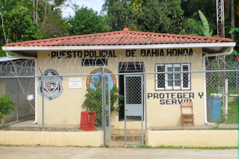
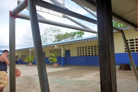
Bahia Honda Police Station La Escuela
 After the village tour, Domingo returned us to our respective boats. A little later, he showed up with gifts of fresh produce: two pineapples, a huge bunch of green bananas, two giant avocados, and an enormous bunch of cilantro leaves. We tried to talk him into keeping some, but there was no stopping him. We hung the bananas outside to wait for them to ripen.

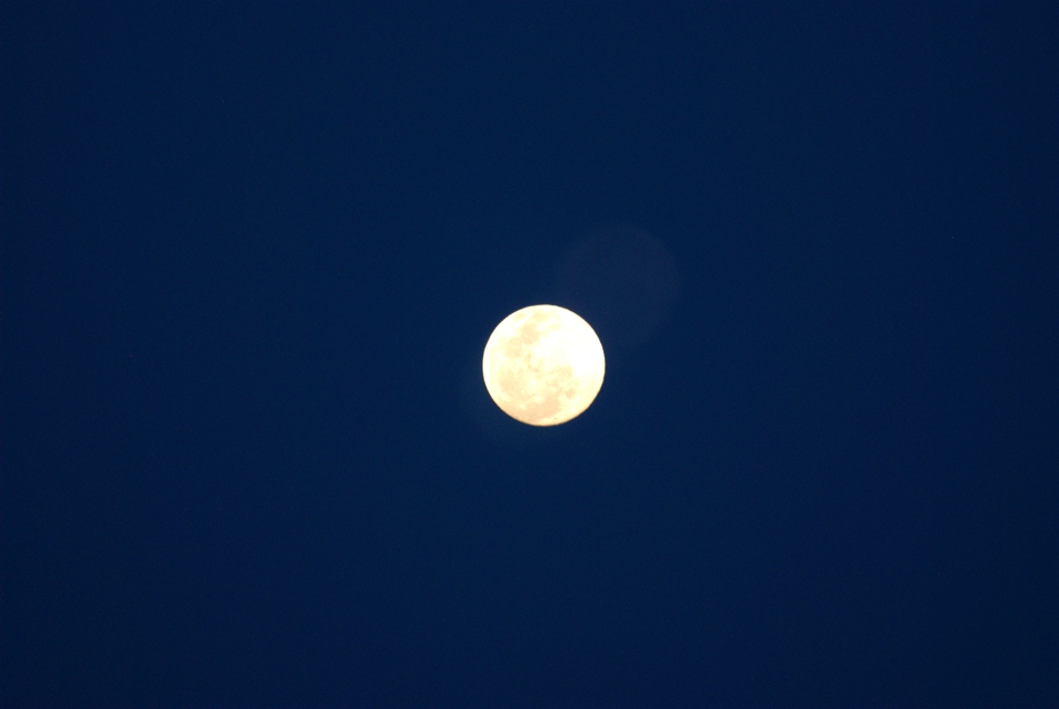
We had the lobsters for dinner. We boiled them, but we weren’t sure how long they should boil. We guessed short, and finished them off in the microwave. They were already dead when we bought them, so the quality wasn’t so good. But considering that this was our wedding anniversary, we enjoyed the meal, topped off with champagne. There was a full moon that night, which always looks huge in the tropics. We took some pictures, but they never do justice.
May 15th, 2014: Bahia Honda – Isla Cebaco
After three lovely nights in Bahia Honda, it was time to resume our journey to the Panama Canal. We agreed with Neko that we would make several relatively short day hops before taking a long overnight passage around Punta Mala. Today’s journey would lead us out of Bahia Honda, southeast to Isla Cebaco. It was a great day for cruising under overcast skies, and we anchored between Isla Cebaco and Isla Gobernadora. We probably could have continued to our next stop, but both Neko and we were in a mood for relaxing.
Position at destination: 7°33’ N, 81°07’ W
Air temp: 87, Water temp: 83
Nautical miles for this leg: 33.2 Total: 4193.9
Departed at 8:00am, arrived at 1:10pm
May 16th, 2014: Isla Cebaco – Ensenada Naranjo
This would be our last short leg before the trip around Punta Mala. It was an easy twenty-four mile run with some favorable currents and light winds. When rounding Isla Cebaco to the southeast, there is a reef about a mile offshore called English Rock. It was interesting to see waves breaking so far offshore with no visible formations around them – thanks for charts!
 As we approached Ensenada Naranjo, Neko caught up with us, and we took some nice shots of them under sail. Ensenada Naranjo is a small bay on the mainland, just a little north of Punta Mariato, which marks the eastward turn towards the Gulf of Panama. There was no village at the bay, but there were a lot of cows. That, and the approaching rainstorm, discouraged us from going ashore, so we had a lazy, relaxing afternoon.
Position at destination: 7°16.5’ N, 80°55.5’ W
Air temp: 88, Water temp: 85
Nautical miles for this leg: 24.9 Total: 4218.8
Departed at 8:45am, arrived at 12:45pm
May 17th – 18th 2014: Ensenada Naranjo – Isla San Jose (Pearl Islands)
The next morning we took a last look at the weather report and called Neko. We agreed that the weather looked favorable for a passage around Punta Mala, and departed a little after 8:30. We expected the passage would take a little over twenty-four hours. The forecast near Punta Mala called for W to SW winds at 15 knots, with three to four foot long period swells. As we departed around Islote Roncador, the seas were confused, but once we turned due east, they calmed down to an orderly fashion. At this point, we were as for south as we would get on our journey to the canal.


Around noon, our pleasant day was slammed in the nose by a strong east wind, blowing around thirty knots right on our nose. The winds waves built very fast, and soon we were slamming into steep seas. Our anchor was getting air time, so we pulled into the beam and Rose worked for a long time to build a complex web of lines that restricted the anchor bounce. We turned back into the maelstrom, and heard Neko call a westbound sailboat. They said that it had been blowing from the east since they rounded Punta Mala, so we resigned ourselves to our fate. It wasn’t so bad that we needed to pull in, and it actually improved throughout the afternoon. By nightfall, we had minimal winds and calm seas, and we rounded Punta Mala without fanfare, and turned NNE towards the Pearl Islands.
Around 10:00PM, I was taking a nap and Rose woke me up to check out the erratic movements of a sailboat heading towards us. It was pitch black, and I was much disoriented. She told me that the boat wasn’t responding to hails, and that it seemed to mirror our movements to get away from it. It took me a couple of minutes to figure out our heading, and we managed to avoid the erratic boat. Since I was now up, I decided to stay up for the night watch. Around midnight, the east wind returned with a fury, accompanied by driving horizontal rain. We were in a Gulf of Panama squall. Neko called and told us they were veering north to avoid sailing directly into the wind. Now that we were in the Gulf, large ships started popping up on the AIS, but we didn’t come close to them. We did see an odd flashing light on the water, which wasn’t notated on any chart. We didn’t get close enough to identify it, but it was pretty spooky. The rough weather stayed with us for a few hours before relatively calming down.
At dawn, we approached the western shore of Isla San Jose in the Pearl Islands. Our anchorage was on the southwest side where we expected shelter from the prevailing west winds. We were excited to see a lot of white sand beaches, and water that was clearer than anything we had seen so far. We dropped the anchor in forty feet of water, bearing in mind that it was high tide, at +fifteen feet!
Position at destination: 8°15.3’ N, 79°05.3’ W
Air temp: 90, Water temp: 85
Nautical miles for this leg: 141.6 Total: 4360.4
Departed at 8:40am, arrived at 10:10am
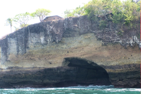
We spent a couple of relaxing days at Isla San Jose. It’s the second-largest island in Las Perlas, but it is private. There is no problem with cruisers landing on the beaches, so we did some exploring. We tried to do some snorkeling, but the water clarity still wasn’t great, so that was a short-lived adventure. We anchored in Ensenada Playa Grande on the east side, sheltered from both west and north winds. We were close to a rock wall that had a small hut on the top. There are sea caves in the area, and apparently the hut is used for fishing in one of the caves.
May 20th 2014: Isla San Jose – Rio Cacique (Isla del Rey)
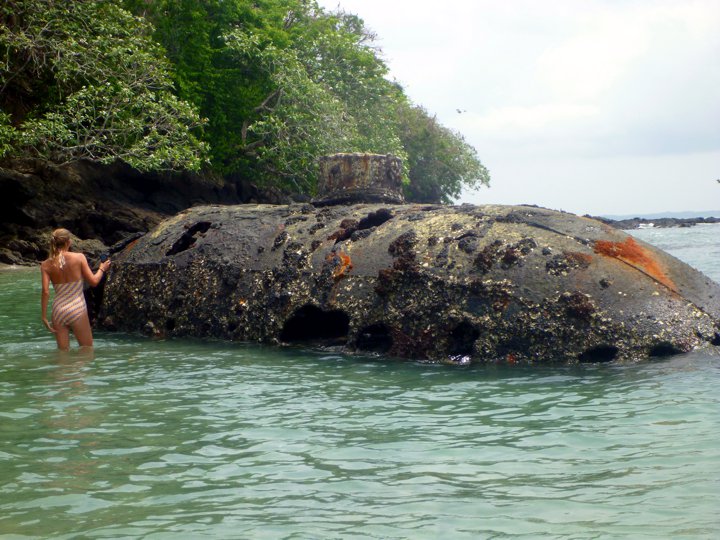
The Bauhaus cruising guide had a section about a 100-year old small submarine that was lying on the beach at Isla San Telmo. Pete was really interested in seeing this, so we decided to cruise over around lunchtime to see the sub, before continuing to the Rio Cacique anchorage. We went around the southern side of San Telmo before going around to the submarine beach on the northern side of the island. We both had a hard time anchoring, as the bottom was very rocky. As we were searching for flat ground, Rose was on the bow and saw a large submerged rock just below the surface that we fortunately missed. For the first time ever, we heard our anchor dragging on rocks, until it finally set in a sandy patch.
We went on shore to see the sub and the beach. The sub looked like a two-man midget sub, and it was well-rusted, with about half of it left.
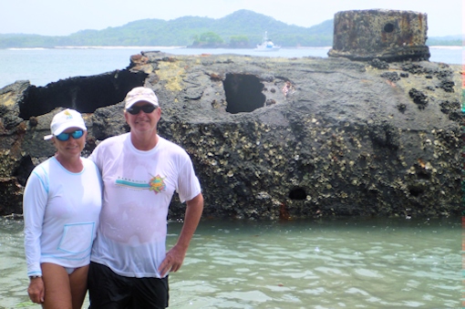 Mary checking out the sub Rosé and Lucky
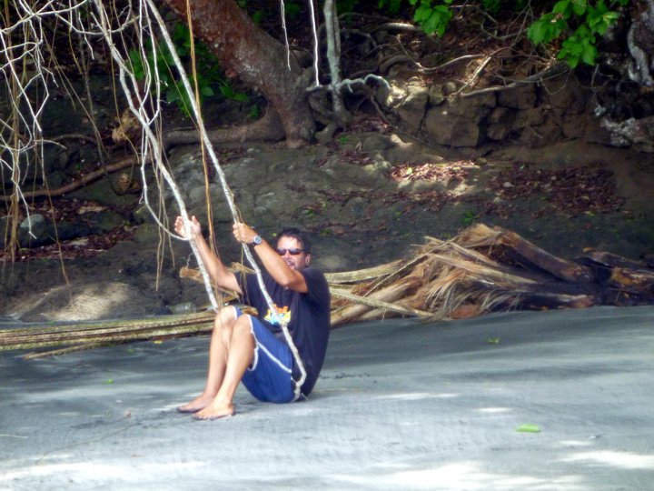 The beach at San Telmo Pete finds a natural swing on the beach
 Tons of pelicans on the beach
If you like pelicans, this is the place to be. There were hundreds of them hanging out on the beach – perhaps a pelican convention? Lucy took a dislike to them, and spent some time vainly chasing after them. The beach was nice, and there were some small caves in the rocks. Pete found a natural swing, but it couldn’t really support him…
We discussed options to get to our next anchorage, Rio Cacique on the big Isla del Rey. Looking at the Bauhaus guide, there was a passage through the reefs to get to Rio Cacique directly from the submarine anchorage. It was a little tricky, but is sowed twelve feet of water at low tide, which was the current tide state. The alternative was to go back around Isla San Telmo, which would take about an hour. We agreed that the direct passage would be okay, and we volunteered to go first. We idled through the passage, and we did indeed see twelve feet. We radioed Neko to let them know we got through clean, and to follow our track. About a minute later, we got a frantic call from Neko saying that they had struck a rock before they got to the reef passage. They weren’t taking on water, but they turned around to go all the way around the island. We guessed that they might have hit the submerged rock that Rosé had seen when we were anchoring. We continued to the Rio Cacique anchorage.

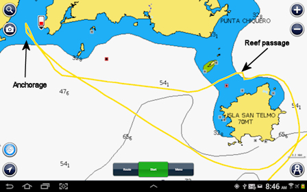
Close up of the jog through the reef Track around San Telmo
 About an hour after we got to the anchorage, Neko arrived. Pete dived the boat to check out the damage. He told us that one of the dagger boards was pretty chewed up, as was the skeg on the starboard pontoon. Both would need to be fixed, but it wasn’t enough to stop their cruise at the time. We agreed that we would both go to Isla Contadora the next day, where there was civilization and phone service. A big thunderstorm came by, filling the dinghy with water. After the storm passed, I turned on the dinghy bilge pump to drain the water, but nada – the pump would not run. I don’t think that pumps like me very much… I had to bail and run out the water.
Position at destination: 8°18′N, 78°54W
Air temp: 90, Water temp: 85
Nautical miles for this leg: 23.2 Total: 4383.6
Departed at 8:30am, arrived at 2:45pm
May 21st, 2014: Rio Cacique (Isla del Rey) – Isla Contador
We left the next morning for Isla Contadora, with no wind, smooth seas, and a current pushing us, for the first time in a very long time. We decided to take the safe route around Isla San Telmo, avoiding any uncharted rocks or reefs. It was a beautiful day for cruising, and we were treated to some great scenery. At one point, we were going nine knots, thanks to the current!
We were really flying! Shoreline of Isla Rey
We arrived at Isla Contadora. This is the most populated island in the Pearls, supposedly with restaurants and grocery stores. We anchored on the north side, just off a beach and a relatively large hotel.
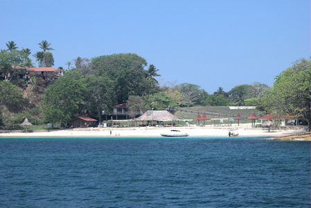
South side of Isla Contadora Playa Galeón at The Point hotel
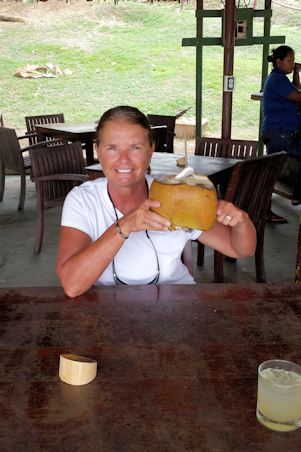 We went ashore to the beach bar, and Rosé enjoyed a very fresh rum and coconut drink. After a round of sundowners, we walked up the small hill to see civilization. There were a few small restaurants, and a very small grocery store. The store carried mostly snack food, although there was some reasonable produce. The prices definitely reflected the tourist nature of the island – Contadora is a big weekend destination for people living in Panama City. The airport was on the hill just above the beach, and ferries came through fairly often. With no dock in town, Panamanian pangas shuttled the passengers to the beach. It was more of a problem for us, as the tide was getting pretty extreme here, at around fourteen feet. We could anchor off of the beach for short visits, but we agreed that we would need to use Neko’s dinghy on wheels for any longer visits. However, one of the tires was flat, so dragging it up was a real chore.
Position at destination: 8°38′, 79°02W
Air temp: 87, Water temp: 86
Nautical miles for this leg: 34.9 Total: 4418.5
Departed at 8:00am, arrived at 1:30pm
We had dinner at a German restaurant on the south side of the airport. We decided to have pizzas, strange fare for a German restaurant. During dinner, a deer sauntered by and the restaurant gave it some food. Apparently, it’s kind of a pet there. During our stay, we wandered around the island, and we saw some very nice houses. There were also a lot of failed developments, with half-constructed buildings. Most people got around on golf carts. Mary had read about a really good restaurant called Casa Tortuga, owned by an Italian chef. We had some general directions, and started walking in what we thought was the right way. After a long walk, someone came by on a golf cart and offered us a ride for the rest of the way – very nice. The restaurant was at Chef Piero’s house. The menu has a fixed price course, with the main dish changing every night, or you can order a pizza. We decided on two pizzas and one main course. It was the best pizza we had eaten in a very long time. If you go to Contador, we highly recommend Casa Tortuga. We talked with Piero for a while. He had lived and cooked in the San Blas Islands for several years, so he gave us some opinions about the best places to go. We got golf cart rides back to the beach, where we found the surf was up a bit. It was a challenge to drag the dinghy down to the water and negotiate through the surf, but we managed without much incident.
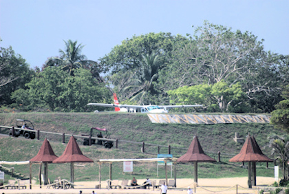
The “airport” just above the beach Ferry from Balboa
May 23rd, 2014: Isla Contador – Mogo Mogo Island
Rose arrives at Mogo Mogo
We had read that Mogo Mogo Island, just south of Contador, was where Survivor: Pearl Islands was filmed. We wanted to see this place, being big fans of the television show. Pete and Mary decided to stay at Contadora, as they were trying to make arrangements to get Neko repaired in Panama City. It was only five miles to the anchorage, and it was a beautiful day. We hopped in Little Blend to have a look. The shows were filmed in 2003, so we knew that the jungle had reclaimed everything. The island was alos used for the Israeli version of the show in 2008. We landed on a beach that we thought might have been used by one of the tribes, and walked through the jungle to another likely looking beach. We took the dinghy further south, and we found a clearing that we thought might have been used for tribal council. Irrespective of Survivor, it was a beautiful place.

Small beach on Mogo Mogo View from the anchorage
Could this be one of the tribe’s beach?

This is the place! Tropical Blend, the sole survivor
Position at destination: 8°35′, 79°01.5W
Air temp: 93, Water temp: 86
Nautical miles for this leg: 10.2 Total: 4428.7
Departed at 10:30am, arrived at 3:45pm
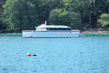
We returned that afternoon to Contadora. It was Friday, and a few boats had arrived from Panama City for the weekend. The bananas that Domingo had given to us decided to ripen – all on the same day! We made a couple of drinks, and peeled and froze the rest. Pete and Mary had found out what I knew to be true – there was no way we were getting in to either Flamenco or La Playita marinas. Flamenco had actually responded to my inquiry, but said they were full. They thought they would have new docks open in June. La Playita never responded at all. There simply is no space for transient boats at these marinas.Most transients take mooring balls at the Balboa Yacht Club, just outside the entrance to the canal – they also said they were full. Mary did find open mooring balls at Taboga Island, about ten miles from Panama City. We decided to join them there while we prepared for our canal crossing.
May 23rd, 2014: Isla Contadora – Isla Taboga
We hoisted the anchor and said adios to Isla Contadora. The sea was as calm as glass, and the northbound current pushed us along quite well. We covered the thirty-four miles in five hours, and arrived at Taboga under threatening skies. A squall was picking up, and we were expecting to get pounded by rain. The owner of the moorings, Chuy, came out on his dinghy to help us tie up to the ball. Our bow sits seven feet over the water, and getting a painter when it is windy can be quite challenging. With Chuy’s help, we were soon snugged to the mooring. The squall never happened, and we had a relaxing afternoon.
Position at destination: 8°47.6′, 79°33’W
Air temp: 87, Water temp: 86
Nautical miles for this leg: 34.1 Total: 4462.8
Departed at 8:45am, arrived at 2:00pm
Click here to continue reading the story of our Panama Canal crossing.