


March 1st: Oven Rock – Cave Cay
Our next destination for the Exumas tour was Cave Cay, about eight and a half miles down the chain. Getting to the anchorage required a precision course over the sand drifts on the bank, but the Explorer charts were dead-on, helping us to arrive incident-free.
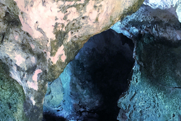
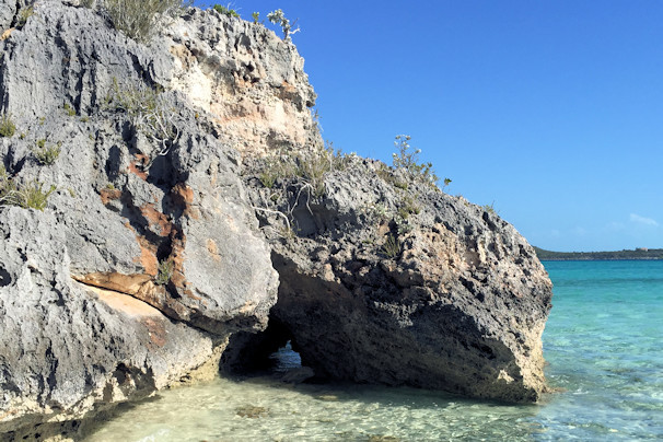
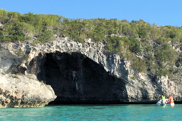
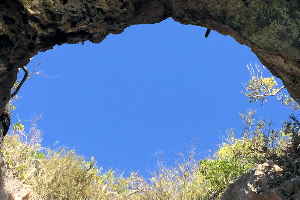
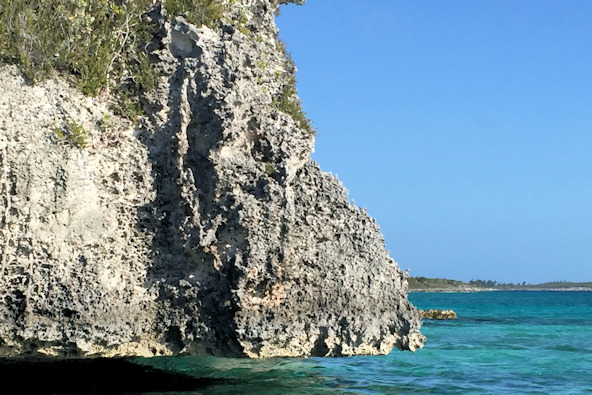
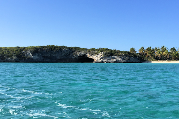
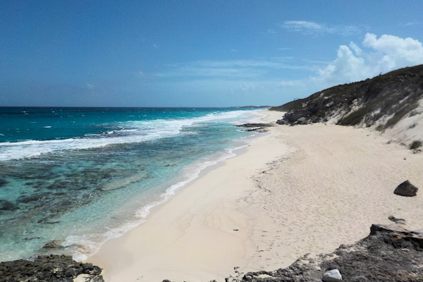
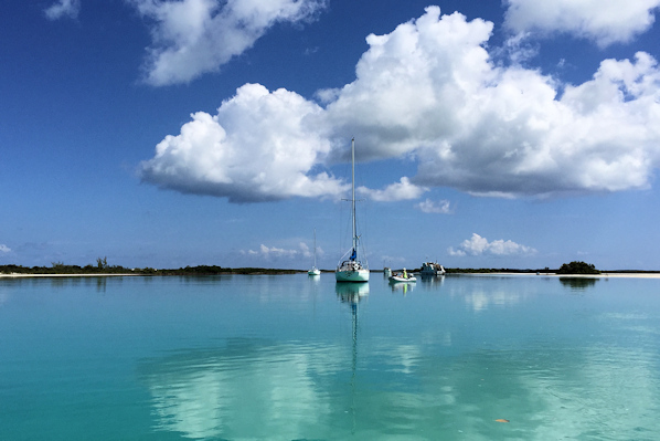
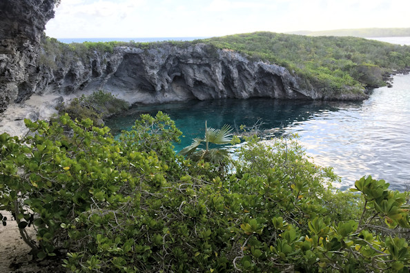
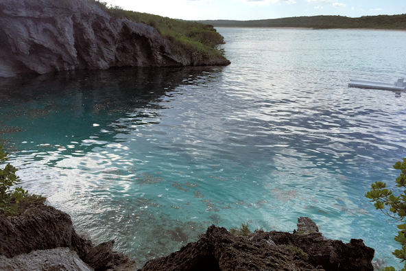
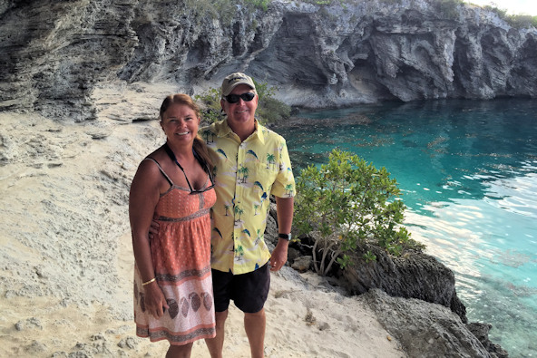
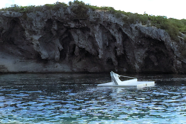
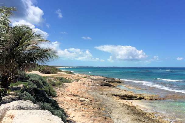
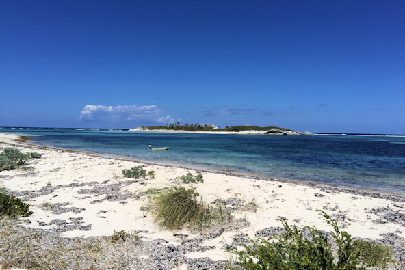
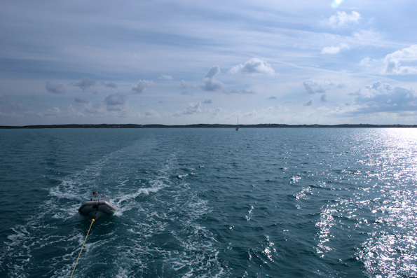
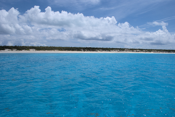
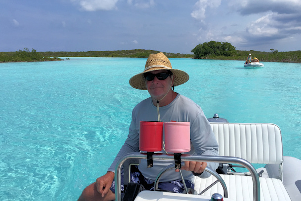
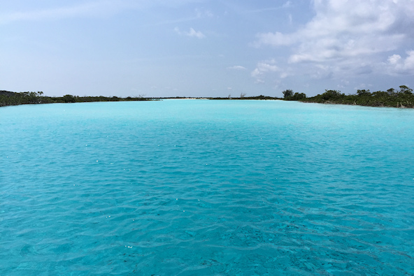
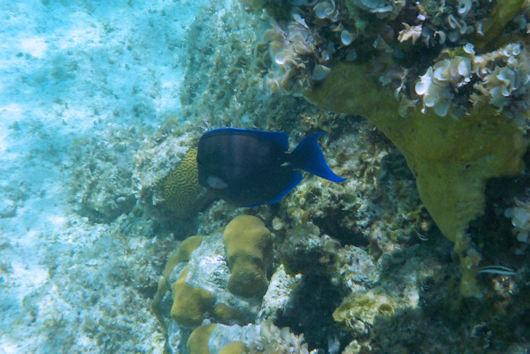
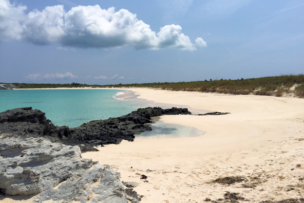
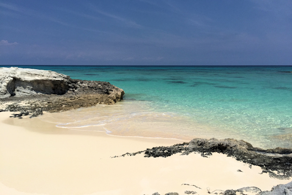
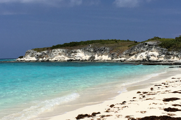
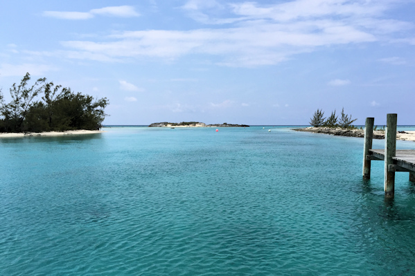
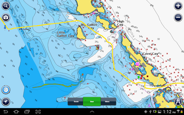 Cave Cay has a well-protected marina inside it, but we opted to anchor outside of the cut. We took a dinghy tour of the area, starting with the small cave that we supposed was the inspiration for the cay’s name. It was tiny, but worth a quick stop. After that, we went south to Musha Cay, where there is supposed to be an underwater sculpture of a mermaid playing a piano, place by David Copperfield. We couldn’t find it, so we just continued to explore the area. There is a large lagoon inside of Rudder Cay that looked like a good place to hide from a hurricane. Also on Rudder Cay, we found another sort of cave that was open to the water, with an open roof as well. Around the side, we could see a gap between the rock formations and the water, since it was low tide. We didn’t find the piano-playing mermaid, but we thoroughly enjoyed the tour.
Position at destination: 23°54.104’ N, 76°16.206’ W
Air temp: 80°, Humidity: 57%, Water temp: 79°
Nautical miles for this leg: 8.58, Total: 7155
Departed at 12:55pm, arrived at 2:30pm
The cave at Cave Cay – duh Typical crystal clear Exumas water
Another cave, this one at Rudder Cay A cave with a sunroof
Mind the gap between the water and the rock Musha Cay
March 2nd: Cave Cay – Lee Stocking Island
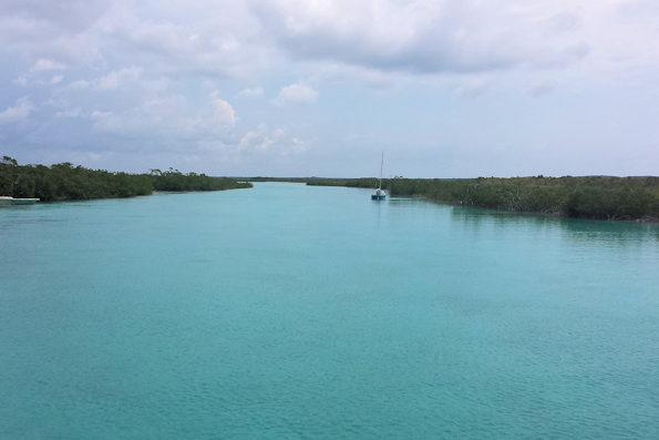
The next stop on the way to Georgetown was Lee Stocking Island, which has a protected anchorage on the bank side of the island. We knew some weather was coming our way, so we wanted to get to the protection that day. Slack tide through Cave Cut was at 12:00 that day. A few minutes before we left, I took the dinghy through the cut to be sure there were no breaking waves, and it was relatively calm, so we proceeded out to the sound. Once in the sound, we felt like we were in the ocean again, with SE swells around four feet off of our starboard bow. It wasn’t too rough, but it had been a long time since we felt like that.
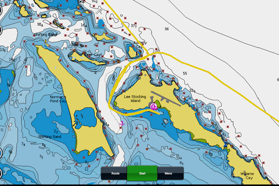 We entered Adderly Cut, which was plenty deep enough at around twenty-five feet. Once we rounded the island and turned east, the depth disappeared, and we found ourselves in seven to eight feet. Globetrotter thought they had a way across the shallow bank to the south, which would save us some time when we left. They quickly ran aground in the sand, and since it was mid-tide, they gave up on that idea and powered back to the anchorage. There were a number of mooring balls in the anchorage, but we had no idea if they had been maintained. There is an abandoned research center, the Caribbean Marine Research Center on shore. The moorings were originally associated with the center. We eventually decided to anchor, as we did not trust the moorings. Globetrotter was feeling lucky, so they tied up to one of them.
Position at destination: 23°46.280’ N, 76°06.325’ W
Air temp: 81°, Humidity: 61%, Water temp: 78°
Nautical miles for this leg: 13.73, Total: 7169
Departed at 12:00pm, arrived at 2:30pm
March 2nd – 6th: Lee Stocking Island
We had to lay up waiting for some weather to clear through. Although this was a remote anchorage, there were a number of things that we could see. We walked through the abandoned center, which was still in fairly good shape. Unfortunately, we didn’t take the camera with us, so no pictures. We walked through the forest to the ocean side, and we were greeted by a huge, gorgeous half-moon beach. At the end of the beach, we found another trail that seemed to lead back to our dinghies. Along the way, we came across a paved airstrip, still in good condition. This would make a great drug smuggling center!
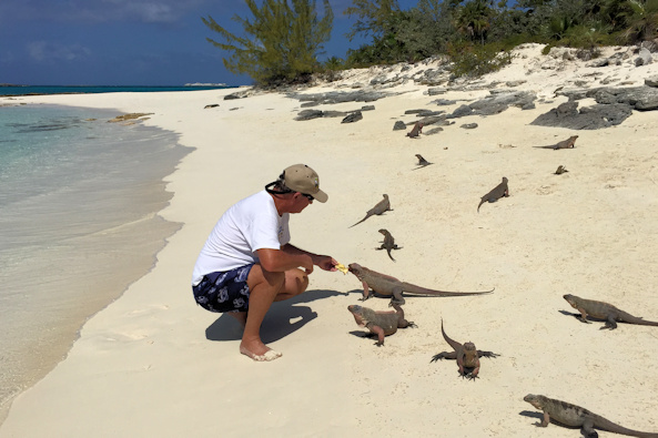
The other place we went to was Leaf Cay, home to a large colony of iguanas. They have pink legs, which we had never seen before. There must have been close to a hundred of them, and they were obviously being fed by boaters. We brought along some carrots and old lettuce with us, and we were able to hand feed them. We also witnessed a fight for domination of the beach by two of the really big males. It wasn’t so much a fight as a triumph of the will. Most of the time they just leaned on each other. After about twenty minutes, one of them gave up and sauntered away.
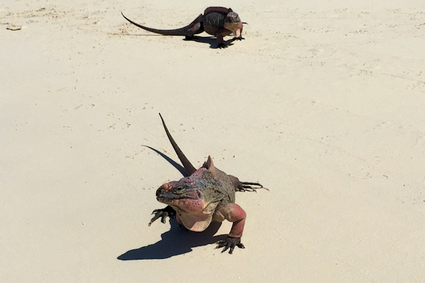
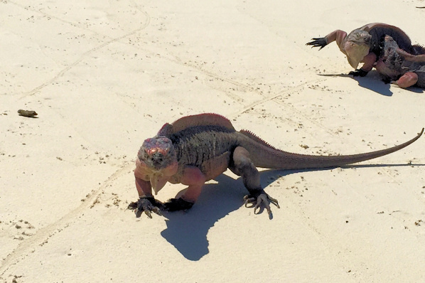
Did you remember to bring lunch? First in line
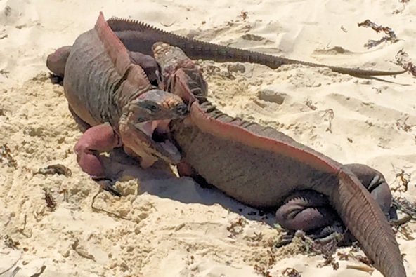
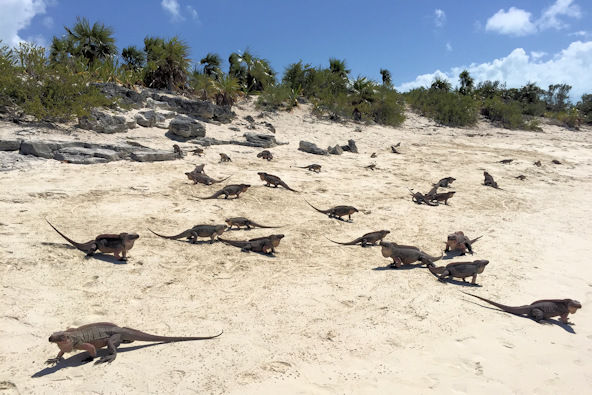
The fight is on! Iguanas everywhere
You’re probably wondering why I called you here View from the beach
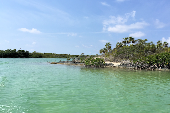
After playing with the iguanas, we went around to the bank side of Norman’s Pond Cay. There was a primitive campground there, apparently for people that are kayaking and hiking around the island. We walked along the shore to the entrance of Norman’s Pond, which is a short mangrove river. We walked up the river to the pond, which is quite large. Along the shore, we saw a ton of starfish and some live conchs.
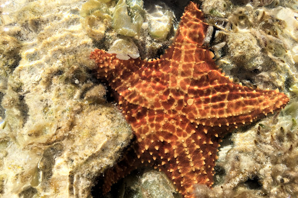
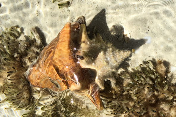
Starfish and conch in the shallows of the cay. Yes, the water was really that clear.
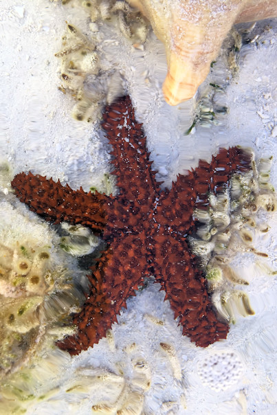
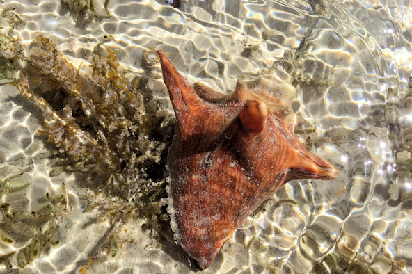
Different starfish and another conch
It was a wet ride back to the Tropical Blend, as the wind on the eastern side of the cay kicked up the wave fetch. We reviewed the weather again, and it looked like we would have a decent day to cruise down to Georgetown.
March 6th: Lee Stocking Island – Georgetown (Monument anchorage)
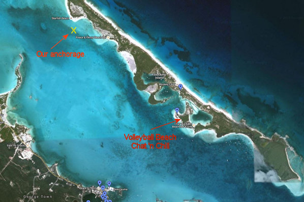
We left with Globetrotter early in the morning to catch the slack tide at Adderly Cut. Once we cleared the cut, we set our lines out for fishing, since it was fairly calm, but we didn’t have any luck. After a few hours, we entered Elizabeth Harbour and started looking for a good place to anchor. Being the middle of March, we missed the peak season by a couple of weeks. Georgetown is one of the biggest cruisers community around – at its peak, there are as many as six hundred boats anchored throughout the area. The most popular anchorages are on the east side of Elizabeth Harbour. We found a likely looking place near Starfish Beach on Stocking Island. We anchored in close quarters, as is necessary in Georgetown. In just ten feet of water, we only played out fifty feet of anchor chain, to avoid any swinging issues with the other boats around us. A few days later, we heard that the count of boats in Georgetown was three-hundred and fifty!
Position at destination: 23°31.655’ N, 75°46.019’ W
Air temp: 80°, Humidity: 64%, Water temp: 80°
Nautical miles for this leg: 27.02, Total: 7196
Departed at 7:40am, arrived at 12:30pm
March 6th – 17th: Georgetown
Georgetown is a huge cruising area every winter. Many of the cruisers coming here have been doing so for years, and there are many organized social events taking place daily. Georgetown has been accurately described as “day camp for adults.” During peak season, each day is jam packed with organized activities, pot lucks, and informal get-togethers at Volleyball Beach, all outlined clearly during the structured Cruiser’s Net every morning at 8 am on channel 72. Some cruisers avoid Georgetown like the plague, since they hate “organized” cruising, but you certainly don’t have to join in activities to enjoy the place.
Georgetown is really made up of two places, Stocking Island and Georgetown proper on Great Exuma Island. Stocking Island is the cruisers side. There is a bar/restaurant named Chat ‘N Chill, a ton of nice beaches, lots of hiking trails, a few resorts, and infinite places to tie or beach your dinghy. It’s also where many of the organized activities take place. Across the harbor is Georgetown, a real town with real Bahamians. It has the largest grocery store we’ve seen in the Exumas; consistent access to propane, a butcher, free R.O. water, a nice bar with Wi-Fi, a nice, long pier for dinghy tie-up, and lots of other fun: city-like, cruiser-friendly stuff. In between Stocking Island and Georgetown is Elizabeth Harbor with a ton of anchorages for all of your directional, social, and weather needs.
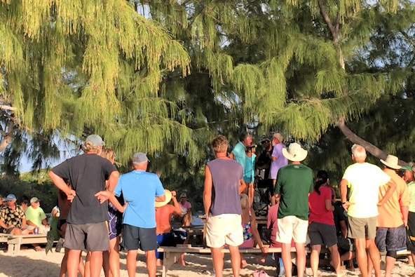
We went ashore at Volleyball Beach, where the Chat ‘n Chill bar is located. This being Friday afternoon, we figured that there would be a Happy Hour – wrong! There is no Happy Hour, and small cocktails were $9 – we’re still in The Bahamas, Toto. We went ahead and had one drink and explored the area. This is the social center for Georgetown. The volleyball court is here, and there are lots of picnic tables where regulars play dominoes (Mexican Train is the preferred game), cards, and other games. On Fridays, they have an open mic stage for cruising musicians. While we were there, someone sang an acapella version of Over the Rainbow, and a very unusual French-speaking woman was performing a very strange dance to it – welcome to Volleyball Beach, where anything goes!

Lots of dinghies at Volleyball Beach Elizabeth Harbour
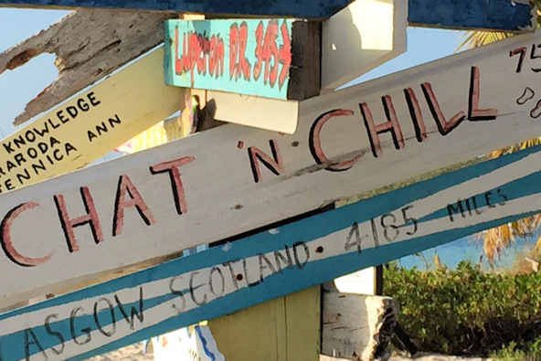
The famous Chat ‘n Chill sign Open mic Friday on the beach
Exuma Markets
The main grocery store in Georgetown is Exuma Markets. It was about a two mile wet dinghy ride across to the dinghy dock in Lake Victoria, an enclosed lagoon bordering Georgetown. During our first week at the anchorage, there was a mild low blowing through, kicking up the waves in the harbor. The ride over to Georgetown was not good, although we did get the benefit of a following sea on the return. Exuma Markets is also the place to pick up forwarded mail, and they offer a few other services to cruisers. At the dinghy dock, there is free fresh water, and every day the sailors that didn’t have watermakers were filling their jerry jugs. We had seen pictures of the dock at peak times, where the dinghies were stacked four or five deep, but we were always able to tie directly to the dock. We found out that the supply boat came in on Tuesday, so Wednesday was the best time to pick up fresh produce. The prices at the market weren’t insane, but they were Bahamas expensive.
Batelco phone
There was a large Batelco office in town. Since our T-Mobile phone did not have a partner in The Bahamas, the rates were regular roaming. We decided to get a 3G smartphone for data and voice, which turned out to be a great purchase. The data network worked quite well throughout the Bahamas, and we were able to use the phone as a data modem (there is an inexpensive app, PDANet, on Android for this).
The meat market
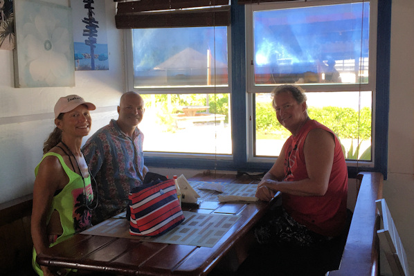
One day in town, Kevin met a cruiser that he knew from earlier. They had a family of five on a wooden sailboat, and they knew the area well. They told us that there was a very good butcher shop (Prime Island Meats) north of town, and that two days a week, the shop sent a truck to pick up customers. We went to the shop to find they had a good selection of meats, as well as some vegetables and pizza crusts. We bought some sandwiches at their deli counter, and picked up some good-looking New York steaks, Italian sausages, and some huge chicken legs. We would return to this shop the following week for more provisions.
The Fish Fry
Directly across the harbor from our anchorage was a group of small shacks collectively called The Fish Fry. On Sunday afternoon, we took the dinghies over to have an early dinner at Shirley’s. The food was delicious, and not as expensive as some other Bahamas restaurants we had been to.
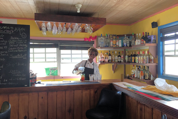
Shirley Donna, Kevin, and Lucky at Shirley’s
Fishin’ and Lobsterin’
Kevin’s cruising friend was an avid spearfisher – it’s legal to spearfish in The Bahamas with a hand-powered spear, as long as you aren’t using a breathing apparatus. They told us about a reef at the far southern end of the harbor where they had found lobster and fish, so we decided to join them. It was about six miles away, but the waters were quite flat the day we went. Kevin and his friend did some spearfishing, and they did get one lobster. We decided to just fish off of our dinghy. We caught a lot of undersized snappers, but we did get one large horse-eyed jack, but they care prime carriers of ciguatera, so no fresh fish that night. On the way back to our anchorage, we saw the Angiamo, which was docked across from us at Shelter Bay in Panama.
The beach at Stocking Island
A short hike across Stocking Island was the Atlantic side, which had a long and beautiful white sand beach. We walked down the beach, which was about a mile and a half long.
The reef and beach off of Stocking Island
The cruisers’ net
There is a very active cruisers’ net on channel 72 at 8:00. Most days I listened to it for the weather report and the entertainment. In addition to weather, there were daily announcements from local merchants, requests for rides to the airport, solicitation of outbound mail, and the entertaining swap and sell. There was a guy on almost every day trying to sell all sorts of goods, including a dinghy and two outboard motors. It sounded like he was giving up the cruising life. Well, sure enough, a couple of days after he sold his dinghy and motors, he was on the net saying that he needed a dinghy! Someone chimed in with, “well, that figures!” On one of our last days, we heard that a group of people planning to cruise south to Grenada that spring were meeting on the beach. We weren’t planning to cruise that far south, but we thought we could get some good information. We did get on the email list. We also found out that cruising in the Dominican Republic is hassle-free when using marinas. That changed our plans – we originally planned to go straight from Turks and Caicos to Puerto Rico, a trip of over 350 miles over some pretty bad waters. Now, we could break up the trip with a few stops in the D.R.
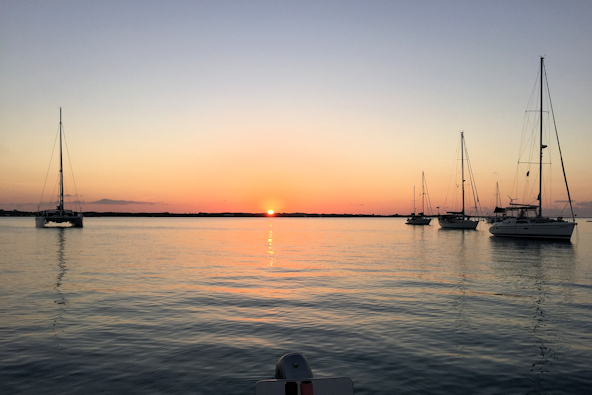
Quincy doesn’t see the big deal about G-town Just another sunset
March 17th: Georgetown – Long Island (Hog Cay)
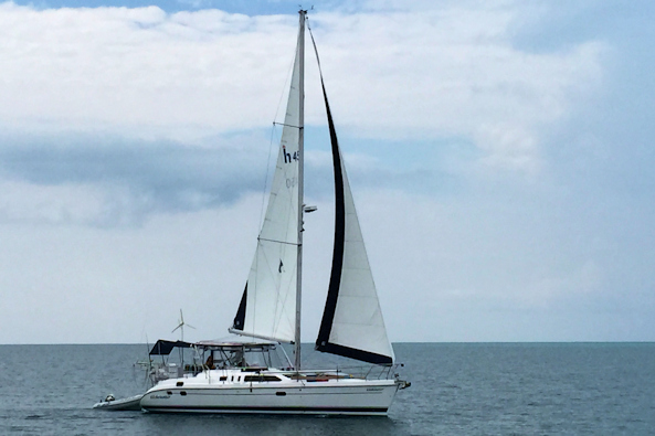
We got the weather window we wanted, and together with Globetrotter, headed over to Long Island. On the way out, there is a narrow opening through a reef that is well-marked. As we approached it, a catamaran in front of us suddenly veered away and performed a 360° turn, almost hitting us. We had no idea why they did this –early morning drinking? We saw them do more of these turns after we passed through the bottleneck – very strange. Once we turned east towards Long Island, the sea totally flattened out. We let out the lines for some fishing. At one point, Globetrotter seemed to stop behind us. We hailed them, and they said they were fighting a monster fish. As we got close to Long Island, we caught a fish, but it was a barracuda, so we said goodbye to it. We anchored off of Joes Sound in very calm, turquoise water. Globetrotter arrived about an hour later, having fought but lost their big fish. The following morning we made a dinghy tour of the sound, which was a large mangrove river. The water was incredibly flat inside the sound, and very peaceful.
Position at destination: 23°36.224’ N, 75°20.945’ W
Air temp: 85°, Humidity: 53%, Water temp: 78°
Nautical miles for this leg: 25.84, Total: 7222
Departed at 9:50am, arrived at 2:30pm
Anchorage off of Hog Cay, Long Island Exploring Joes Sound
March 18th: Hog Cay – Simms
After touring Joes Sound, we set off in a dead calm for our next anchorage at Simms, a small town some eleven miles south. It was a clear, bright day, and for the most part, we were cruising in ten to fourteen feet of water. It was so clear that we could count the legs on the starfish below us. Rose was convinced that we were in just a few feet of water, and many times she asked about our debt. The Explorer guide said that Simms had a town dock and a few stores, but when we went to the shore, we discovered that the “town dock” was more of a basin for fishing boats with a rock wall around it. We didn’t see any way to climb up the wall, so we decided to skip the town. We went back on board, made an early dinner, and spent hours playing Mexican Train with Kevin and Donna, laying waste to the vodka we had purchased in Georgetown.
Position at destination: 23°28.759’ N, 75°14.666’ W
Air temp: 81°, Humidity: 48%, Water temp: 81°
Nautical miles for this leg: 11.29, Total: 7233
Departed at 11:50am, arrived at 2:05pm
March 19th: Simms – Thompson Bay
Our next destination was Thompson Bay, the main anchorage on the west side of Long Island. There were supposedly grocery stores, restaurants, bars, and shops lining the shore in the village of Salt Pond. After arriving, we took the tenders in to a recommended restaurant, only to find that it had closed a month earlier. We stopped at a tourist office, where we found out there would be a festival at Clarence Town the next day, and that we could catch a free bus to the festival. We walked north to find a restaurant and the grocery store, which were also by the dock and a car rental place. We decided to rent a car for exploring the island the following day. Typical of The Bahamas, the car was expensive, at $80 per day for a four-year old Toyota.
Position at destination: 23°21.237’ N, 75°08.319’ W
Air temp: 79°, Humidity: 57%, Water temp: 80°
Nautical miles for this leg: 11.41, Total: 7244
Departed at 9:20am, arrived at 11:30am
March 20th: Tour of Long Island
We picked up the car and headed south. Long Island is aptly named, as it is eighty miles from top to bottom. Our first stop was at Dean’s Blue Hole. The Bahamas are full of blue holes, which are large marine caverns or sinkholes, open to the surface. They have developed in a bank or island composed of a carbonate bedrock (limestone or coral reef). Dean’s Blue Hole is the world’s deepest known salt water blue hole with an entrance below the sea level. It plunges 663 ft. in a bay west of Clarence Town, and it frequently plays host to freediving competitions. Unfortunately, it was cloudy when we were there, so we couldn’t clearly see the outlines of the hole in the water.
View from above You can see the edge of the hole
Posing at Dean’s Blue Hole The freediving station
Continuing south, we drove through Clarence Town, which was much smaller than we had expected it would be. We tried to find a beach that was on the west side of the island, on the nearly impassible bank, but we never got to it. At the far south end of the island we stopped to take some pictures at Gordon’s Beach, which is at the end of the road.
Gordon’s Beach Small park at the beach
Leaving the south end, we ventured back to Clarence Town for lunch. We went to the small Flying Fish Marina, where the lunch guests were gathering for their feast.
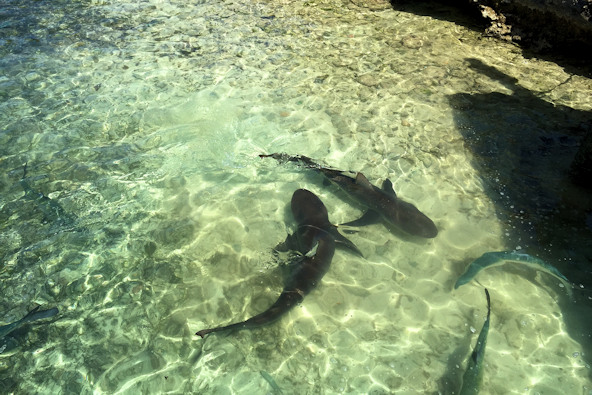
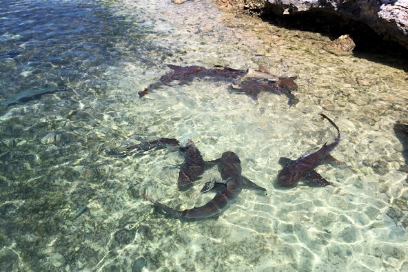
Nurse sharks, lemon sharks, rays, and tarpon were anxious to feast on fish guts
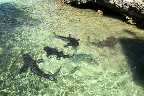
Intuitively obvious for anyone with an IQ higher than a slug’s
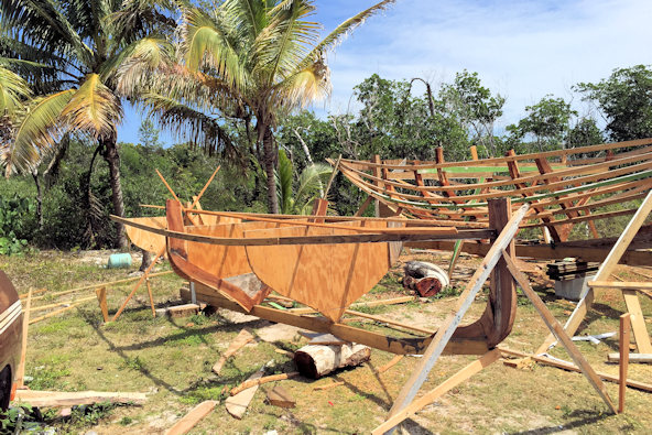
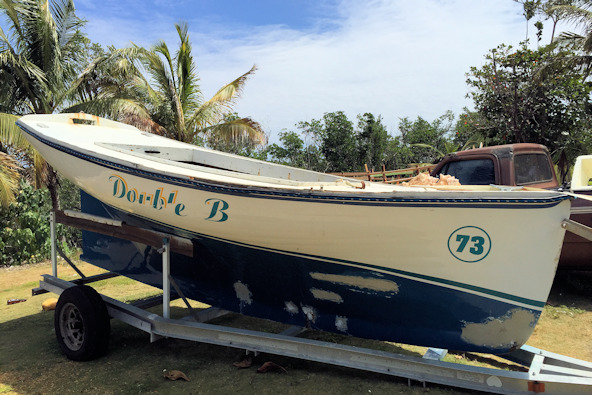
We had a nice lunch at Rowdy Boys in Clarence Town – typical Bahamas fare of hamburgers! Behind the restaurant was a small yard where Family Island racing boats were being built. Rowdy Boys overlooks a beautiful reef, typical of the Atlantic side of the Out Islands.
Family Island regatta boat under construction The reef on the Atlantic side of Clarence Town
While in Clarence Town, we checked out the “festival’ we had been told about. After seeing it, we were very glad that we had not taken the bus from Salt Pond, as we would be stuck in Clarence Town for a very long time after seeing the tiny “festival”. There were a handful of produce stands and a few jewelry makers, and one food stand that had no tables or chairs. Perhaps on an island with a population under 3000, this was a festival…
Continuing back north, we came across a land crab migration. Some locals were snatching them up for dinner, but we just took photos. Later we took the short drive to the Atlantic side to see a different kind of beach and reef.
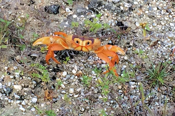
Beaches on the Atlantic side are rocky Cute land crab – they were a little bigger than our hands
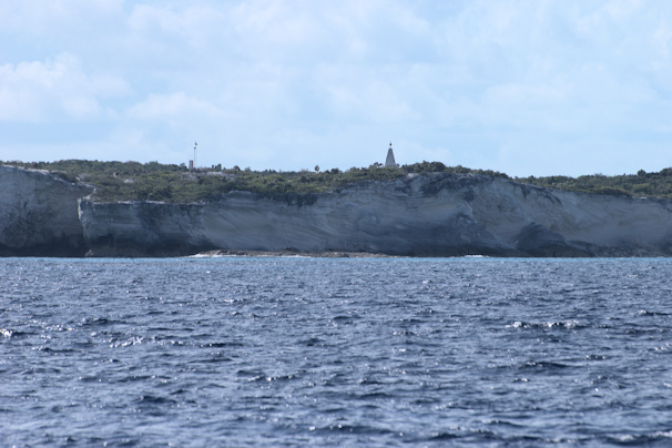
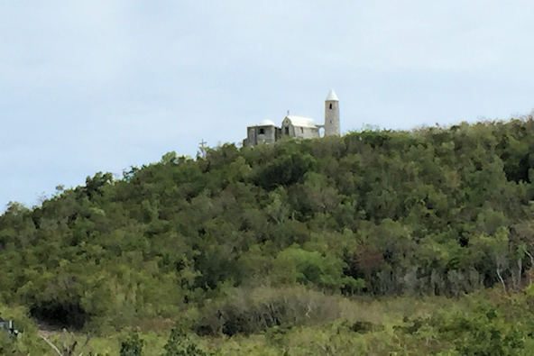
At the north end of Long Island is the Christopher Columbus monument, where some scholars believe Columbus first landed in 1492. The inscription dedicates the monument to the native people at the time, who Columbus had a great hand in wiping out – hmmm… The view from the top was breathtaking. However, the road was really designed for a 4WD, but our trusty Toyota made it anyway.
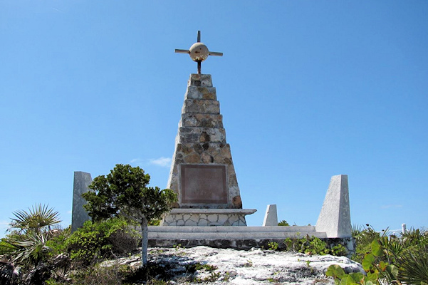
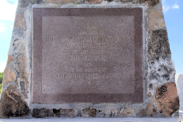
The monument Inscription dedicated to the native people
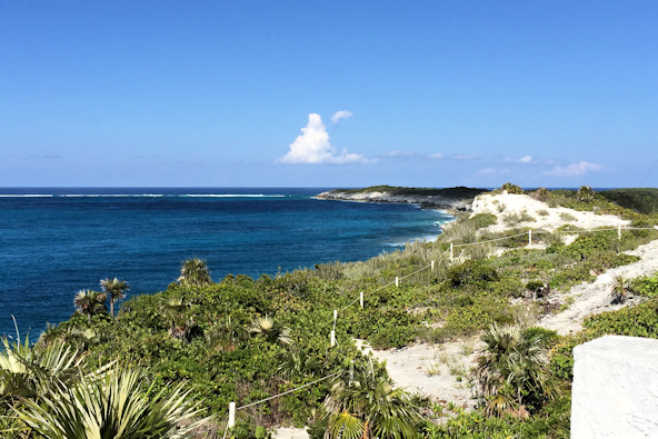
View to the north towards Conception Island View to the west towards Great Exuma
March 22nd: Thompson Bay – Calabash Bay
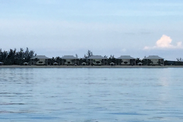
It was time to leave Thompson Bay, and start our trek northward back to Florida. Our first stop was the far northwestern side of Long Island, where there is a pretty high end resort called Cape Santa Maria. Once again, the water looked spectacular. Once we anchored, we went ashore to check out the resort – it was very posh, and we had a couple of drinks on the beach.
Position at destination: 23°39.158’ N, 75°20.323’ W
Air temp: 79°, Humidity: 50%, Water temp: 81.5°
Nautical miles for this leg: 23.99, Total: 7268
Departed at 9:00am, arrived at 1:45pm
Calabash Bay anchorage Towing Little Blend, with Globetrotter following
Shoreline at Calabash Bay Cape Santa Maria resort
March 23rd: Calabash Bay – Conception Island
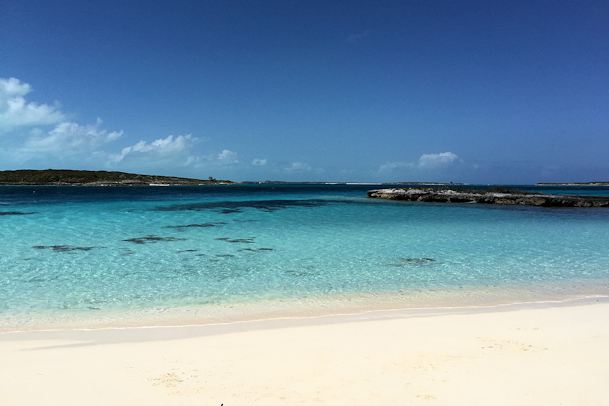
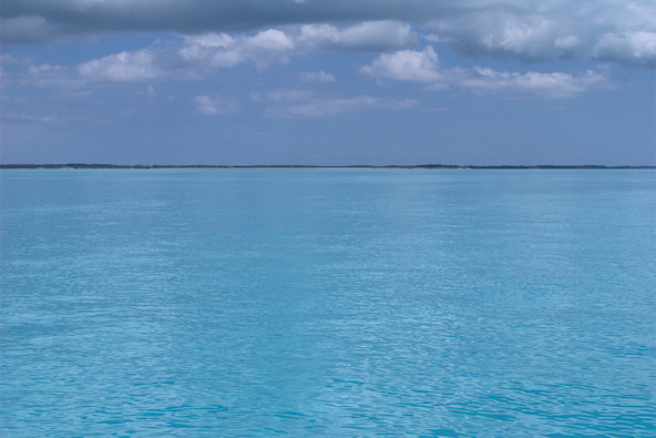
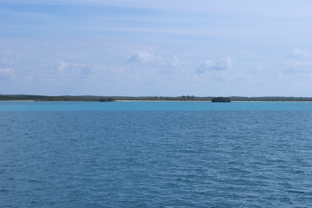
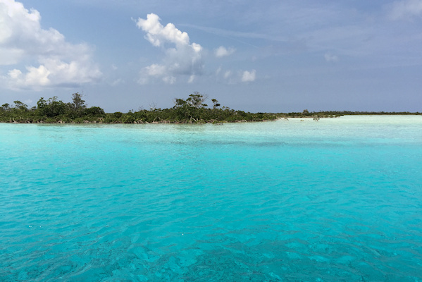
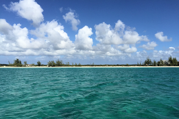
Next on our tour of the Out Islands was Conception Island, which is a National Park. It is known for its beaches (surprise, surprise), reefs, and extensive mangrove estuary. There were a handful of boats in the large anchorage, and the waters were crystal clear.
Position at destination: 23°50.847’ N, 75°07.261’ W
Air temp: 81°, Humidity: 55%, Water temp: 80.5°
Nautical miles for this leg: 23.99, Total: 7292
Departed at 9:30am, arrived at 12:45pm
We took the dinghy around to the southeastern side, where there is a large and extensive mangrove-lined estuary. The outer section has that beautiful turquoise patented Bahamas water, while inside the water has a green hue, but still very clear. The interior section was full of small turtles, but they were very shy, so we weren’t able to get any pictures. On the way back out of the estuary, we ran across the tender from Angiamo – it’s a small world, indeed.
North shore of Long Island, Columbus Monument Beach at the Conception Island anchorage

Near the estuary entrance Interior of the estuary – the turtle area
Kevin and Donna Fabulous water color
Navigating through the estuary – not a challenge
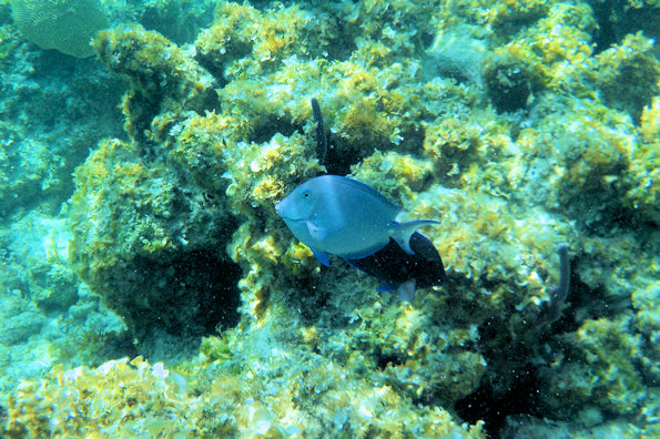
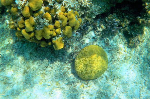
On our second day, we walked over to the north side of the island, where there were supposed to be reefs with good snorkeling. We were disappointed, as the reefs weren’t very pristine, with little coral and few fish. The reefs in the Bahamas just aren’t very healthy.
Sparse reef at Conception Island
Northshore beach
Beach on the anchorage side
March 25th: Conception Island – New Bight, Cat Island
While we were at Conception, our newly-overhauled watermaker failed. This time it was the low-pressure pump, which pumps in the seawater. There was nothing we could do about it, as it is a very specialized pump. At the time, we didn’t have any water in our auxiliary tanks, so we would need to buy some at a marina. Water is quite expensive in the Bahamas, and it was $0.35 per gallon at the closest marina on Cat Island, the Hawk’s Nest Resort. As with most places in The Bahamas, the entrance was tricky, with a lot of tidal current sand shoaling. We were able to tie up to the fuel dock with some difficulty, as the tide in the cut was generating a lot of current. We ended up taking around two-hundred gallons, and we figured we could easily manage the remaining two and a half weeks we expected to be in The Bahamas.
Views from the fuel dock at the Hawk’s Nest Marina
After filling the water tanks, we continue our way to the anchorage off of New Bight. Once we rounded the corner of Cat Island, it was literally smooth sailing over the shallow bank. On their voyage, Globetrotter caught a mahi-mahi, which they brought over to our boat for cooking, as they didn’t have a grill – it was most tasty!

Globetrotter cruising along the bank Kevin’s mahi-mahi
Position at destination: 24°17.215’ N, 75°25.279’ W
Air temp: 80°, Humidity: 62%, Water temp: 83.5°
Nautical miles for this leg: 42.28, Total: 7335
Departed at 6:50am, arrived at 3:05pm
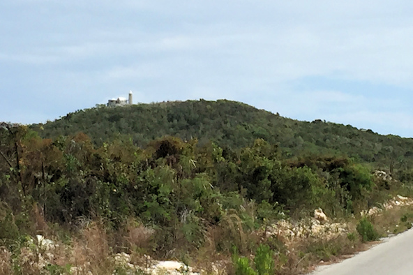
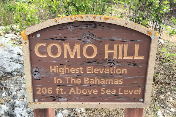
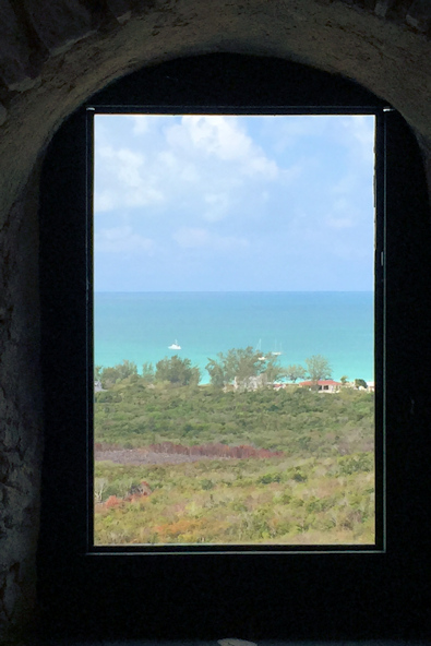
Close to New Bight is the highest hill in The Bahamas, Como Hill, at just 206 feet. Near the top is a ruined monastery called The Hermitage. John Hawes, known as Father Jerome, built this complex around 1939. You can easily hike to it, and there are designated Stations of the Cross along the way. Even for those of who aren’t religious, it’s an interesting and impressive site, given that all of the materials had to be carried up to it.
Approaching The Hermitage
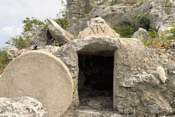
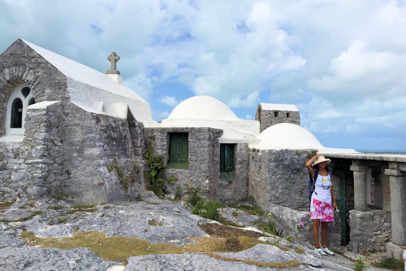
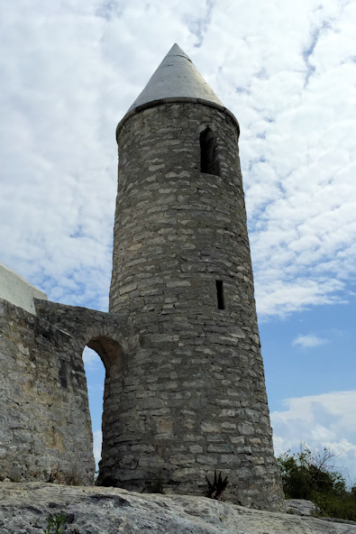
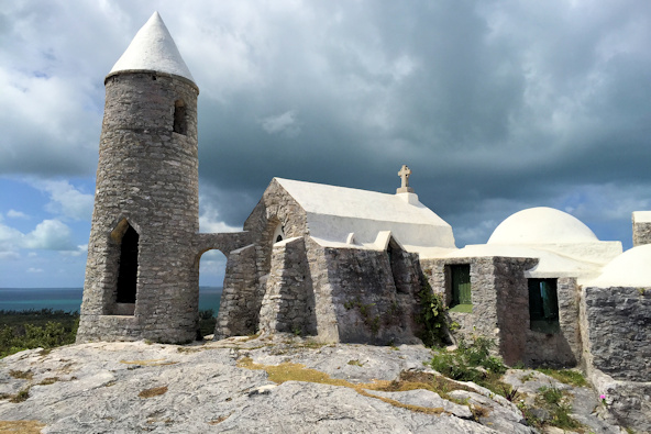
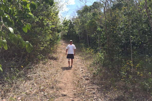
Great view of The Hermitage This path was much easier than the one we took up
After hiking back from The Hermitage, we had lunch at one of the “restaurants” on the beach. We chose Hidden Treasures, as it had lots of conch and crack – what more could you ask for? Across the street was a “boatyard” where the family regatta boats were being built. It’s hard to believe that what looked like total chaos could turn into racing boats.
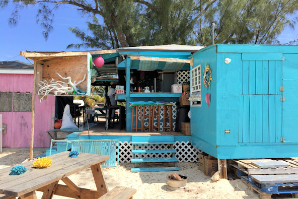
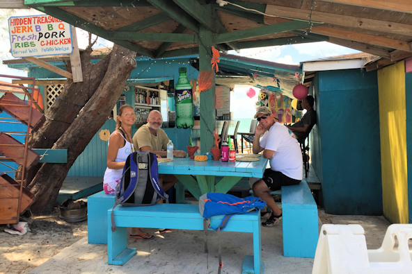
Cat Island beach “restaurant” Donna, Kevin, and Lucky at Hidden Treasures
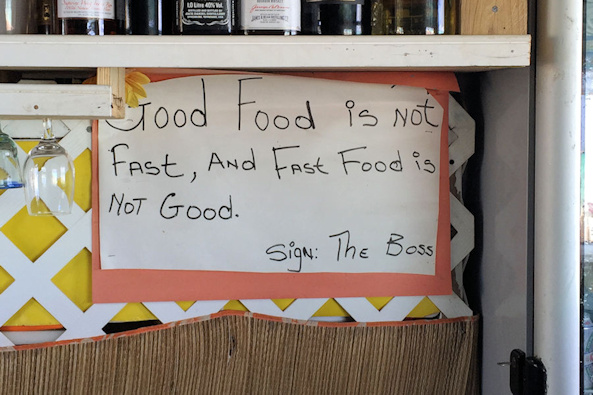
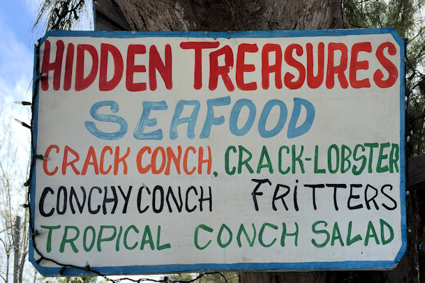
The food wasn’t really good or fast… Conch and Crack – what more could you ask for?
Works in progress The finished product
Donna is having a happy The beach at Old Bight
We checked the weather, and discovered that a system was coming in from the southeast, so we decided to relocate to Old Bight, where we would have more protection from any fetch. A couple of other boats joined us. The anchorage was very large, so we were able to find a well-protected spot to drop the hook. The beach was expansive and beautiful, and just over the south side of the island was the Hawk’s Nest marina. We waited another day for the weather, which turned out to be a non-event, before moving north to Half Moon Cay.
March 26th: New Bight – Old Bight
Position at destination: 24°13.161’ N, 75°24.077’ W
Air temp: 81°, Humidity: 58%, Water temp: 82°
Nautical miles for this leg: 4.29, Total: 7339
Departed at 3:30pm, arrived at 4:20pm
March 28th: Old Bight – Half Moon Cay
Our next destination was Half Moon Cay, formerly known as Little San Salvador Island. It was purchased by Norwegian Cruise Line, and is now owned by Holland America. Carnival ships, owned by Holland America, also frequently visit. When the ships are not present, cruisers are allowed on the beach. It’s a beautiful location, and only about 50 acres have been developed for the cruise ship riff-raff. After we arrived, we found out that Globetrotter had a dinghy incident while underway. They were towing their dinghy on a tight leash when the motor worked its way off of the transom and fell into the ocean. Fortunately, it had a tether line on it so Kevin was able to retrieve it. He had washed it out, cleaned the carb, changed the oil, and changed the spark plug, and it was alive again. However, a lot of oil had spilled in the cockpit, and they didn’t have anything to clean it up with. Fortunately, we had an oil spill kit, so we rushed it over to them.
During the cruise, we were fishing and hooked a large mahi. It’s not so easy landing a fish when you are towing a dinghy. We decided it would be best to bring the fish in through the cockpit door on the side of the transom. Rosé came back to help me, and she opened the door as I brought the fish in. Mahi’s are good fighters in the water, but they really go crazy when you take them out of the water. As soon as I dragged it in to the cockpit, it went wild, and managed to flip the hook. I quickly went to close the cockpit door, but Rosé had latched it open out of habit. Before I could unhook the latch, we watched the big bull Dorado slide out of the cockpit.
Position at destination: 24°35.004’ N, 75°57.722’ W
Air temp: 74°, Humidity: 50%, Water temp: 79°
Nautical miles for this leg: 41.82, Total: 7381
Departed at 8:50am, arrived at 4:30pm
March 28th – March 31st: Half Moon Cay
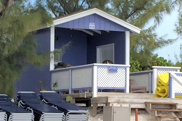
We spent a couple of days at this beautiful bay. We only had a cruise ship in for one of the days we stayed, so we had full access to the beach. On the beach, there are cabanas and villas that are rented to cruise ship passengers for the day. The cost is pretty high – the cabanas are $280, villas for $500, and a private oasis for $1500 – ouch! Kevin found out that the villas were not locked up, and he ventured in to find that the hot tubs were working. He and Donna decided to take advantage of the free hot tub, but we passed. We knew that the staff were living somewhere on the island, but we never saw them when the ships were gone. Still, we didn’t want to chance getting thrown off of the beach – Kevin was bolder.
When the ship was in, we were asked not to go on shore. There weren’t as many guests on shore as I might have thought. There are a number of activities available, including horseback riding, water sports, glass bottom boat, fishing, etc. There are numerous bars and restaurants on shore, including one modeled after an old pirate ship. We had a good time wandering around the deserted developments and enjoying the beautiful beach.
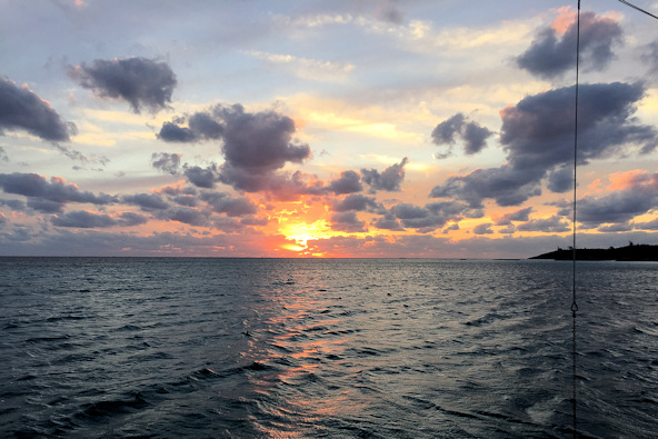
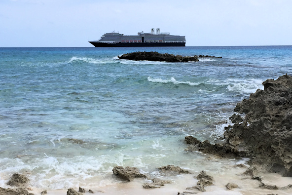
Sunset over Half Moon Cay A Holland America ship
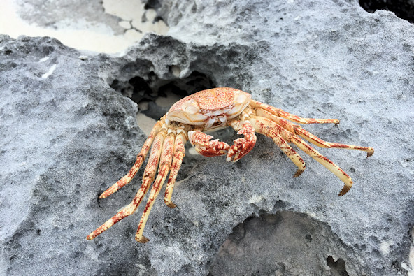
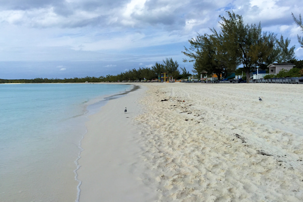
Menacing welcome from a local resident The beach at Half Moon Cay, sans cruise ship riff-raff
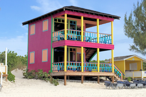
Beach cabana – $280 Beach villa with Kevin’s hot tub – $500