


January 1st: Rodriguez Key – Sands Key
On the first day of the New Year, we continued our voyage up the Keys towards Miami. Based on information from Active Captain, we decided to cross over into Biscayne Bay using the Caesar Creek inlet. We believed that at high tide, we could safely transit through the well-marked channel, and then anchor in the protection of Biscayne Bay. However, once we started to transit the channel (while avoiding the big wakes laid down by speeding powerboats), we didn’t see the depths indicated, so we decided not to use the cut. Instead, we decided to continue outside using the Hawks Channel to Sands Key, an open roadstead anchorage near Boca Chica Key. In the light east winds, we believed it would be comfortable. Other than the frequent wakes kicked up by the passing powerboats, it was relatively comfortable. We had a nice view of the south Miami skyline in the distance.

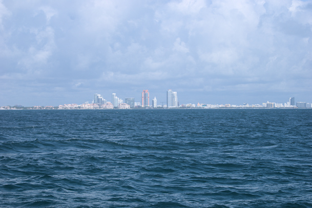
Miami skyline from Sands Key
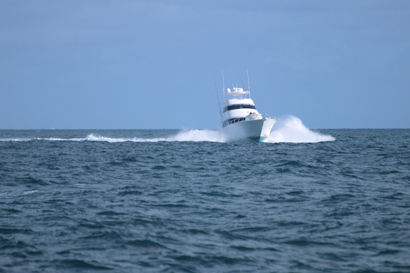

Big wakes from Key-bound powerboats Lighthouse at Sands Key
Position at destination: 25°30.117’ N, 80°10.342’ W
Air temp: 77°, Humidity: 60%, Water temp: 78°
Nautical miles for this leg: 33.9, Total: 6498
Departed at 9:30am, arrived at 3:00pm
January 2nd: Sands Key – University Cove anchorage, Miami
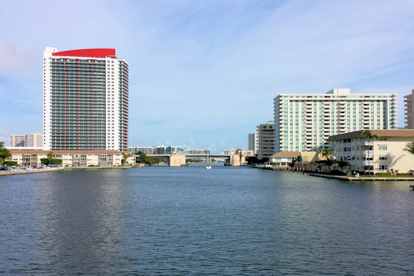
This day marked our entry into the Intracoastal Waterway. Back when Tropical Blend was Island Magic, it had been through the waterway, and the original owners had left the bridge guide on board. Using this guide, we figured that for the most part, we could cruise between the bridges to catch the next openings. Most of them seem to be timed for a speed of five to six knots.
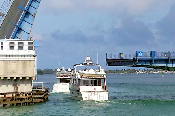
There are two main inlets from the ocean into Miami Harbor – Government Cut and Fisherman’s Channel. Government Cut is closed to private traffic whenever there are two cruise ships docked there, which of course there were that day. We took Fisherman’s Channel to the south of Dodge Island. It’s full of commercial vessels loading and unloading, along with a lot of marine traffic. Before entering the channel, we had to come in through the cut from the ocean. We had no experience running inlets, and didn’t think too much of it. We knew that the tide was going out, opposing the eastern swells, but we didn’t really know how strong the current could be. We slowed down to four knots, and the inlet was like a washing machine. After a few minutes, we cleared the inlet and headed into the Fisherman’s Channel.
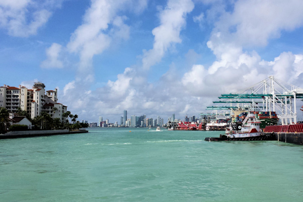

Commercial activity in Fisherman’s Channel Welcome to Miami!
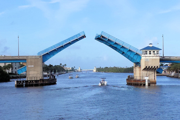
At the end of the channel, we turned north into the ICW. The first bridge was the Dodge Island RR Bridge, open except when a train comes through. We passed by the American Airlines Arena, where the NBA’s Miami Heat get spanked by the Warriors.
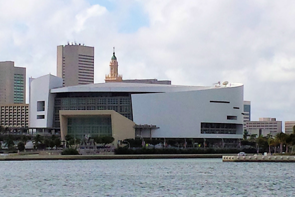

The American Airlines Arena Downtown Miami

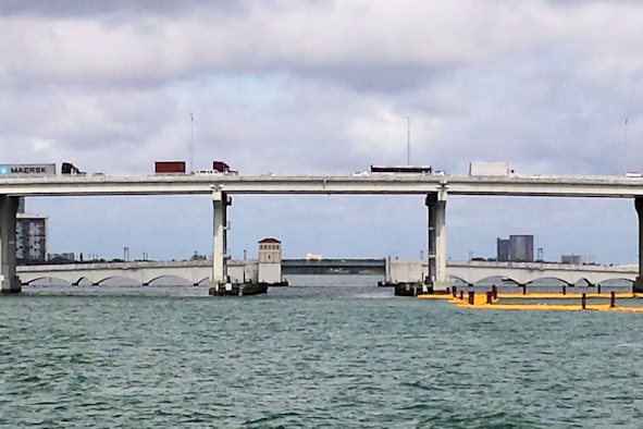
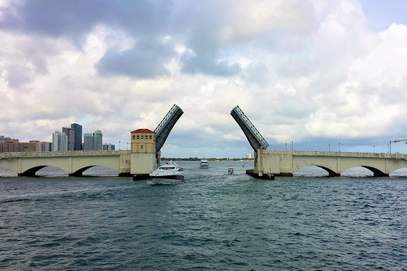
Dodge Street Bridge MacArthur Causeway Bridge

 Mile 1088.6 – we had our first wait at the Venetian Way Bridge, but only for about five minutes.
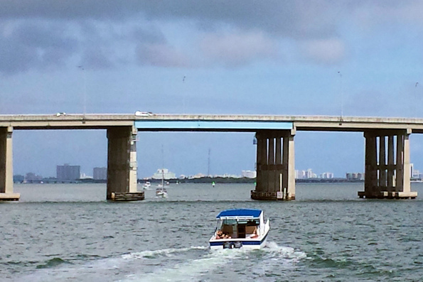

Mile 1087.1 – the fixed Julia Tuttle Causeway, at fifty-six feet, followed by the 79th Street J.F.K. Bridge
Mile 1081.4 – Broad Causeway
We had decided to use anchorages while transiting the waterway. It was very likely the marinas would be full, this being the New Year’s weekend. Based on the Active Captain reviews, the anchorage near Florida International University. Just east of the waterway was a big sandbar that looked like party central for the adults, while the University Cove anchorage was more family-oriented, with swimmers and kayaks. Since this was a holiday, there were a lot of people around, but not too many boats. We found a comfortable spot to anchor and watched the people parade around us.

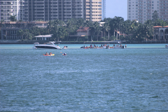
Sandspur Island, just east of the ICW channel – there’s a party going on!

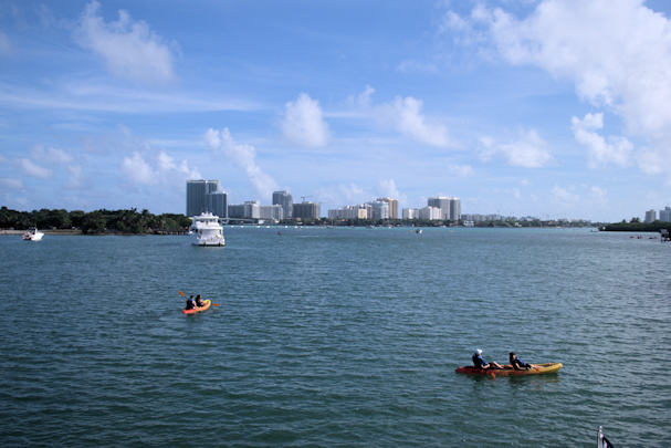
University Cove anchorage at Oleta River State Park
Position at destination: 25°54.502’ N, 80°08.141’ W
Air temp: 79°, Humidity: 64%, Water temp: 78.5°
Nautical miles for this leg: 29.1, Total: 6527
Departed at 8:20am, arrived at 1:30pm
January 3rd: University Cove anchorage – Lantana Bridge (Lake Worth)
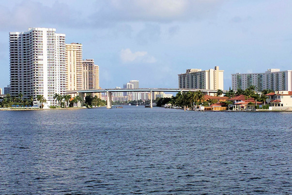
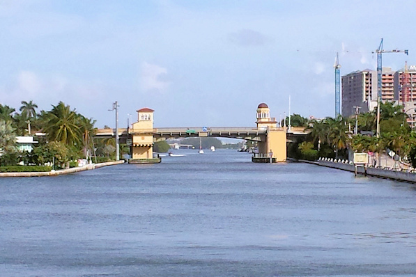
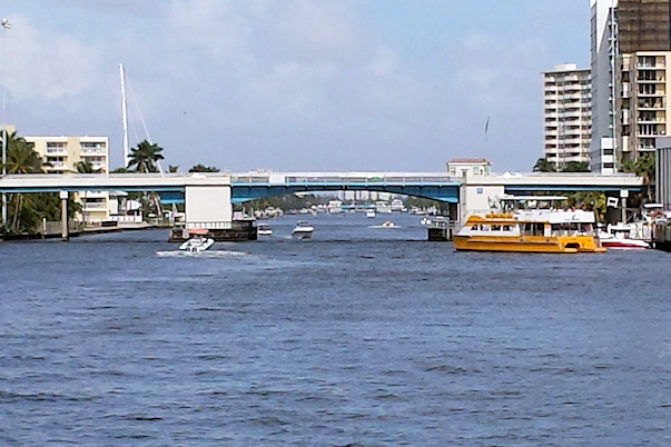
We got an early start Saturday morning for what promised to be a long day of bridges, bridges, and more bridges. We left at 8:30 in order to catch the 8:45 opening of the Sunny Isles Bridge, just a mile and a half away.


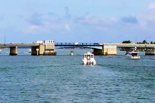
Mile 1078.0 – S.R. 826, NE 163rd St. (Sunny Isles)
Mile 1076.5 – William Lehman Causeway Mile 1074 – Hallandale Beach Blvd.

Mile 1072.2 – Hollywood Beach Blvd. Mile 1075 – heavy development
We were making good time and hitting all of the openings until we hit a snag at the Hollywood Beach Blvd. Bridge. The opening was delayed as the bridge tender checked out what she thought might be an accident on the approach road. The delayed opening cost us close to ten minutes, and we only had five minutes to make the next opening of the Sheridan St. Bridge. We had to put the hammer down, and fortunately we don’t throw a wake. We barely made the opening, which saved us forty-five minutes.
Mile 1070.5 – Sheridan St. Mile 1069.4 – Dania Beach Blvd.
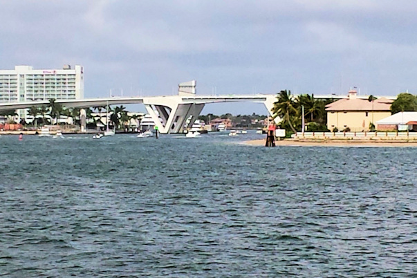
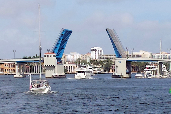
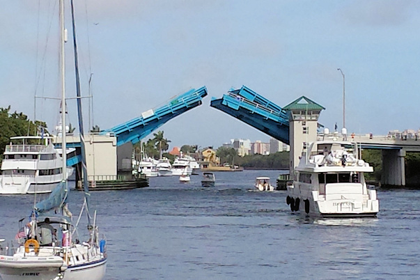
Mile 1065.9 – 17th St. Bridge (Ft. Lauderdale) Mile 1064 – Las Olas Blvd. Bridge
Between the 17th St. and Las Olas bridges, we passed by Port Everglades, which was full of cruise ships being prepared for their next cruises. It’s funny how in this area, you can pass close enough to reach out and touch the cruise ships, but in Miami you aren’t even allowed in the channel where they are berthed. Once we passed through the Las Olas Bridge, we were in Fort Lauderdale, and we started to see some really nice houses on the waterway.
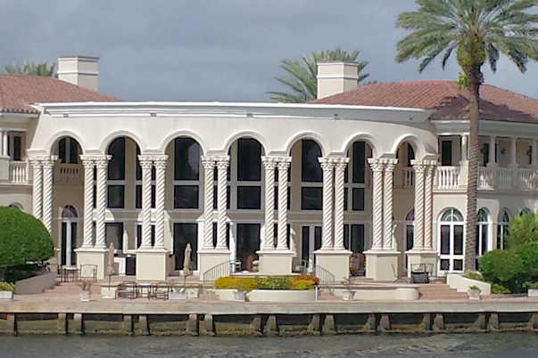

The houses on the ICW got really big Several of the many cruise ships in Port Everglades
Mile 1062.6 – Sunrise Blvd. Bridge Mile 1060.5 – Oakland Park Bridge
Between the Sunrise and Oakland Park bridges, our timing luck ran out, and we just missed the 11:15 opening. We jogged in place for a while, and there was a nice-looking restaurant with a big dock just before the bridge. Someone came out and asked if we wanted to tie up for lunch, but it was early, so we thought we would tie up further along – a decision we would regret. We did see a manatee in the area.

Mile 1059 – Commercial Blvd. Bridge Mile 1056 – Atlantic Blvd. Bridge (Pompano Beach)
As we were approaching the Hillsboro Bridge, we heard a radio hail for the bridge tender. A sailboat was calling to say they had a “special situation” and wanted an opening on demand. Their “special situation” was that they had a group of four boats together. The bridge tender wasn’t having any of that “special situation”, and they had to wait like the rest of us.
Mile 1055 – 14th St. Bridge Mile 1050 – Hillsboro Blvd. Bridge (Deerfield Beach)
Just past the Hillsboro Blvd. Bridge is Lake Boca Raton, a lagoon to the east of the waterway. We were thinking about anchoring here for the night, but even though it was large, it appeared to be totally packed. By now, we were actively looking for a dockside restaurant, but we hadn’t seen one since we had the offer back in Fort Lauderdale.


Mile 1048.2 – Camino Real Bridge (Boca Raton) Mile 1047.5 – Palmetto Park Bridge


Mile 1044.9 – Spanish River Bridge (Delray Beach) Mile 1041.1 – Linton Blvd. Bridge
As we passed through Delray Beach, we picked up a lot of transmissions to the George Bush Bridge. That one opens on demand, but the bridge tender wasn’t a very pleasant individual. We guessed that some boats weren’t in line when the bridge opened, but they saw the opening and called in to ask him to hold the bridge. He would practically scream at them about how many cars were waiting, and that he couldn’t hold the bridge for anyone. One thing that we had learned was that the openings were very strict. Unless you were waiting in line for the scheduled opening, they were not going to hold the bridge for you, even if you were pretty close. I guess if you are in a car and you plan your trip to miss an opening, you might get miffed if you have to wait … a whole minute. Anyway, it was what it was. When passing through any bridge, you are expected to request the opening and identify your boat, even if there are others in line ahead of you. We made it through the day without being yelled at…


Mile 1039.6 – Atlantic Ave. Bridge Mile 1038.7 – George Bush Blvd. Bridge
Mile 1035.8 – 15th Ave. Bridge (Boynton Beach) Mile 1035 – Ocean Ave. Bridge
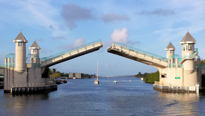
We passed through our last bridge of the day, the medieval-looking Ocean Ave. Bridge in Boynton Beach. After that, it was a run up the narrow channel through Lake Worth to our anchorage just south of the Lantana Ave. Bridge in Palm Beach. We looked through the shallow mud for some decent depth, and finally found a spot just south of the Loggerhead Marina. There were a couple of other odd-looking boats in the area. The marina was a base for head boats, and they didn’t seem to like where we were anchored. We left plenty of room for them to enter and exit the marina, but they liked to cut awfully close to us.

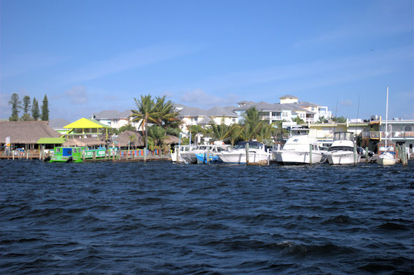
Lake Worth Loggerhead Marina at the Lantana Bridge
Position at destination: 26°34.973’ N, 80°02.873’ W
Air temp: 78°, Humidity: 60%, Water temp: 79°
Nautical miles for this leg: 43.7, Total: 6571
Departed at 8:30am, arrived at 5:00pm
January 4th: Lantana Bridge – Old Port Marina, North Palm Beach
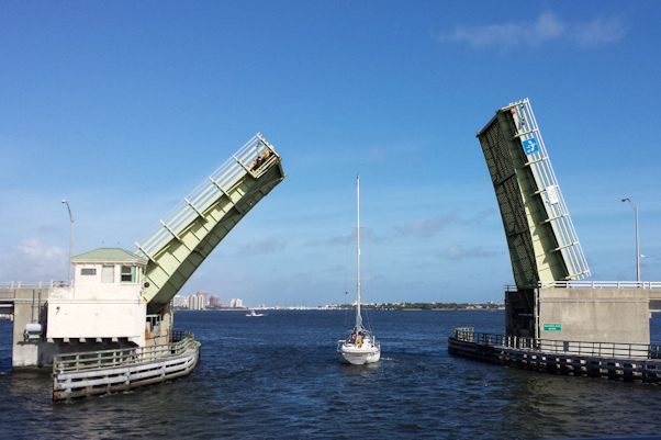
On our final day in the ICW, we slept in before leaving to catch the 10:00 opening of the Lantana Bridge.


Mile 1031 – Lantana Ave. Bridge Mile 1028.8 – Lake Worth Bridge
The Lake Worth Bridge has thirty-five feet of clearance, and it opens on demand. The sailboat in front of us requested an opening, and as we followed them through the bridge tender told us that next time, we would not need an opening. Well, our mast is thirty-five feet above the waterline, plus it has some electronics on top, so there is no way that we would go through when that bridge was closed. It’s interesting that the bridge tenders are not allowed to answer questions about the tide, but this guy thought he could eyeball exactly how much clearance we needed.
It’s a little bit of a long run at 5.5 nautical miles from Lantana Bridge to the Southern Ave. Bridge, which opens on the quarter and three-quarter. To make the opening, the distance has to be covered in less than forty-five minutes. Fortunately we had a very strong tide pushing us along at eight knots, so we made the 10:45 opening easily. Just before we got to the Royal Park Bridge, a Feadship motor yacht pulled out and asked to go to the front of the line. It was called Sissi , and it had a very round stern. We weren’t sure why they wanted to go first – maybe they were filming? It wasn’t a big deal, so the several boats in line allowed it to move ahead.
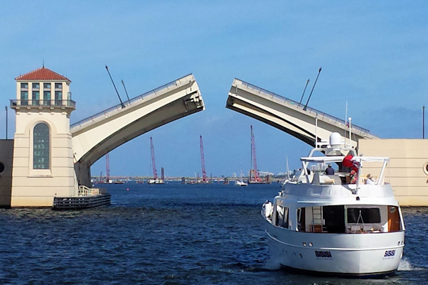
Mile 1024.7 – Southern Blvd. Mile 1022.6 – Royal Park
After requesting the head of the line, Sissi literally crawled through the bridge. It’s less than a mile to the Flagler Memorial Bridge, but with the strong current, we actually had to shift into reverse to avoid hitting the Sissi since it was going so slow. Again they asked to be at the head of the line, and they even asked the boats on the other side of the bridge to let them through first. Some boaters are born prima donnas. They stopped so far back from the bridge, we all had to reverse our course. When the bridge opened, we were delighted that the southbound boats went through first, ignoring Sissi’s request. After we cleared the bridge, we started to pass Sissi , but then they sped up – a very annoying captain, indeed.
We were finished with drawbridges, and we only needed to transit through the northern section of Lake Worth to get to our destination. The mooring field south of the inlet looked very full as we passed by. Just in front of us, a Nordhavn 47, Let’s Dance, emerged from the Lake Worth inlet and led the way to Old Port Cove. We worked our way past the inlet and the Port of Palm Beach to Peanut Island. This is a popular weekend destination for local boaters, and it was packed on that Sunday.

Peanut Island on a Sunday afternoon
The last bridge was the Blue Heron Bridge, fixed at sixty-five feet. Getting to it from Peanut Island was a little tricky. The ICW channel is very narrow there, working its way through a very crowded anchorage. Some boats really push the limits of the channel, anchoring where they swing into it. As we worked through this mess, we saw our net boat, a real beauty!
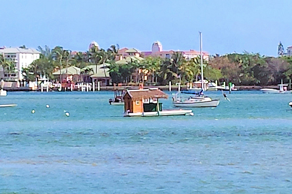

We can only dream Blue Heron Blvd. Bridge
After a few more miles, we arrived at Old Port Cove. We had a hard time finding the entrance, but once we figured out where it was, we docked without further incident. OPC is a truly first-class marina. It has floating docks with synthetic boards (easy on-off and no splinters). It does have the standard double slips with pilings in the front – I guess the single slips on the West Coast are the anomaly, not the norm. Upon checking in, we found out that they had a special rate for Nordhavns, at $0.98 per foot per night – less than half of the going rate. We also got a hand-painted bottle of wine, and free sodas or coffee for our stay. After some of the ratty marinas we had stayed in, this was a real pleasure. We had lunch at the marina restaurant, and settled in for our refit project.
Position at destination: 26°49.887’ N, 80°03.266’ W
Air temp: 78°, Humidity: 65%, Water temp: 78°
Nautical miles for this leg: 16, Total: 6587
Departed at 10:00am, arrived at 12:30pm
January 4th – 22nd: Old Port Cove Marina (the 2015 refit project)
The refit
We had planned a major refit with Yacht Tech, a Nordhavn specialist. Yacht Tech provides full service, and they are also a major broker of used Nordies on the East Coast. We counted over a dozen boats in the marina, from an N40 up to an N86. Most of the boats were N47’s and N50’s. We had maintenance, repairs, and upgrades planned. If you are interested in the details about the refit, click here.
We were planning two weeks for the refit, but of course it took longer. We thought by arranging it in advance, we could get things done quickly. We think Yacht Tech is a good yard, but they really weren’t prepared for us. They could have ordered the needed parts and arranged subcontractor schedules, but they really waited for us to arrive. Also, January is the busiest time for boat work in Florida. For example, we wanted to get some rain shields made over our pilothouse doors. We thought that a small canvas awning would work, and we found a major supplier of canvas for boats. We found out that they had a backlog of three months!
One of the key items on our list was to get the corrosion in the aluminum window frames repaired. It turns out that this is extremely sensitive to rain, and it rained off and on most of the time we were there. Plus, the subcontractor was pretty well booked up. In addition, we found out that replacing our wind instrument required a new through-hull sensor, and a cherry picker to mount the vane on top of the mast, so we needed a haul-out – which was also booked up. At the end of the day, we decided that we would return to Florida in April to complete the job. We needed to be in the Bahamas to meet friends at the beginning of February, so we couldn’t extend the work schedule.
The USPS stinks
We wanted to be legal with taking the cat into the Bahamas. To do this, you have to send in a form with a cash payment to the Agriculture Department – I think it was just $10. I downloaded and completed the form, and we went to a UPS office to send the package. We found out that because the address was a P.O. Box in the Bahamas, UPS could not deliver it. I thought that the P.O. Box delivery restriction was a USA thing, but it turns out that the Post Office has a monopoly on international boxes as well. We went to a Post Office branch, and they had two choices: first-class mail with a delivery time of five to ten days, or Priority Mail International Express with a delivery time of three to five days. It was a huge difference in price, at $1.20 vs. $43.95, but not wanting to take chances, I chose the expensive method. A few days later, I checked on the status, and found that it had not even left the United States! After the snafu we had with the delivery to Puerto Vallarta, I was incensed. I went back to the branch to complain, but they told me I could only go online to file a case. I did this, to no avail. Shortly before we left, I did get the stamped form back from the Bahamas. It had taken almost two weeks for the letter to get to them. The Post Office finally responded, simply saying that the matter was closed because my letter had been delivered. They totally ignored the point that I had paid an exorbitant amount for express delivery, but the actual delivery was well beyond that. I hate the USPS…
Out and about in South Florida
Part of the refit was replacing the sanitation hoses, so we didn’t want to be aboard during that. We rented a condo in West Palm Beach for a week while the boat was torn apart. It was a very dog-friendly place, with dogs in the complex, and a dog park across the street. Quincy did enjoy being in the place – we took him outside a lot, which he thoroughly enjoyed.
While in Florida, we got our fill of Asian food, and did a lot of provisioning. We restocked the liquor cabinets at Total Wine, a liquor superstore. We had a lot of visits to West Marine and Home Depot to take care of supplies. We did some mall shopping for the first time since we were in Panama City. We seemed to be going somewhere every day.
We also made a trip up to Green Cove Springs, near Jacksonville, where our mail forwarder is located. We picked up a number of packages that we had ordered, and we also obtained our drivers licenses and registered to vote in Florida, making us official residents. The day we chose to go up there was really cold. A cold front was blowing through, bring temperatures in South Florida down to the fifties, and a frigid 34° in Jacksonville – brrr!
January 22nd: Old Port Marina – Old Port Marina
After finishing as much of the boatwork as possible, we waited a few days for a weather window. The Gulf Stream can be treacherous in the winter when a cold front is passing through. You have a three-knot current pushing north, opposed by wind waves pushing south, and you can get standing waves of up to ten feet – very dangerous. We decided to leave the evening of the 22nd, which had a forecast of normal trade winds and reasonable seas. We had decided to make the crossing overnight to Grand Bahama Island, staying at the Old Bahama Bay Marina in West End for a couple of days before moving on the Nassau.
We pulled out under a moonless sky at 10:00 that night, and we immediately discovered that very few of the channel markers for the ICW were lit. Most didn’t even have reflectors on them. We proceeded slowly down Lake Worth, with Rosé on the bow straining to find the markers using the lights of the city, while I tried to steer using radar and the chart plotter. It was a little nerve-wracking, and when we went past Peanut Island, a boat had anchored in the ICW channel, forcing us to port, where we had a soft landing on the bottom. After rounding Peanut Island, we steered towards the Lake Worth Inlet. It’s the largest inlet in South Florida, at 800 feet wide and 35 feet deep. It’s used by freighters and cruise ships frequenting the Port of Palm Beach. Other than our interesting experience entering the Government Cut in Miami. We didn’t understand the dangers in running an inlet even of this size. As we approached the inlet, we started to experience the incoming swell, pitching about three or four feet. From the lights of the city behind us, I could see breakers across the inlet. Fortunately, they weren’t too big and we proceeded without incident.
By now we had been out of the marina for about one and a half hours, so I did an engine check. As part of our refit, we had the stuffing box repacked. The stuffing box is where the propeller shaft exits the hull, and it is surrounded by a gland that has wax-impregnated strings around it. This allows a small amount of seawater through to keep the gland cool, but not too much for the bilge pump to handle. Yacht Tech told me that they packed it loose, so I figured I would need to tighten up the gland while we were underway. Normally, the gland is about fifteen degrees above the ambient water temperature. When I looked at the gland, I couldn’t see any water dripping at all, and the temperature was at 135°, which is hot enough to melt the wax. Clearly it had been packed way too tight. I loosened the gland to the limit, but not one drip of water came out. We couldn’t run to the Bahamas like this, so we decided to return to the dock.
Meanwhile, we noticed diesel fumes in the pilothouse. We had the new forced-air fans that had just been installed on, and I guessed that there was more air coming in to the engine room than could be exhausted, and somehow the excess was venting into the cabin and the pilothouse. Fortunately a switch had been installed for them so I turned them off while we were in the pilothouse.
As we approached the inlet, I tried to figure out the best way to run it, and I decided to go at a course of 30° to avoid getting swamped from behind. That sort of worked, but as we surfed over some of the waves, we got pretty sideways, so white knuckles were in abundance. Once through the inlet, we returned to the marina, and tied up alongside the fuel dock. First thing in the morning, I called Yacht Tech, and they came out and removed some of the packing. We did a short sea trial in Lake Worth, and we were satisfied with the drip rate and temperature. As for the fumes, it was a mystery to Yacht Tech where they were coming from.
In the morning, we checked back in to the marina, into our old slip. Now there were some weather issues, so we had to wait a couple of more days before crossing over. We were still well within our window to meet our friends in Nassau on January 28th.
Position at destination: 26°49.887’ N, 80°03.266’ W
Air temp: 78°, Humidity: 65%, Water temp: 78°
Nautical miles for this leg: 17.6, Total: 6604
Departed at 10:10pm, arrived at 2:00am
January 24th: Old Port Marina – Old Bahama Bay Marina, West End, Bahamas
With improving weather, we left for The Bahamas on January 24th. To avoid navigating the ICW in the dark, we left at 5:00, and anchored near the inlet. I had read up on running inlets, and learned to go at slack tide, which would be at 10:00PM that night. At slack tide, we ran through the inlet, much easier than on our previous time. Once out in the Gulf Stream, we did have some occasional rollers, and it was a pretty rough cruise. At one time, I opened the refrigerator/freezer in the salon, which opens to the starboard side. We hit a roll, and a beer mug came flying out and landed square on my big toe. Not fifteen minutes later, the same thing happened again – d’oh! That time I didn’t put the mug back in.
Just after dawn broke, we arrived at the marina. It’s well-protected, and there is an area just north of it inside the breakwater for anchoring. We dropped the anchor and waited for the staff to open the office. Once we saw signs of life, we called the marina, got our slip assignment, and docked without incident. Customs and immigration is on-site, and checking in was fast. You have to pay $300 for a cruising permit that is good for six months, including one re-entry. When asked how long we were staying, I stupidly was honest and said that we would be leaving around the end of March, so we were granted a three-month stay. Stupid, because you can get up to six months – more on that later.
Position at destination: 26°42.069’ N, 78°59.489’ W
Air temp: 72°, Humidity: 58%, Water temp: 73°
Nautical miles for this leg: 61.8, Total: 6666
Departed at 5:00pm, arrived at 6:45am
The marina was somewhat marginal. The docks were okay, but with fixed concrete and forward pilings, getting off and on the boat required some athletic prowess with the four foot tide. The bathrooms and showers were pretty bad, aged and decrepit. The rate was decent, at $1.75 per foot, but power was expensive, at a fixed $0.70 per foot per night. Water was unlimited, but at $15 per night. We checked out the grounds of the resort, which were very beautiful. There was a nice swimming pool and a gorgeous white sand beach. We had an early lunch at the restaurant on the beach, while we watched a photo shoot going on. Apparently this was for either the resort or the Bahamas Tourism Authority, depending upon who you asked. They were constantly changing the arrangement of the tables, including the centerpieces. They were taking photos of the models on the beach and with water sports, but the water, at least by our standards, was pretty cold.
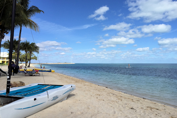
The beach at Old Bahama Bay The marina docks
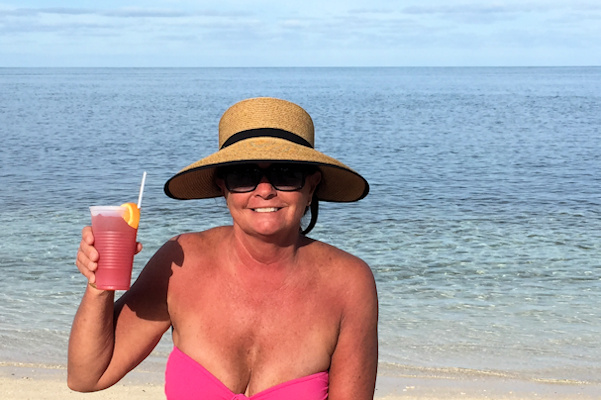

That first Bahama Mama tasted great! Very nice pool at the resort
After lunch, we used the wifi at the restaurant to check weather, and we were surprised to see that it was going to get nasty. There was a norther forecast starting the next day that was supposed to be blowing thirty to thirty-five knots, with seas over six feet. It was listed as dangerous. We talked with some people on a trawler next to us, and they had a similar report. The wind was supposed to decrease starting the day after, so we considered our options. Having just arrived, and tired from our trip, we really didn’t want to leave right then for Nassau, which would take around twenty-four hours. The only anchorage that offered protection was in the Berry Islands, but that would require going around to the west side and navigating a pretty tricky course, which we would not do at night. Since most of our course to Nassau would be to the southwest with a following sea, we decided to wait another day and hopefully get a fast and smooth ride. As promised, the wind really howled the next day. We were measuring gusts over thirty-five, and sustained at twenty-five. The whitecaps were really rolling on the ocean, and we were wondering if we could really leave the next day. If we couldn’t, we would just need to call Cat and Tim to have them stay somewhere in Nassau – you just never know with the weather.
January 27th– 28th: Old Bahama Bay Marina – Palm Cay Marina, New Providence Island
 Our course took us along the southern coast of Grand Bahama Island due southwest to the Berry Islands, then SSW to New Providence Island. Once we passed Freeport, the current pushing us went away, but we still had a nice comfortable following sea. As darkness fell, we started to get some random big swells on our port beam. We decided to alter course to the south the decrease the effect of those swells. Sometime that night, a particularly violent roll hit us, launching our new laptop off of the table. That’s amazing, considering the table has a leather cover on it. Fortunately, it still operated, although there was some damage around the power and LAN ports.
Once we turned to the east for New Providence Island, conditions calmed down a lot. Rosé was on the early morning watch when she had some trouble from a cruise ship. It appeared to be holding outside of Nassau, but it was drifting around a bit, and it was blocking our course. She tried hailing them, but they wouldn’t answer. She woke me up and explained what was happening. I hailed them and did get an answer. We’ve had this problem before, where ships won’t answer a hail from a woman – very bad form. They told me that they were drifting while they were waiting for a pilot, so I announced our intention to pass them to starboard.
After we passed the cruise ship and the Nassau harbor entrance, we had to tiptoe through the reefs to get to the south side of New Providence Island. The island has a veritable minefield of reefs around it, so you need to be very careful when cruising in the area. We used all of our chart resources, and went through without grabbing the reef. Once we were on the south side, we lined up our approach for Palm Cay Marina. There is a dredged channel into the marina with channel markers at the beginning. After that, you keep a straight course that is identified by the dark underwater rocks piled on either side – almost like a runway. Follow the runway to the end of the channel, turn hard to port, and then you are at the entrance of the marina. We were assigned to an end tie, which was very convenient, although we again had fixed docks with a range of three and a half feet.
Position at destination: 25°01.272’ N, 77°16.457’ W
Air temp: 77°, Humidity: 43%, Water temp: 72°
Nautical miles for this leg: 152.2, Total: 6818.3
Departed at 8:45am, arrived at 9:45am
January 28th – 30th: Palm Cay Marina, New Providence Island
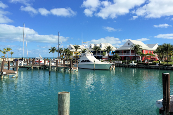
Our friends Cat and Tim were due to arrive that afternoon, so we gave ourselves a break, and hired a local Rastafarian to wash the boat. He did a great job, but it did take a lot of expensive water. Like most places in the Bahamas, water and power were expensive at the Palm Cay Marina. The slip rate was $1.75 per foot, the water was $0.35 per gallon, and the power was $0.65 per kW. It took about two-hundred gallons to wash the boat – ouch! As for the marina, it was pretty nice, but still being built out. There are a number of condos at Palm Cay, mostly finished now. There is a restaurant at the beach, which has both a pool and a small protected lagoon. The marina office was little more than a shack. There was a building being constructed next to it that we thought would be the new office, but it turned out to be a shower, laundry, and convenience store. For now, we had access to one of the empty condos for laundry (one machine) and the shower (one). Fortunately, the marina wasn’t very busy, although the laundry took a very long time to complete a cycle. The marina had wifi, but it didn’t work on the docks – you had to go next to the office or in the laundry condo to get any service.
Cat and Tim arrived, and we were very glad to see them. They had previously visited us in Ixtapa, Mexico a year earlier. We had some champagne to welcome them, and then had dinner at the restaurant. We discussed cruising plans, and decided to spend the next day at Palm Cay – the beach was beautiful, and it seemed like a relaxing way to spend the day.

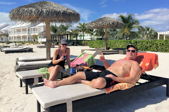
Palm Cay marina beach Cat and Tim working on a tan
One of the best features at the marina was the courtesy car. I can’t recall what model it was, but they referred to it as the egg car – it did resemble an egg. It was free to cruisers for two-hour use, and you could sign up for a time slot. The second morning we used the car to go to a nearby shopping center, where we picked up some provisions and beer. That was our first shock to pricing in the Bahamas. We had been warned that beer could cost up to $65 a case, but we didn’t believe it. Well, believe me, it was true. Even the local beer, Kalik, cost $65 for a case. Tim picked up a case of Kalik and a case of Bud, and we were ready to go. We spent the afternoon on the beach killing off some Bahama Mamas, and we were ready to cruise.
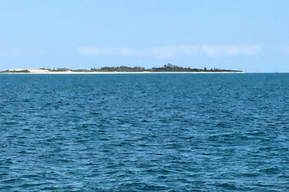

Norman’s Cay The beach on the bank side of Norman’s Cay


Cat, Lucky, and Tim We’re in The Bahamas!
We anchored inside the cut between Normans and Wax Cays. We had read about anchoring in the cuts – you are subject to tidal currents in them. This is the home of the Bahamaian moor, where you deploy two anchors from the bow at a 90° spread. We anchored over fourteen feet of sand, feeling pretty comfortable. A few hours later, we were watching a movie when we heard a “shhh” noise and felt a little bump. We had moved 180°, and were now in just over five feet of water, resting on the sand. The tide had changed, resulting in a complete shift of the current. This was the hard way we learned about the hazards of anchoring in a cut. After this experience, we would be VERY careful about our anchoring position, understanding the effects of the tidal current. Since we were surrounded by nothing but sand, we decided to stay where we were for the night, leaving at high tide at first light.
Position at destination: 24°35.374’ N, 76°48.754’ W
Air temp: 73°, Humidity: 43%, Water temp: 76.5°
Nautical miles for this leg: 39.37, Total: 6858
Departed at 9:30am, arrived at 3:00pm
January 31st: Normans Cay – Shroud Cay
We got up at first light to move away from our sand trap. We deiced to go the short distance to Shroud Cay, where we could pick up a mooring from the Exuma Cays Land and Sea Park. It was 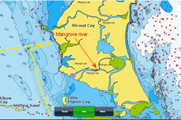 pretty windy that morning, as a cold front blew through, and we had a hard time grabbing the ball, as the painters are very short. The wind was stronger than the bow thruster, so it was hard to keep the bow stable while Rosé hooked the painter, but we eventually picked it up. The north swell was causing some rolling, so we deployed the flopper stoppers – this was the first time that we had one on each side, which worked much better than a single one. We spent the morning sunning on the boat deck, and in the afternoon, we took the dinghy to ride through the mangrove river that runs through Shroud Cay to the Atlantic side. That was a great experience, and for the most part, problem-free. There were a few spots that got shallow enough where we had to jump out and pull the dinghy by hand.


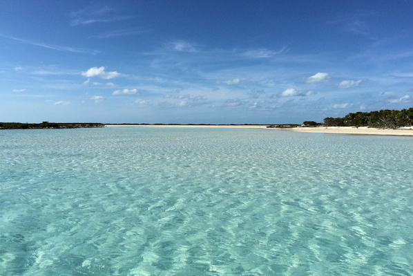
Beach on the bank side of Shroud Cay Sparse vegetation in the Exumas
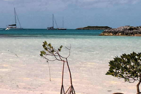
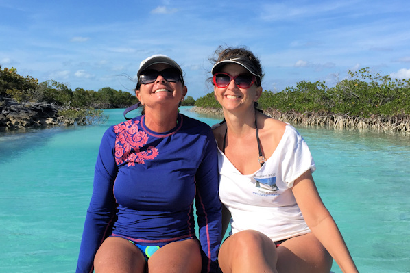
Boats moored off of Shroud Cay Rosé and Cat enjoying the mangrove tour

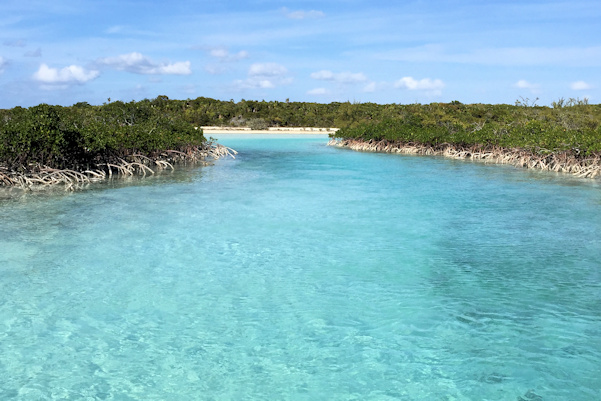
Tim and Cat The mangrove river through Shroud Cay

Near the entrance on the Atlantic side

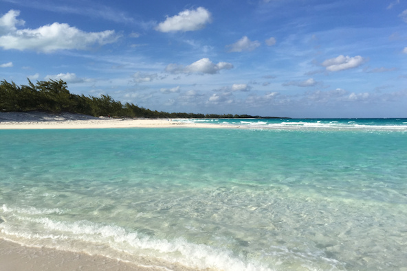
The beach on the Atlantic side
The water color in the Exumas is unbelievable. It’s like being in the world’s largest swimming pool. It’s so clear that it becomes a real chore to judge how deep it is when you’re cruising along. The cays have very little growth on them reflecting the lack of rain and soil in the area. The beaches are very white, with amazingly soft sand. These islands really are a beach lover’s paradise.
Position at destination: 24°31.925’ N, 76°47.878’ W
Air temp: 78°, Humidity: 45%, Water temp: 71.5°
Nautical miles for this leg: 5.95, Total: 6863.6
Departed at 7:45am, arrived at 8:30am