


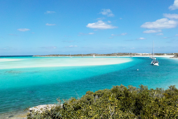
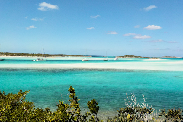
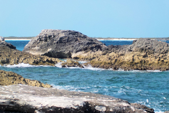
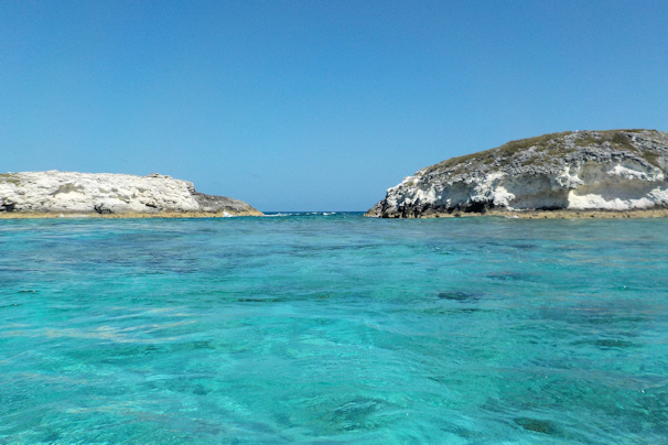
February 1st: Shroud Cay – Emerald Rock
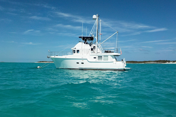
Our next destination for the Exumas tour was Warderick Wells. This spot has two anchorages – Warderick Wells on the north side, and the large bay of Emerald Rock on the south side. This is also the headquarters of the Exumas Land and Sea Park. The mooring balls at Warderick Wells are on a reservation system. In the morning, the rangers call out on the radio boats that can have a ball. If there is no answer, they move down the list. We hadn’t made a reservation, and it was clear that we weren’t going to get one, so we went to the southern anchorage of Emerald Rock, which has a lot of mooring balls on a first-come, first-serve basis. We had no problem finding a choice ball there.
Position at destination: 24°22.979’ N, 76°37.400’ W
Air temp: 79°, Humidity: 45%, Water temp: 73°
Nautical miles for this leg: 18.8, Total: 6882
Departed at 8:15am, arrived at 11:45am

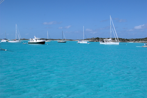
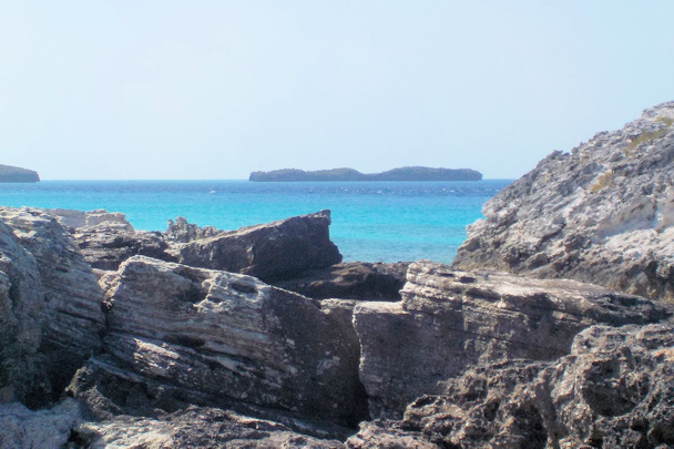
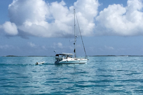
The beach at Emerald Rock View of the anchorage from our boat
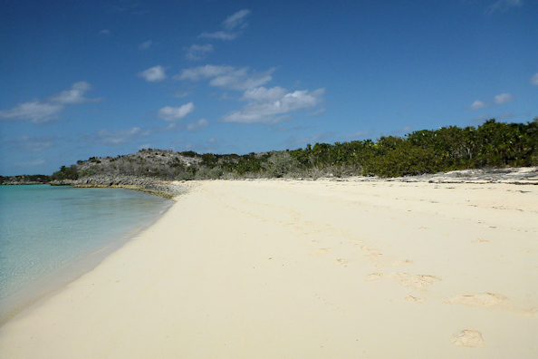

Walking on the beach Tropical Blend on a mooring
We took some drinks to the beach and walked around for some time. This being Super Bowl Sunday, we were looking forward to watching the game. We were expecting to watch it on our satellite TV system, which comes from DirecTV Caribbean out of Trinidad. That afternoon, we turned on the pre-game show only to find that the picture was close to non-existent. I reset the receiver, but nothing. Wracking my brain, I remembered that the satellite coverage had a donut hole over the southeastern Bahamas, and now we were apparently in the hole. I wanted to confirm this, so I went over to a trawler next door to us that also had a satellite dome on it. Their coverage was out of Florida, so they still had a good picture. But they told us that the ranger station was hosting a potluck Super Bowl party that night, so we had a solution!
 That afternoon while we were preparing our contribution for the party, we threw some food scraps overboard and saw a remora that was under the boat gobbling up whatever we threw out, including Quincy’s droppings – ewwww. It’s a very strange looking fish with something that looks like a sneaker footprint on top of it. It uses this to attach itself to marine life, commonly sharks. It’s not a parasite, as it simply attaches itself to a host, and feeds off of dead skin, food bits, etc. It seemed to enjoy the shade of the boat.
Just before dark, we left for the party, which was at the ranger station about a half a mile north of us. The wind was blowing hard, and it was chilly, so we actually had to bundle up. The party itself was a blast. The rangers only had two small tube televisions, but we could see enough of the game. There was a ton of food, and the rangers provided some rum and beer. All in all, we had a great time, until Seattle blew the game with that inexplicable intercepted pass.
February 2nd: Emerald Rock – Big Major Spot
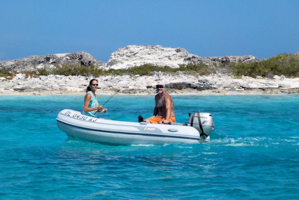
We had promised to take Cat to one of the iconic boating destinations in the Exumas: the swimming pigs at Big Major Spot. For many years, the pigs living on this beach have been swimming out to boaters that toss food into the water for them. We had been told they love apples, so we had purchased a bag of them back in Nassau, and cut them up. We took the dinghy towards the beach, and the porkers started swimming out to us. Feeding them was fascinating and fun. Their eyesight in the water isn’t very good, so they tended to bump around, and we were concerned about keeping them from chomping the dinghy. They were pretty aggressive in the water, but on the beach, they were quite gentle. We saw kids on the beach petting them, and they were like pets.
Position at destination: 24°10.98’ N, 76°27.549’ W
Air temp: 80°, Humidity: 66%, Water temp: 77°
Nautical miles for this leg: 18.0, Total: 6900
Departed at 8:15am, arrived at 11:30am


All on board for the pigs! Where are the apples?
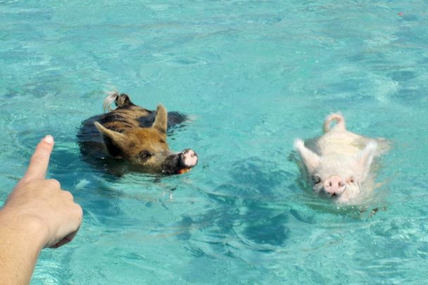

Look! Thar be pigs! Using the snout as a snorkel
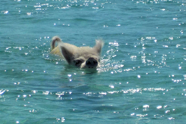
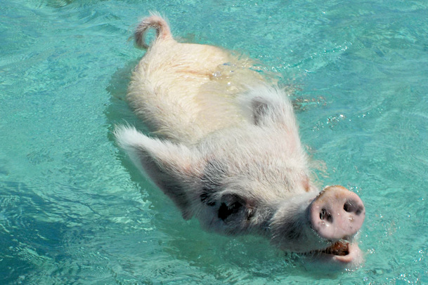
This little white one was very persistent
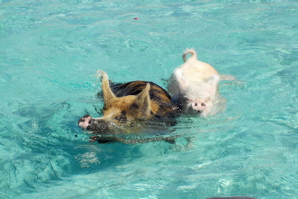
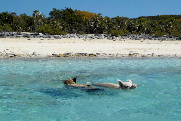
It’s a race One of you is going the wrong way
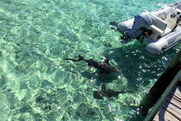
 After spending the morning feeding the pigs, we took the dinghy over to Staniel Cay, about a mile south of Emerald Rock. There is a settlement there, along with a sort of marina and a fun bar – the Staniel Cay Yacht Club. The marina looked pretty rickety – there is no way we would want to be there with any kind of wind. Even getting off the dinghy was difficult. You had to tie up at the bottom of the dock and then ascend up a ladder that went beyond vertical, with sharks literally swimming just beneath you. There are a number of fishing boats that clean their catches at Staniel Cay, so the sharks (nurse and lemon) and rays come in for the free meals – they are almost pets. Tourists often get into the water with them, and as far as we could tell, there was no biting going on.
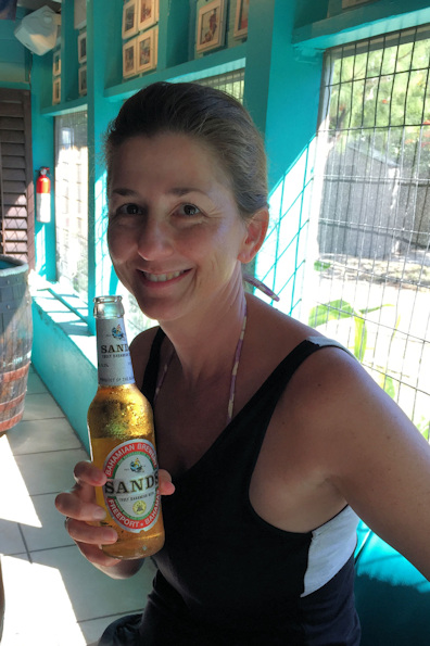
Staniel Cay has a pretty cool bar and restaurant, a marginal marina, an overpriced “resort”, and a few shops. We did find the combination laundry and liquor store, where Tim replenished his beer collection. The bar is in the open, but the bathrooms are air conditioned. I never had to go so many times during a lunch in my life.

Sharks swarming around the dock The bar at the Staniel Cay Yacht Club
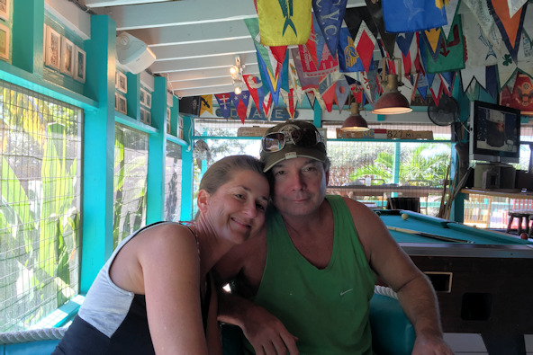

Cat and Tim sharing a tropical moment ‘Nuff said!
February 3rd: Big Major Spot – Highborne Cay
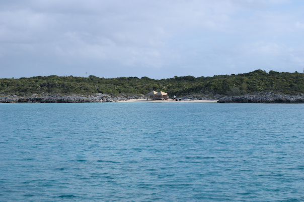
 For our last day in the Exumas, we cruised north to Highborne Cay, which would lead to an easy hop back to Nassau. Cat and Tim were going to spend a few days in a resort in Nassau, so we needed to get them back on the 4th. Highborne Cay is at the northern end of the Exumas, and there isn’t a protected anchorage, but with very settled weather, we anchored in the open roadstead off of the northwest side. There was a large yacht in the anchorage with two tenders, and the crew set up a pavilion on the beach, but the guests were too lazy to use it. That night, we had a small party, and Quincy tried his paw at dancing, but didn’t seem to go for it so much.


At anchor off of Highborne Cay The beach at Highborne Cay

This superyacht’s crew spent a couple of hours setting up the beach pavilion
Position at destination: 24°42.954’ N, 76°49.841’ W
Air temp: 75°, Humidity: 67%, Water temp: 78°
Nautical miles for this leg: 43.68, Total: 6944
Departed at 8:05am, arrived at 2:30pm
February 4th: Highborne Cay – Palm Cay Marina, Nassau
It was time to get Cat and Tim back to Nassau for the land part of their vacation. We had a gentle swell across the Yellow Bank, and docked back at Palm Cay without incident, although this time, we had an inside slip instead of the end tie. We planned to stay here for a few days to get the laundry and provisioning done, and to spend some time with Cat and Tim in Nassau.
Position at destination: 25°01.262’ N, 77°16.471’ W
Air temp: 76°, Humidity: 60%, Water temp: 71.5°
Nautical miles for this leg: 32.48, Total: 6977
Departed at 9:10am, arrived at 2:15pm
February 4th – 9th: Nassau
In addition to the courtesy “egg car”, the marina had a rental car, which I think was a Honda Fit. The car had some serious transmission issues, but it survived. We rented it for a day to drive around Nassau with Cat and Tim. We met them at the Fish Fry, a bunch of restaurants west of the city center. Most of the places had similar menus, but the restaurant we chose had a floor show. The places hire guys to stand out front and get tourists to come in (most of the clientele is from cruise ships). We liked our guy (David) – he was from Cat Island and had some good local knowledge about the Out Islands. Just before we went in, he got into a fist fight with the barker next door. We’re not sure what the fight was about, but there was blood drawn. David said that he was insulting the restaurant, and a war of words led to blows. Anyway, the lunch was pretty good, and then we decided to visit the Atlantis Resort.
Getting to Atlantis requires going over the bridge to Paradise Island, but as soon as you are across, the lane you are in splits out. Of course, there were no signs at the start of the bridge to indicate which lane we should use. After driving around a bit, we finally found a parking lot that looked like it was part of the resort, but it turned out to be the employee lot. We parked in it anyway, and took the very long walk into the resort. Unless you are staying there, everything costs money to get into, but somehow we managed to get into the aquarium, which was really beautiful.
Afterwards, we did some shopping at nearby malls, and then went to see the Atlantis Marina, which also has a shopping complex next to it. The marina had a few super yachts in it, along with the occasional oddball sailboats. Rates in the marina vary wildly depending on your dock, so it can be relatively affordable for a short stay, which gets you full resort privileges. We dropped Cat and Tim off at their resort, and said goodbye for another year. Quincy was lucky, as there was a KFC near the marina. Other than that, we did a little more provisioning and picked up a few things at the chandlery.
February 9th: Palm Cay Marina – Highborne Cay
We left for the Exumas on the morning of the ninth. Palm Cay had a reasonable price for fuel at $3.87 per gallon, so we decided to add 330 gallons. After fueling up, we crossed the Yellow Bank and anchored off of Highborne Cay, in the same open roadstead we were in a few days earlier. The forecast was pretty benign, so we felt fine about being there.
Position at destination: 24°01.262’ N, 76°16.471’ W
Air temp: 79°, Humidity: 64%, Water temp: 74°
Nautical miles for this leg: 32.68, Total: 7009
Departed at 8:30am, arrived at 2:45pm

Back at Highborne Cay This place looks and smeel familiar
February 10th: Highborne Cay – Palm Cay Marina
Dangerous gale from the south drives us back to Nassau
Around midnight, we started to feel the bow pitching, and rain squalls were coming through. The wind was from the south, so we guessed that it was just a passing squall. The wind continue to increase in intensity, and the rain was horizontal. The bow pitching was getting really bad, and by 2:00am we noticed that our position had changed. We checked the anchor, and we found out that our anchor snubber had shredded, and we were letting out chain. That snubber used a 5/8” poly line with a hook around the chain, but it had failed. There were a couple of other boats in the anchorage, and they were also moving around. We weren’t sure if they were dragging, or under power, but we kept a sharp eye on them. We turned on all of our exterior lights to make sure they would see us. We were now in a full force gale, and it was clear that we couldn’t stay. With no snubber, we decided to return to Nassau to replaces it. With the south wind, the cruise back was actually fairly smooth, but around dawn the wind shifted to the northeast, and we heard a great clatter from the flying bridge. Just like in Belize, the bimini frame had ripped back. I went up in the gale and horizontal rain to secure it, and we continued our run back to Palm Cay. As we approached the marina, we called them to confirm availability, and in a miracle, the wind settled down, making docking easy.
Position at destination: 25°01.262’ N, 77°16.471’ W
Air temp: 75°, Humidity: 60%, Water temp: 73°
Nautical miles for this leg: 32.68, Total: 7042
Departed at 3:10am, arrived at 9:30am
We found out that we could get the egg car at 11:00, so we went into the chandlery in Nassau to get a new snubber made. The store had the parts needed, and they had a guy that could splice it together within an hour. We had lunch and then picked up the new snubber – this was the third snubber we would be using. Exhausted, we went back to the marina, and checking the weather, decided we would leave on the 12th. There was nothing in the forecast like to south gale that had blown us off of Highborne Cay. Sometimes weather in the tropics is unpredictable, and can be dangerous.
February 12th: Palm Cay Marina – Hawksbill Cay
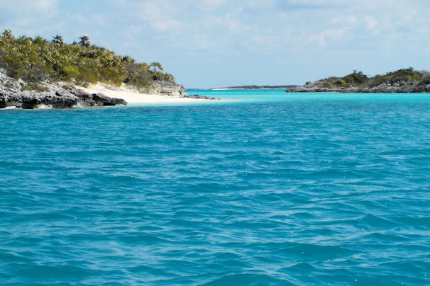
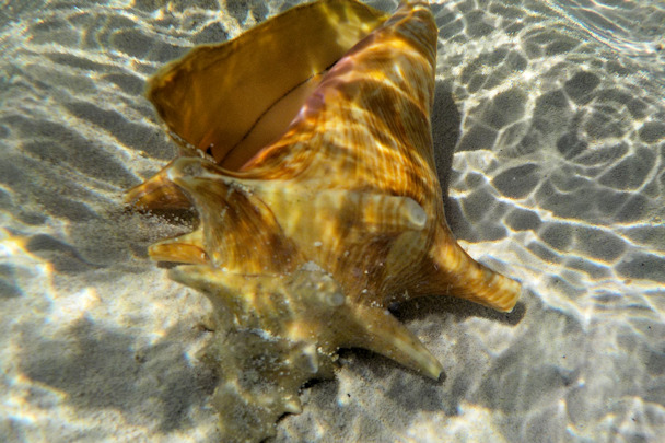
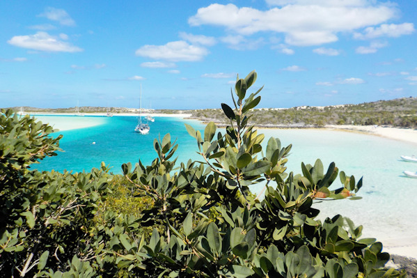
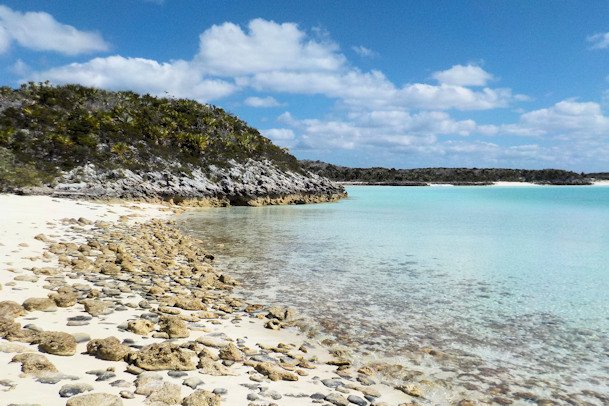
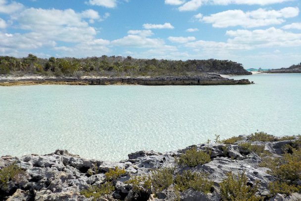
With our recent horrid memories of Highborne Cay fresh with us, we decided not to anchor in open roadsteads in the Exumas again. Hawksbill Cay is about eleven miles south of Highborne Cay, with Exumas Parks moorings. We felt a lot more comfortable staying there, and it was an easy approach across the sand banks. We explored the cut just south of Hawksbill Cay. There was a gorgeous lagoon, with that Exuma-colored water. On shore, there was a conch nursery, with many small conchs just off the beach.
Position at destination: 24°27.898’ N, 76°46.120’ W
Air temp: 73°, Humidity: 42%, Water temp: 72°
Nautical miles for this leg: 44.44, Total: 7086
Departed at 9:15am, arrived at 4:00pm
Moored at Hawksbill Cay View of the cut

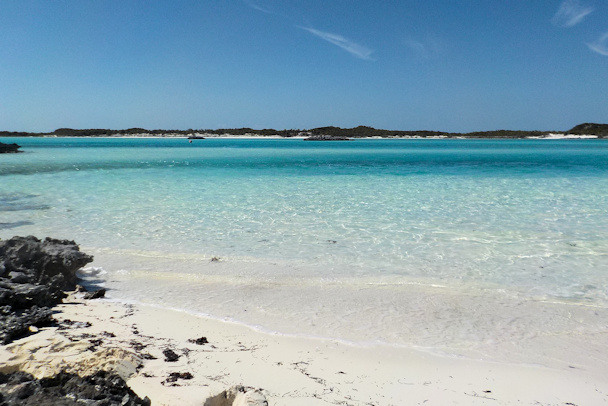
Inside the lagoon
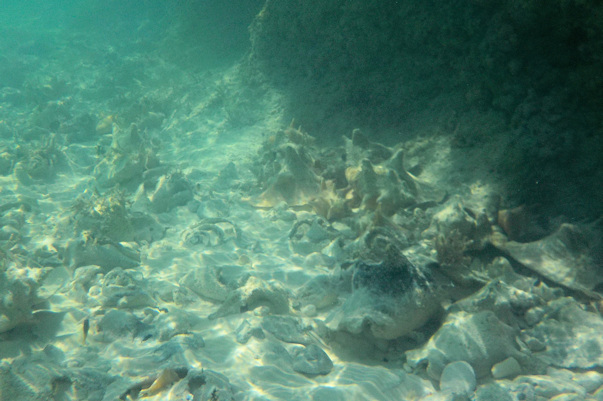
The conch nursery just off of the beach Conch on underwater display

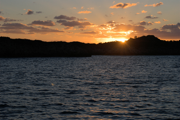
A perfect conch shell Sunset over Hawksbill Cay
February 14th: Hawksbill Cay – Warderick Wells Cay
When we arrived at Hawksbill Cay, we called the ranger station at the park and got on the mooring reservation list for Warderick Wells. In the morning we were notified that we could have a ball, so we proceeded to cruise to the anchorage. Like most places in the Exumas, the entrance to Warderick Wells is a little tricky as you cruise over the sand banks to get to the cays, but we had the Explorer charts, which do a fabulous job of identifying the waypoints. We were assigned a mooring at the far north end of the field, and we immediately noticed just how close the moorings are together. As we would swing in a slightly different direction than the boat in front of us, we would get within about ten feet, so we shortened up our line to the mooring.
Position at destination: 24°23.860’ N, 76°37.976’ W
Air temp: 70°, Humidity: 60%, Water temp: 72.5°
Nautical miles for this leg: 14.17, Total: 7101
Departed at 9:30am, arrived at 12:00pm
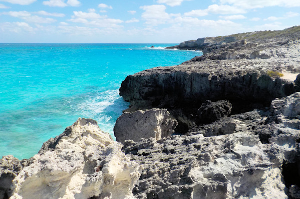
February 14th – 16th: Warderick Wells Cay
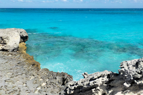
We dinghied in to the ranger station and paid for two nights on the ball. The first night we were there, a Valentine’s Day party was taking place on the beach – apparently there is a beach party on Saturday night, which coincided with Valentine’s Day. At dusk we went to the beach with our drinks. There were quite a few people from the anchorage there. The wind was howling, and it got cold fast, so it was a short party. But we did pick up some good local information. Warderick Wells has a number of hiking trails, but we were cautioned to wear shoes, not flip-flops, as the lunar limestone rock on the trails could tear up flip-flops in a hurry.


Storm clouds over Warderick Wells View of the anchorage – Tropical Blend is in the middle
The next day we did some hiking. We started by going to Boo-Boo Hill, named after the ghost that supposedly resides on the top. Parts of the trail were over the limestone rock, which was indeed very sharp. The view from the top of the hill was spectacular.
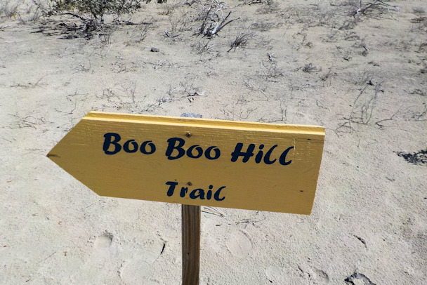
View from the ranger station This way to the ghosts
Views of the anchorage from Boo Boo Hill

Whale skeleton on the beach The Atlantic side of the cay

The coastline below Boo Boo Hill
We hiked down the Boo Boo Hill trail, and set off to see Barefoot Beach. This trail was worse than the Boo Boo Hill trail – it was almost 100% over the limestone, and a little difficult to follow. Barefoot Beach is on the Emerald Rock side – very scenic. But given the number of rocks there, we weren’t sure how it came to be called Barefoot Beach.

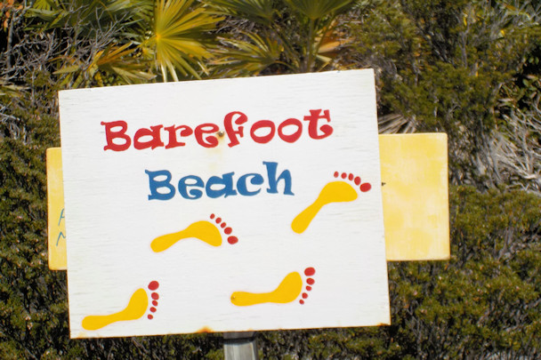
I don’t think you’d really want to be barefoot on this beach
After seeing Barefoot Beach, we set off on the Causeway Trail to see the Sunset Causeway, a bridge that separates two large tidal pools. Well, the “bridge” wasn’t so impressive, but the scenery was once again lunar in nature. We started down another trail that would lead us to the Atlantic side of the cay, but all of the balancing on the limestone shards was wearing on us, so we headed back to Little Blend.

The bridge on the Causeway Trail
February 16th: Warderick Wells Cay – Cambridge Cay
We had a small window in the weather to keep moving south. For just a day, there would be a break in the norther pattern that was becoming predominant. We decided to cruise to Cambridge Cay, the next stop in the Exumas Land and Sea Park. The balls there are on a first-come, first serve basis, so we had a back-up plan to anchor off of Bell Island, which seemed to offer protection from both the north and east. Getting around Bell Island from the Exuma Bank 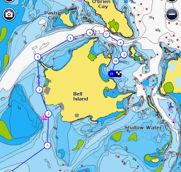 was tricky, as you have to cut in from the south to find enough water under your keel, and then hug the island to get around it. There is a resort on Bell Island, and as we approached it, the “mail boat” (small supply ship) was leaving, taking the same route that we were looking at. That told us that those boats have a very shallow draft, with probably a flat bottom. We got down to eight feet in a couple of places, but we ran around the island at close to idle before clearing back in to deeper water in the cut. We rounded Bell Island, and we guessed that the mooring balls were all taken. We fit in a good-sized slot between two other boats, and dropped the anchor in about ten feet of water off of Bell Island. Unfortunately, we soon figured out that we were getting a lot of swell from the tide coming through the cut due east of us, and we were concerned about what would happen once the tide shifted. We decided to hoist the anchor and seek out a protected spot near the mooring field in Cambridge Cay. We found a spot just south of the mooring field that appeared to be protected, with one other boat at anchor. We weren’t totally comfortable, but with darkness descending quickly, we dropped the anchor with a lot of scope, and set the Drag Queen anchor alarm.
Position at destination: 24°17.196’ N, 76°32.364’ W
Air temp: 70°, Humidity: 63%, Water temp: 73°
Nautical miles for this leg: 15.56, Total: 7116
Departed at 10:50am, arrived at 3:00pm
February 17th – 22nd: Cambridge Cay
We swung through the night, due to our proximity to the cut on both sides of Cambridge Cay. In the morning, we saw a boat leave a mooring, so we immediately moved over to it. That afternoon, the north wind started to blow at twenty knots or more, and we were really pulling on the ball. We had only used a single line to the ball’s painter, and it was making a lot of noise sawing back and forth. Our line was not chafing, but the noise was pretty bothersome, so we added a second line to form a bridle, which was much quieter, and gave us more peace of mind. There was an extensive beach area on the north end of the cay. At low tide, the sands in front of it were exposed for a good hundred yards or so. We took Little Blend over to explore it.
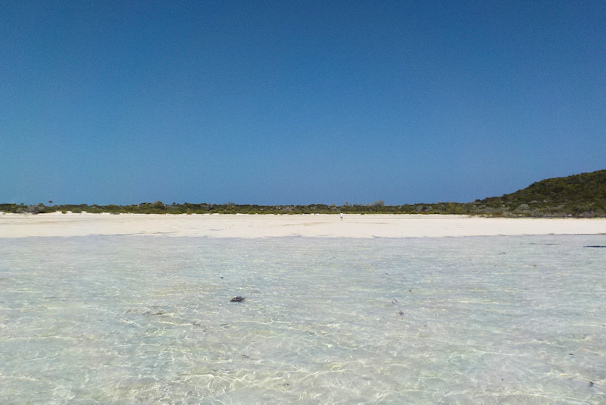

Exposed beach at Cambridge Cay Tropical Blend is third from the right

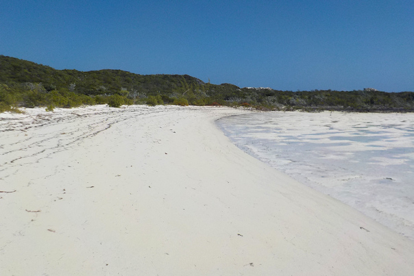
Sand at low tide The beach at Cambridge Cay
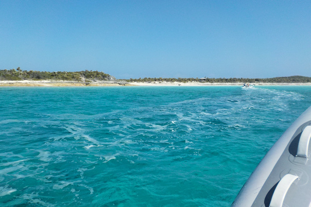
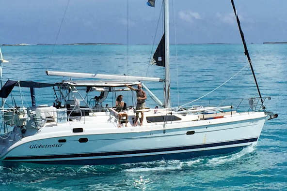
After exploring the beach on the north end, we went over to the beach on the west side, where we had seen a number of dinghies tied up. There was a short hike to the ocean on the west side of the cay. Just as we arrived, two couples were coming back to their dinghies, and they told us they were going south to a cut where the ocean spills over into the sound over a short natural seawall, forming a natural whirlpool. We decided to join them, and headed south to the opening through Compass Cay, about two miles away. Once there, we made introductions. Once couple was on the sailboat Globetrotter, Kevin and Donna. They were from North Carolina, spending this season in The Bahamas before returning home. The second couple was on the trawler moored just south of us, but we can’t recall their names now.
We anchored Little Blend just off of the beach and hiked up the small estuary to the wall opening. Our new friends ventured into the pool below the wall, but given the 73° water temperature, we elected to be cowards and just walked around the area. Our experience in the 90° waters of Panama had spoiled us for good! At the pool, we could actually see the difference in sea level between the Bank and Sound sides.

Approaching the beach at Compass Cay At high tide, large waves break over the wall
The sea level in the sound was higher Nice view of Cambridge Cay
We returned to Cambridge Cay, following Kevin and Donna. They suddenly came to a halt in front of us, and Kevin told us that he was having issues with his motor not running a high revs. We followed them at slow speed to make sure they got back safely. They invited us over for sundowners later that day. They were the boat that we had seen anchored off of the south end of the mooring field. We reciprocated the sundowners on our boat, and Kevin was delighted to discover our DVD collection. He and I like the same scifi series, and since we were hunkered down from the wind, he borrowed some of our series for some marathon watching. In turn, we borrowed some movies from him. We agreed to buddy-boat for a while in The Bahamas, since we had similar agendas.
February 22nd: Cambridge Cay – Big Major Spot
We finally got a break from the weather and decided to move on to Big Major Spot, the home of the swimming pigs. When I was starting up the instruments, I got impatient with our Furuno VX2 plotter, which we use as our primary chartplotter and AIS. The boot-up can be sped up by pressing the Menu key, but I mistakenly pushed the Clear key, which had the effect of wiping out our entire voyage track from Alameda – d’oh! In addition, the AIS stopped working. I wasn’t sure if the AIS failure was related to the Clear button mistake, but I couldn’t do anything to get it running again. I figured we would have to wait until we returned to Florida to get it fixed – double d’oh! It was a short and easy cruise to Big Major Spot.
Position at destination: 24°11.027’ N, 76°27.663’ W
Air temp: 82°, Humidity: 71%, Water temp: 76.5°
Nautical miles for this leg: 13.26, Total: 7129
Departed at 9:30am, arrived at 11:45am
February 22nd – 25th: Big Major Spot
We spent a few days at Big Major, and we decided to try some fishing from the dinghy. We tried some trolling in the waters around Fowl Cay and Little Major Spot, but we only had a couple of strikes and a lost lure for our efforts. It was a beautiful area, so the trip wasn’t a total bust.
Ready to catch something, anything! Donna and Kevin had the same luck as us

Opening to the Exuma Sound Little beaches were everywhere
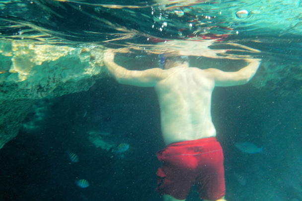
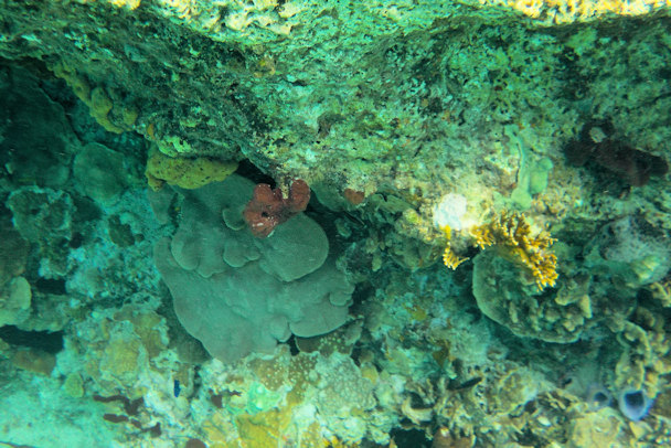
Kevin had previously gone snorkeling at Thunderball Cave, which had been used in the filming of the James Bond movie Thunderball. It’s a cut through a rock that has a lot of fish in it. The  water had warmed up to 77°, so we decided to give it a try. The key there is the tide – it’s only safe to traverse at slack tide, as the tidal current in the cut can be up to five knots. We looked at the tide table, and figured that 11:30 would be the best time. We took the dinghies over and tied up to the small balls distributed outside of the cave. Upon entering the water, we immediately felt the pull of the tidal current, taking us to the cave. The entrance was really narrow, and we decided against entering the cave with that much current. Without any wetsuit protection, we could easily get dragged against the rocks, probably resulting in some big cuts. We stuck to snorkeling around the entrance and along the wall on the outside. There were a lot of fish, unlike the rest of The Bahamas. Getting back to the dinghy turned out to be a real chore. I had gone along the wall, and I found that I could barely outkick the current going back. I pulled myself along the wall, but I eventually had to let go to swim over to the dinghy. It was only about twenty yards away, but it took an incredible effort to get there. That was the first time in my life when I felt in danger in the water, and Rosé had the same feeling. After we made it back, Kevin wanted to go through the cave to the other side, so we said we would circle around and pick him up in the dinghy. He made it, with just a few scratches. I’m not sure how we got the tide wrong, but it is really dangerous to swim in the cuts when the tidal current is running.

I’m supposed to go in there? It was hard to hold the camera still in the current
Thunderball Cave wall Sunset at Big Major Spot anchorage
One afternoon we went over to Staniel Cay for lunch. The fisherman were cleaning their catch, and the diners had assembled. Some of the tourists decided to wade amongst the nurse sharks and the rays, and it was funny to watch their eyes grow wide when the sharks swam around them. These sharks definitely knew the difference between legs and fish parts, though. We bought some highly overpriced vodka at the combination laundry and liquor store, and picked up some relatively fresh produce at one of the tiny groceries.
The next morning we saw the Bahamas National Defence (Bahamian Navy) boat coming into the anchorage. They were stopping at all of the boats in the anchorage to inspect paperwork. One of their first stops was a sailboat anchored just south of us. We knew the crew was on board, but they didn’t answer the hails or knocks. The navy boat went through the anchorage counter-clockwise, stopping at our boat at the end of their tour. They just wanted to see our documents and cruising permit, and were very friendly and nice. They stopped again at the sailboat with the hidden crew, but no response again. As soon as the navy boat turned the corner to go back to Staniel Cay, the crew bounded out from below and left like scalded rabbits. Clearly, they had not gotten their cruising permit, and they figured they could just hide out – pretty bad form.
February 25th: Big Major Spot – Black Point
The next destination on our tour of the Exumas was Black Point Settlement, a village and a large harbor on Great Guana Cay, a little south of Staniel Cay. Kevin and Donna had been through this area earlier, so we followed them in. As was becoming the norm, the forecast was for the wind to pick up for a few days, so we planned to be there for the duration.
Globetrotter leading the way Donna and Kevin enjoying the smooth cruise


Cruising through shallow waters Quincy checking out the view
Position at destination: 24°05.770’ N, 76°24.358’ W
Air temp: 84°, Humidity: 64%, Water temp: 78°
Nautical miles for this leg: 8.75, Total: 7138
Departed at 10:50am, arrived at 12:30pm
February 25th – 28th: Black Point
Kevin and Donna knew their way around Black Point from their previous stopover. There a few small restaurants, including Scorpions, where they got “cripsy wings” that they really enjoyed. We agreed that they were pretty good, and we even got a to-go order for Quincy. There are two dinghy docks for the settlement – one at the town dock, requiring a pretty big step up, and another at the laundry, which also provides Internet service.
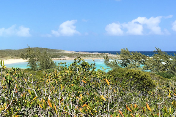
On our second day, we went for a walk around the east side of the bay. There was a pretty big blow hole, so we took a number of pictures. The shoreline here is more craggy limestone – definitely not flip-flop friendly! There were a couple of small beaches on the sound side. Continuing down the road, we saw a number of houses under construction, but appearing to be abandoned. Kevin explained that in The Bahamas, citizens can hold land simply by starting construction on it. In many cases, they manage to build a few foundation walls, and then stop construction, waiting for more money, we guessed. There were several of these sites that had excellent views of the bay. When we returned to the dock, a number of people from the community were hanging around. The “mail boat” was due in shortly. In The Bahamas, the mail boat brings supplies to the remote islands once or twice per week. There was a small child who was very excited, and he told us he was getting a bicycle. The mail boat was a highlight for many of the residents.

View of the bay and the anchorage

Now where is that blowhole? Definitely not Barefoot Beach!

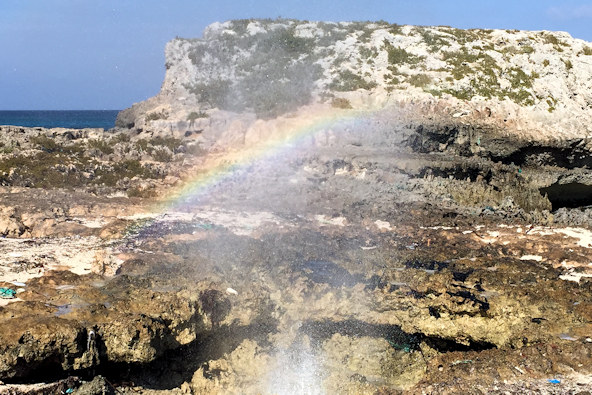
Thar she blows! Every blowhole should have its own rainbow
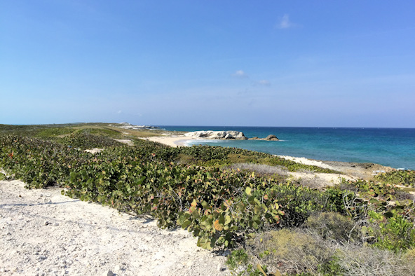

An actual beach on the sound side Great backdrop for a portrait


The craggy coastline Construction, interrupted

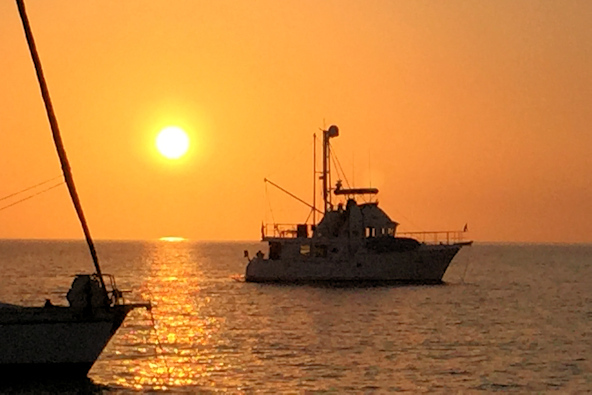
The mail boat hath arrived Sunset over the Tropical Blend
Another laptop bites the dust
On the third day, we took some laundry up to the Rockside Laundry, a very clean self-service facility with wifi. That day the wind was blowing pretty hard from the east, and the boats were pitching quite a bit. We took the laptop up to take advantage of the wifi. After some time I noticed that the battery level was low, so I decided to take it back to the boat. Instead of turning it off, I simply closed the lid. Once I got back to the boat, the pitching was pretty severe, and the swim platform was moving up and down by about two feet. I had a hard time getting off of the dinghy, and I decided I would be best served by first placing the bag holding the laptop onto the swim platform, which turned out to be a very bad idea. Just as I was setting the bag down, the platform jerked up violently, and the laptop hit it pretty hard. I managed to get onto the platform, and then returned to the laundry. Later when I restarted the laptop, it failed to start, giving me an error about an “unbootable device”. This was similar to the failure we had experienced with our older laptop in Panama. I tried a number of things, including booting in safe mode, but I couldn’t get past the error. Unfortunately, I had never created a bootable drive. However, Kevin also had Windows 8.1, so I created a boot drive from his machine. Sadly, this didn’t work either. I could get some signs of life, but it could never finish booting up. I eventually decided that the hard drive must have crashed when it hit the platform. And no, I had not backed it up for quite some time. Photos, our log files, and a lot of other irreplaceable stuff was on that drive. I hoped that once we got back to Florida, it could be recovered – d’oh!
February 28th: Black Point – Oven Rock (Little Farmer’s Cay)
The next stop for us was Oven Rock off of Little Farmer’s Cay. The main attraction of this anchorage is its proximity to one of the largest caves in The Bahamas. We had an easy, smooth cruise to the anchorage, and decided to dinghy down to TY’s Sunset Bar and Grill for lunch. It’s located on the south end of Little Farmer’s Cay, about a mile and a half south of Oven Rock. We had a great BBQ lunch and took it easy for the rest of the day.
Position at destination: 23°59.026’ N, 76°19.976’ W
Air temp: 84°, Humidity: 67%, Water temp: 81.5°
Nautical miles for this leg: 8.38, Total: 7147
Departed at 9:30am, arrived at 11:00am
The following morning we went ashore to find the cave. The trail markers were pretty much in place as the directions we had found on Active Captain, except for the last trail to the cave. The trail disappeared on top of the hill, and we had to do some bushwhacking to find the cave. Once we got there we were really impressed by the size of the mouth. There are also extensive pools inside the cave that some people dive, but we contented ourselves by watching Kevin swim in the cool, fresh water.

View of the beach Entrance of the cave

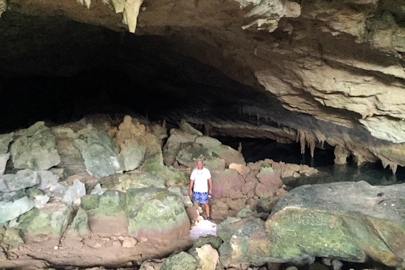
Kevin getting ready for a cold swim It’s a really big cave

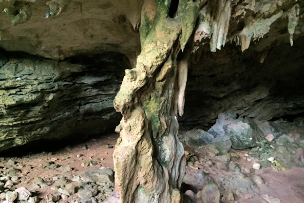
The pool in the cave Stalactite, meet stalagmite